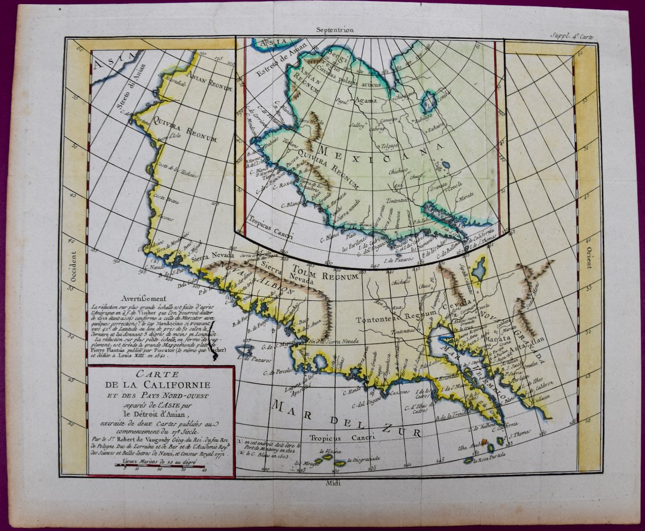
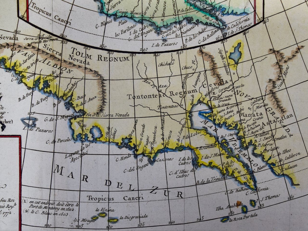
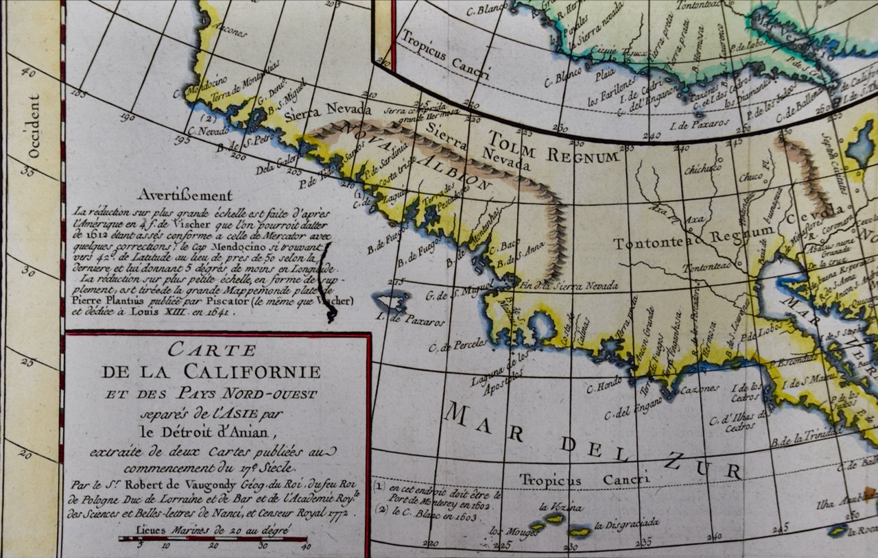
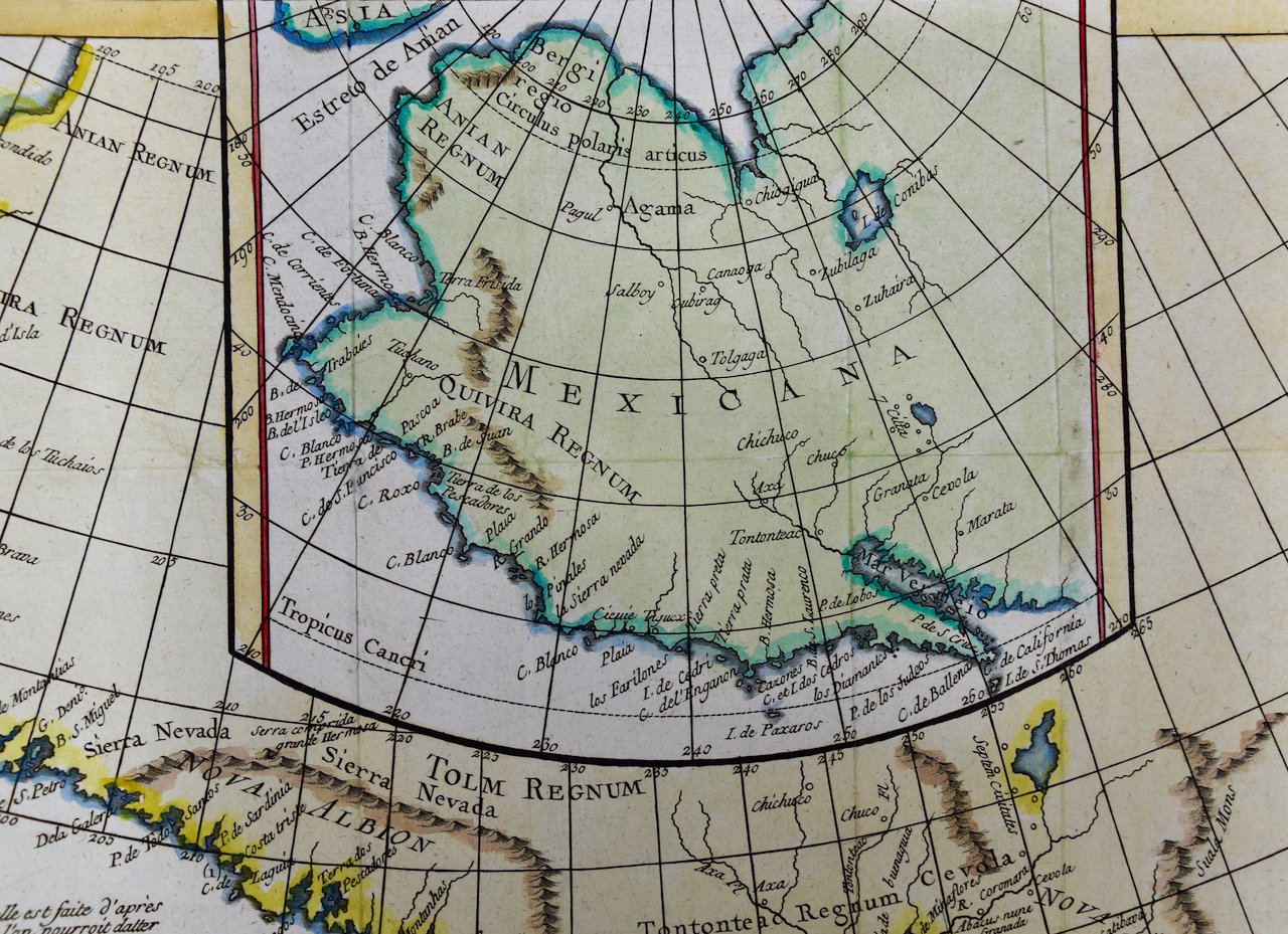
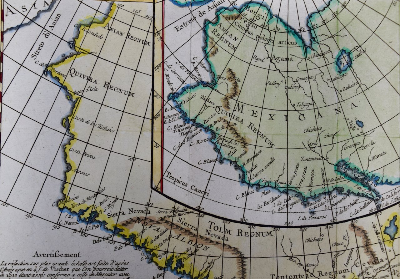
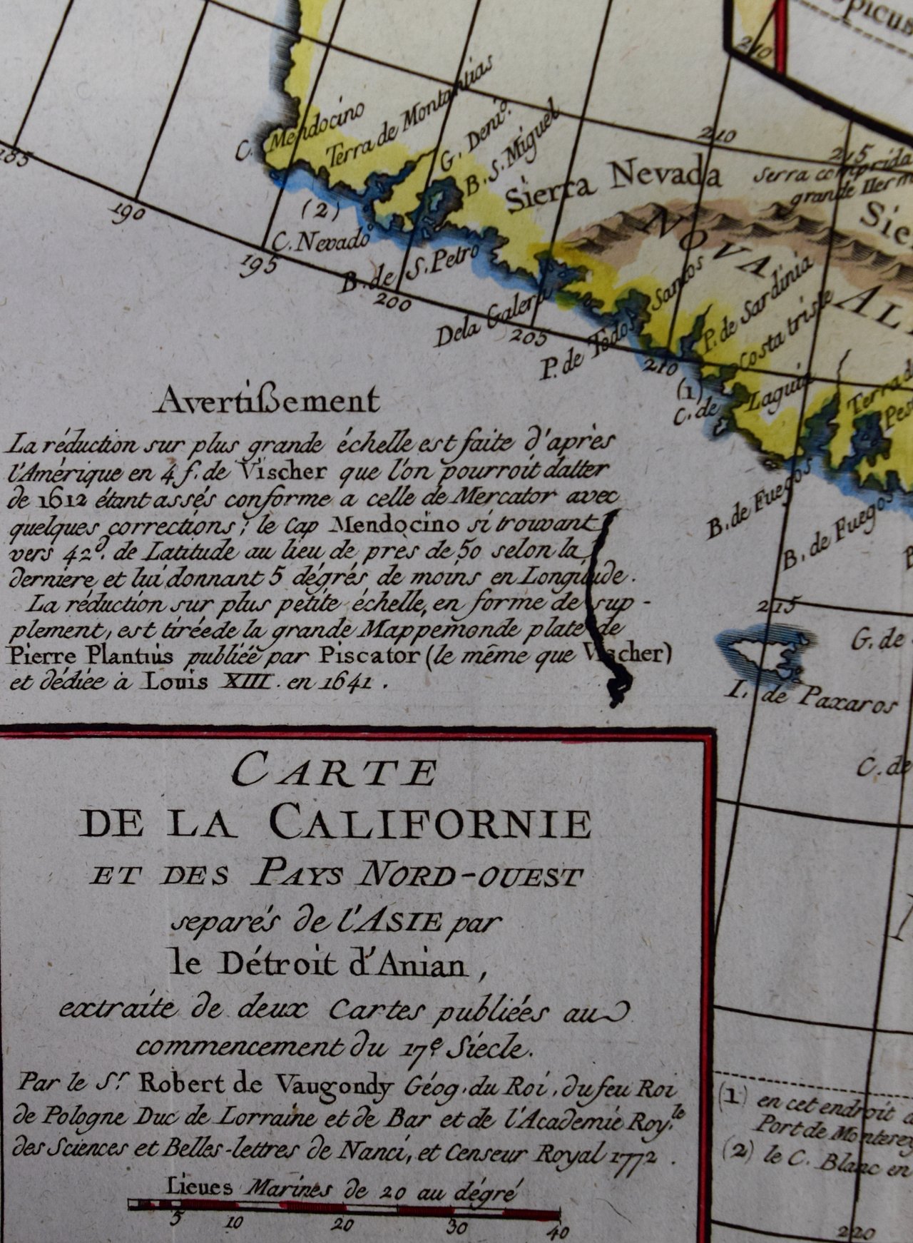
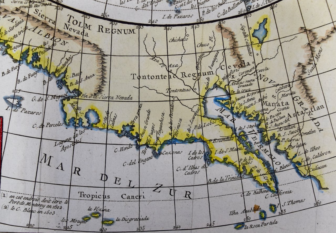
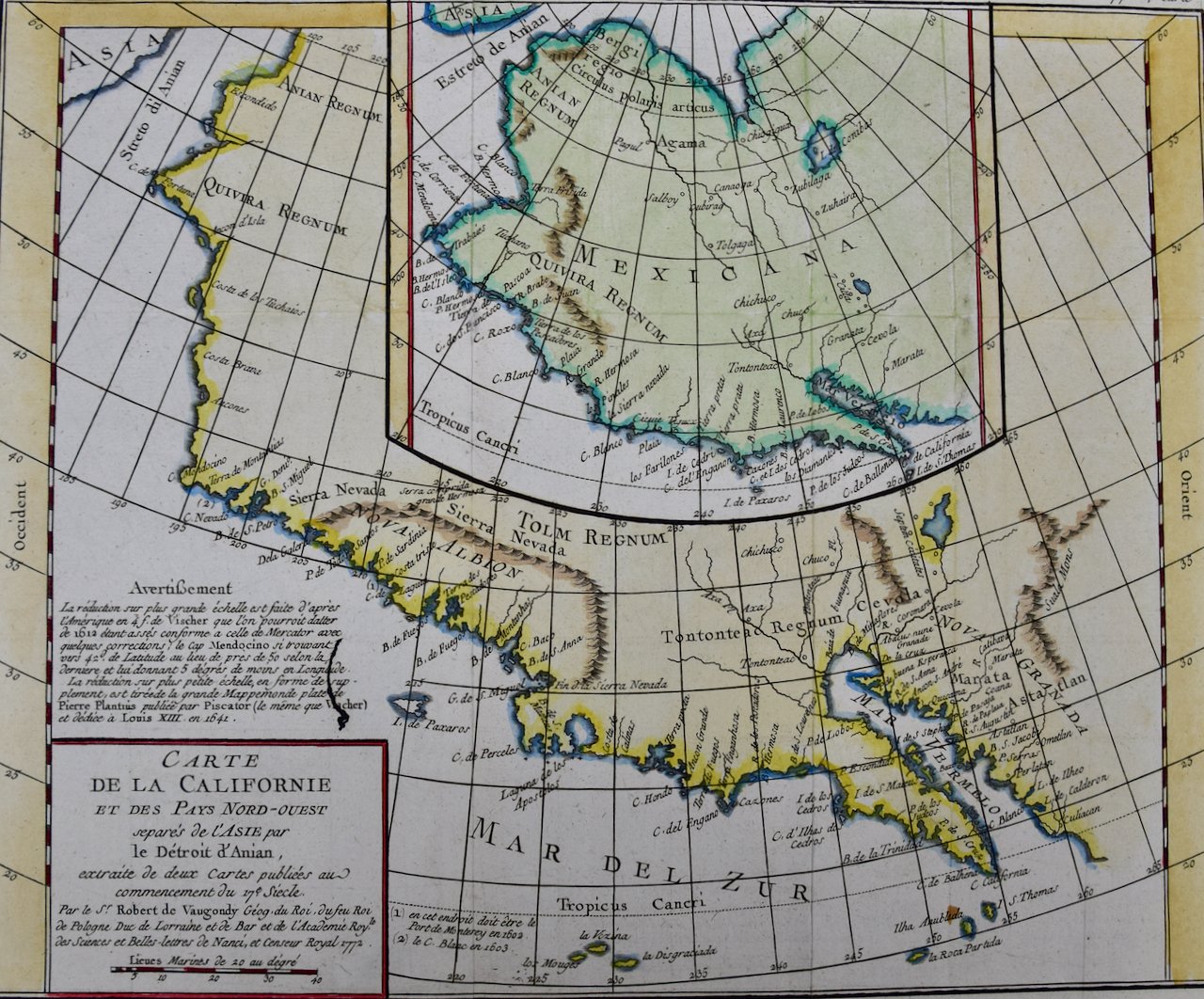
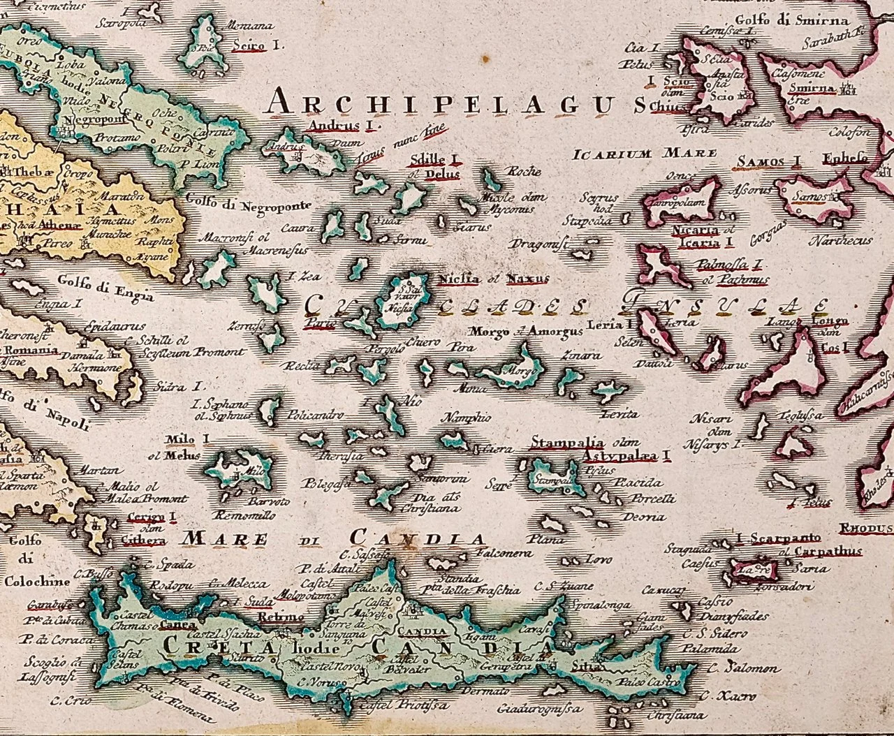
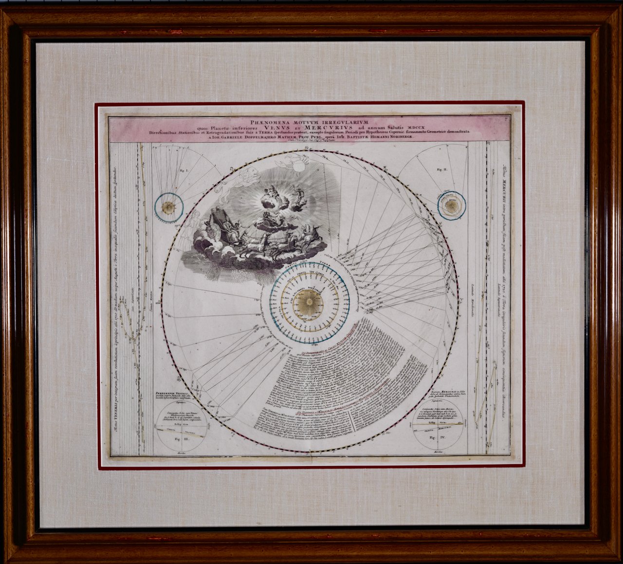
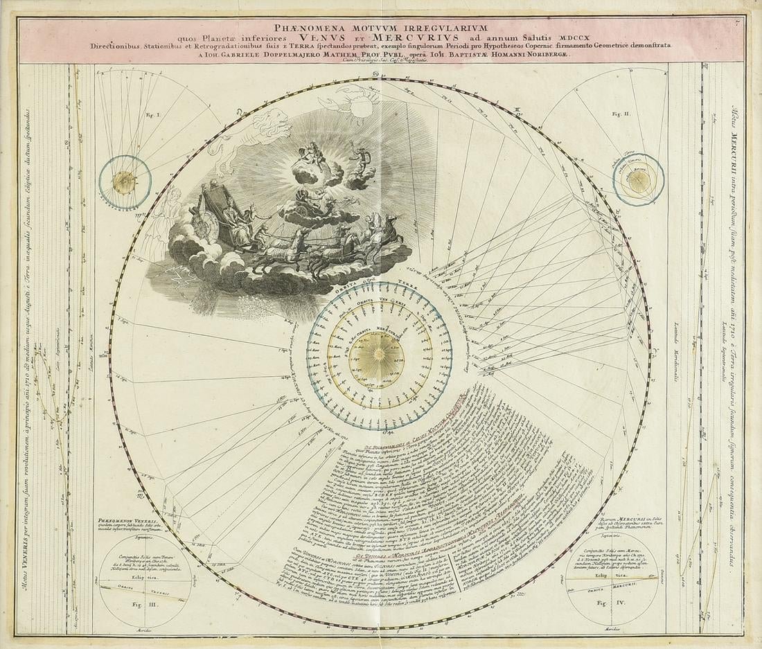
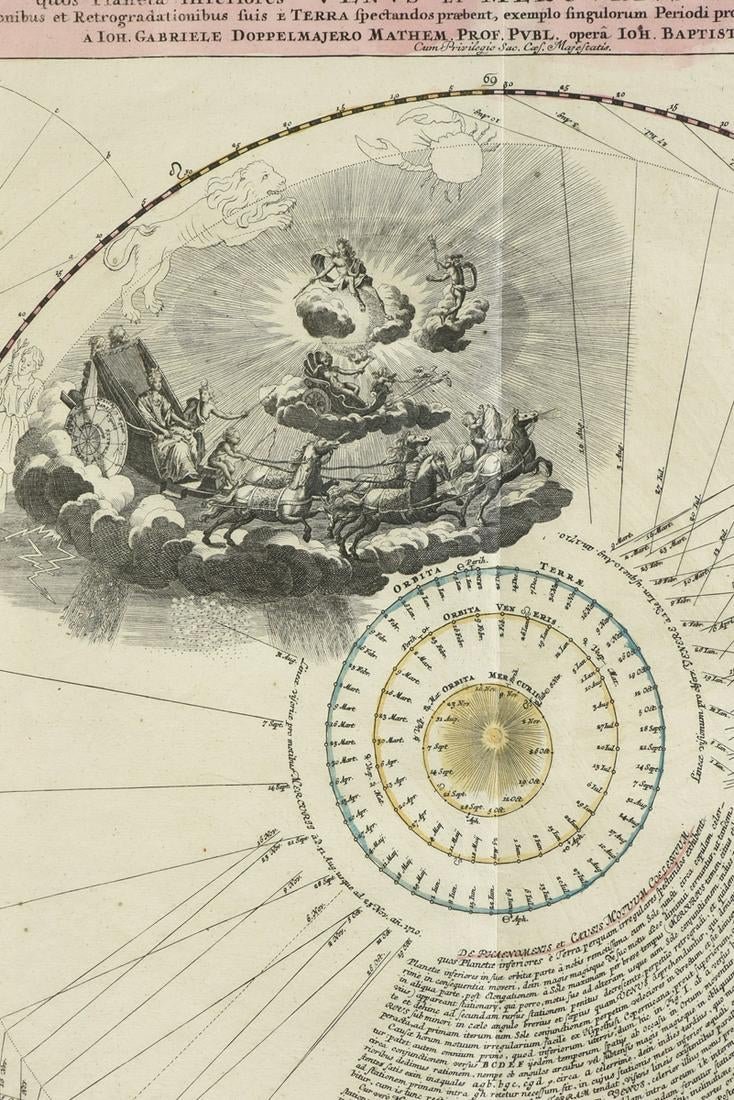
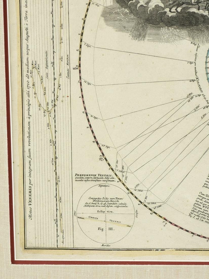
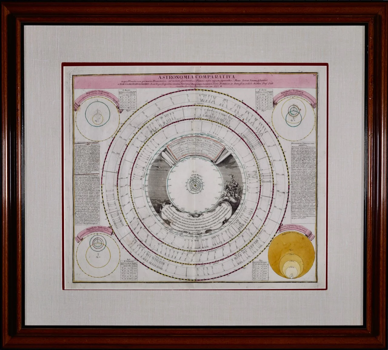
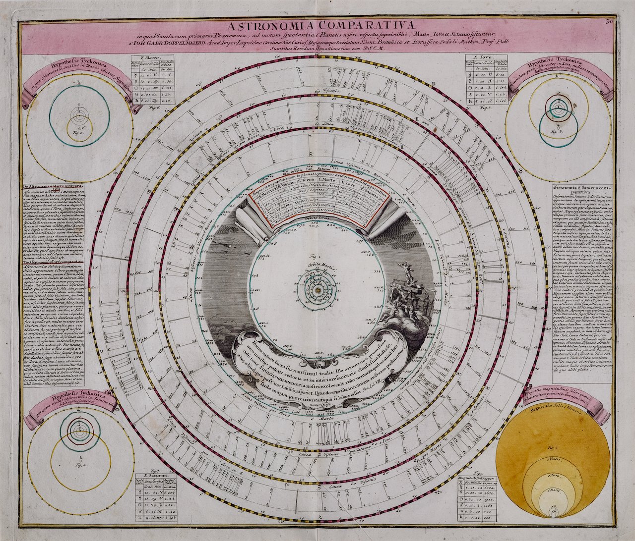
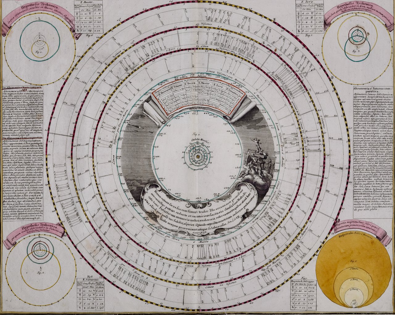
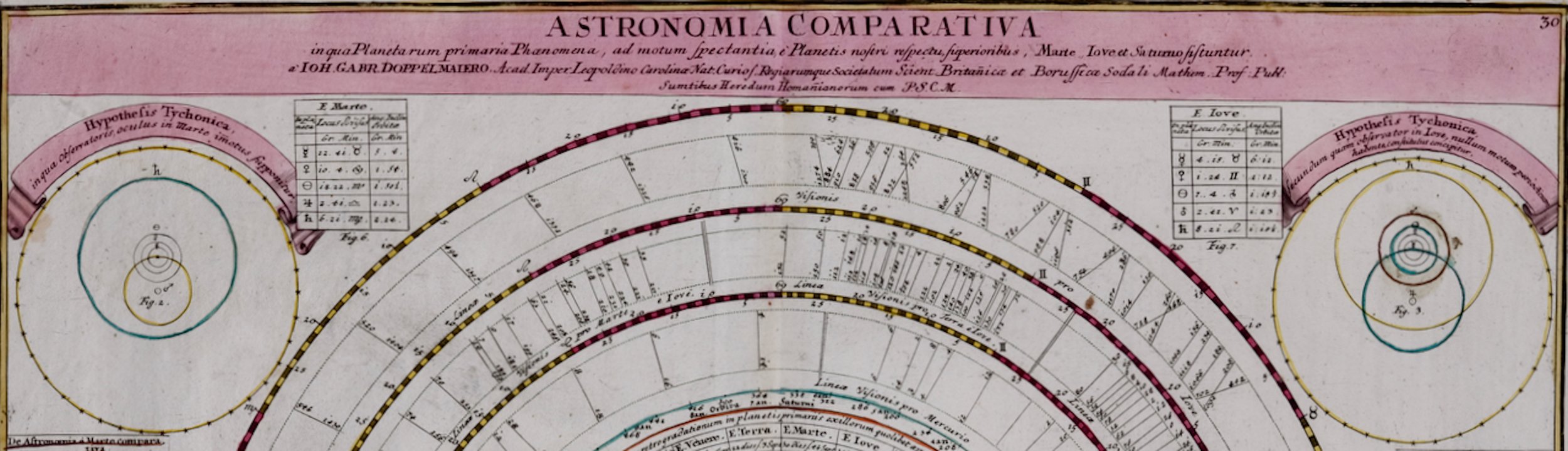
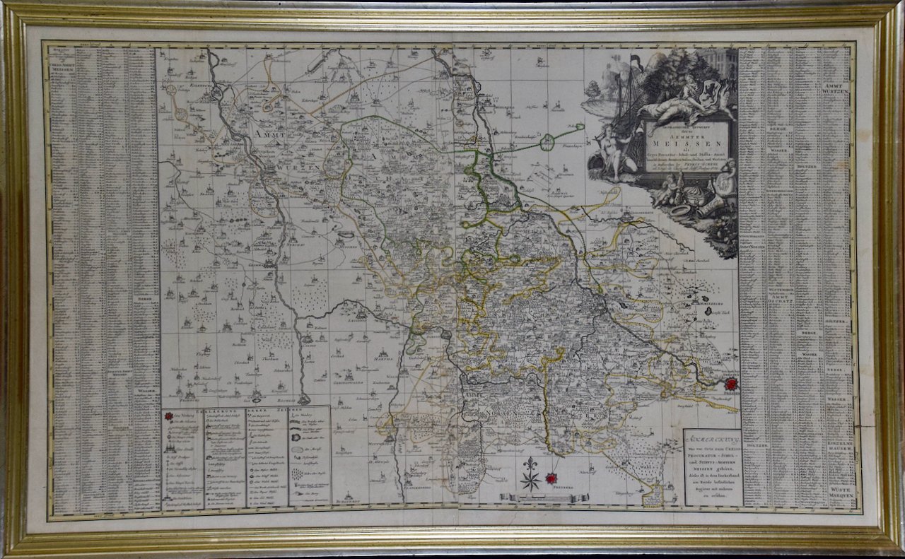
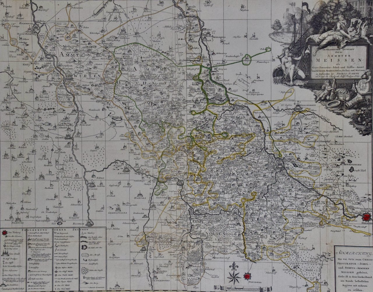
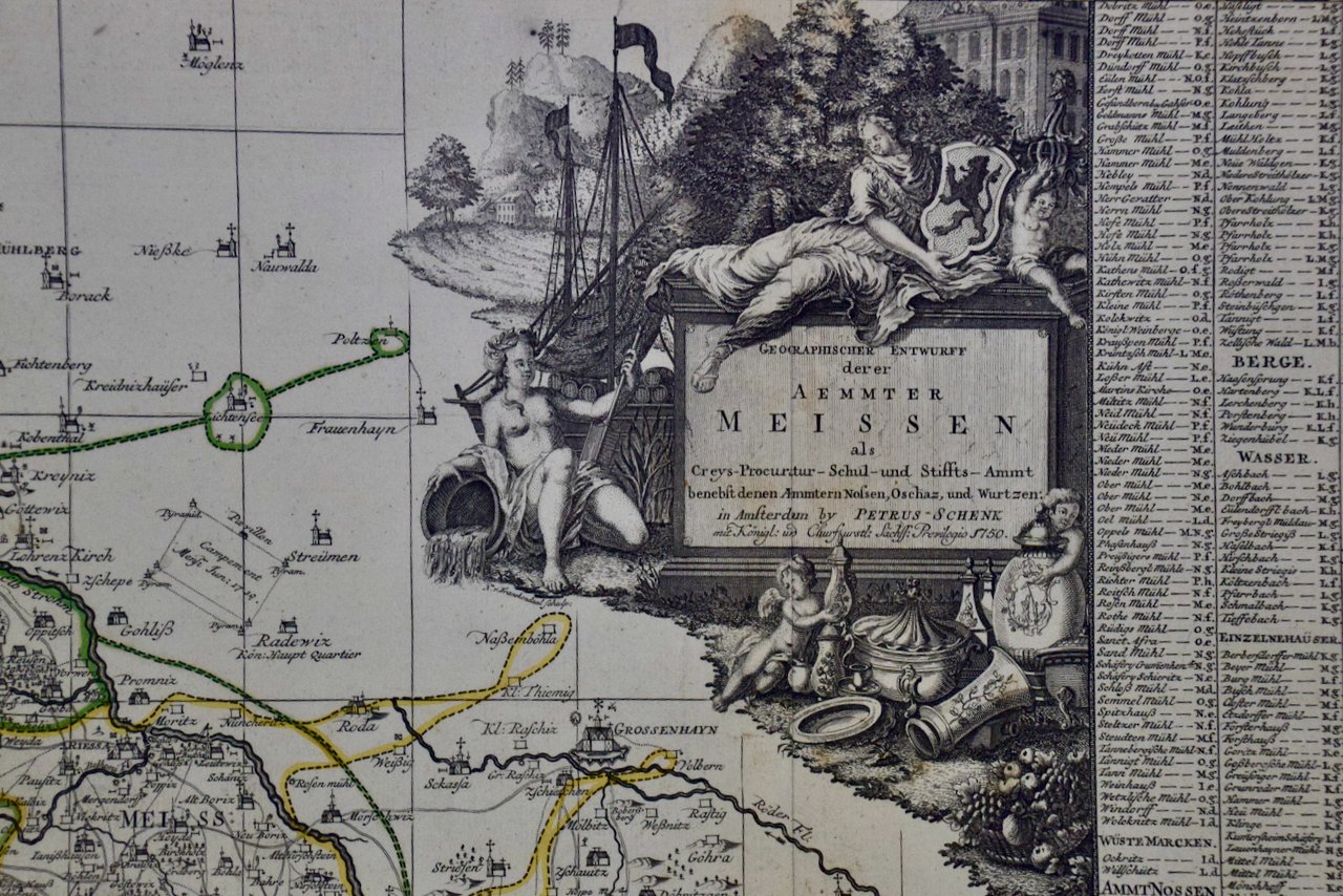
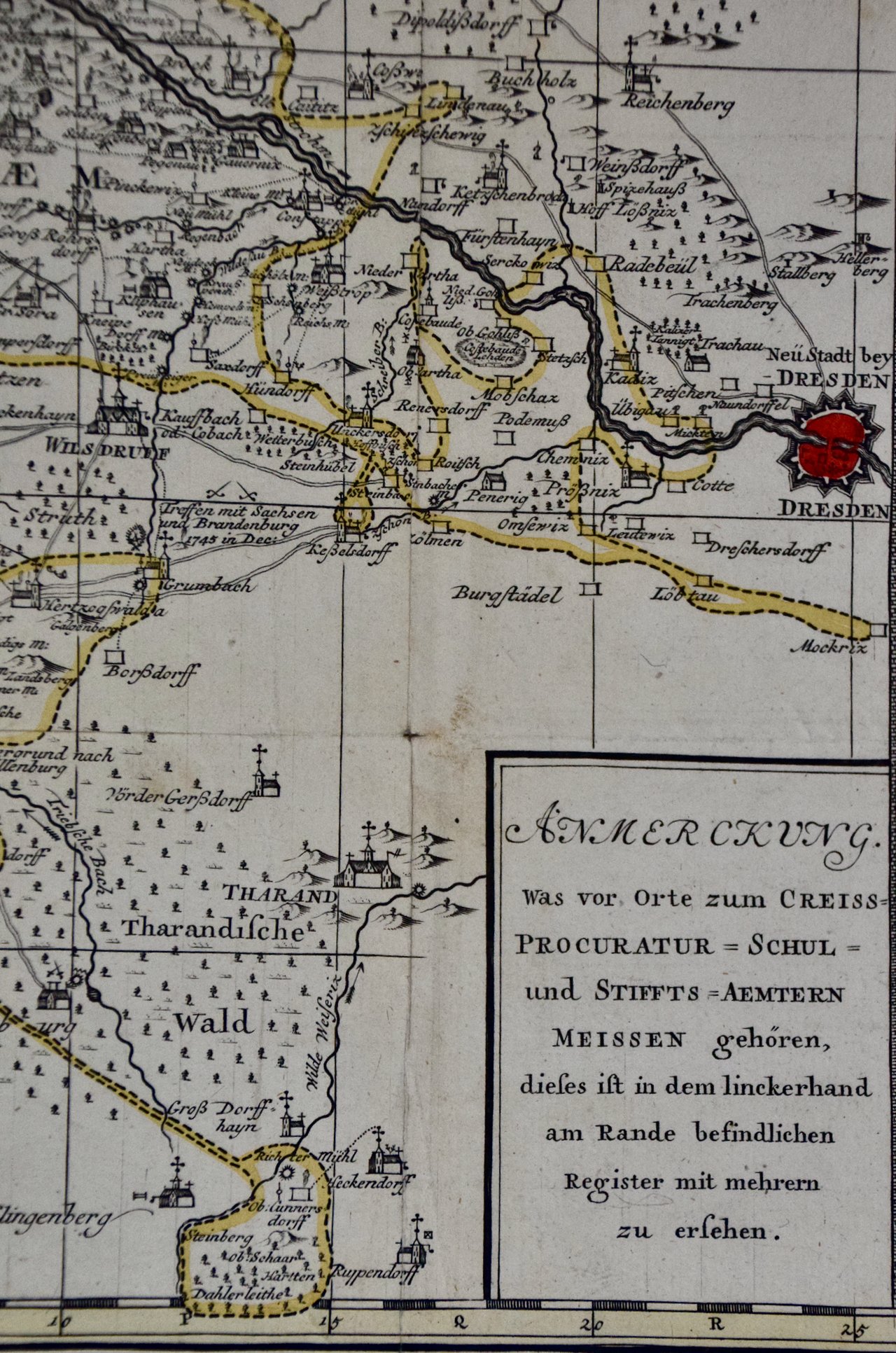
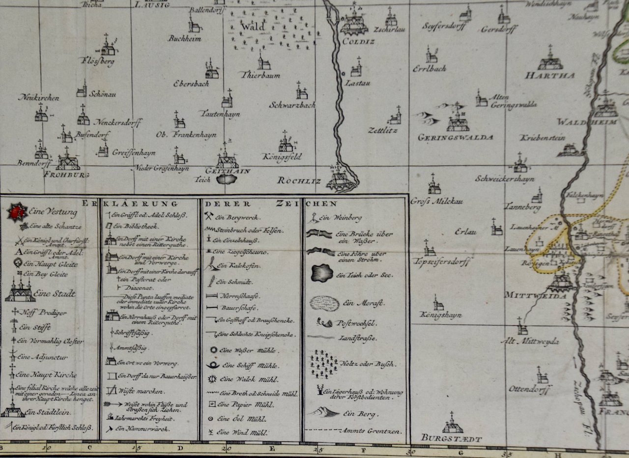
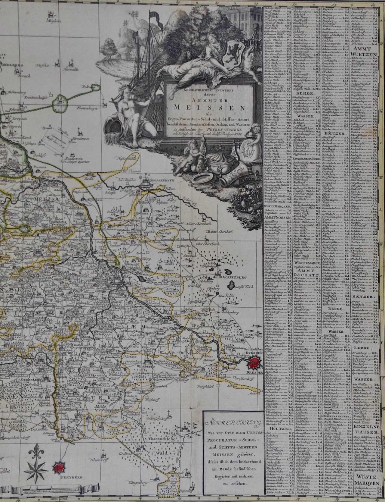
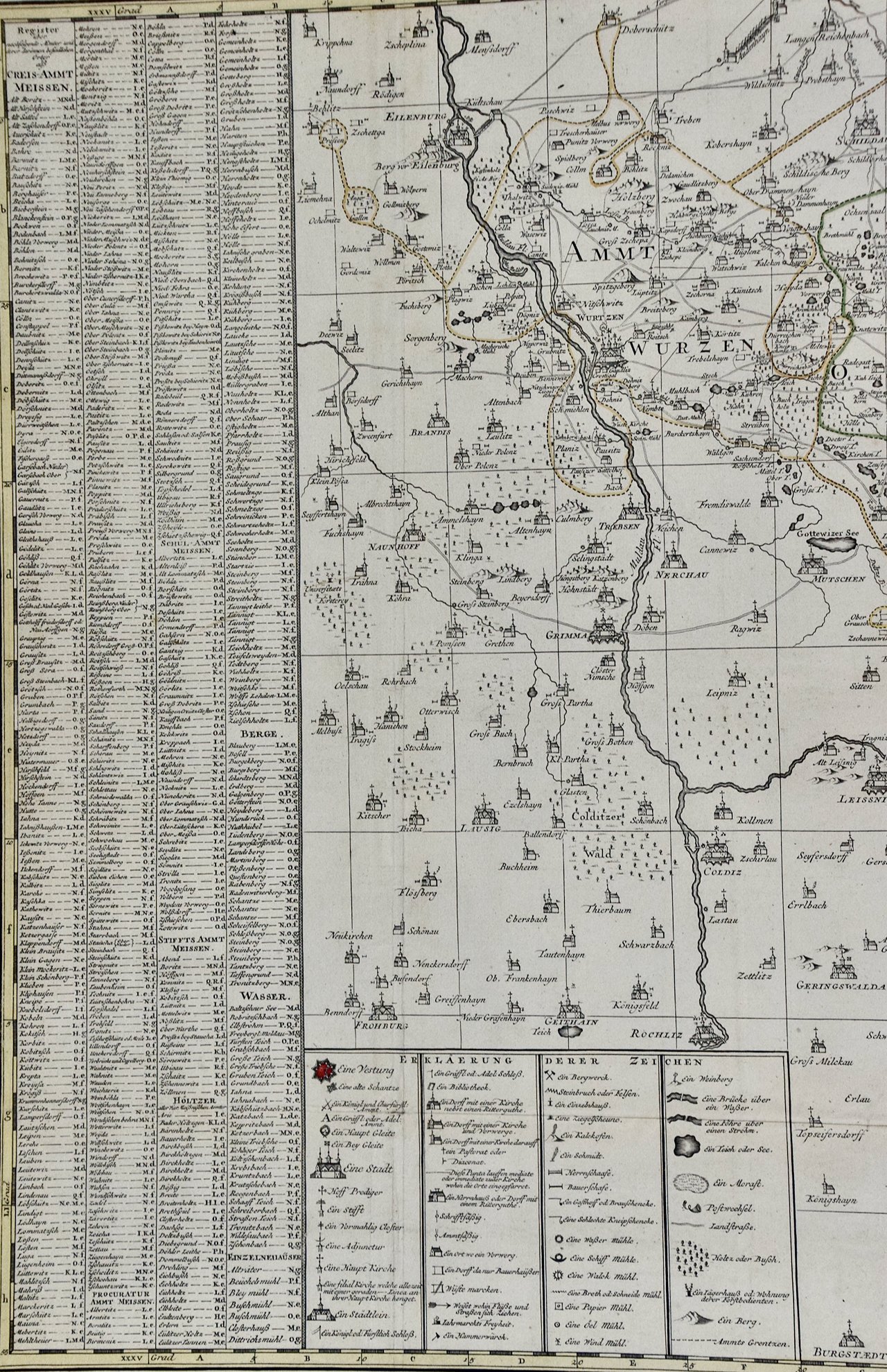
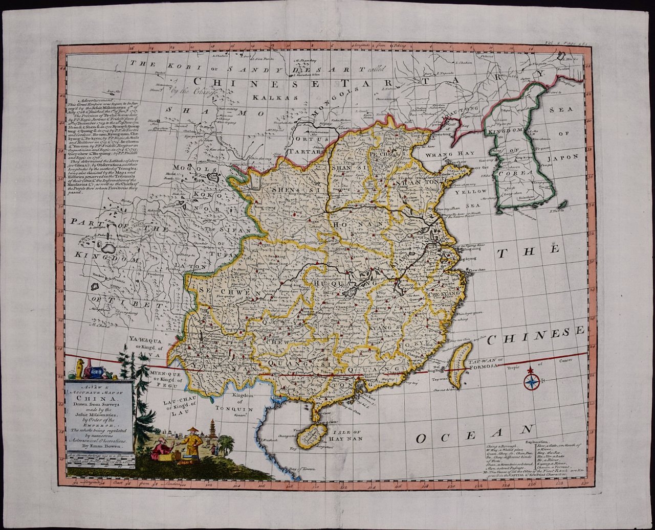
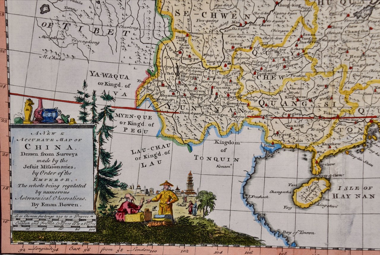
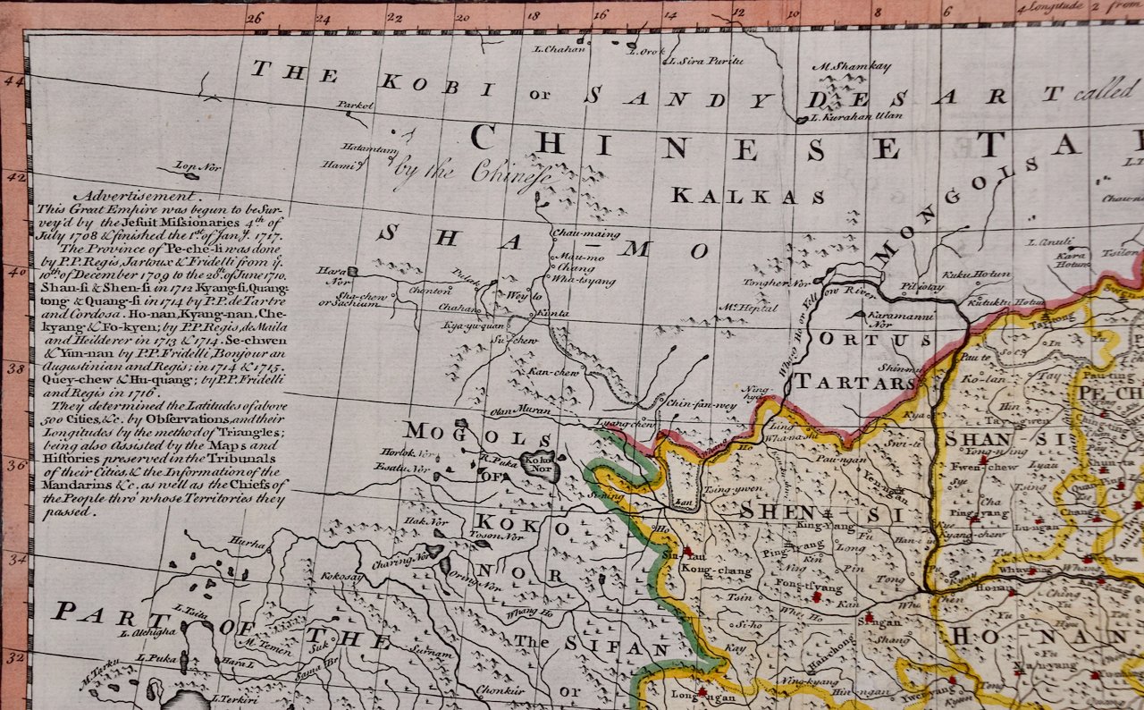
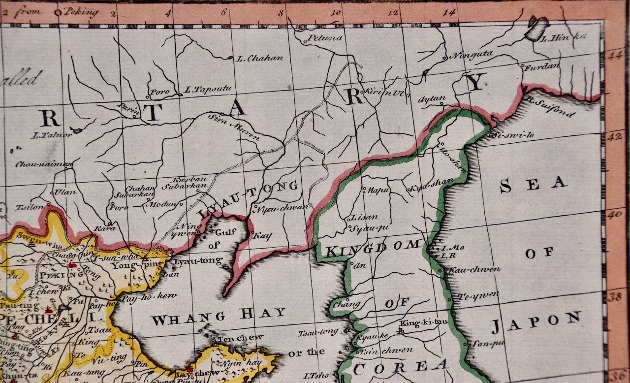
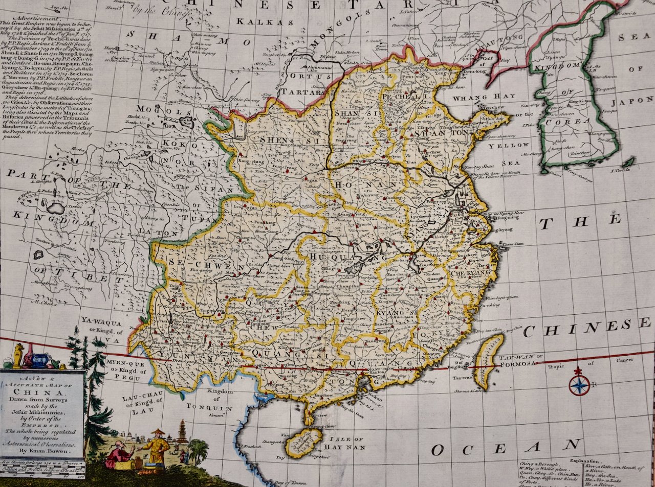
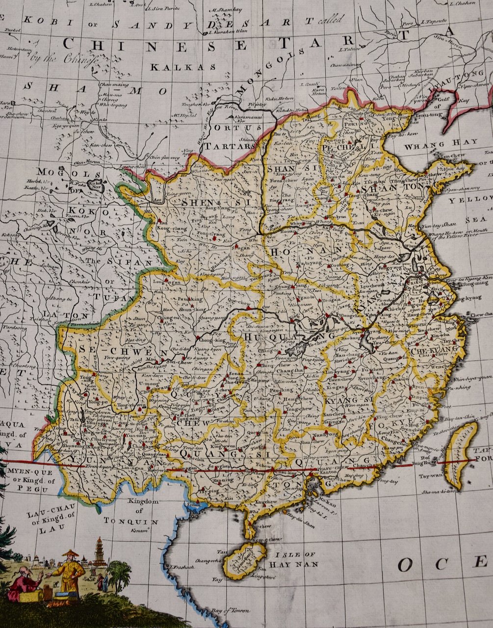
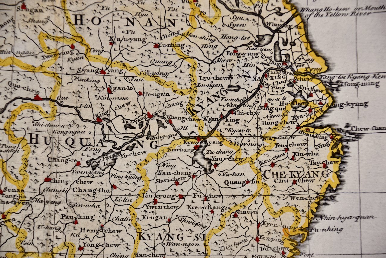
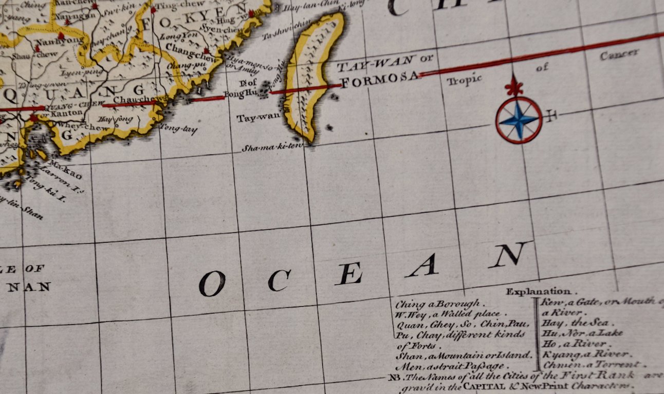
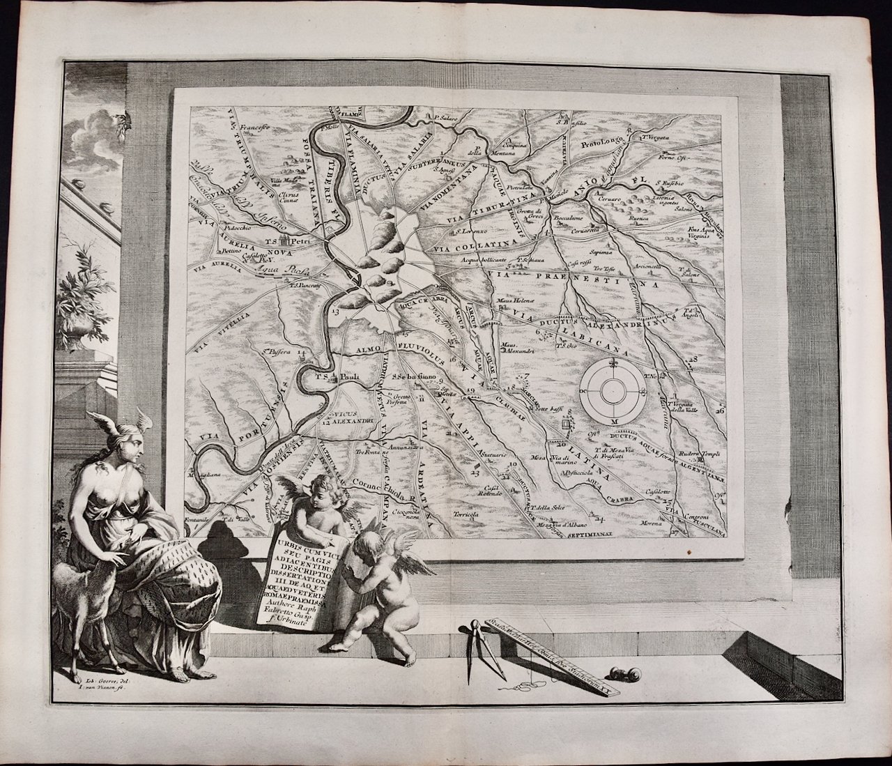
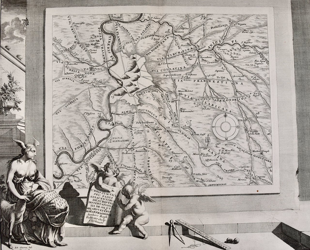
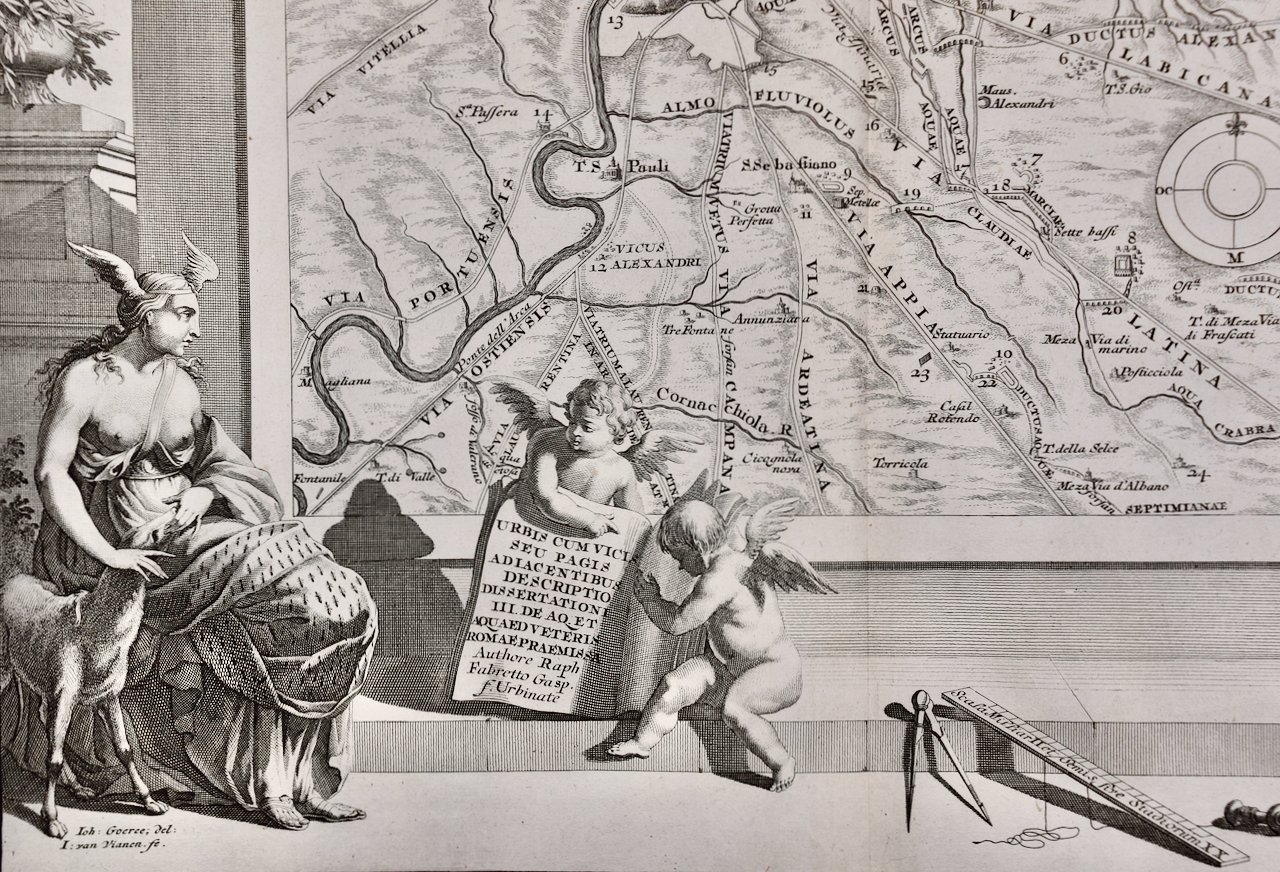
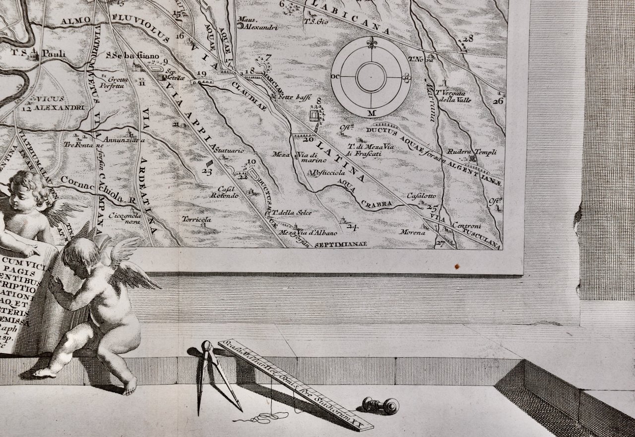
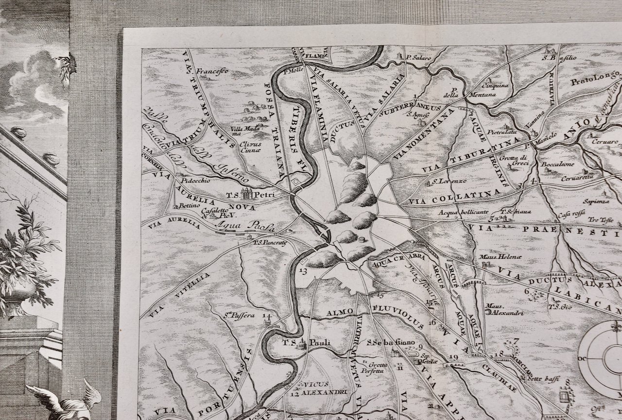
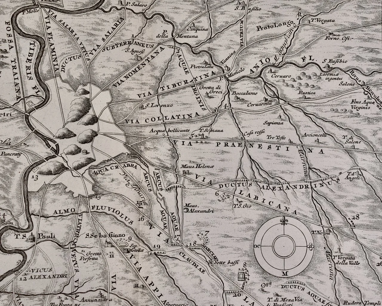
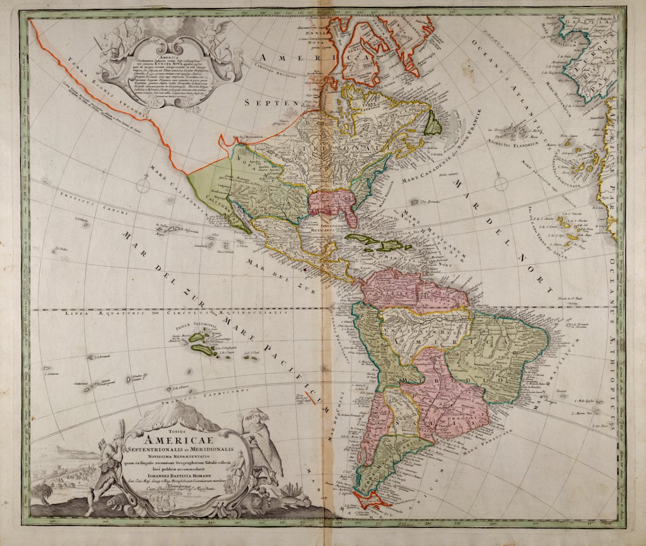
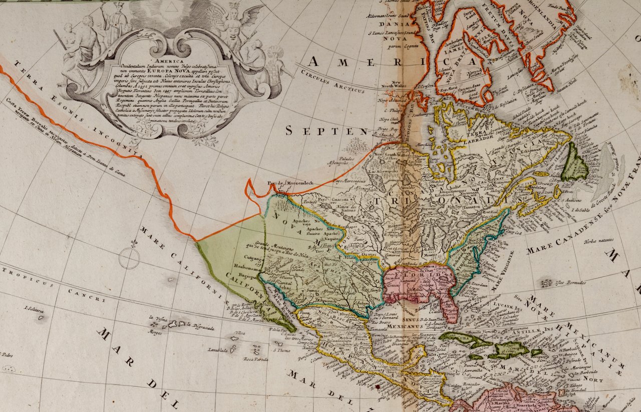
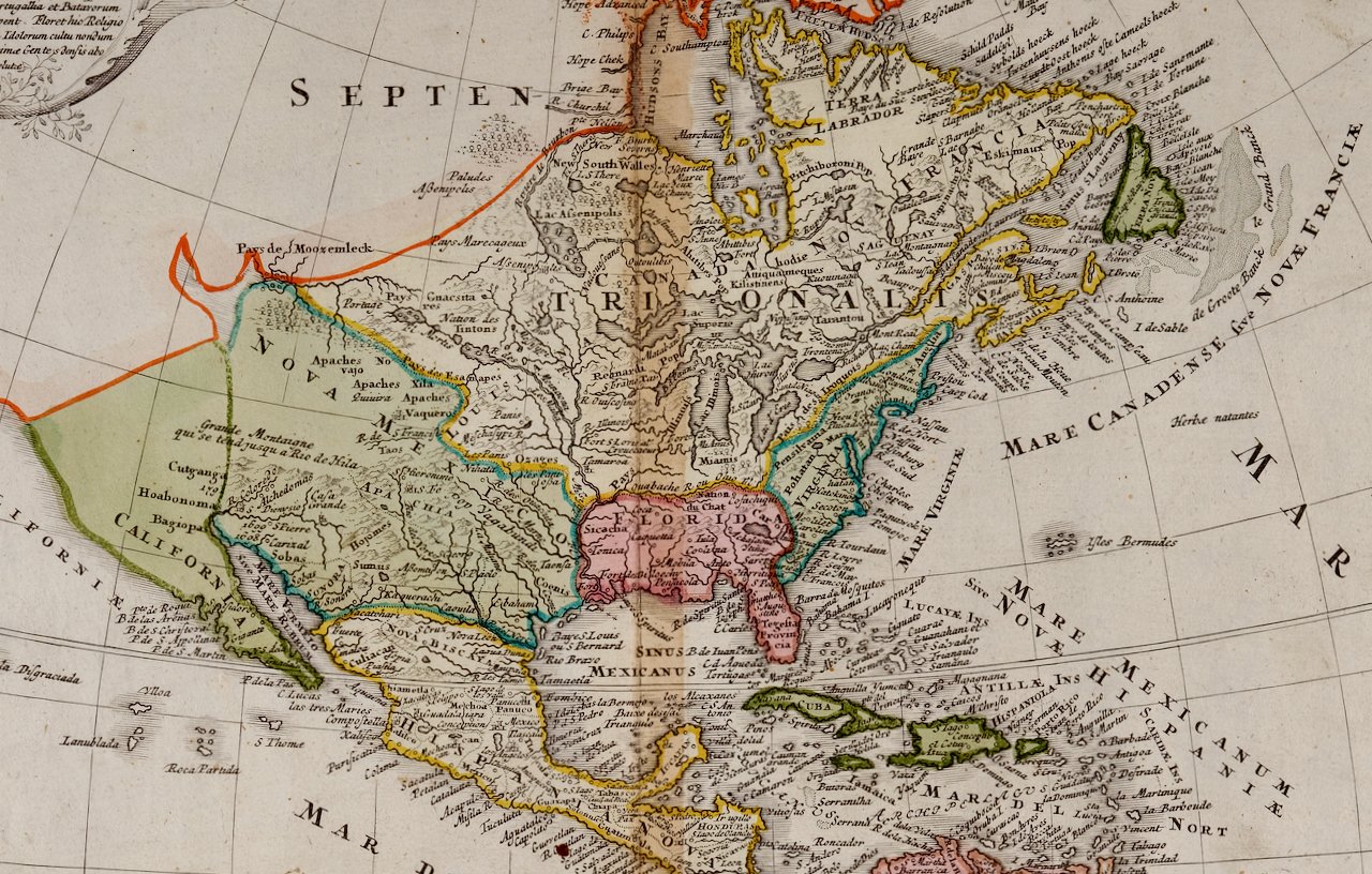
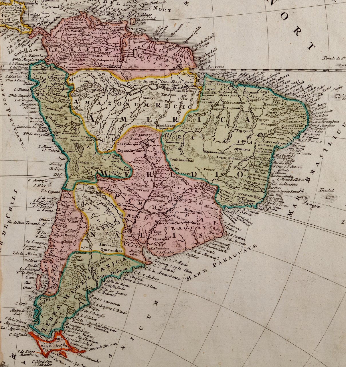
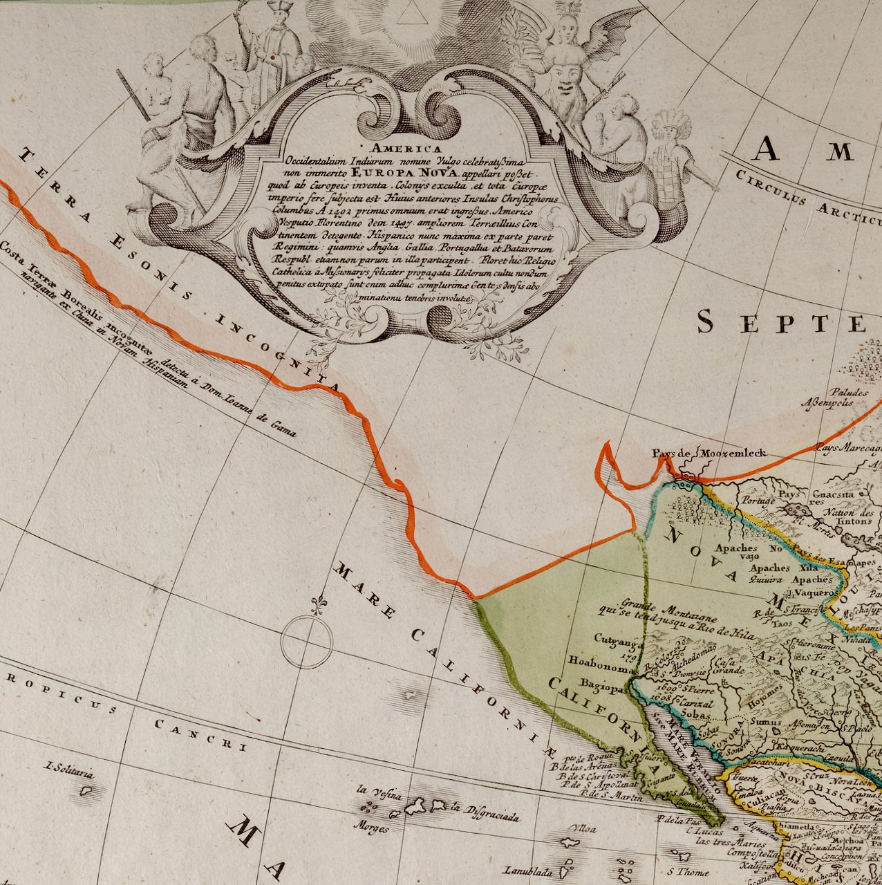
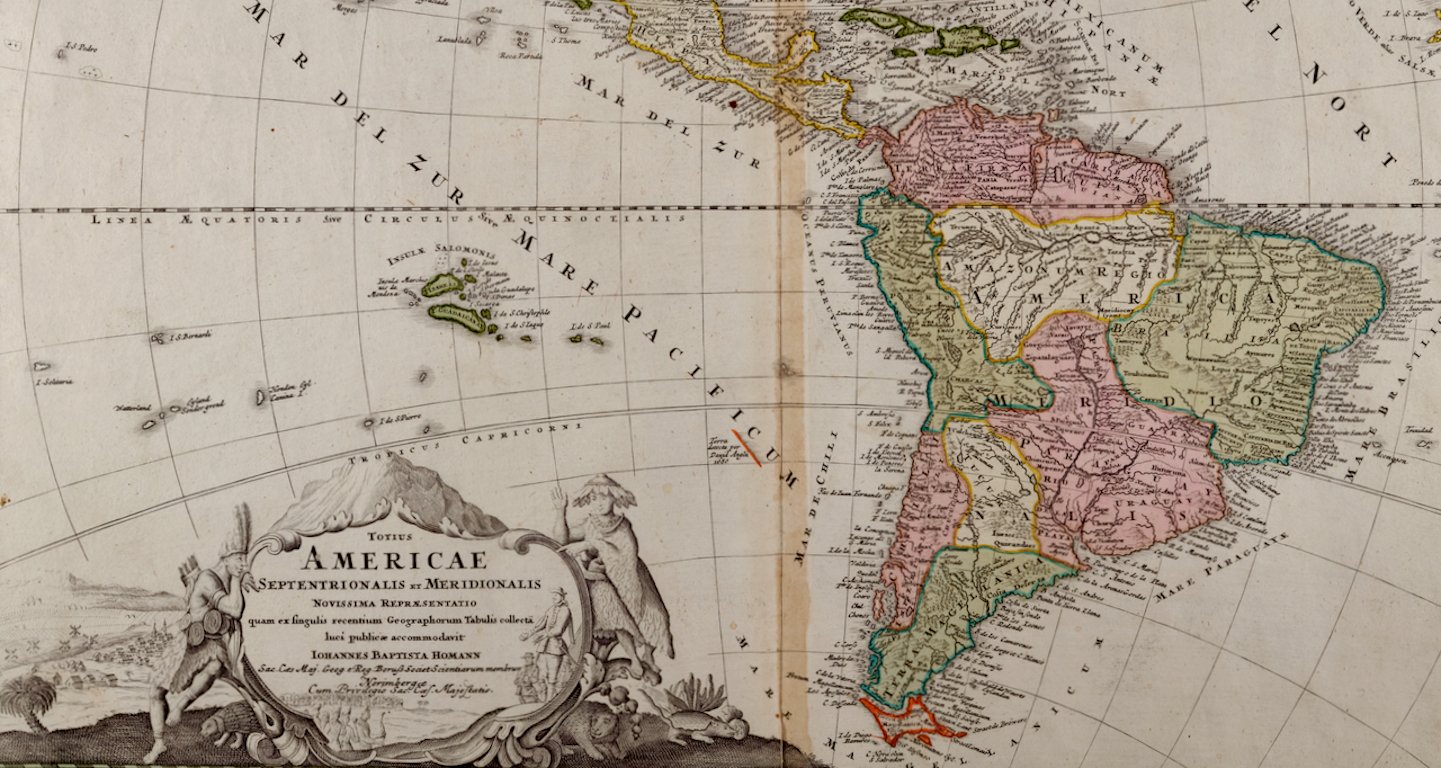
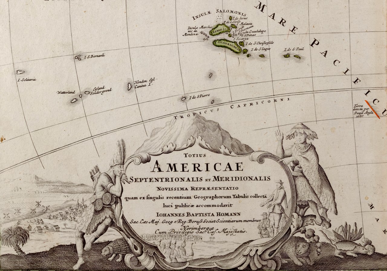
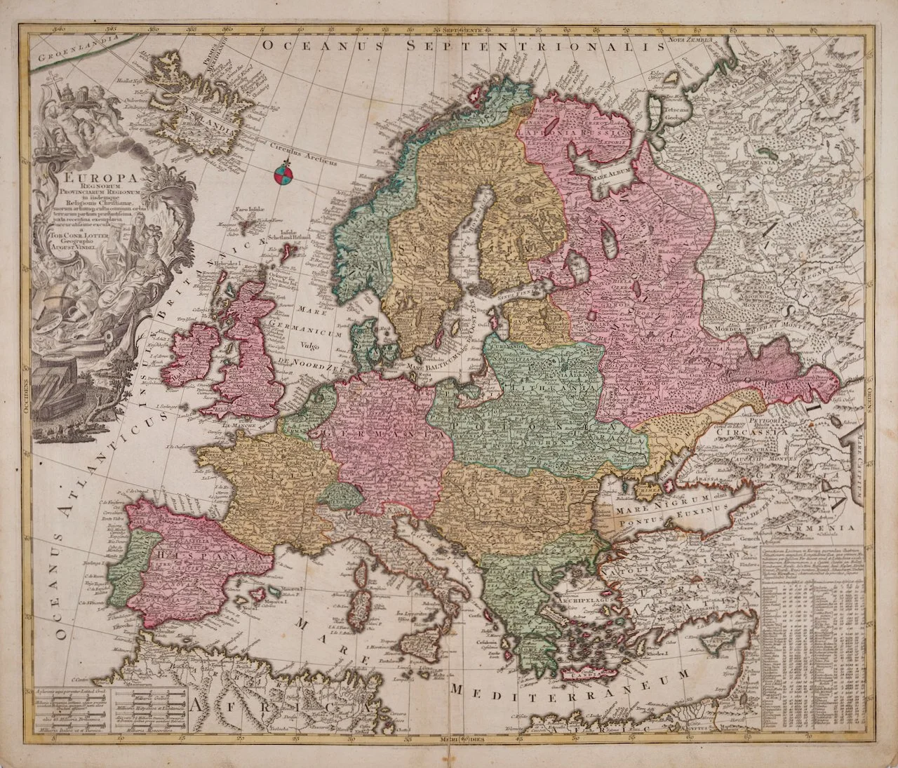
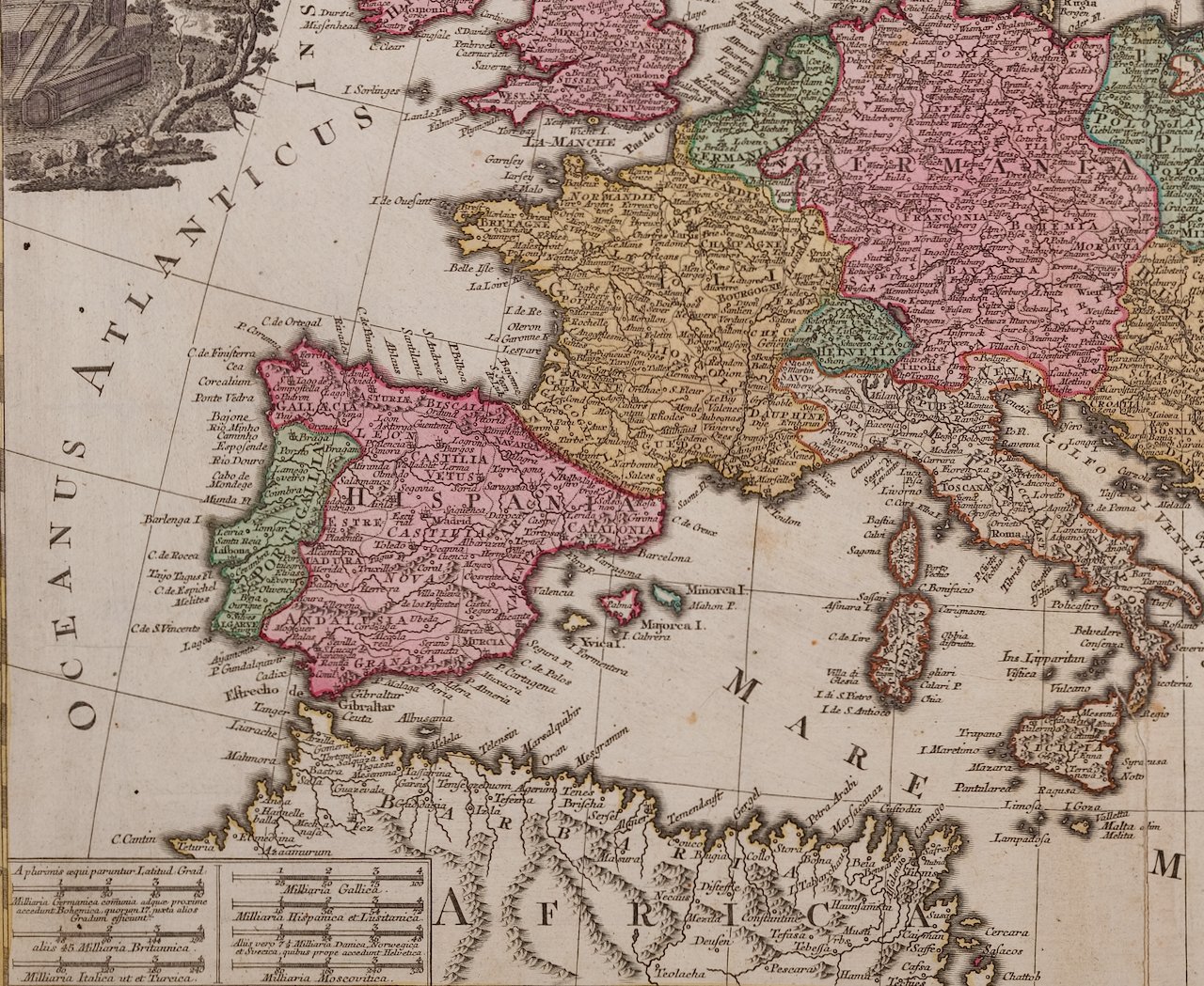
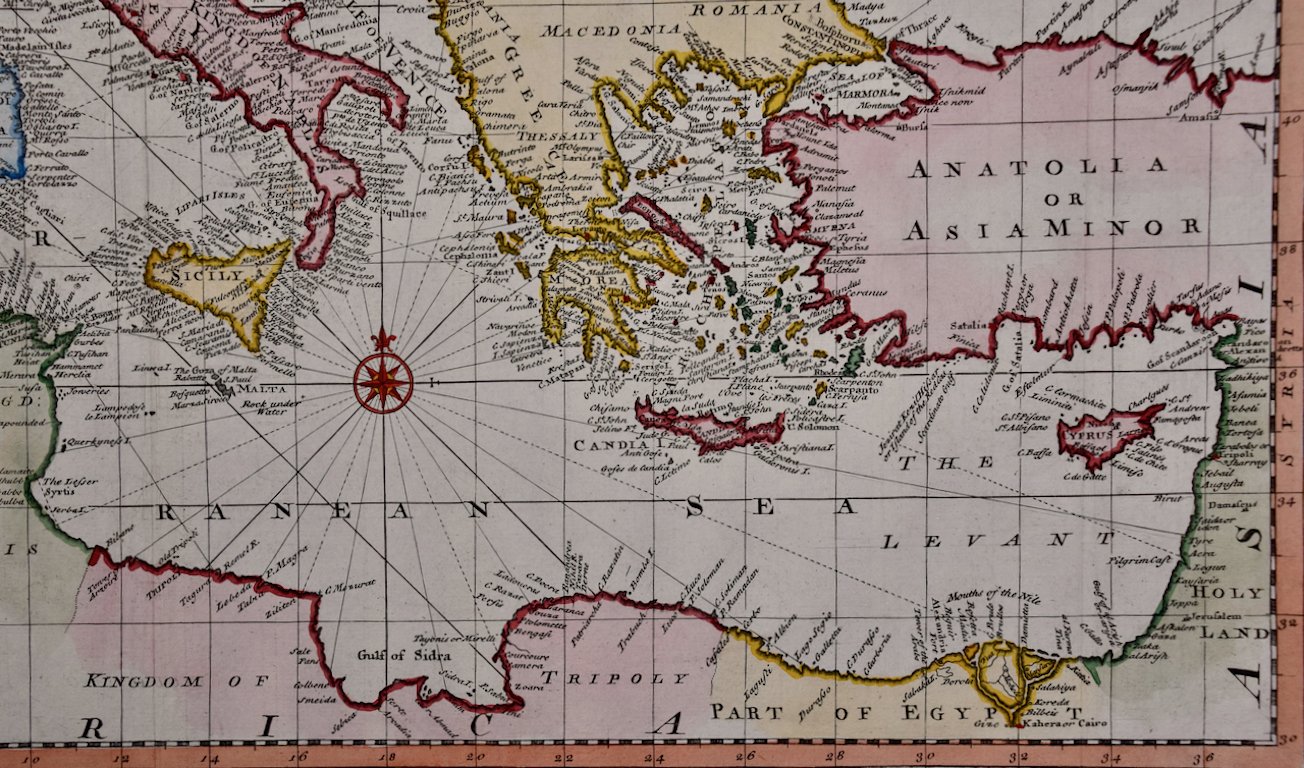
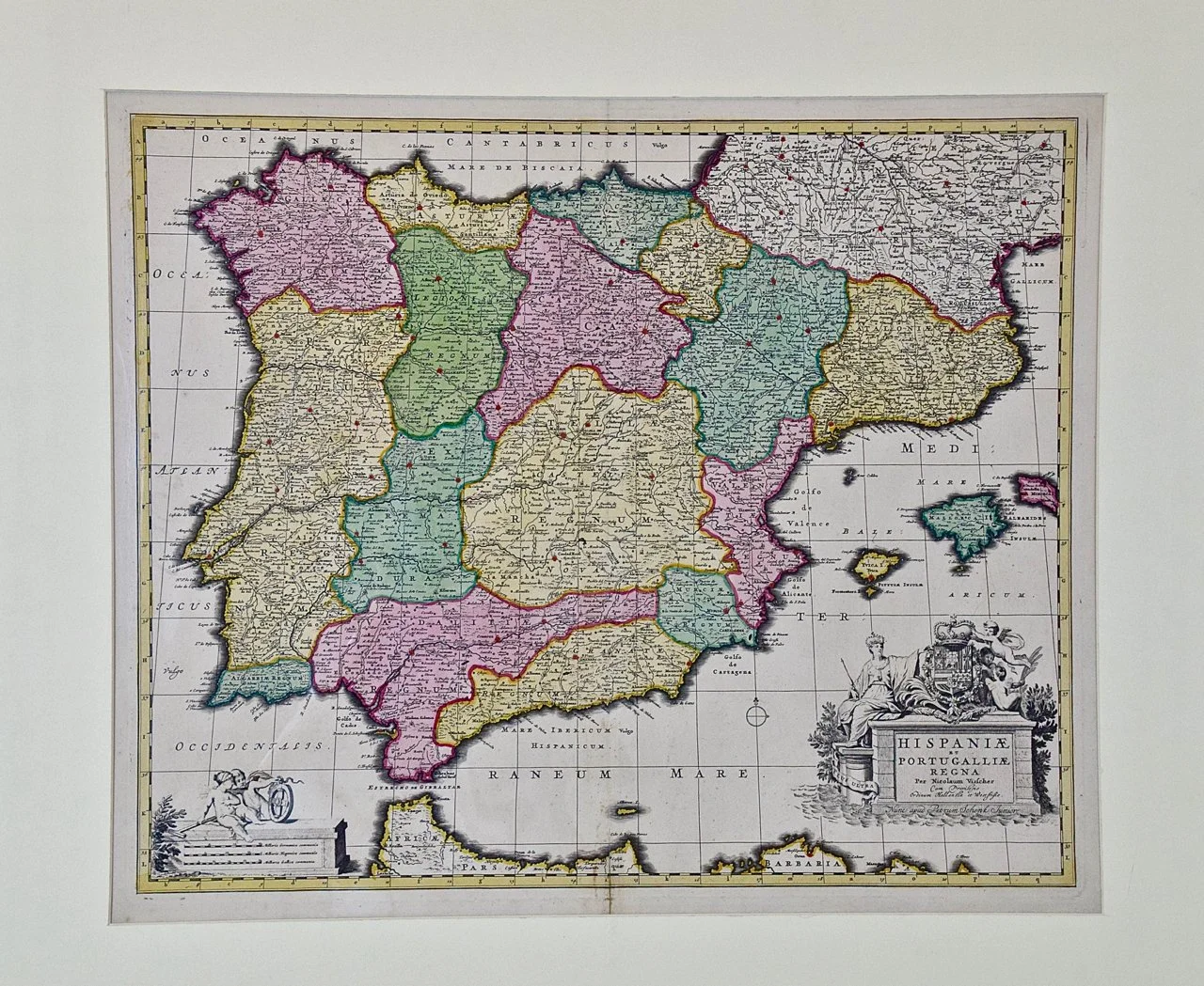
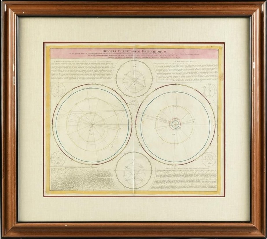
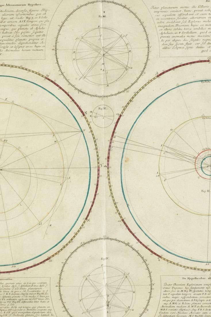
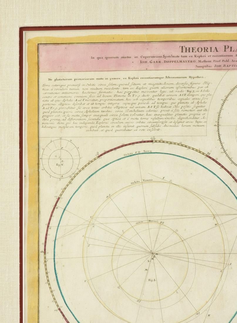
18th Century 18th Century Clear Antiquarian Prints Antiquarian Maps Celestials World Historical 19th Century 18th Century 17th Century 16th Century Americas Europe Russia Asia Africa Middle East & Holy Land Oceania City Plans & Views Battle Maps & Scenes Sea Charts Miscellaneous Antiquarian Books Paintings and Drawings Filters Categories Select a Category Antiquarian Prints Abstract Art Deco American Modern Naturalistic Victorian Romantic Old Masters Historical 20th Century 19th Century 18th Century 17th Century 16th Century Early American Civil War Gold Rush Exploration Maritime Science Natural History Insects Animals Birds Botanicals Topographical Views Landscape Africa America Egypt and the Holy Land Europe France Great Britain Hawaii New Zealand Tahiti Tonga Russia Portraiture Satire Religious Saints Decorative Art Fine Arts Graphic Arts Costumes Architecture Bridges Churches Miscellaneous Antiquarian Maps Celestials World Historical 19th Century 18th Century 17th Century 16th Century Americas North America South America Europe Austria Belgium Croatia England France Germany Greece Holland Hungary Ireland Italy Netherlands Scotland Spain Sweeden United Kingdom Russia Asia China East Indies India Indonesia Phillipines Africa Middle East & Holy Land Oceania City Plans & Views Battle Maps & Scenes Sea Charts Miscellaneous Antiquarian Books Illustrated Religious Art Architecture Exploration & Travel History Customs and Traditions Natural History Math & Science Astronomy People Literature Satire Children's Paintings and Drawings Filter Clear Filter West Coast of Africa; Guinea & Sierra Leone: Bellin 18th Century Map $575.00 St. Christophe (St. Kitts): Bellin 18th Century Hand Colored Map $575.00 West Africa: 18th Century Hand-colored Homann Map Entitled "Guinea Propria" $1,875.00 The Kingdom of Naples and Southern Italy: A Hand-Colored 18th Century Homann Map $1,175.00 18th Century French Map and City View of Joppe/Jaffa 'Tel Aviv' by Sanson $1,075.00 Hand Colored 18th Century Homann Map of Austria Including Vienna & the Danube $625.00 A Hand Colored 18th Century Framed Map of South America by Thomas Jefferys $475.00 California: 18th Century Hand-colored Map by de Vaugondy $975.00 Sweden and Adjacent Portions of Scandinavia: A Hand-colored 18th C. Homann Map $975.00 Danube River, Italy, Greece and Croatia: A Hand-colored 18th C. Homann Map $875.00 Captain Cook's Exploration of Tahiti: 18th C. Hand-colored Map by Bellin $775.00 The Orbits of Venus and Mercury: An 18th C. Framed Celestial Map by Doppelmayr $2,175.00 Theories of Planetary Orbits: A Framed 18th C. Celestial Map by Doppelmayr $2,175.00 Meissen, Germany : A Large Framed 18th Century Map by Petrus Schenk $1,175.00 China: An Original 18th Century Hand-colored Map by E. Bowen $1,075.00 Map of the World: An Original 18th Century Hand-colored Map by E. Bowen $1,275.00 Roman Hills, Aqueducts and Roads: An Early 18th Century Map by Jan Goeree $575.00 North and South America: An 18th Century Hand-colored Map by Johann Homann $2,375.00 Europa Regnorum Provinciarum: 18th Century Hand-colored Map of Europe by Lotter $875.00 Map of the East Indies: An Original 18th Century Hand-colored Map by E. Bowen $1,275.00 Map of the Russian Empire: An Original 18th Century Hand-colored Map by E. Bowen $675.00 Mediterranean and Adriatic Seas: Original 18th Century Hand-colored Map by Bowen $1,275.00 Siberia as Explored by Behring: Original 18th Century Hand-colored Map by Bowen $475.00 Spain and Portugal: A Hand-colored 17th/18th Century Map by Visscher 1725 $1,275.00 Theories of Planetary Motion: An 18th C. Framed Celestial Map by Doppelmayr $2,175.00 No results found No results match your search. Try removing a few filters.