Skip to Content
Timeless Intaglio: Rare Prints, Maps & Books
Shop
All Listings
Antiquarian Prints
Antiquarian Maps
Antiquarian Books
Artists
Our Story
Previews
Contact
Login Account
0
0
Search
Timeless Intaglio: Rare Prints, Maps & Books
Shop
All Listings
Antiquarian Prints
Antiquarian Maps
Antiquarian Books
Artists
Our Story
Previews
Contact
Login Account
0
0
Search
Folder: Shop
Back
All Listings
Antiquarian Prints
Antiquarian Maps
Antiquarian Books
Artists
Our Story
Previews
Contact
Login Account
Search
Shop China: An Original 18th Century Hand-colored Map by E. Bowen
4983 Bowen, A New & Accurate Map of China.jpeg Image 1 of 8
4983 Bowen, A New & Accurate Map of China.jpeg
4983A Bowen, A New & Accurate Map of China.jpeg Image 2 of 8
4983A Bowen, A New & Accurate Map of China.jpeg
4983B Bowen, A New & Accurate Map of China.jpeg Image 3 of 8
4983B Bowen, A New & Accurate Map of China.jpeg
4983C Bowen, A New & Accurate Map of China.jpeg Image 4 of 8
4983C Bowen, A New & Accurate Map of China.jpeg
4983D Bowen, A New & Accurate Map of China.jpeg Image 5 of 8
4983D Bowen, A New & Accurate Map of China.jpeg
4983E Bowen, A New & Accurate Map of China.jpeg Image 6 of 8
4983E Bowen, A New & Accurate Map of China.jpeg
4983F Bowen, A New & Accurate Map of China.jpeg Image 7 of 8
4983F Bowen, A New & Accurate Map of China.jpeg
4983G Bowen, A New & Accurate Map of China.jpeg Image 8 of 8
4983G Bowen, A New & Accurate Map of China.jpeg
4983 Bowen, A New & Accurate Map of China.jpeg
4983A Bowen, A New & Accurate Map of China.jpeg
4983B Bowen, A New & Accurate Map of China.jpeg
4983C Bowen, A New & Accurate Map of China.jpeg
4983D Bowen, A New & Accurate Map of China.jpeg
4983E Bowen, A New & Accurate Map of China.jpeg
4983F Bowen, A New & Accurate Map of China.jpeg
4983G Bowen, A New & Accurate Map of China.jpeg

China: An Original 18th Century Hand-colored Map by E. Bowen

$1,075.00

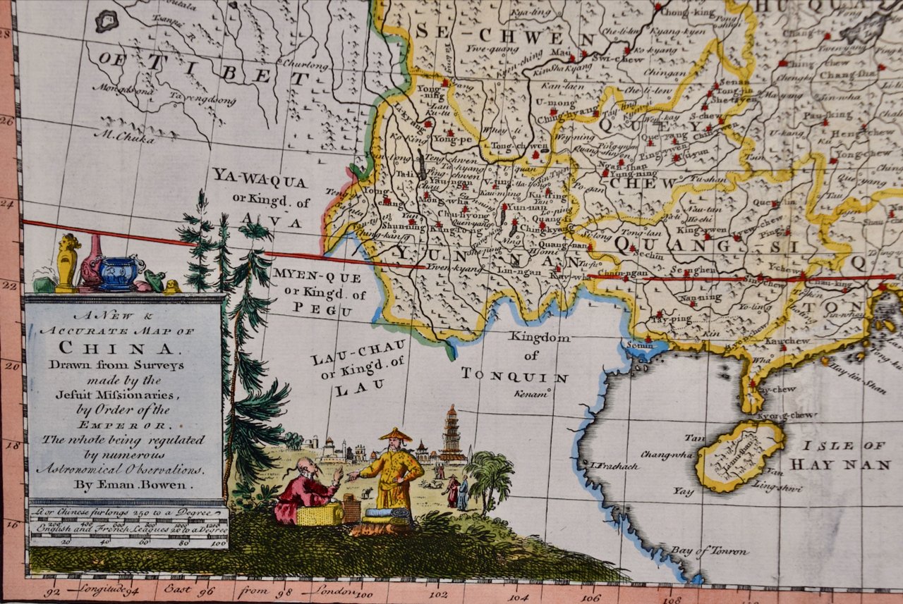
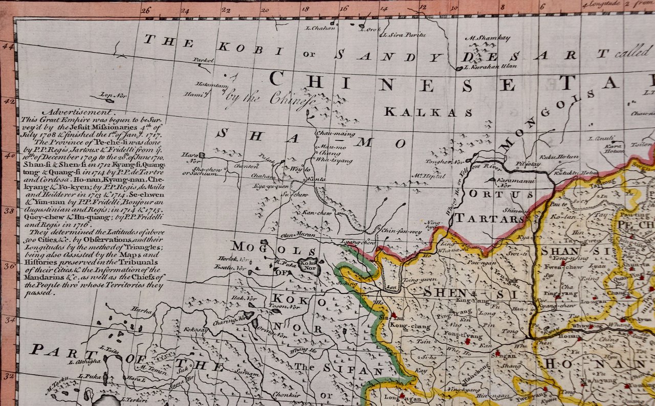
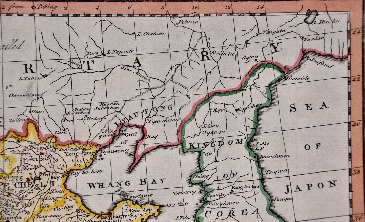
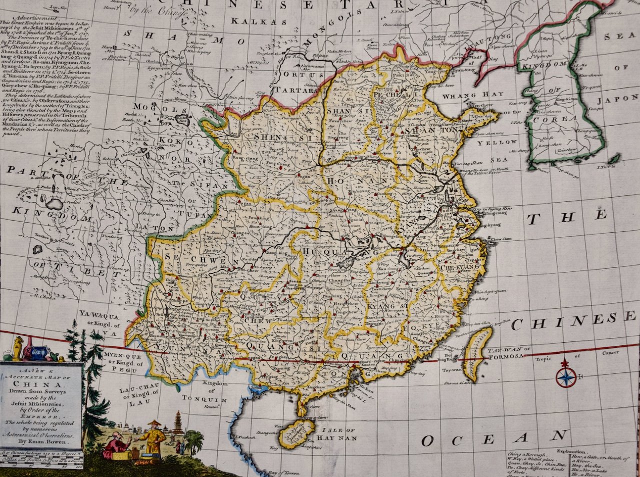
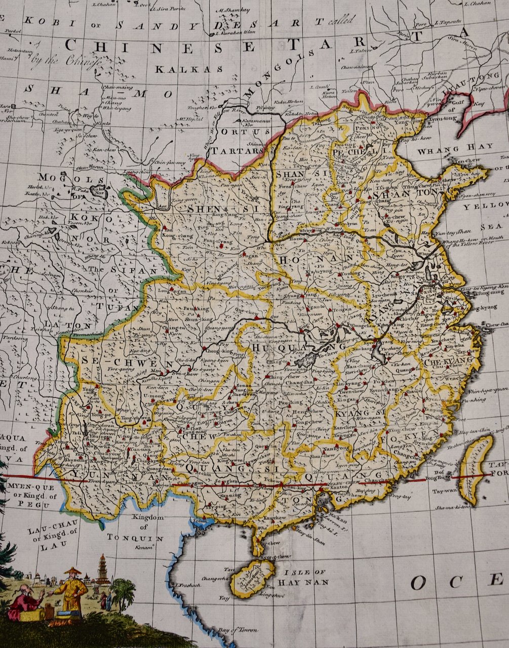
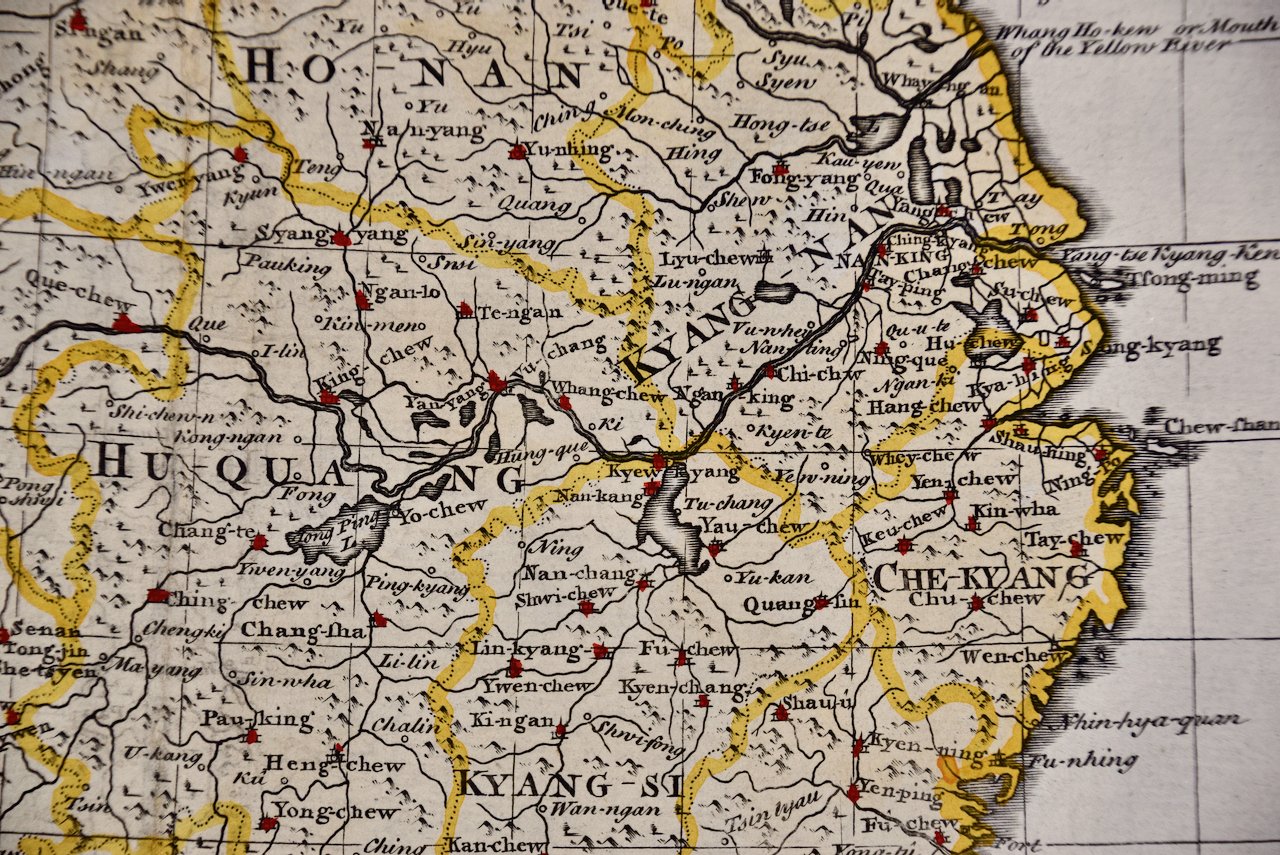
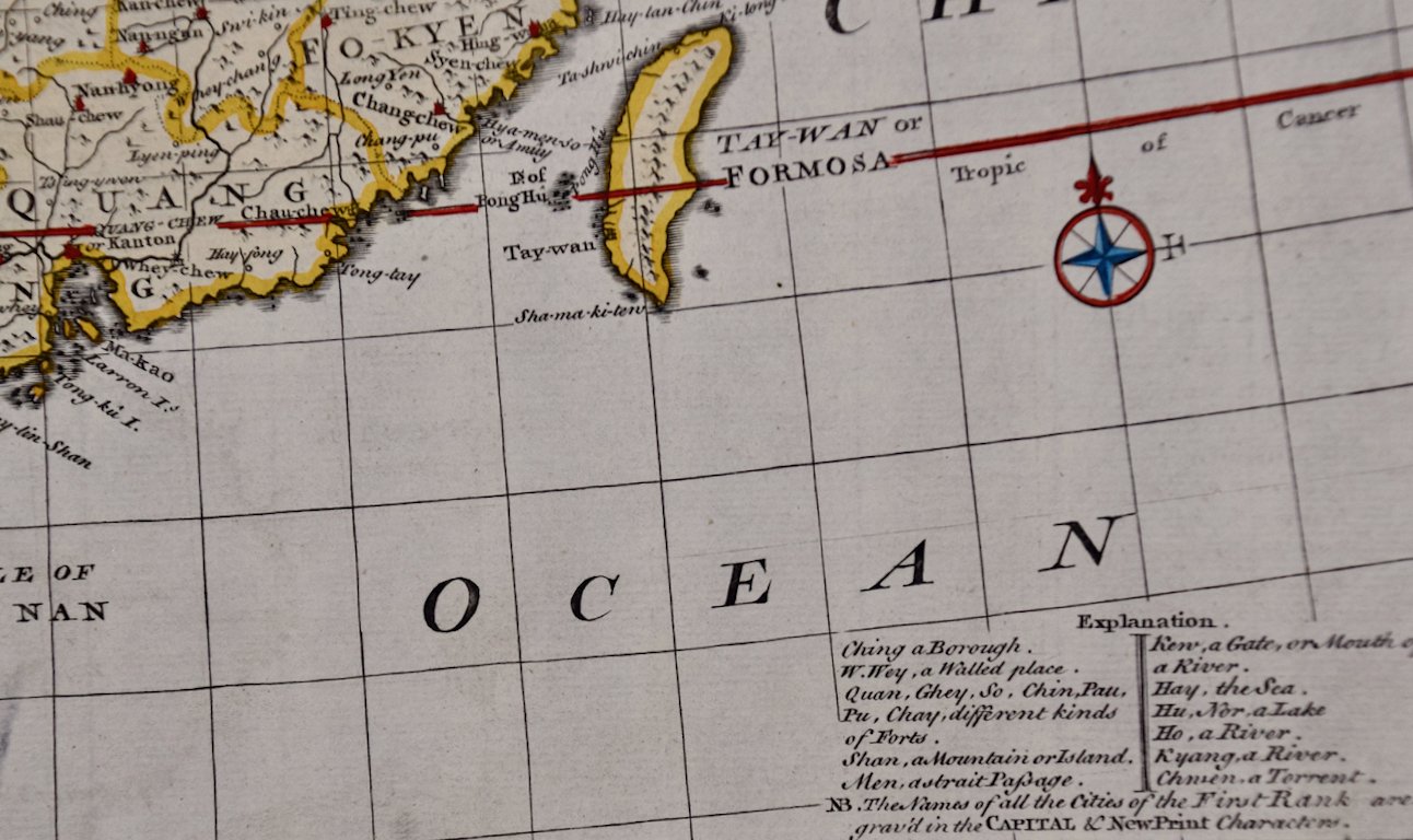
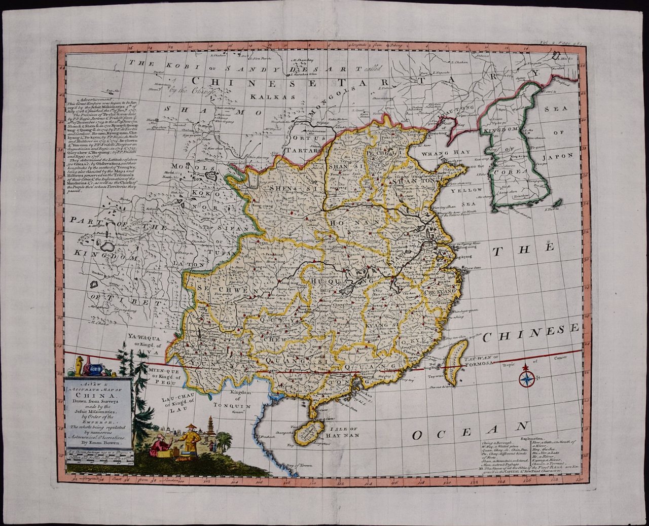
This is an original 18th century hand-colored map entitled "A New & Accurate Map of China, Drawn from Surveys made by the Jesuit Missionaries, by order of the Emperor. The whole being regulated by numerous astronomical observations" by Emanuel Bowen. It was published in 1744 in London in John Harris's "Navigantium atque Itinerantium Bibliotheca" or "A Complete Collection of Voyages and Travels". This highly detailed and colorful map depicts China, Korea, Taiwan (Formosa), the Yangtze and Yellow Rivers, the great cities of China and a portion of Mongolia in the north and Southeast Asia in the south.

Creator: Emanuel Bowen (1694 - 1767, British)

Creation Year: 1744

Dimensions: Height: 15.75 in (40.01 cm) Width: 19.75 in (50.17 cm)

Medium: Engraving

Condition: See description below.

Reference #: 4983

Add To Cart

This is an original 18th century hand-colored map entitled "A New & Accurate Map of China, Drawn from Surveys made by the Jesuit Missionaries, by order of the Emperor. The whole being regulated by numerous astronomical observations" by Emanuel Bowen. It was published in 1744 in London in John Harris's "Navigantium atque Itinerantium Bibliotheca" or "A Complete Collection of Voyages and Travels". This highly detailed and colorful map depicts China, Korea, Taiwan (Formosa), the Yangtze and Yellow Rivers, the great cities of China and a portion of Mongolia in the north and Southeast Asia in the south.

Creator: Emanuel Bowen (1694 - 1767, British)

Creation Year: 1744

Dimensions: Height: 15.75 in (40.01 cm) Width: 19.75 in (50.17 cm)

Medium: Engraving

Condition: See description below.

Reference #: 4983

The map is embellished with a Compass Rose in the lower right and an elaborate decorative title and distance scale cartouche in the lower left, which depicts Chinese architecture, pottery, a landscape with farm animals and a salesman sitting on the ground showing his wares to a standing wealthy appearing customer. Text in the upper left describes Jesuit surveys of China in the early 18th century.

This striking and beautifully hand-colored original 18th century map is printed on laid chain-linked paper with wide margins. The sheet measures 15.75" high and 19.75" wide. There is a vertical center fold, as issued. There are two tiny edge chips about the lower right corner. The map is otherwise in very good to excellent condition.

Emanuel Bowen (1694-1767) was a prominent British engraver and cartographer. He was born in Wales and worked in London as a mapmaker and engraver for much of his career. Bowen was honored as a fellow of the Royal Society and as the Royal Mapmaker to both to King George II of England and Louis XV of France. Based in London, Bowen was highly regarded for producing some of the largest, most detailed, most accurate and most attractive maps of his era. He is known to have worked with some of the most prominent cartographic names of the period including Herman Moll, John Owen, and Thomas Kitchin. Bowen was known for his skill in combining information from various sources to create comprehensive and useful maps. Bowen produced a wide range of maps, including maps of the British Isles, Europe, North America, Africa, and Asia. He also created maps for several important atlases, including the "Complete Atlas" (1752) and "A Complete System of Geography" (1747). Despite his renown and success, Bowen, like many cartographers, died in poverty. Upon Emanuel Bowen's death, his cartographic work was taken over by his son, Thomas Bowen who also died in poverty. Bowen's legacy as one of the most influential cartographers of the 18th century lives on through his many important maps and atlases.

Related Works

North Holland, Netherlands: A Large 17th C. Hand-colored Map by Sanson & Jaillot 4768A Sanson & Jaillot, Le Comte De Hollande.jpeg 4768B Sanson & Jaillot, Le Comte De Hollande.jpeg 4768C Sanson & Jaillot, Le Comte De Hollande.jpeg 4768C Sanson & Jaillot, Le Royaume De Hongrie.jpeg 4768D Sanson & Jaillot, Le Comte De Hollande.jpeg 4768E Sanson & Jaillot, Le Comte De Hollande.jpeg 4768F Sanson & Jaillot, Le Comte De Hollande.jpeg 4768G Sanson & Jaillot, Le Comte De Hollande.jpeg 4768J Sanson & Jaillot, Le Royaume De Hongrie.jpeg
North Holland, Netherlands: A Large 17th C. Hand-colored Map by Sanson & Jaillot
$2,175.00
Portugal: A Large 17th Century Hand-colored Map by Sanson and Jaillot 4759A Sanson & Jaillot, Le Royaume de Portugal et des Algarves.jpeg 4759B Sanson & Jaillot, Le Royaume de Portugal et des Algarves.jpeg 4759C Sanson & Jaillot, Le Royaume de Portugal et des Algarves.jpeg 4759D Sanson & Jaillot, Le Royaume de Portugal et des Algarves.jpeg 4759E Sanson & Jaillot, Le Royaume de Portugal et des Algarves.jpeg 4759F Sanson & Jaillot, Le Royaume de Portugal et des Algarves.jpeg 4759G Sanson & Jaillot, Le Royaume de Portugal et des Algarves.jpeg 4759H Sanson & Jaillot, Le Royaume de Portugal et des Algarves.jpeg
Portugal: A Large 17th Century Hand-colored Map by Sanson and Jaillot
$2,175.00
Dutch Map and City Plan of La Roche-sur-Foron, France, 17th Century Hand Colored 3257A Decker Map Rupes Allobrogum Vulgo La Roche.jpg 3257B Decker Map Rupes Allobrogum Vulgo La Roche.jpg 3257C Decker Map Rupes Allobrogum Vulgo La Roche.jpg 3257D Decker Map Rupes Allobrogum Vulgo La Roche.jpg 3257E Decker Map Rupes Allobrogum Vulgo La Roche.jpg 3257F Decker Map Rupes Allobrogum Vulgo La Roche.jpg 3257G Decker Map Rupes Allobrogum Vulgo La Roche.jpg
Dutch Map and City Plan of La Roche-sur-Foron, France, 17th Century Hand Colored
$1,675.00
Map of the Russian Empire: An Original 18th Century Hand-colored Map by E. Bowen 5196A Bowen, A New & Accurate Map of The Whole Russian Empire, As Contain'd Both In Europe and Asia.jpeg 5196B Bowen, A New & Accurate Map of The Whole Russian Empire, As Contain'd Both In Europe and Asia.jpeg 5196C Bowen, A New & Accurate Map of The Whole Russian Empire, As Contain'd Both In Europe and Asia.jpeg 5196D Bowen, A New & Accurate Map of The Whole Russian Empire, As Contain'd Both In Europe and Asia.jpeg 5196E Bowen, A New & Accurate Map of The Whole Russian Empire, As Contain'd Both In Europe and Asia.jpeg
Map of the Russian Empire: An Original 18th Century Hand-colored Map by E. Bowen
$675.00
Northern Italy: A 16th Century Hand-colored Map by Abraham Ortelius 1424A Ortellius, Veronae Urbis Territorium (1).jpeg 1424B Ortellius, Veronae Urbis Territorium.jpeg 1424 Ortellius, Veronae Urbis Territorium.jpeg 1424C Ortellius, Veronae Urbis Territorium (1).jpeg 1424D Ortellius, Veronae Urbis Territorium (1).jpeg 1424E Ortellius, Veronae Urbis Territorium.jpeg 1424F Ortellius, Veronae Urbis Territorium.jpeg 1424G Ortellius, Veronae Urbis Territorium.jpeg
Northern Italy: A 16th Century Hand-colored Map by Abraham Ortelius
$1,975.00

Prints
Maps
Books
Featured Items
Recent Acquisitions

Contact
Our Story
Sell Your Items
Subscribe to our newsletter!

FAQs
Terms and Conditions