Skip to Content
Timeless Intaglio: Rare Prints, Maps & Books
Shop
All Listings
Antiquarian Prints
Antiquarian Maps
Antiquarian Books
Artists
Our Story
Previews
Contact
Login Account
0
0
Search
Timeless Intaglio: Rare Prints, Maps & Books
Shop
All Listings
Antiquarian Prints
Antiquarian Maps
Antiquarian Books
Artists
Our Story
Previews
Contact
Login Account
0
0
Search
Folder: Shop
Back
All Listings
Antiquarian Prints
Antiquarian Maps
Antiquarian Books
Artists
Our Story
Previews
Contact
Login Account
Search
Shop Persia & Afghanistan: A Framed Hand-colored 17th Century Map by John Cary
4980 Cary, A New Map of Persia from the Latest Authorities.jpeg Image 1 of 10
4980 Cary, A New Map of Persia from the Latest Authorities.jpeg
4980A Cary, A New Map of Persia from the Latest Authorities.jpeg Image 2 of 10
4980A Cary, A New Map of Persia from the Latest Authorities.jpeg
4980B Cary, A New Map of Persia from the Latest Authorities.jpeg Image 3 of 10
4980B Cary, A New Map of Persia from the Latest Authorities.jpeg
4980C Cary, A New Map of Persia from the Latest Authorities.jpeg Image 4 of 10
4980C Cary, A New Map of Persia from the Latest Authorities.jpeg
4980D Cary, A New Map of Persia from the Latest Authorities.jpeg Image 5 of 10
4980D Cary, A New Map of Persia from the Latest Authorities.jpeg
4980E Cary, A New Map of Persia from the Latest Authorities.jpeg Image 6 of 10
4980E Cary, A New Map of Persia from the Latest Authorities.jpeg
4980F Cary, A New Map of Persia from the Latest Authorities.jpeg Image 7 of 10
4980F Cary, A New Map of Persia from the Latest Authorities.jpeg
4980G Cary, A New Map of Persia from the Latest Authorities.jpeg Image 8 of 10
4980G Cary, A New Map of Persia from the Latest Authorities.jpeg
4980H Cary, A New Map of Persia from the Latest Authorities.jpeg Image 9 of 10
4980H Cary, A New Map of Persia from the Latest Authorities.jpeg
4980I Cary, A New Map of Persia from the Latest Authorities.jpeg Image 10 of 10
4980I Cary, A New Map of Persia from the Latest Authorities.jpeg
4980 Cary, A New Map of Persia from the Latest Authorities.jpeg
4980A Cary, A New Map of Persia from the Latest Authorities.jpeg
4980B Cary, A New Map of Persia from the Latest Authorities.jpeg
4980C Cary, A New Map of Persia from the Latest Authorities.jpeg
4980D Cary, A New Map of Persia from the Latest Authorities.jpeg
4980E Cary, A New Map of Persia from the Latest Authorities.jpeg
4980F Cary, A New Map of Persia from the Latest Authorities.jpeg
4980G Cary, A New Map of Persia from the Latest Authorities.jpeg
4980H Cary, A New Map of Persia from the Latest Authorities.jpeg
4980I Cary, A New Map of Persia from the Latest Authorities.jpeg

Persia & Afghanistan: A Framed Hand-colored 17th Century Map by John Cary

$1,175.00

This colorful and detailed early 18th century copperplate map by John Cary entitled "A New Map of Persia from the Latest Authorities" was published in London in 1801. It depicts Persia, the region of modern day Afghanistan, the Caspian Sea, the Sea of Aral, the Persian Gulf and portions of the Black Sea and the northern portion of the Indian Ocean. Portions of modern-day Saudia Arabia, Qatar and Pakistan are included.

Creator: John Cary (1755 - 1835, British)

Creation Year: 1801

Dimensions: Height: 23.5 in (59.69 cm)
Width: 25.75 in (65.41 cm)
Depth: 1 in (2.54 cm)

Medium: Engraving

Condition: See description below.

Add To Cart

This colorful and detailed early 18th century copperplate map by John Cary entitled "A New Map of Persia from the Latest Authorities" was published in London in 1801. It depicts Persia, the region of modern day Afghanistan, the Caspian Sea, the Sea of Aral, the Persian Gulf and portions of the Black Sea and the northern portion of the Indian Ocean. Portions of modern-day Saudia Arabia, Qatar and Pakistan are included.

Creator: John Cary (1755 - 1835, British)

Creation Year: 1801

Dimensions: Height: 23.5 in (59.69 cm)
Width: 25.75 in (65.41 cm)
Depth: 1 in (2.54 cm)

Medium: Engraving

Condition: See description below.

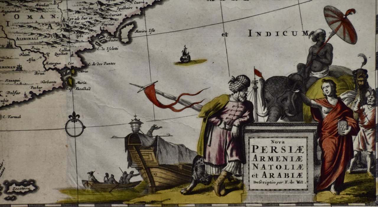
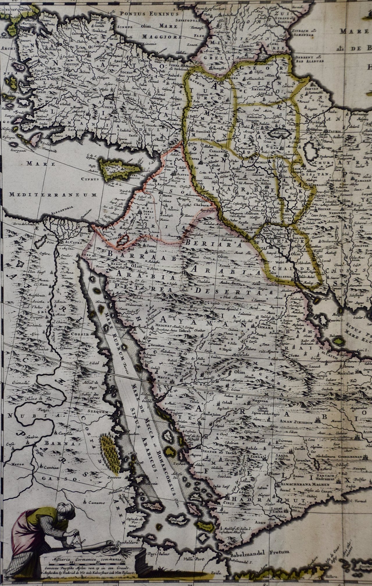
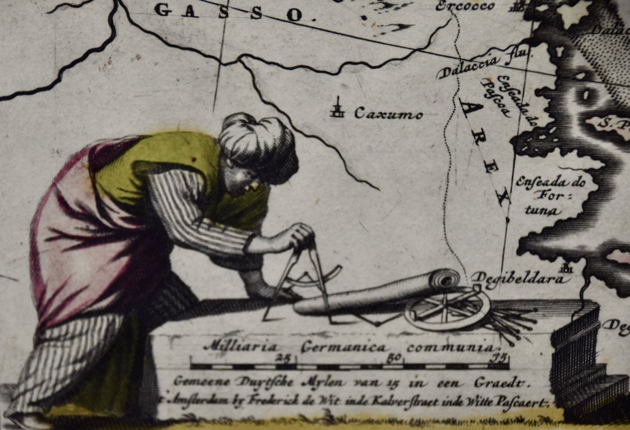
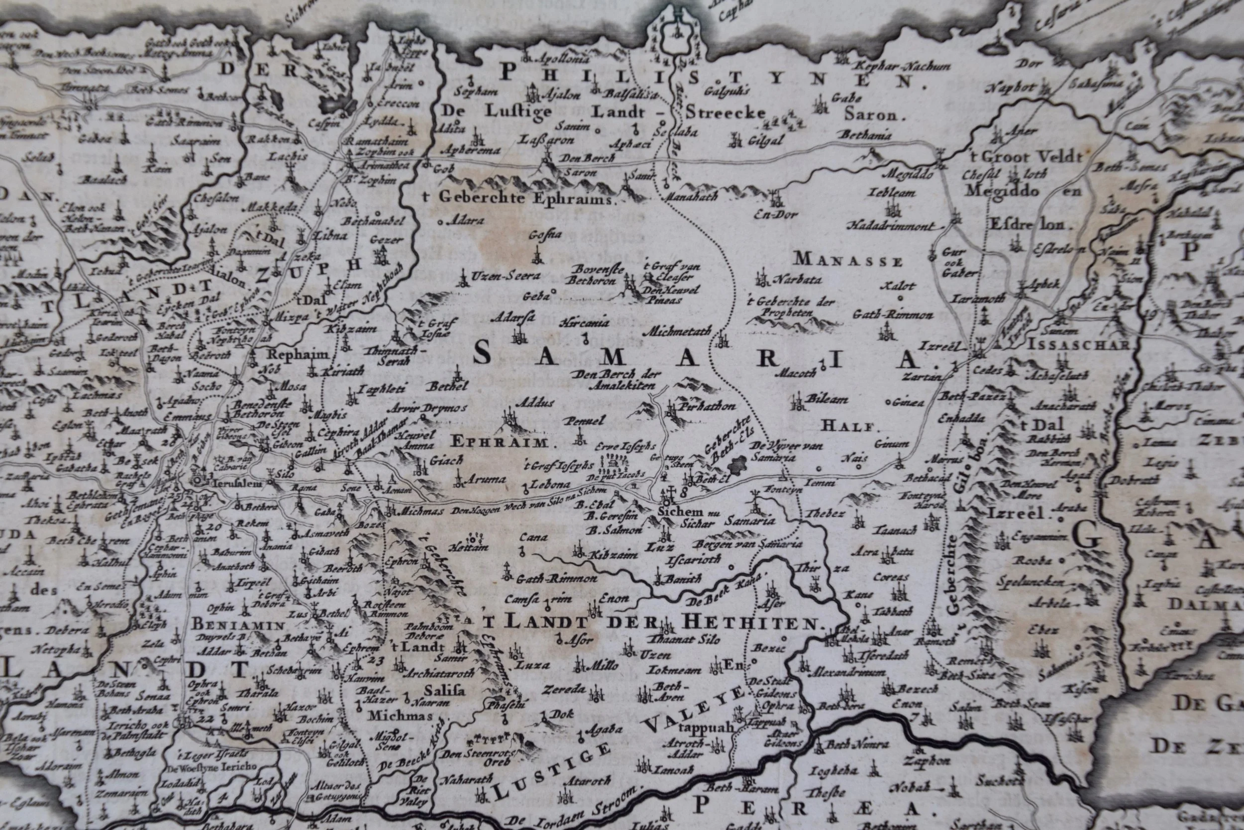
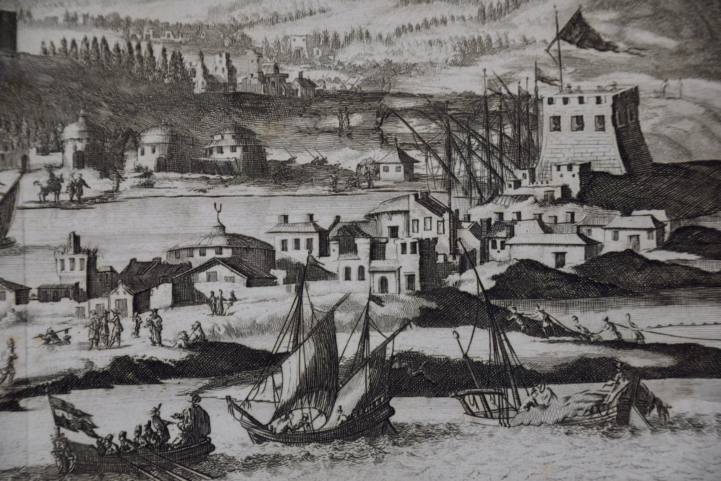
This hand-colored map is presented in a brown wood frame with a gold inner trim and a light tan mat. It is glazed with TruVue UV conservation glass. The frame measures 23.5" high, 25.75" wide and 1" deep. There is a central vertical fold as issued. There is a short tear to the right of the lower portion of the fold and mild color offset in the lower left from the lower right as a result of having been folded in an atlas for many years. The map is otherwise in very good condition.

Related Works

Church of St. Helena, Bethleham: Roberts' 19th C. Hand-colored Lithograph 3201A Roberts, Church of St. Helena, Bethlehem.jpeg 3201B Roberts, Church of St. Helena, Bethlehem.jpeg 3201C Roberts, Church of St. Helena, Bethlehem.jpeg 3201D Roberts, Church of St. Helena, Bethlehem.jpeg
Church of St. Helena, Bethleham: Roberts' 19th C. Hand-colored Lithograph
$2,975.00
Sold
Temple of Hathor, Dendera Egypt: David Roberts' 19th C. Hand-colored Lithograph 4676A Roberts, View from Under the Portico of the Temple of Dendera.jpeg 4676B Roberts, View from Under the Portico of the Temple of Dendera.jpeg 4676C Roberts, View from Under the Portico of the Temple of Dendera.jpeg 4676D Roberts, View from Under the Portico of the Temple of Dendera.jpeg
Temple of Hathor, Dendera Egypt: David Roberts' 19th C. Hand-colored Lithograph
$3,375.00
Sold
Approach to Mount Sinai 1839: Roberts' 19th C. Hand-colored Lithograph 3206A Roberts, Approach to Mount Sinai Wady Barah Feby 17th 1839.jpeg 3206B Roberts, Approach to Mount Sinai Wady Barah Feby 17th 1839.jpeg 3206C Roberts, Approach to Mount Sinai Wady Barah Feby 17th 1839.jpeg
Approach to Mount Sinai 1839: Roberts' 19th C. Hand-colored Lithograph
$2,975.00
David Roberts' 19th Century Duo-tone Lithograph, "Suez, General View" 1449A Roberts Suez, General View.jpg 1449B Roberts Suez, General View.jpg 1449C Roberts Suez, General View.jpg 1449D Roberts Suez, General View.jpg
David Roberts' 19th Century Duo-tone Lithograph, "Suez, General View"
$2,350.00
Tiberias from the Walls: David Roberts' 19th C. Hand-colored Lithograph 3218 Roberts, Tiberias from the Walls, Safed in the Distance.jpeg 3218B Roberts, Tiberias from the Walls, Safed in the Distance.jpeg 3218C Roberts, Tiberias from the Walls, Safed in the Distance.jpeg
Tiberias from the Walls: David Roberts' 19th C. Hand-colored Lithograph
$975.00

Prints
Maps
Books
Featured Items
Recent Acquisitions

Contact
Our Story
Sell Your Items
Subscribe to our newsletter!

FAQs
Terms and Conditions