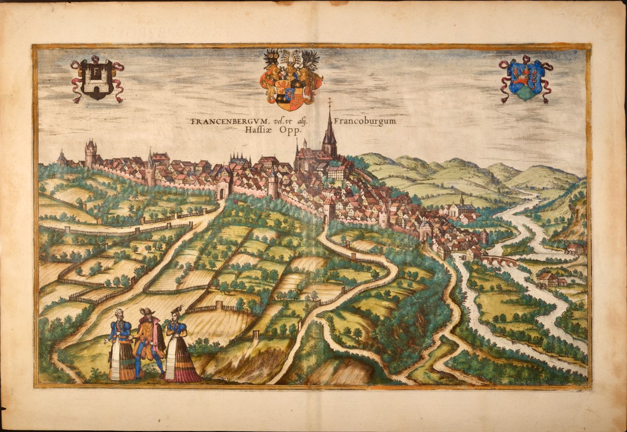
Image 1 of 9
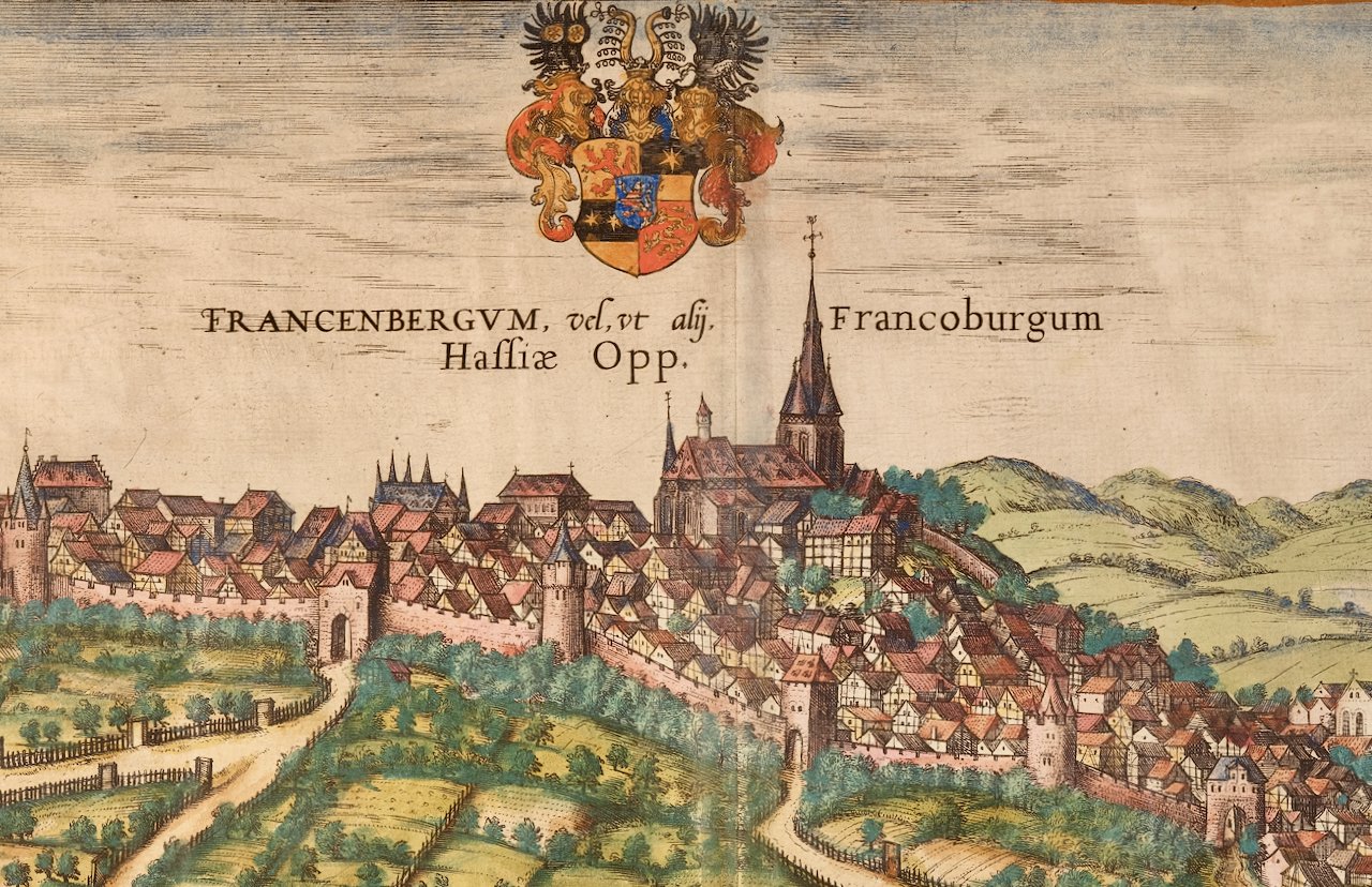
 Image 2 of 9
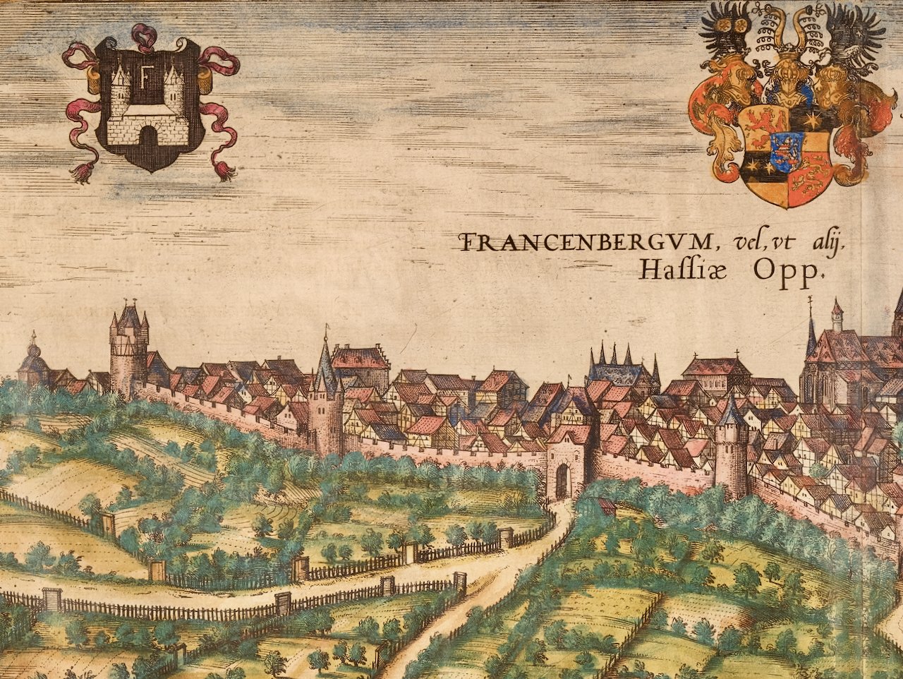
 Image 3 of 9
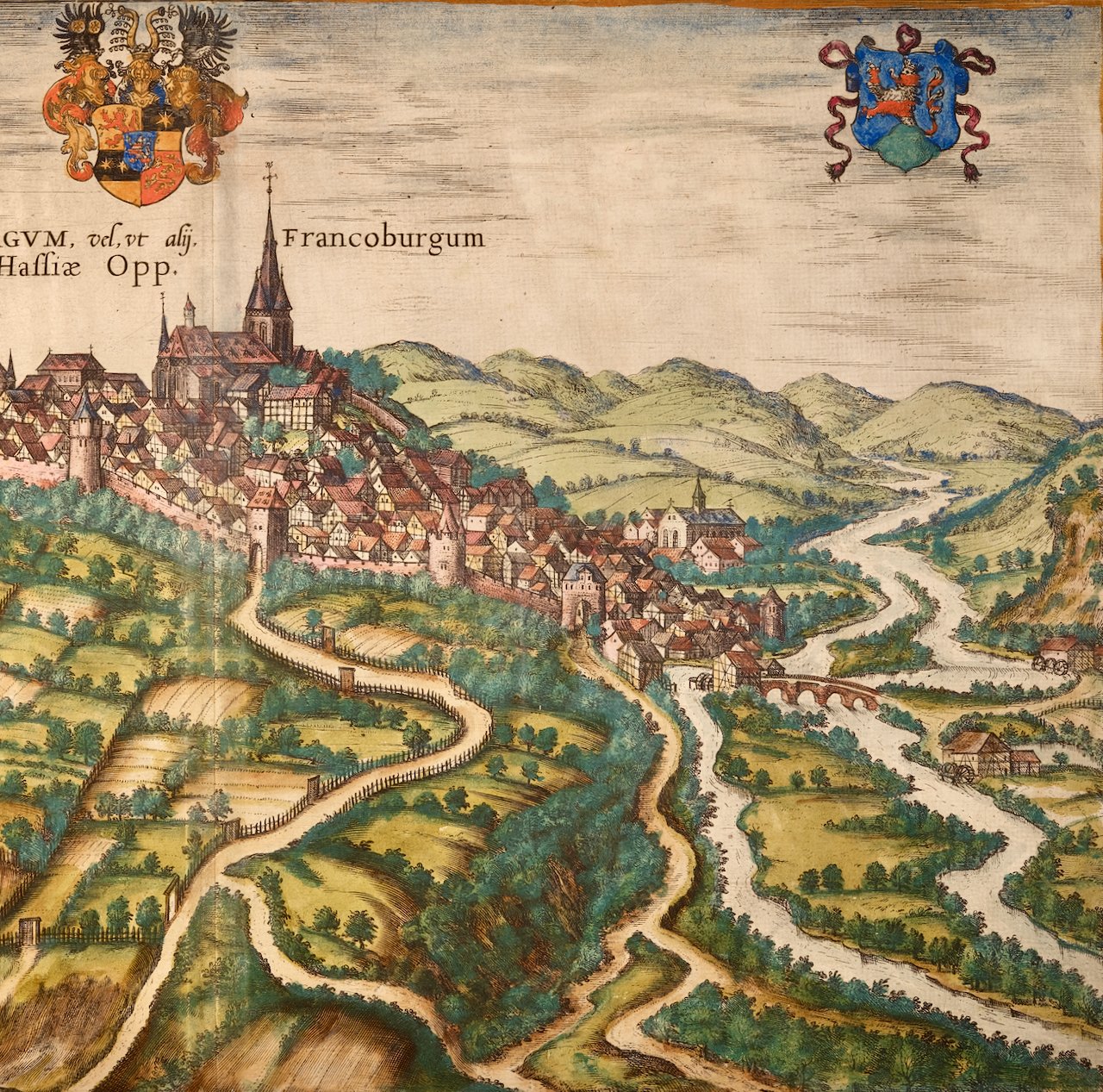
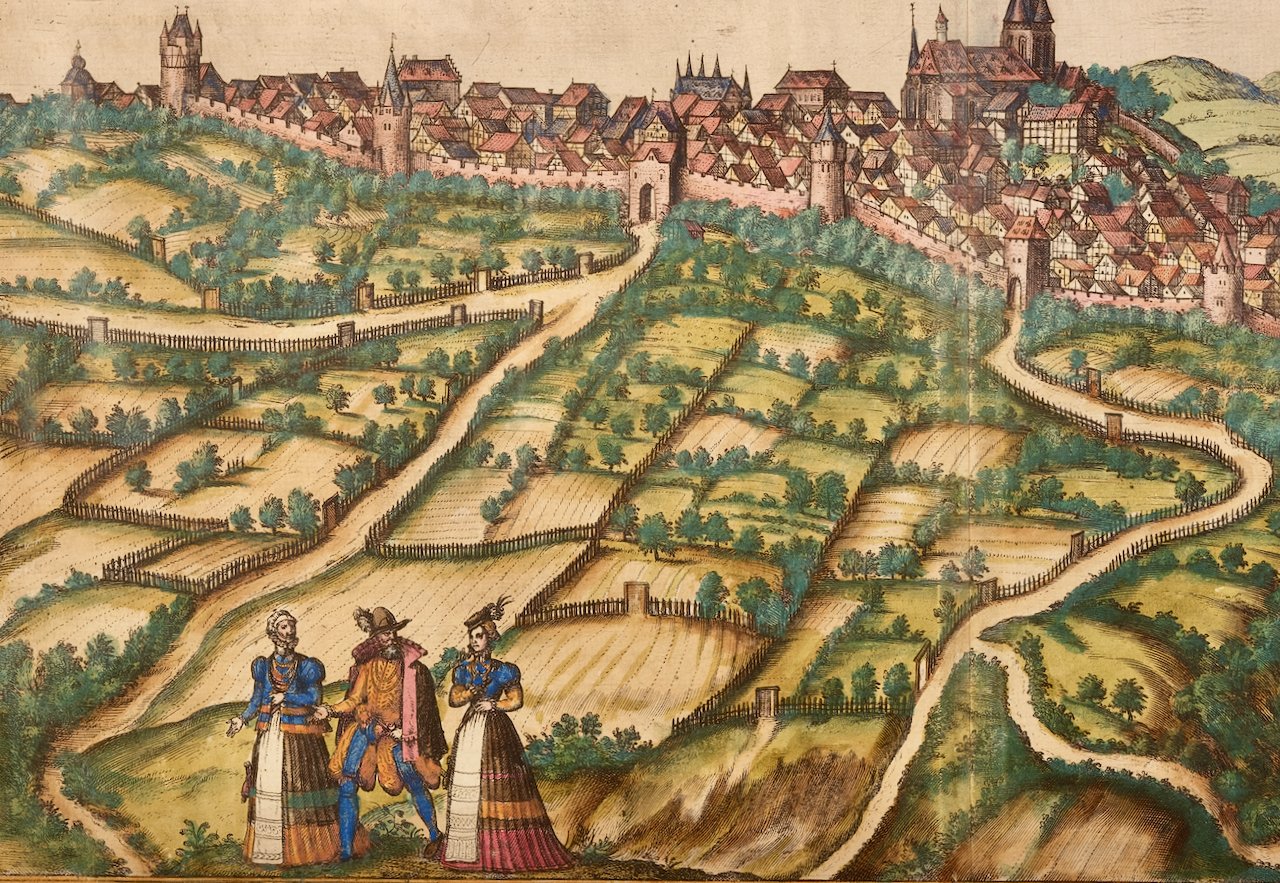
 Image 4 of 9
 Image 5 of 9
 Image 6 of 9
 Image 7 of 9
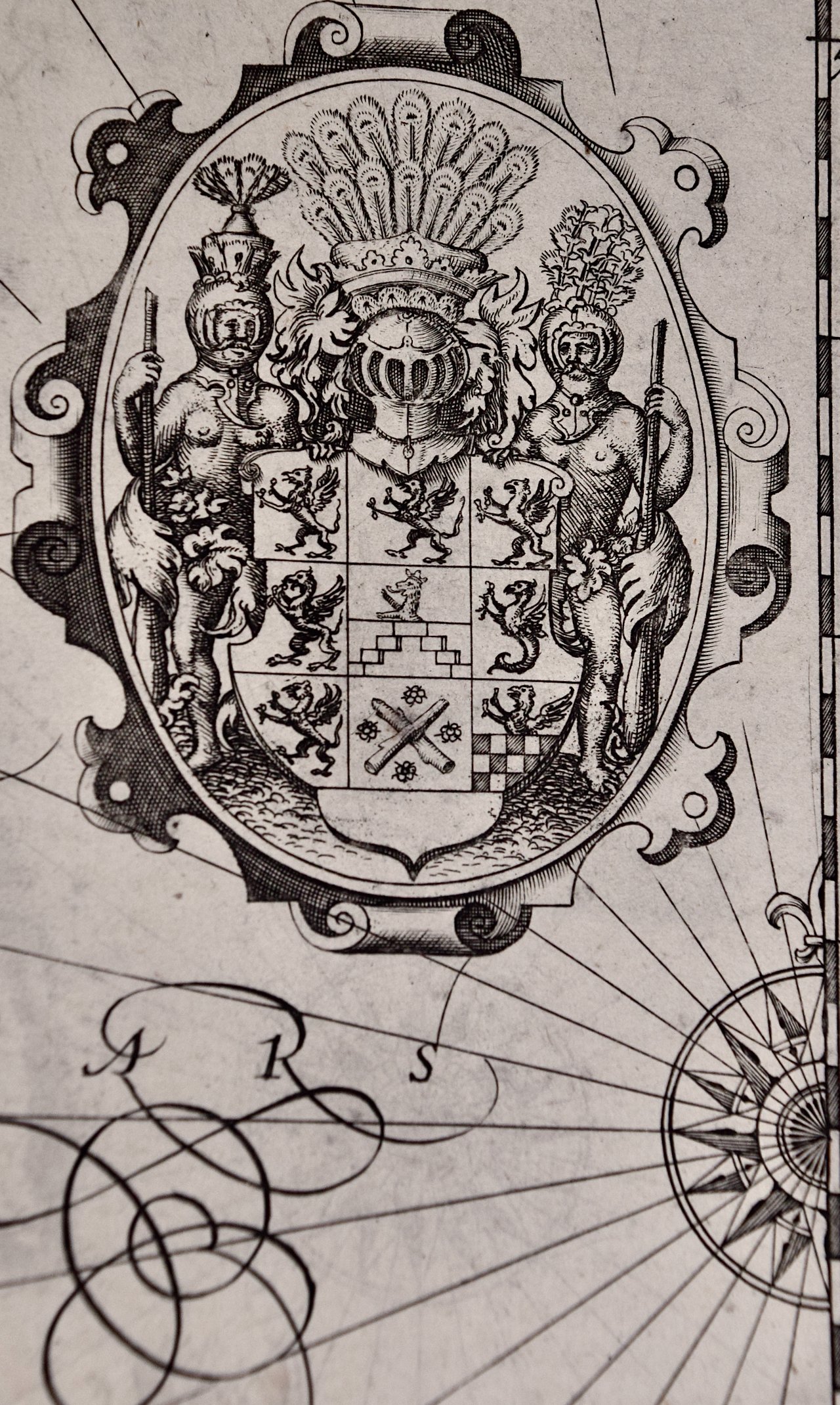 Image 8 of 9
 Image 9 of 9
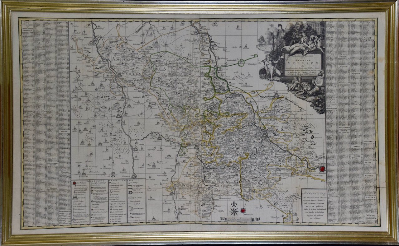
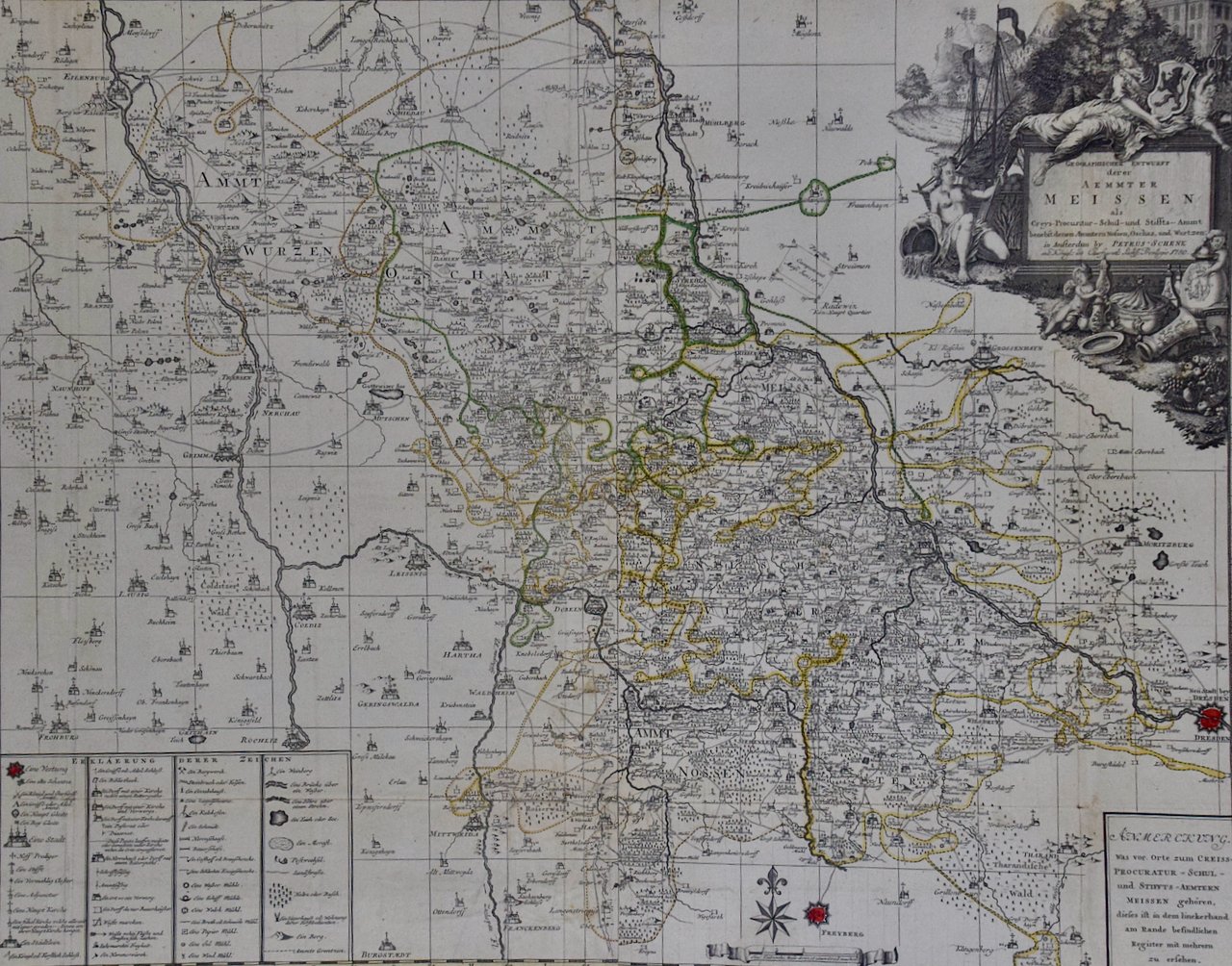
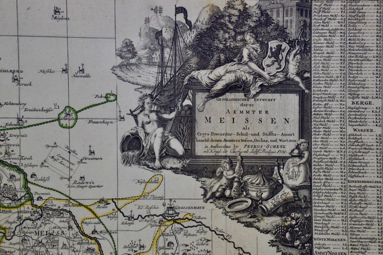
map of Rügen with Hiddensee by Eilhard Lübben. Shows the coast of the Baltic Sea from Peenemunde and Stralsund to Barhöft and the island of Rügen with many details. The coastline of Rügen largely corresponds to today's characteristics. The map is decorated with two galleons, several sea monsters, two large compass roses, one mileage scale with dividers and a cartouche with a large coat of arms. The left and right sides are flanked with 15 small coat of arms each. From the Mercator-Hondius Atlas published in 1623. Latin text on verso.
This map is focussed on Rügen Island (Latin: Rugia, Ruegen), Germany's largest island. It is located in the Baltic Sea, off the Pomeranian coast of northern Germany and is part of the state of Mecklenburg-Western Pomerania. In the Middle Ages it was ruled by Denmark. It later became a Duchy and then Province of Pomerania and in the 19th century, part of Germany.
This detailed and quite decorative map contains two striking compass roses, two detailed sailing ships, three sea monsters, a bird, as well as a massive coat-of-arms and a smaller one in the upper map on the right. There are thirty smaller coat-of-arms along both side borders (fifteen along each side border), representing the island's leading families. There is jagged line to the right of the title cartouche in the right lower corner that resulted from a crack in the copper plate, which presumably occurred shortly after production of the plate, or even before, as it seen on virtually all surviving examples of the map.
This highly detailed and striking map is printed on thick, laid, chain-linked paper with wide margins. The sheet measures 18.38" wide and 21.75" high. There is Latin text on the verso. The map has a central fold, as issued. There is faint discoloration and an occasional small spot in the margins and a small chip at the lower edge of the sheet. There is some offset of outlines from the opposite side of the map resulting from having been folded in an atlas for almost 400 years. The map is otherwise in excellent condition.
Gerard Mercator (1512-1594) is one of the greatest cartographers of all time. His friend, Abraham Ortelius, referred to Mercator as being the “contemporary Ptolemy”. He was born in Flanders and moved to Duisburg in the Netherlands, where he lived and worked for the rest of his life. In addition to producing important maps and globes, he invented a projection on maps that presented all parallels and meridians at right angles to each other, with the distance between the parallels extending towards the poles, allowing accurate latitude and longitude calculation and navigational routes to be drawn using straight lines. This was an important technological advance for navigation at sea, as this allowed seafarers to plot their course without having to adjust their course based on frequent compass readings. These lines became known as Mercator's projections when used by subsequent cartographers, including current map makers. As mentioned above, he is also the first to use the term “atlas”, to describe a collection of maps published in one bound book.
Jodocus Hondius (1563-1612) was a prominent globe maker and map engraver from Ghent (Flanders). After spending some time in London, he established his business in Amsterdam in 1593. Hondius bought the plates of Gerard Mercator in 1604 and added around 40 of his own maps in an atlas that he first published in 1606, preserving Mercator's name. After his death in 1612 in Amsterdam, the business was continued by his sons Jodocus II and Henricus.