 Image 1 of 8
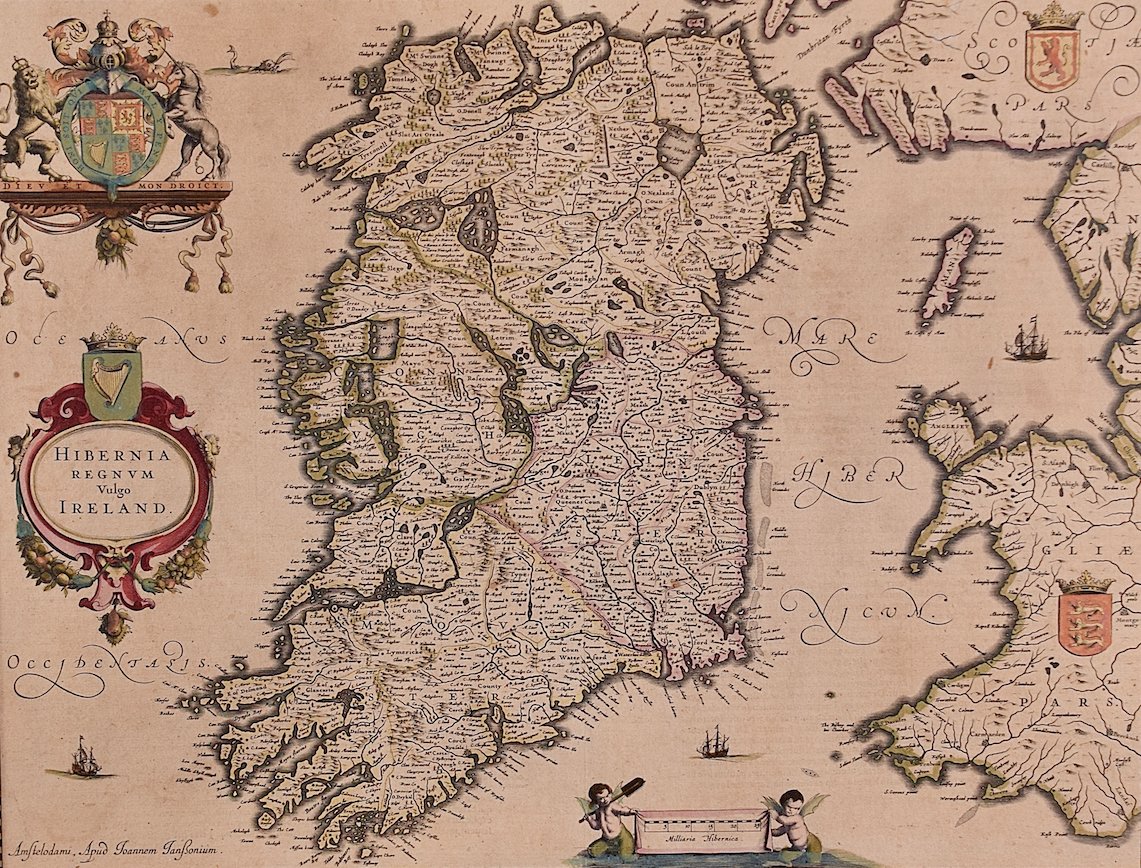 Image 2 of 8
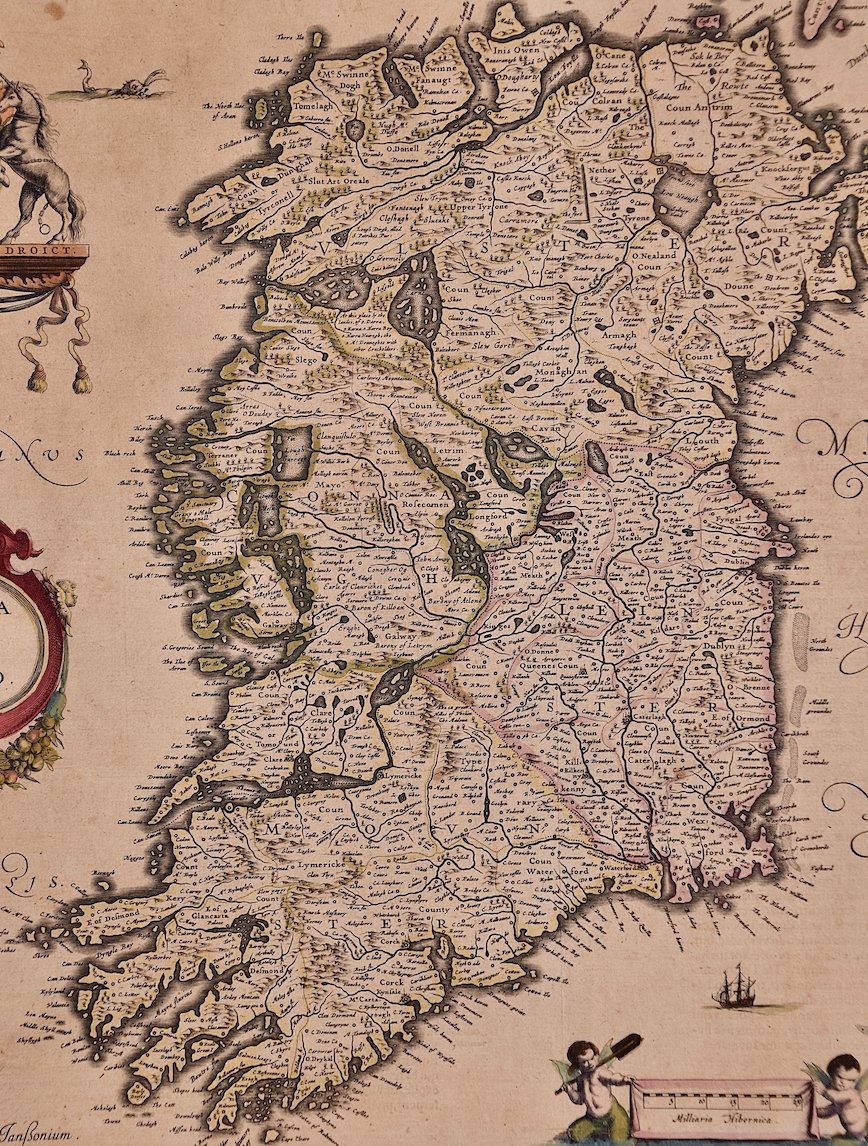 Image 3 of 8
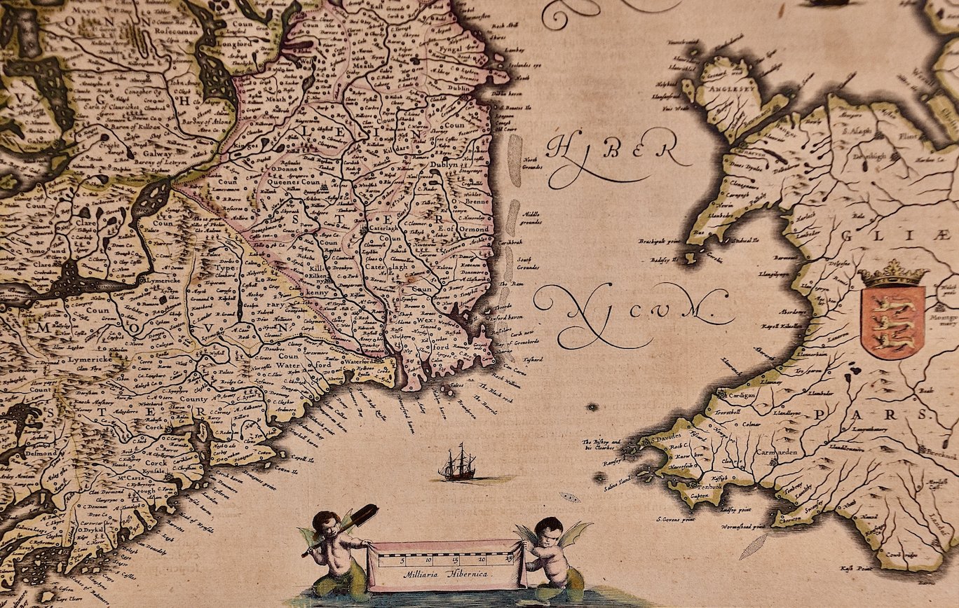 Image 4 of 8
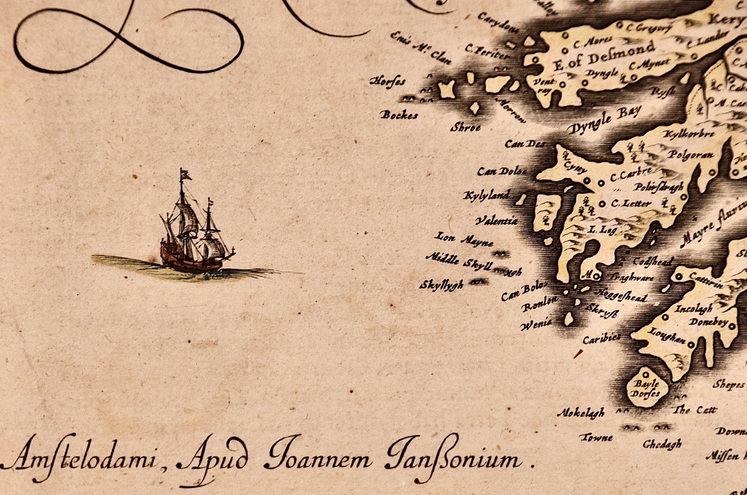 Image 5 of 8
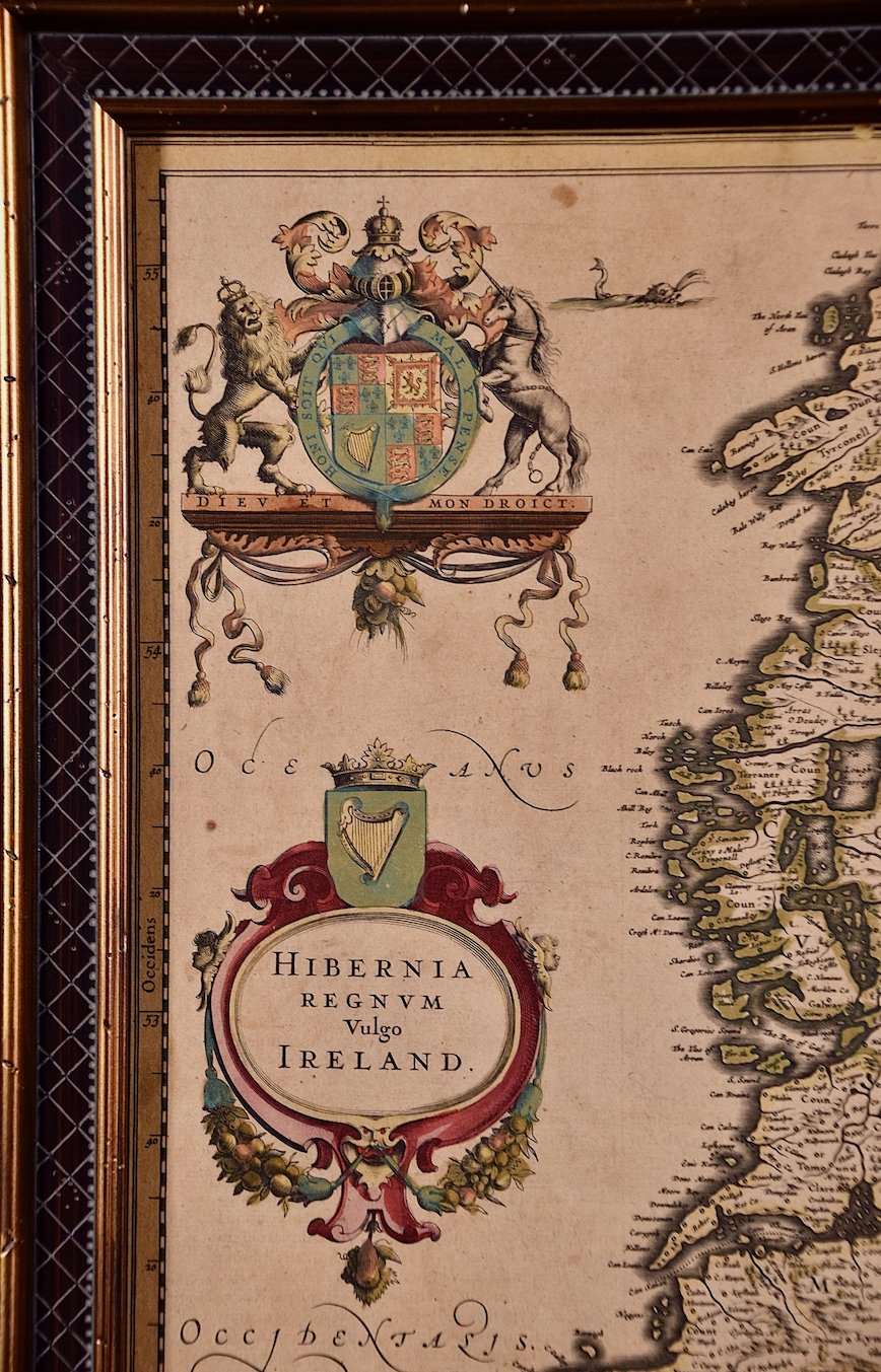 Image 6 of 8
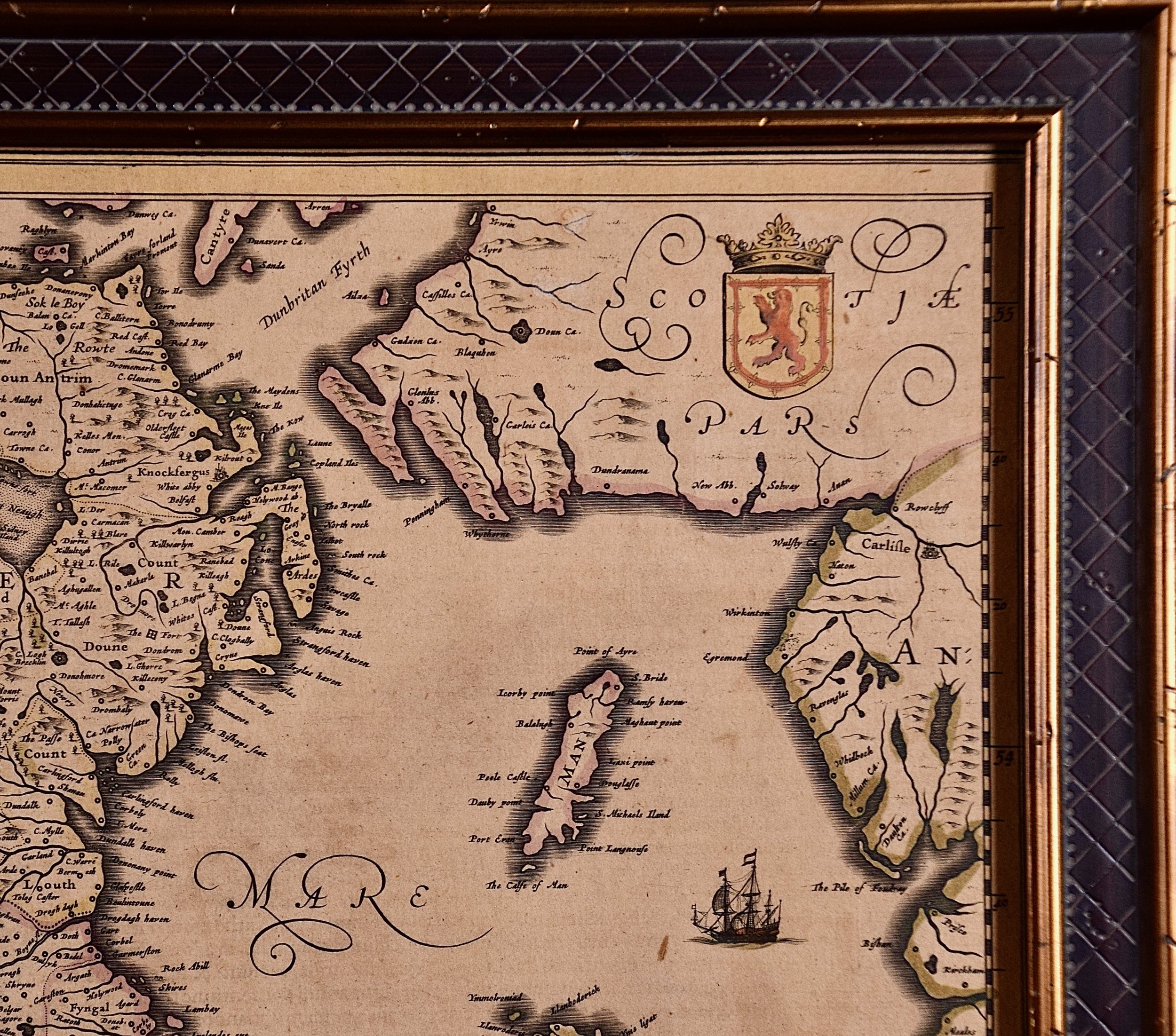 Image 7 of 8
 Image 8 of 8
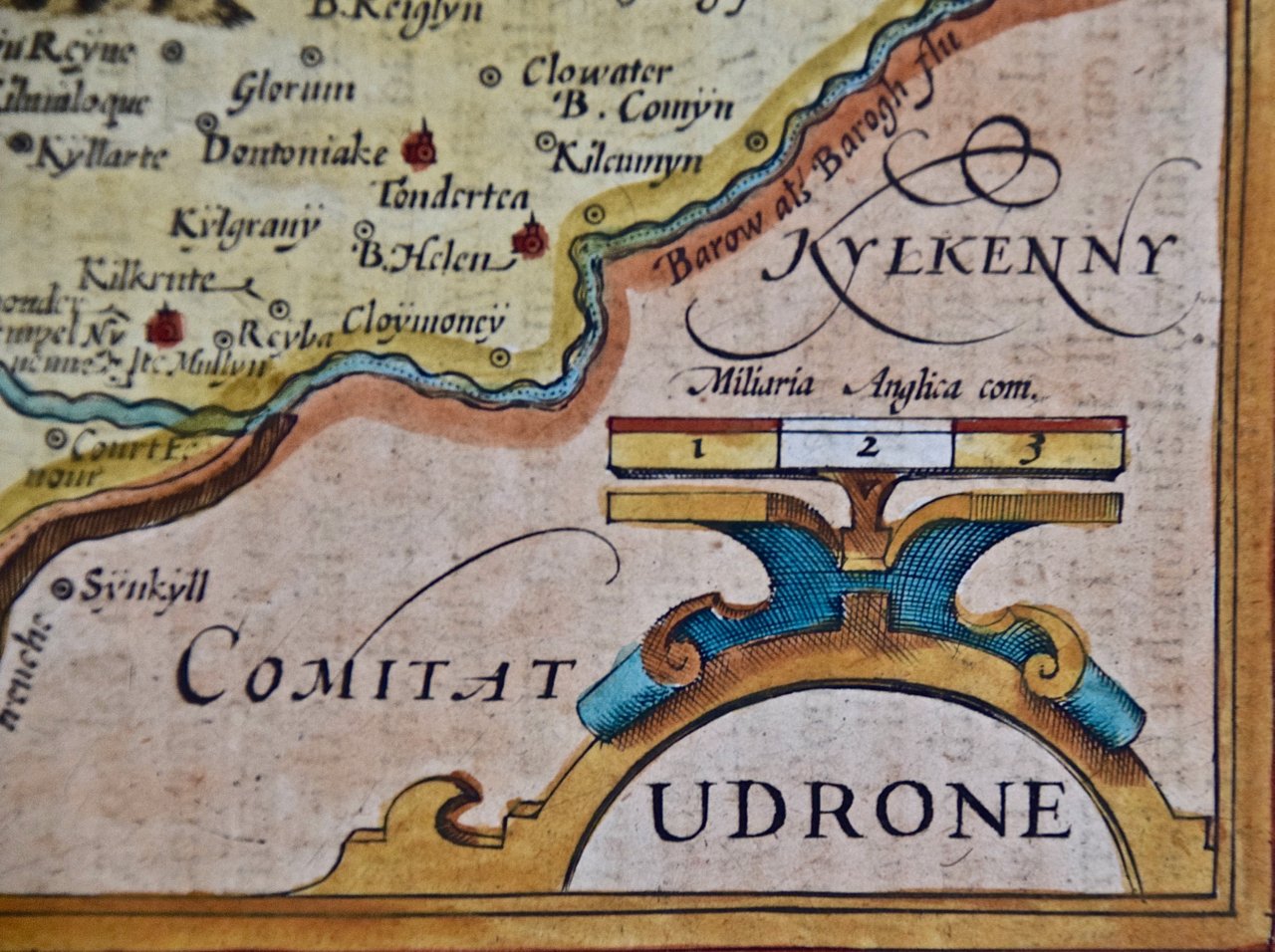
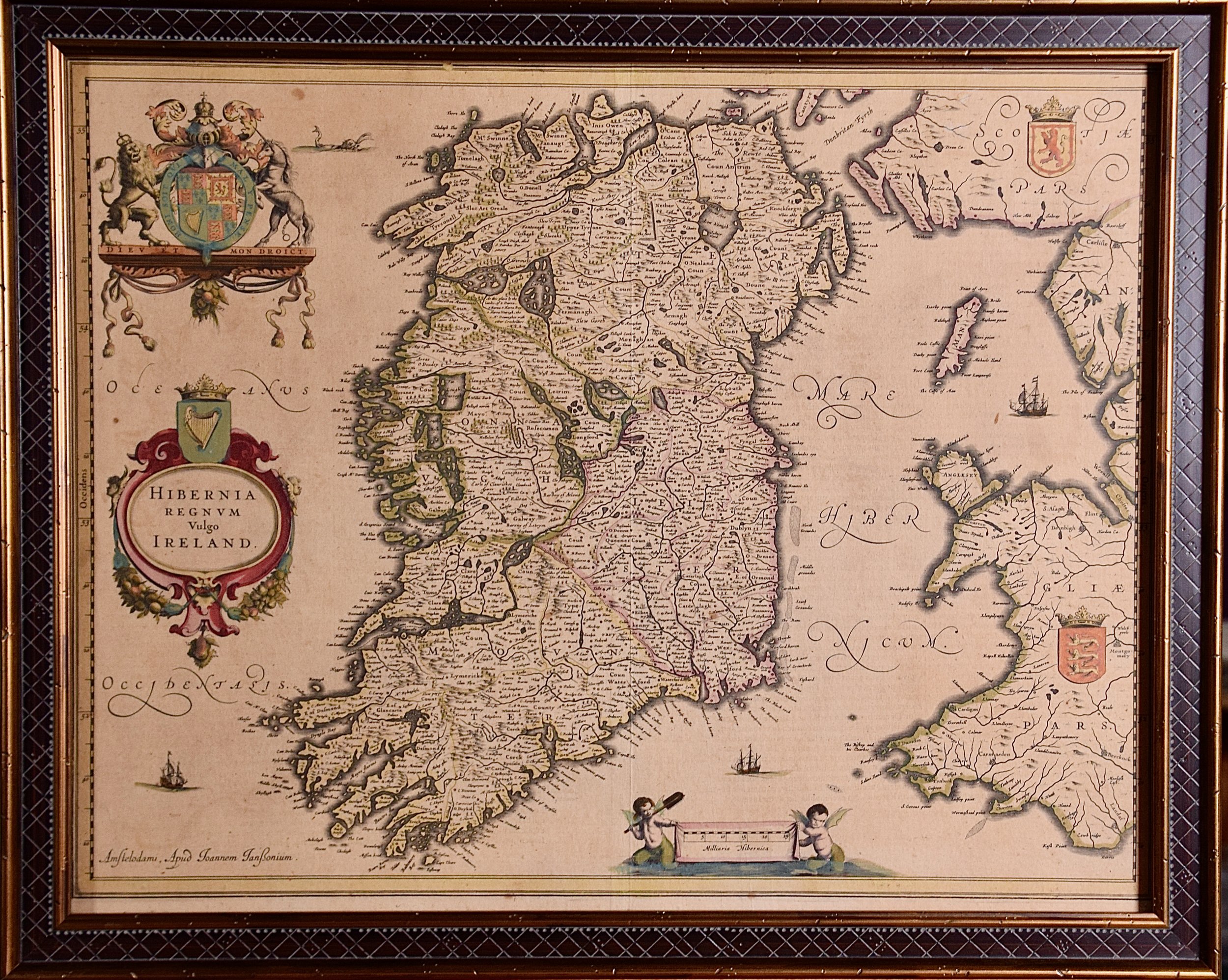
This 17th century hand-colored map is presented in an ornate, gold-colored wood frame with a criss-cross pattern in a black center panel. It is glazed with UV protected conservation glass. The frame measures 17.88" high, 22" wide and 0.75" deep. There is a vertical center fold, as issued. There are a few small spots and mild diffuse toning, but the map is otherwise in very good condition.
Johannes Janssonius (1588-1664), also known as Jansson, was a Dutch cartographer and publisher born in Arnhem, the Netherlands, in 1588. He was the son of a printer and publisher, and as a young man, he trained in engraving and mapmaking. In 1612, Janssonius moved to Amsterdam and began working with his brother-in-law, the prominent cartographer and publisher Jodocus Hondius. Together they produced maps and atlases, including an updated version of Mercator's atlas. After Hondius' death in 1629, Janssonius took over the business and continued to produce high-quality maps and atlases. He worked with some of the leading cartographers of his time, including Willem Blaeu and Nicolas Sanson. Janssonius' maps were highly regarded for their accuracy and attention to detail. He produced maps of Europe, Asia, Africa, and the Americas, as well as detailed maps of individual countries and regions. In addition to his cartographic work, Janssonius was also involved in publishing works on history, travel, and natural science. He died in Amsterdam in 1664, leaving behind a legacy as one of the leading cartographers and publishers of his time.