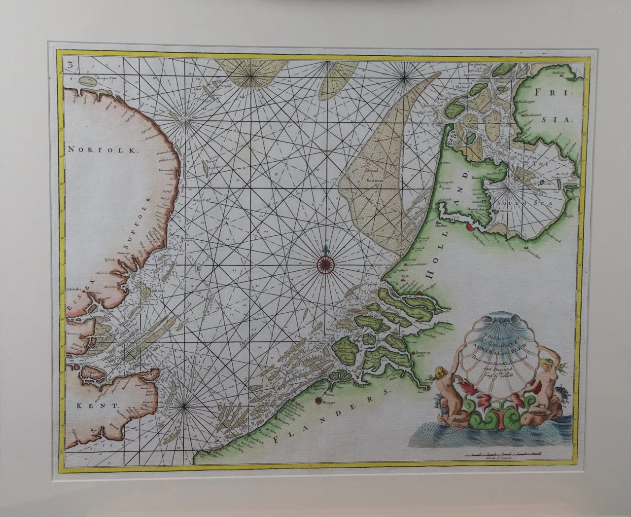
Image 1 of 7
 Image 2 of 7
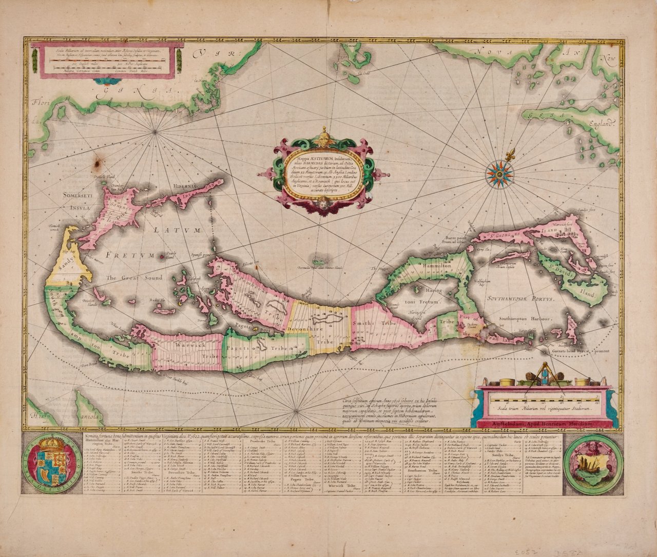
 Image 3 of 7
 Image 4 of 7
 Image 5 of 7
 Image 6 of 7
 Image 7 of 7
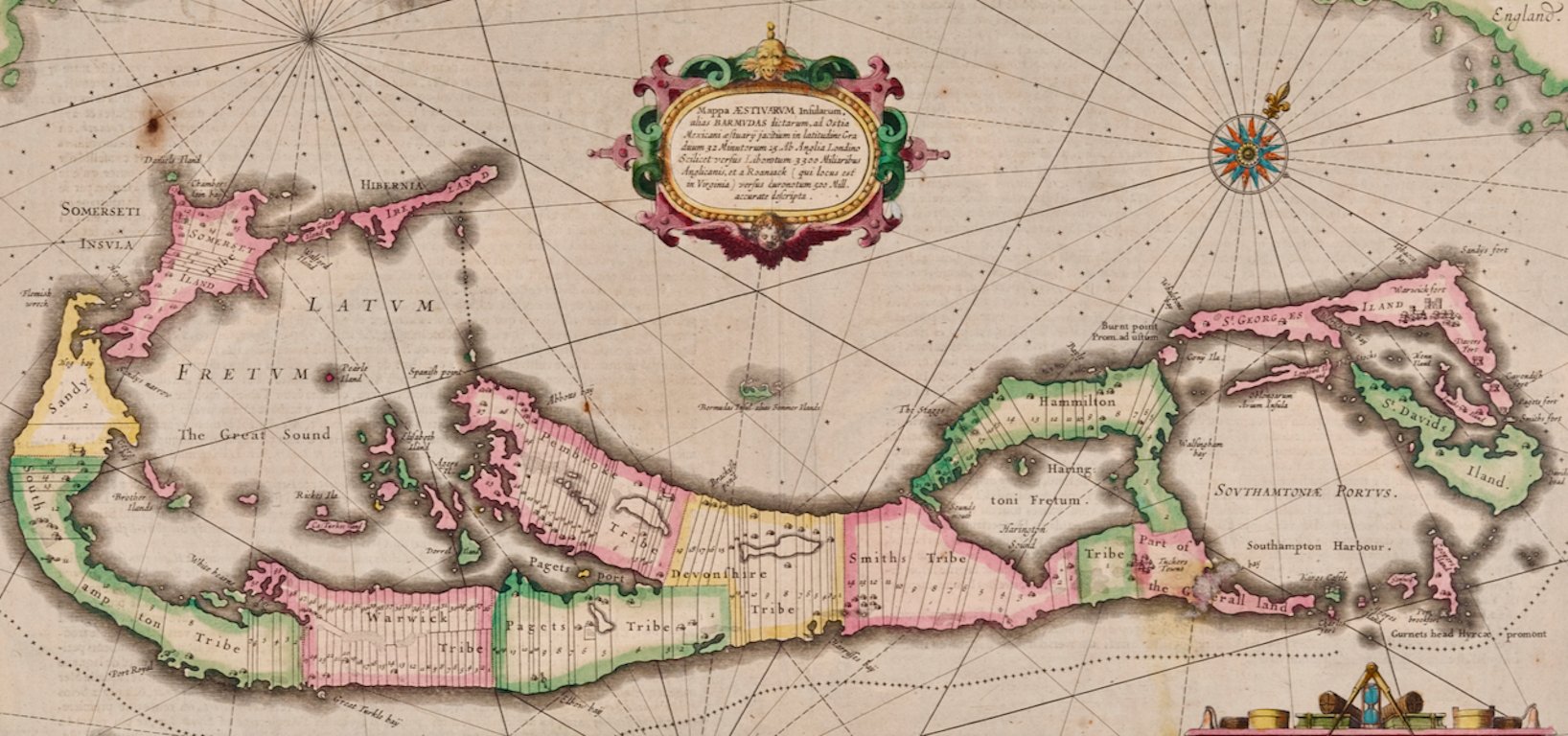
The West Indies island of Saint Kitts was known in the 15th century as "San Cristóbal", as it was discovered by Christopher Columbus during his second voyage in 1493 and he named it in his own honor. It was called St. Christophe in the 18th century and later became St. Kitts. It is part of the arc of the Windward Islands, in the Lesser Antilles. It lies east of Puerto Rico, while Nevis is located to the south-east and the Dutch island of St. Eustatius is to the north-west. It was originally colonized by France and England, and to a lesser extent, the Netherlands. It is the largest island the federation it currently forms with Nevis, forming the State of St. Kitts and Nevis.
The map is printed on laid, chain-linked, watermarked paper. There are wide margins all around, particularly the right and lower margins, and two vertical folds, as issued. There is mild irregularity of the left edge and a few small spots, but the map is otherwise in excellent condition.
Two other Bellin maps are available, including an unframed map of the southwest portion of Africa, "Partie de la Coste de Guinee" (Coast of Guinea, Sierra Leone, Africa), and a map of St. Lucie framed in lucite. These maps would make a striking display grouping. A discount is available for the purchase of two or more maps.
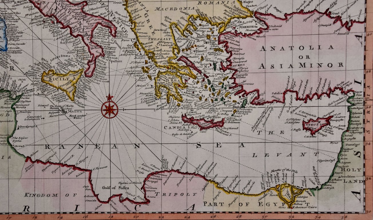
The map was prepared by Jacques Nicolas Bellin (1703–1772), who was one of the most important cartographers of the 18th century. He served for a number of years as map and chart maker, as well hydrographer to the King of France.