Skip to Content
Timeless Intaglio: Rare Prints, Maps & Books
Shop
All Listings
Antiquarian Prints
Antiquarian Maps
Antiquarian Books
Artists
Our Story
Previews
Contact
Login Account
0
0
Search
Timeless Intaglio: Rare Prints, Maps & Books
Shop
All Listings
Antiquarian Prints
Antiquarian Maps
Antiquarian Books
Artists
Our Story
Previews
Contact
Login Account
0
0
Search
Folder: Shop
Back
All Listings
Antiquarian Prints
Antiquarian Maps
Antiquarian Books
Artists
Our Story
Previews
Contact
Login Account
Search
Shop West Africa: 18th Century Hand-colored Homann Map Entitled "Guinea Propria"
4560 Homann, Guinea Propria, nec non Nigritiae vel Terrae Nigrorum Maxima Pars.jpeg Image 1 of 7
4560 Homann, Guinea Propria, nec non Nigritiae vel Terrae Nigrorum Maxima Pars.jpeg
4560A Homann, Guinea Propria, nec non Nigritiae vel Terrae Nigrorum Maxima Pars.jpeg Image 2 of 7
4560A Homann, Guinea Propria, nec non Nigritiae vel Terrae Nigrorum Maxima Pars.jpeg
4560B Homann, Guinea Propria, nec non Nigritiae vel Terrae Nigrorum Maxima Pars.jpeg Image 3 of 7
4560B Homann, Guinea Propria, nec non Nigritiae vel Terrae Nigrorum Maxima Pars.jpeg
4560C Homann, Guinea Propria, nec non Nigritiae vel Terrae Nigrorum Maxima Pars.jpeg Image 4 of 7
4560C Homann, Guinea Propria, nec non Nigritiae vel Terrae Nigrorum Maxima Pars.jpeg
4560D Homann, Guinea Propria, nec non Nigritiae vel Terrae Nigrorum Maxima Pars.jpeg Image 5 of 7
4560D Homann, Guinea Propria, nec non Nigritiae vel Terrae Nigrorum Maxima Pars.jpeg
4560E Homann, Guinea Propria, nec non Nigritiae vel Terrae Nigrorum Maxima Pars.jpeg Image 6 of 7
4560E Homann, Guinea Propria, nec non Nigritiae vel Terrae Nigrorum Maxima Pars.jpeg
4560F Homann, Guinea Propria, nec non Nigritiae vel Terrae Nigrorum Maxima Pars.jpeg Image 7 of 7
4560F Homann, Guinea Propria, nec non Nigritiae vel Terrae Nigrorum Maxima Pars.jpeg
4560 Homann, Guinea Propria, nec non Nigritiae vel Terrae Nigrorum Maxima Pars.jpeg
4560A Homann, Guinea Propria, nec non Nigritiae vel Terrae Nigrorum Maxima Pars.jpeg
4560B Homann, Guinea Propria, nec non Nigritiae vel Terrae Nigrorum Maxima Pars.jpeg
4560C Homann, Guinea Propria, nec non Nigritiae vel Terrae Nigrorum Maxima Pars.jpeg
4560D Homann, Guinea Propria, nec non Nigritiae vel Terrae Nigrorum Maxima Pars.jpeg
4560E Homann, Guinea Propria, nec non Nigritiae vel Terrae Nigrorum Maxima Pars.jpeg
4560F Homann, Guinea Propria, nec non Nigritiae vel Terrae Nigrorum Maxima Pars.jpeg

West Africa: 18th Century Hand-colored Homann Map Entitled "Guinea Propria"

$1,875.00

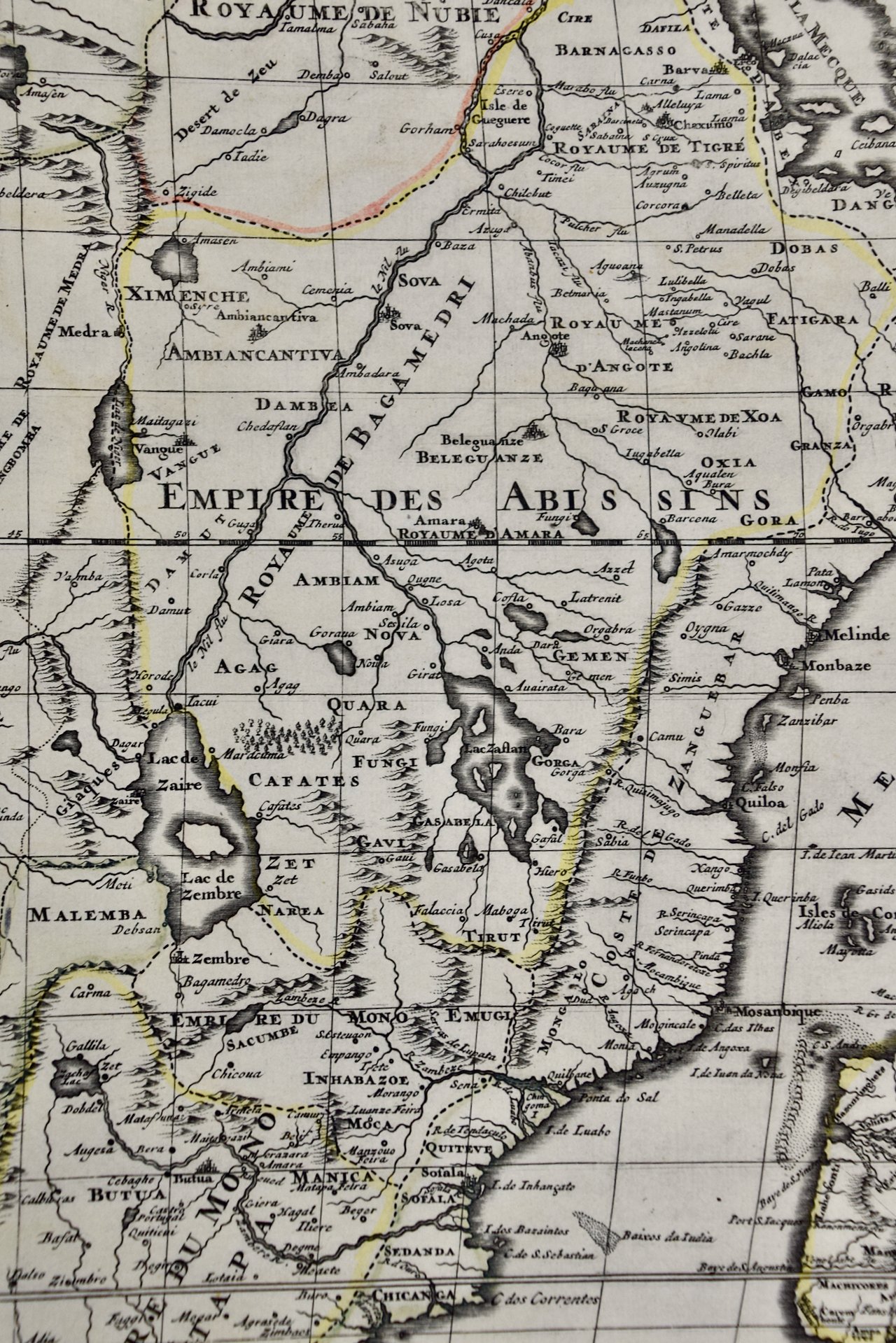
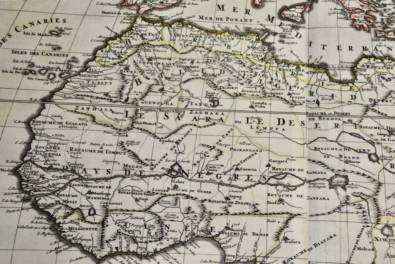
This is a scarce richly hand colored copper plate engraved map of Africa entitled "Guinea Propria, nec non Nigritiae vel Terrae Nigrorum Maxima Pars" by Johann Baptist Homann (1664-1724), published in Nuremberg, Germany by Homann's heirs in 1743. It depicts what at the time was called Guinea and portions of a very large Ethiopia, and now multiple countries, including Benin, Burkina Faso, Cape Verde, The Gambia, Ghana, Guinea, Guinea-Bissau, Gabon, Congo, Ivory Coast, Liberia, Mali, Mauritania, Niger, Nigeria, Senegal, Sierra Leone Togo and portions of Algeria, Morocco, Chad, The Democratic Republic of Congo, The Central African Republic and Angola. West Africa's extensive Atlantic coastline made it a popular location for trade between Africa, Europe and the Americas in the 18th century.

Creator: Johann Baptist Homann (1664 - 1724, German)

Creation Year: 1743

Dimensions: Height: 20.5 in (52.07 cm) Width: 23.5 in (59.69 cm) Depth: 1 in (2.54 cm)

Medium: Engraving

Condition: See description below.

Reference #: 4560

Add To Cart

This is a scarce richly hand colored copper plate engraved map of Africa entitled "Guinea Propria, nec non Nigritiae vel Terrae Nigrorum Maxima Pars" by Johann Baptist Homann (1664-1724), published in Nuremberg, Germany by Homann's heirs in 1743. It depicts what at the time was called Guinea and portions of a very large Ethiopia, and now multiple countries, including Benin, Burkina Faso, Cape Verde, The Gambia, Ghana, Guinea, Guinea-Bissau, Gabon, Congo, Ivory Coast, Liberia, Mali, Mauritania, Niger, Nigeria, Senegal, Sierra Leone Togo and portions of Algeria, Morocco, Chad, The Democratic Republic of Congo, The Central African Republic and Angola. West Africa's extensive Atlantic coastline made it a popular location for trade between Africa, Europe and the Americas in the 18th century.

Creator: Johann Baptist Homann (1664 - 1724, German)

Creation Year: 1743

Dimensions: Height: 20.5 in (52.07 cm) Width: 23.5 in (59.69 cm) Depth: 1 in (2.54 cm)

Medium: Engraving

Condition: See description below.

Reference #: 4560

The very elaborate and decorative cartouche features a group of Africans in a village by a body of water. Children play around inscribed ivory tusks. One of the children holds a compass tool.

This striking map of West Africa has a central vertical fold, as issued, with minimal discoloration along the fold and a small defect along the edge of the sheet in the lower right. The map is otherwise in very good condition.

Johann Baptist Homann (1663-1724) was a mapmaker who founded the famous Homann Heirs publishing company. He lived his entire life in Bavaria, particularly in Nuremberg. Initially, Johann trained to become a priest before converting to Protestantism and working as a notary. In 1702, Johann founded a publishing house that specialized in engravings. The firm flourished, becoming the leading map publisher in Germany and an important entity in the European map market. In 1715, Johann was named Imperial Geographer to the Holy Roman Empire by Charles VI and made a member of the Prussian Academy of Sciences. Most importantly for his business, his reputation and contacts gained him imperial printing privileges which protected his publications and recommended him to customers. Johann is best known for this Grosser Atlas ueber die ganze Welt, or the Grand Atlas of the World, published in 1716.

Related Works

Africa: A Large 17th Century Hand-colored Map By Sanson and Jaillot 4754A SANSON & JAILLOT, L'Afrique divisйe suivant l'estendue de ses principales.jpeg 4754B SANSON & JAILLOT, L'Afrique divisйe suivant l'estendue de ses principales.jpeg 4754C SANSON & JAILLOT, L'Afrique divisйe suivant l'estendue de ses principales.jpeg 4754D SANSON & JAILLOT, L'Afrique divisйe suivant l'estendue de ses principales.jpeg 4754E SANSON & JAILLOT, L'Afrique divisйe suivant l'estendue de ses principales.jpeg 4754F SANSON & JAILLOT, L'Afrique divisйe suivant l'estendue de ses principales.jpeg 4754G SANSON & JAILLOT, L'Afrique divisйe suivant l'estendue de ses principales.jpeg 4754H SANSON & JAILLOT, L'Afrique divisйe suivant l'estendue de ses principales.jpeg
Africa: A Large 17th Century Hand-colored Map By Sanson and Jaillot
$2,175.00
West Africa: A 17th Century Hand-Colored Map by Mercator/Hondius 1304 Mercator-Hondius, Guineae Nova Descriptio (1).jpg 1304 Mercator-Hondius, Guineae Nova Descriptio.jpg 1304 Mercator-Hondius, Guineae Nova Descriptio – Version 5.jpg 1304 Mercator-Hondius, Guineae Nova Descriptio – Version 6.jpg
West Africa: A 17th Century Hand-Colored Map by Mercator/Hondius
$575.00
Sold
1220 Sanson, Africa Vetus.jpeg 1220 Sanson, Africa Vetus.jpeg 1220 Sanson, Africa Vetus.jpeg 1220 Sanson, Africa Vetus.jpeg 1220 Sanson, Africa Vetus.jpeg
"Africa Vetus": A 17th Century Hand-colored Map By Sanson
$1,375.00
West Coast of Africa; Guinea & Sierra Leone: Bellin 18th Century Map 4617A Bellin-Prevost, Partie de la Coste de Guinee (Coast of Guinea, Sierra Leone, Africa).jpeg 4617B Bellin-Prevost, Partie de la Coste de Guinee (Coast of Guinea, Sierra Leone, Africa).jpeg 4617C Bellin-Prevost, Partie de la Coste de Guinee (Coast of Guinea, Sierra Leone, Africa).jpeg 4617D Bellin-Prevost, Partie de la Coste de Guinee (Coast of Guinea, Sierra Leone, Africa).jpeg 4617E Bellin-Prevost, Partie de la Coste de Guinee (Coast of Guinea, Sierra Leone, Africa).jpeg
West Coast of Africa; Guinea & Sierra Leone: Bellin 18th Century Map
$575.00
"Nova Barbariae Descriptio", a 17th Century Hand-Colored Map of North Africa 3640A Janssonius, Nova Barbariae Descriptio.jpg 3640B Janssonius, Nova Barbariae Descriptio.jpg 3640C Janssonius, Nova Barbariae Descriptio.jpg 3640D Janssonius, Nova Barbariae Descriptio.jpg 3640E Janssonius, Nova Barbariae Descriptio.jpg 3640F Janssonius, Nova Barbariae Descriptio.jpg 3640GJanssonius, Nova Barbariae Descriptio.jpg
"Nova Barbariae Descriptio", a 17th Century Hand-Colored Map of North Africa
$1,275.00

Prints
Maps
Books
Featured Items
Recent Acquisitions

Contact
Our Story
Sell Your Items
Subscribe to our newsletter!

FAQs
Terms and Conditions