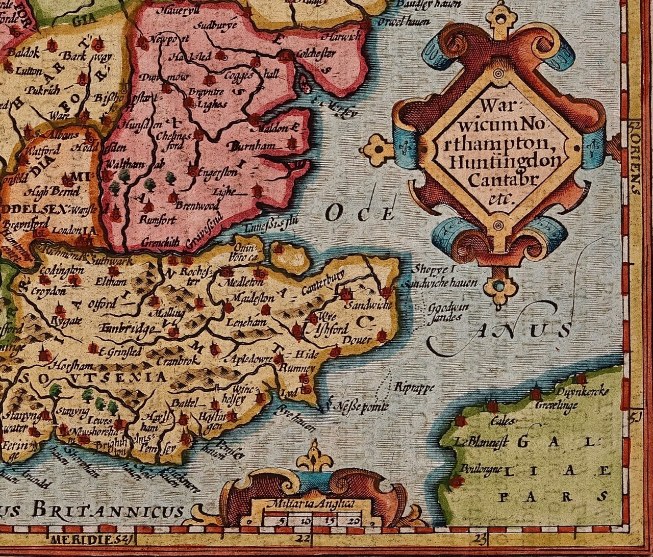
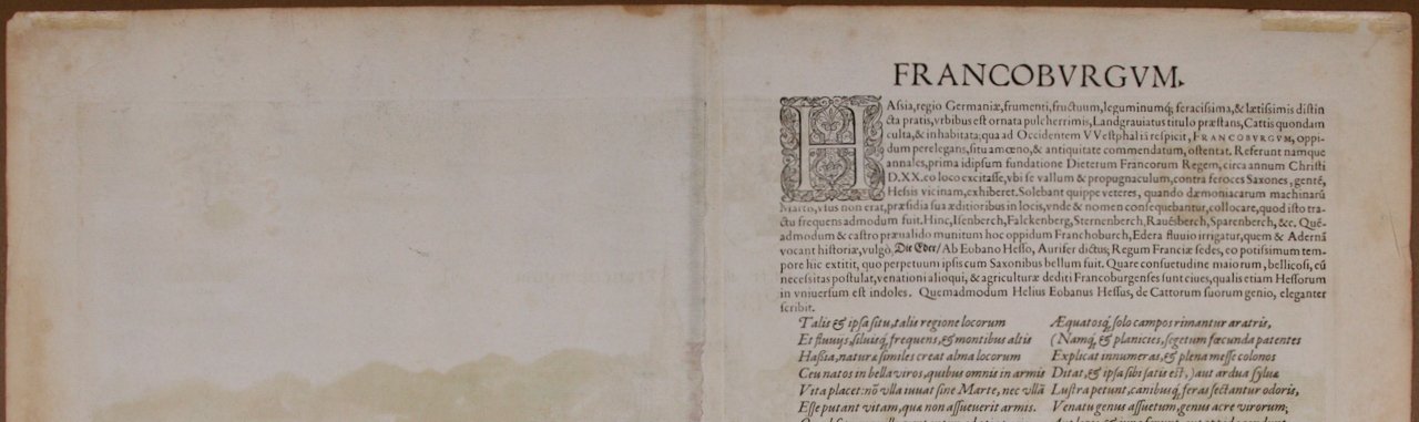
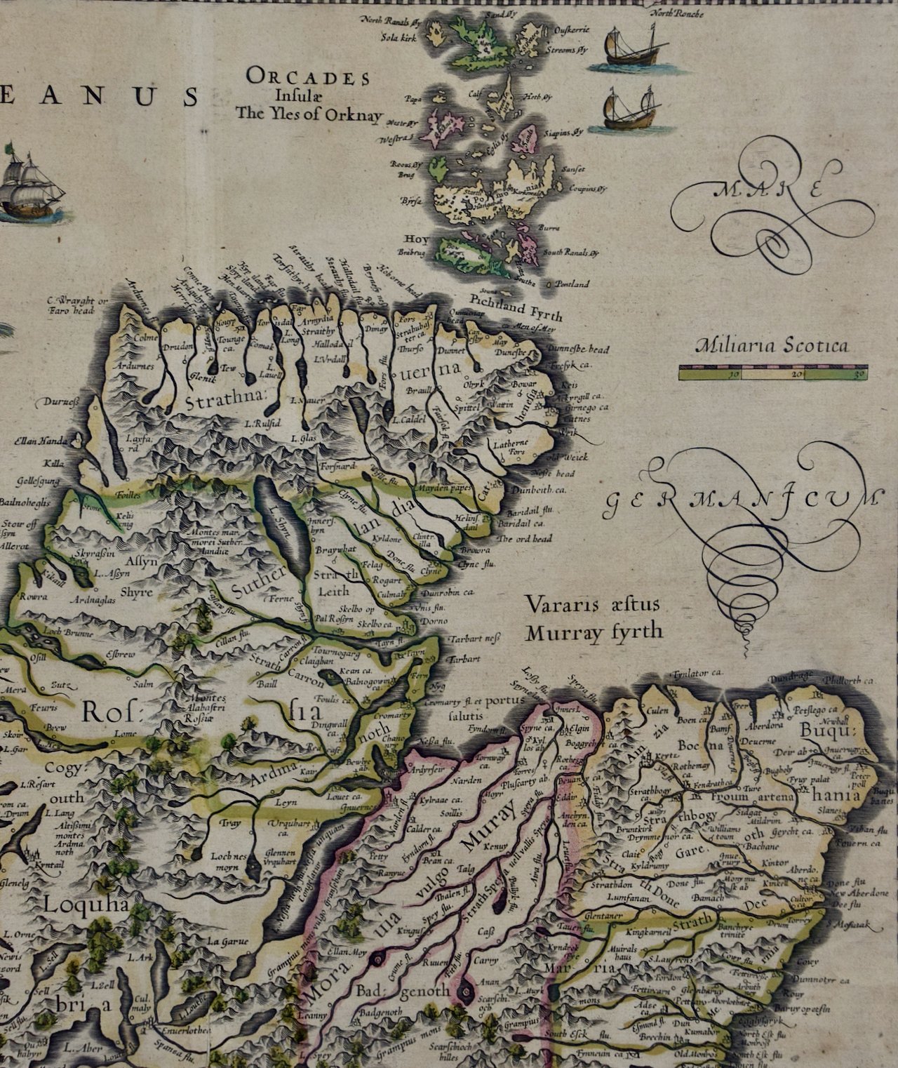
 Image 1 of 5
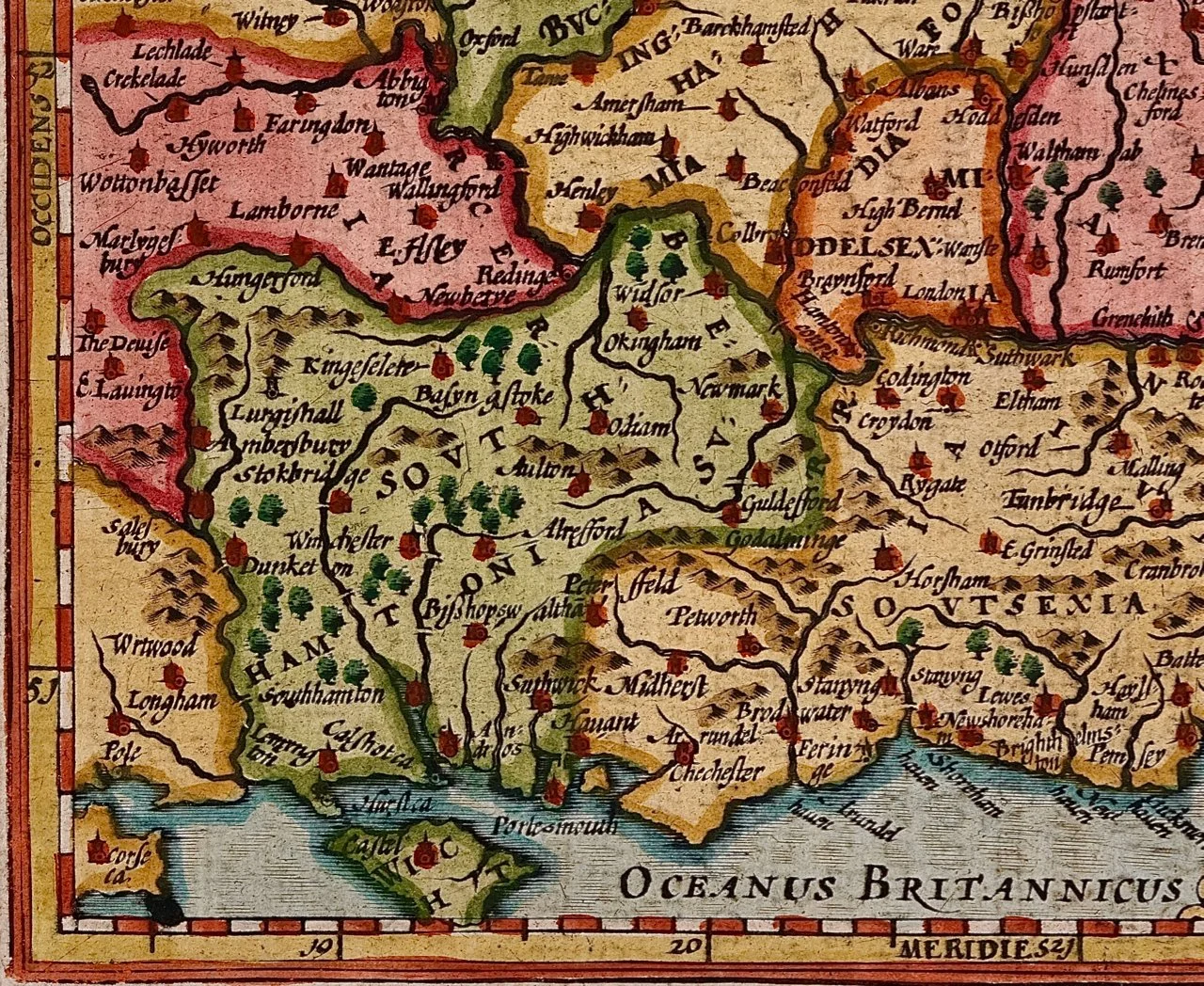
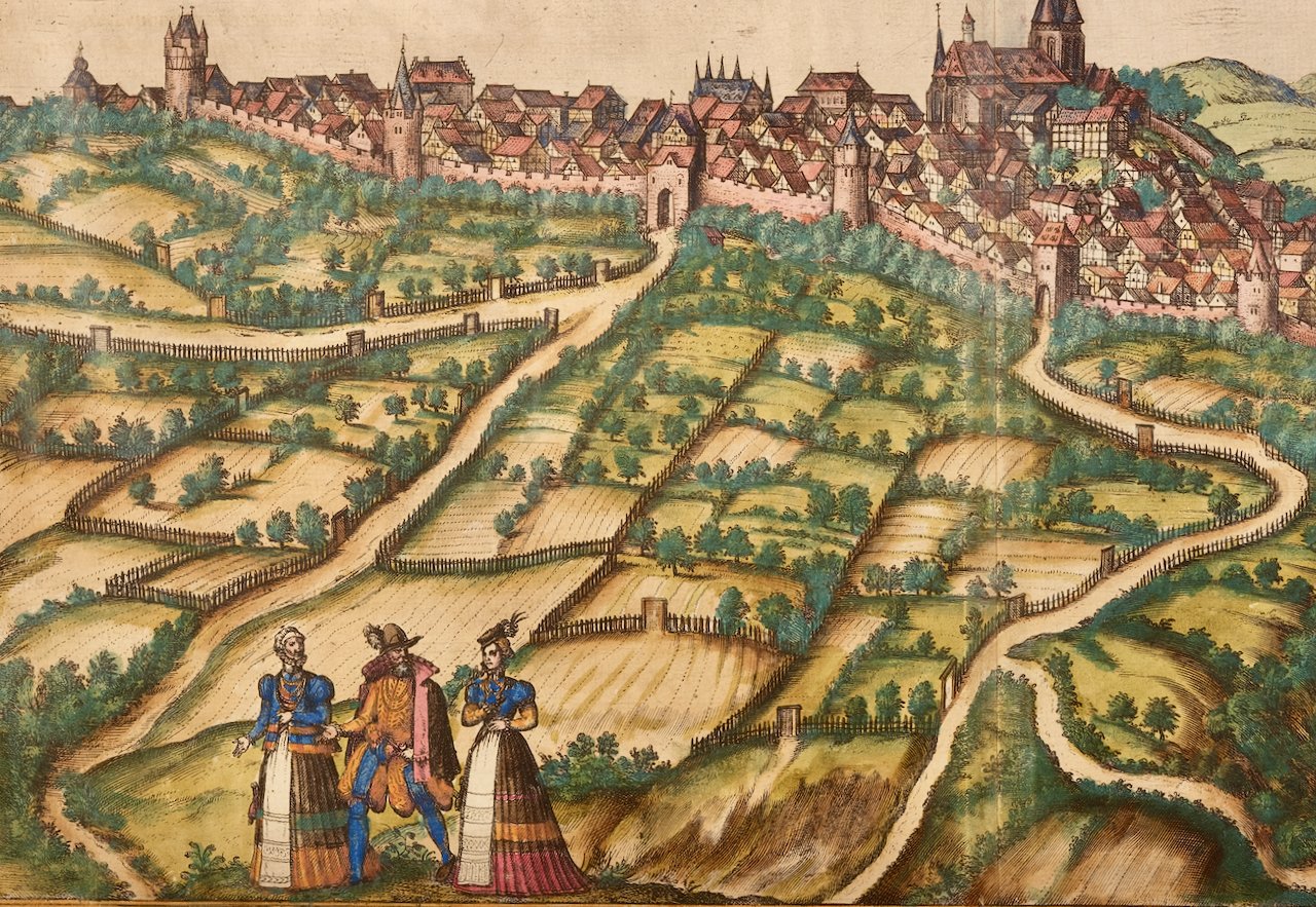
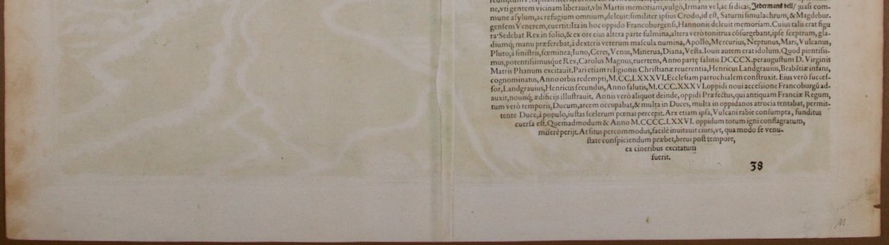
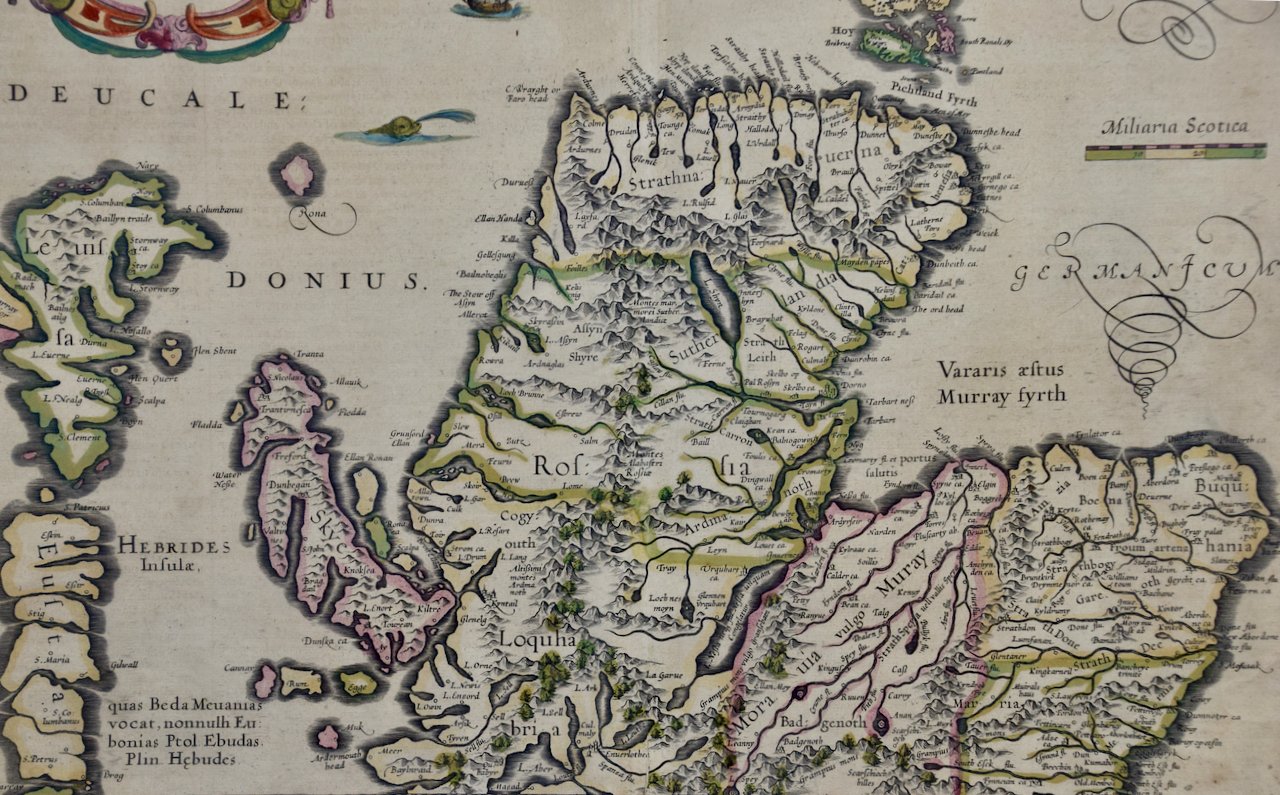
 Image 2 of 5
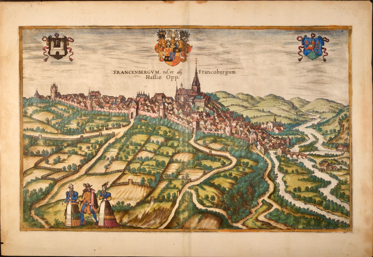
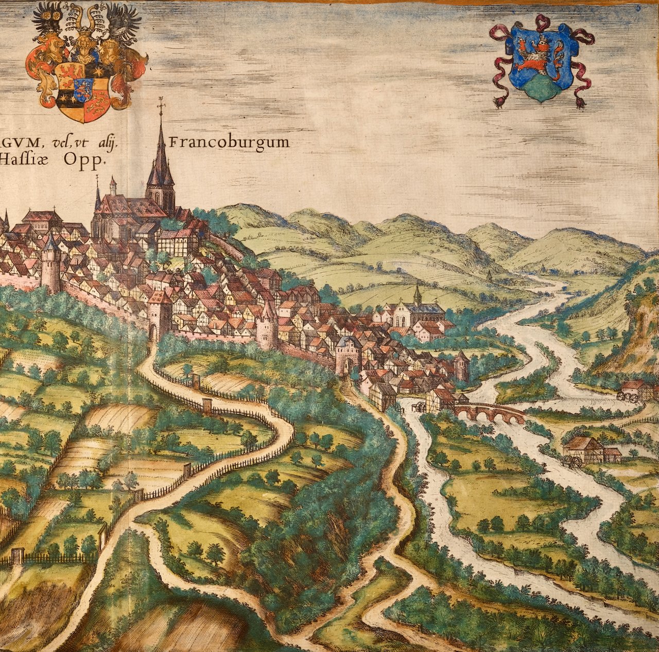
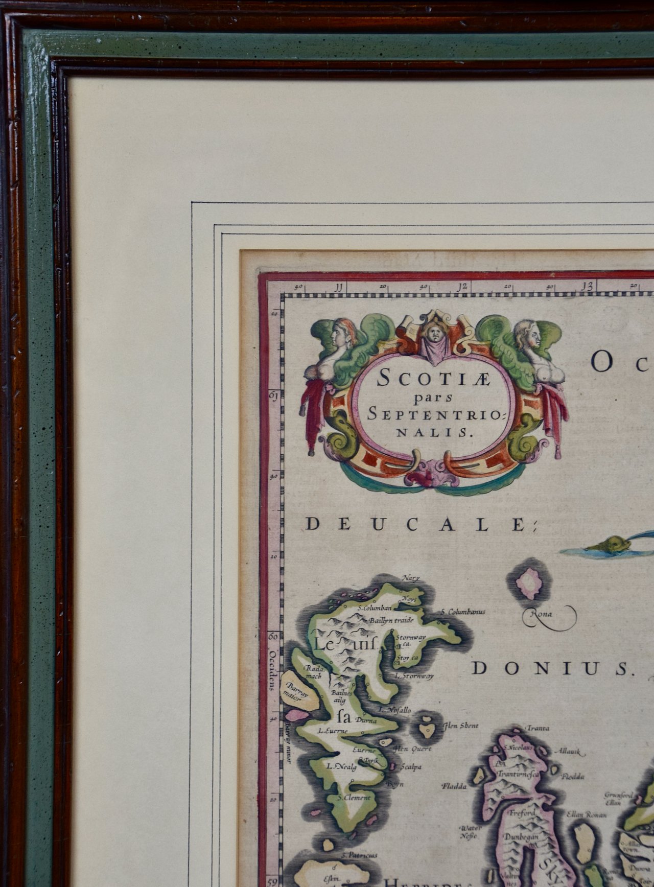
 Image 3 of 5
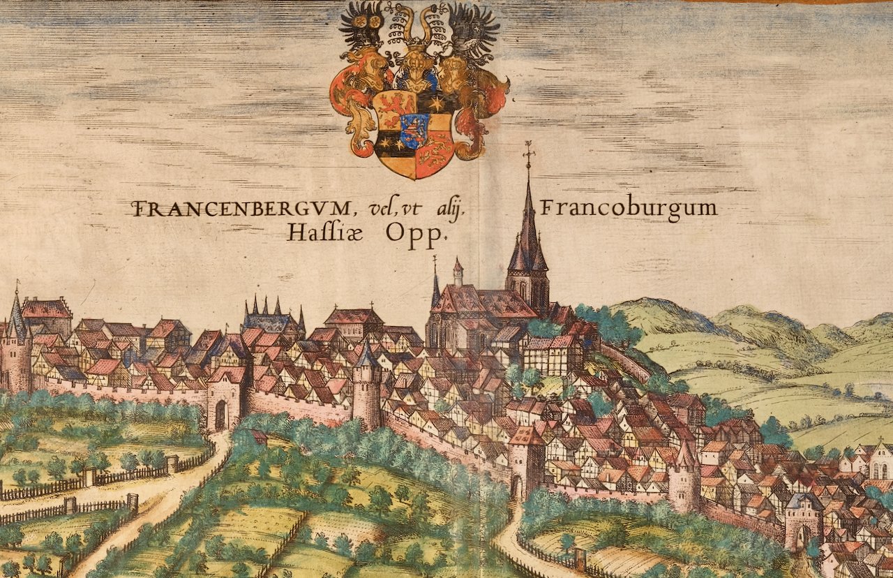
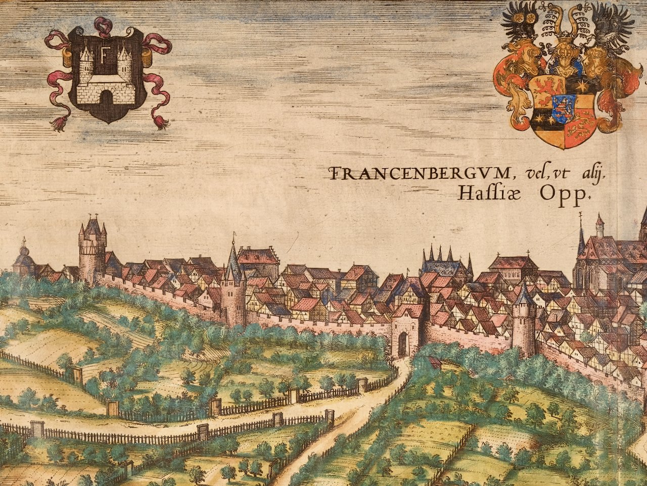
 Image 4 of 5
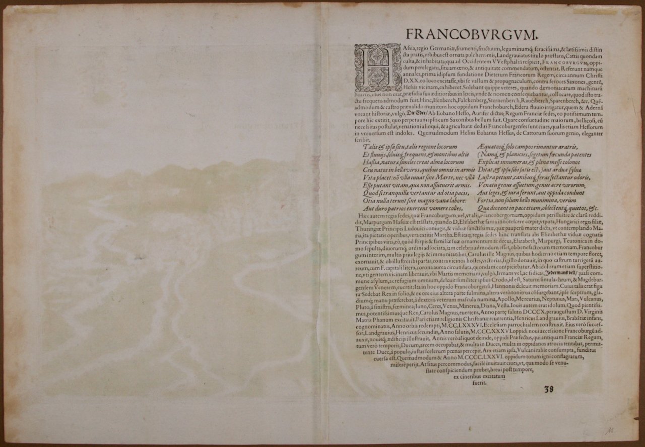
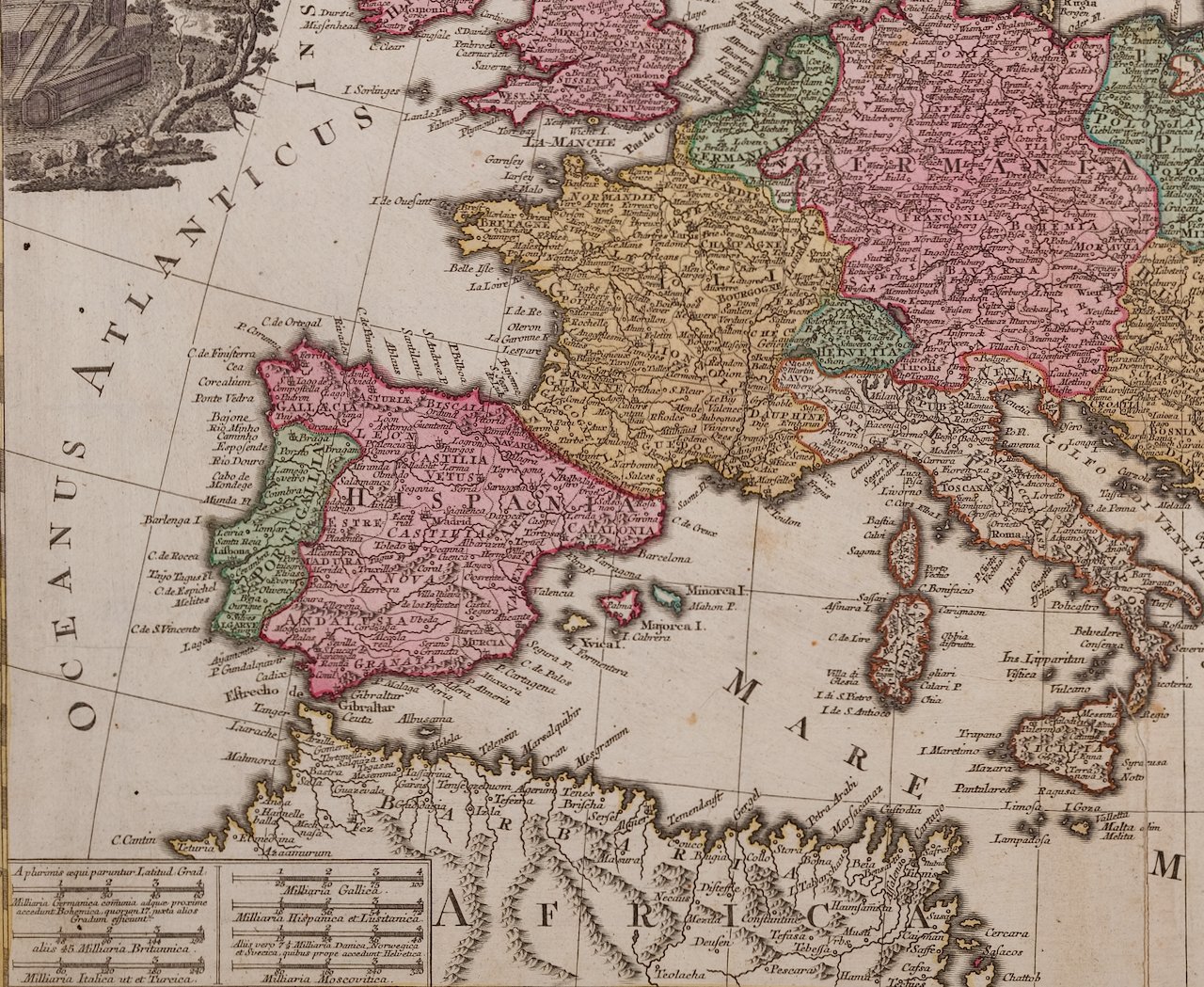 Image 5 of 5
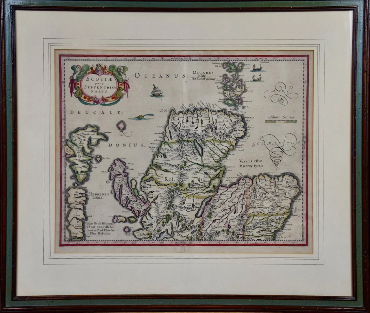
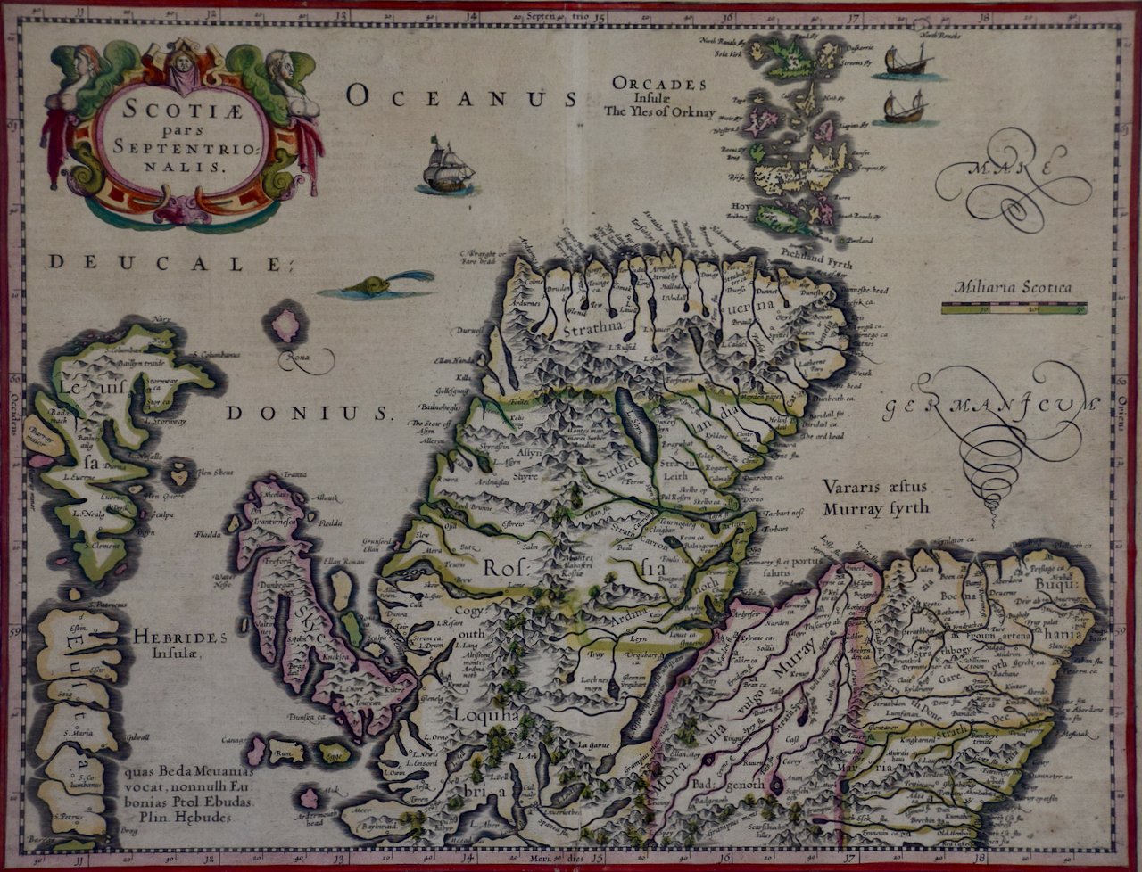
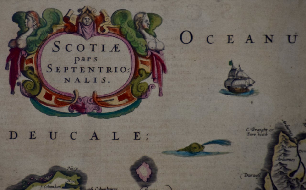
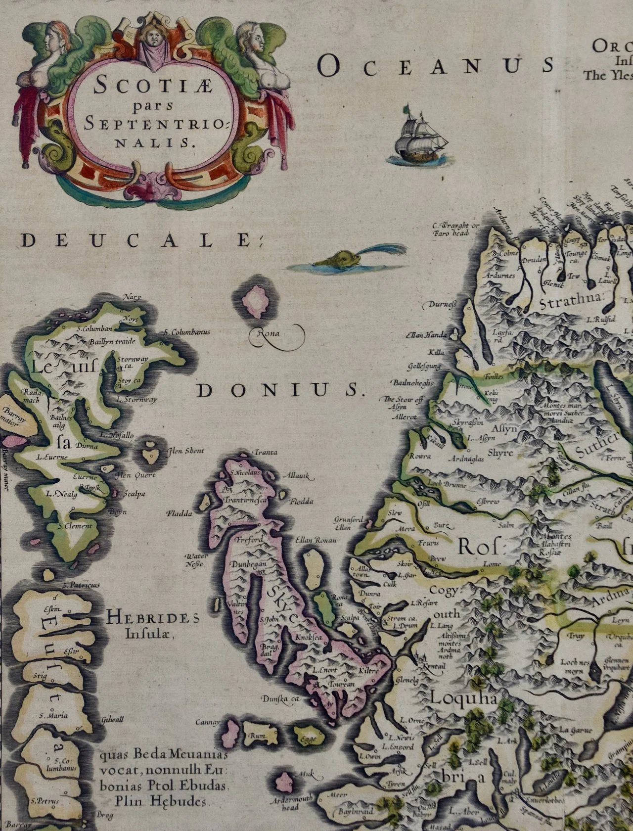
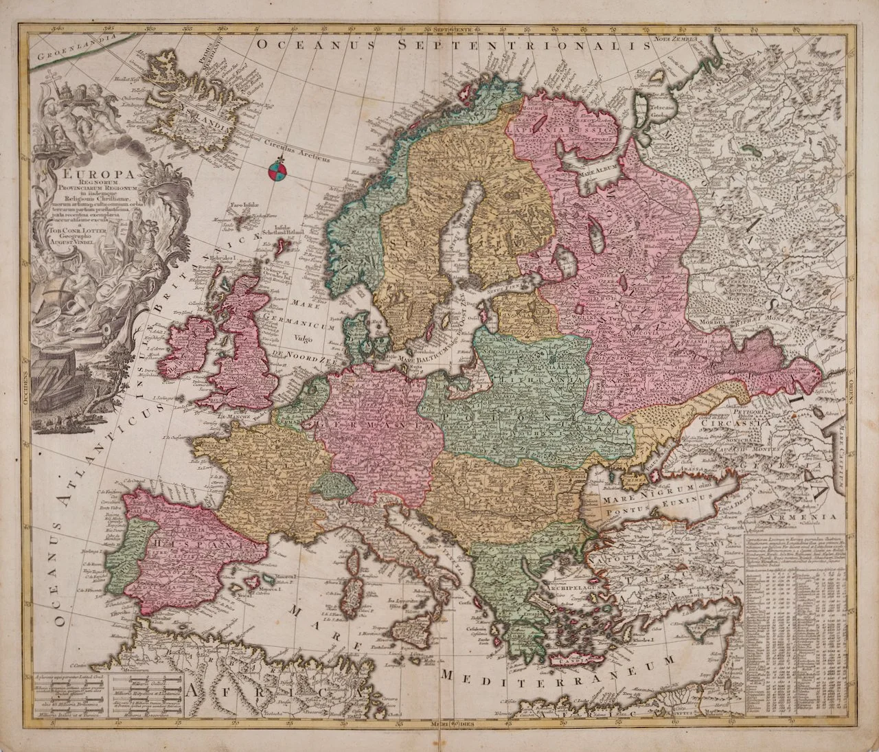
This beautiful engraved hand-colored map of Europe is printed on a sheet that measures 20.88" high and 24" wide, with good margins all around. There is a central vertical fold, as issued. There is mild spotting, more prominently in the margins than in the map, and creases the lower corners, with a small area of loss at the lower edge of the right lower corner. There is a short separation of the lower center fold, which has been professionally reinforced on the verso. This striking map is otherwise in very good condition, particularly for its age.
Tobias Conrad Lotter (1717-1777) was a German engraver, publisher, and cartographer who lived and worked in Augsburg, a city in southern Germany. He was born into a family of engravers and learned his craft from his father and grandfather, both of whom were renowned artists. Lotter began his career as an engraver and later became a publisher of maps, atlases, and other printed materials. He was known for his exceptional skill in engraving and for the high quality of his maps, which were praised for their accuracy and attention to detail. In addition to his work as a cartographer, Lotter was also active in politics and served as a member of the city council in Augsburg. He was a respected member of the community and was known for his dedication to his work and his commitment to public service. Today, Lotter is remembered as one of the most important cartographers of the 18th century, and his maps are highly sought after by collectors and historians. His work has been praised for its beauty, accuracy, and historical significance, and he is considered to be one of the most important figures in the history of mapmaking.