 Image 1 of 8
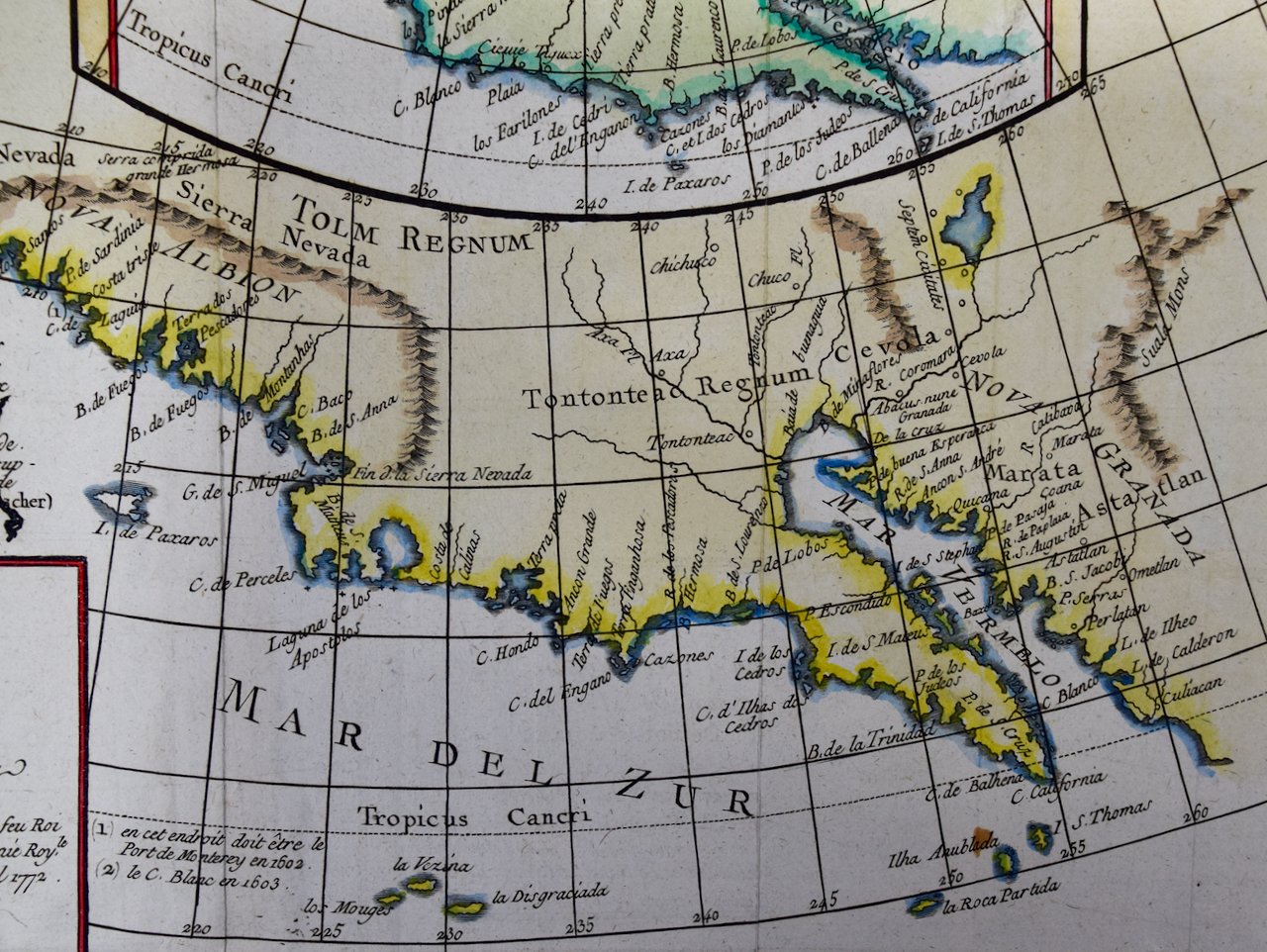 Image 2 of 8
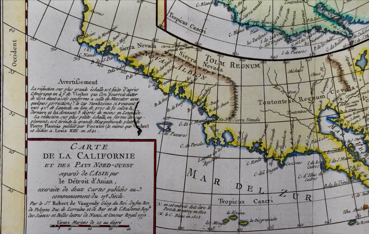 Image 3 of 8
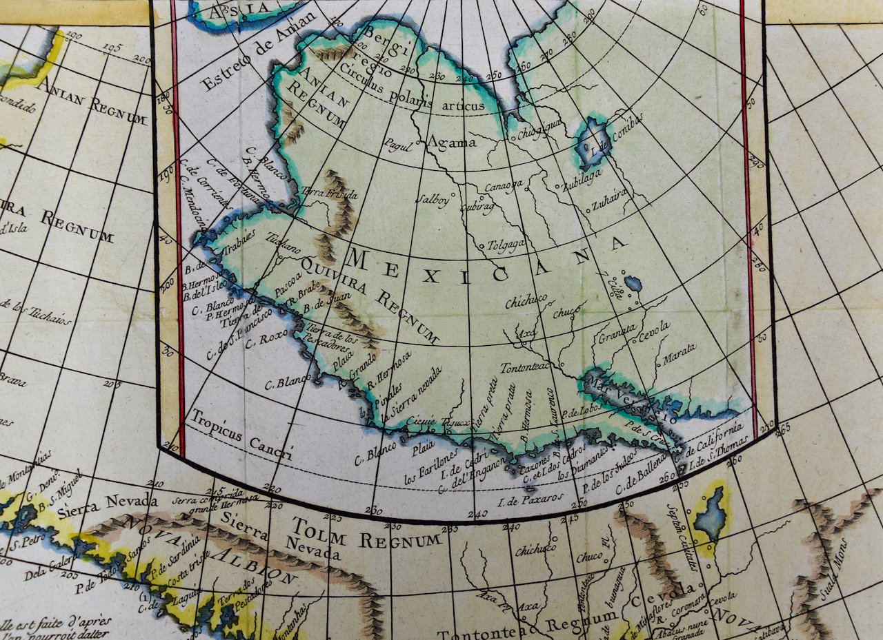 Image 4 of 8
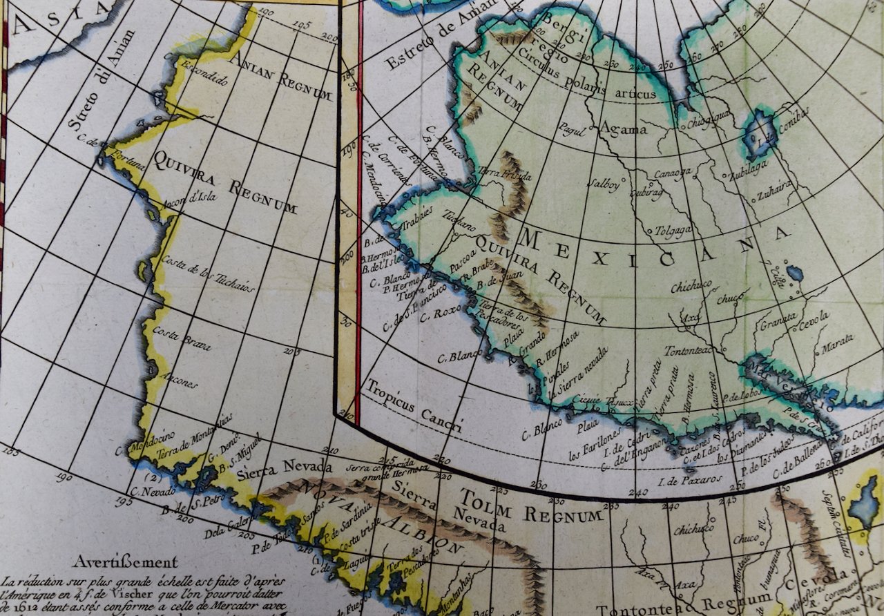 Image 5 of 8
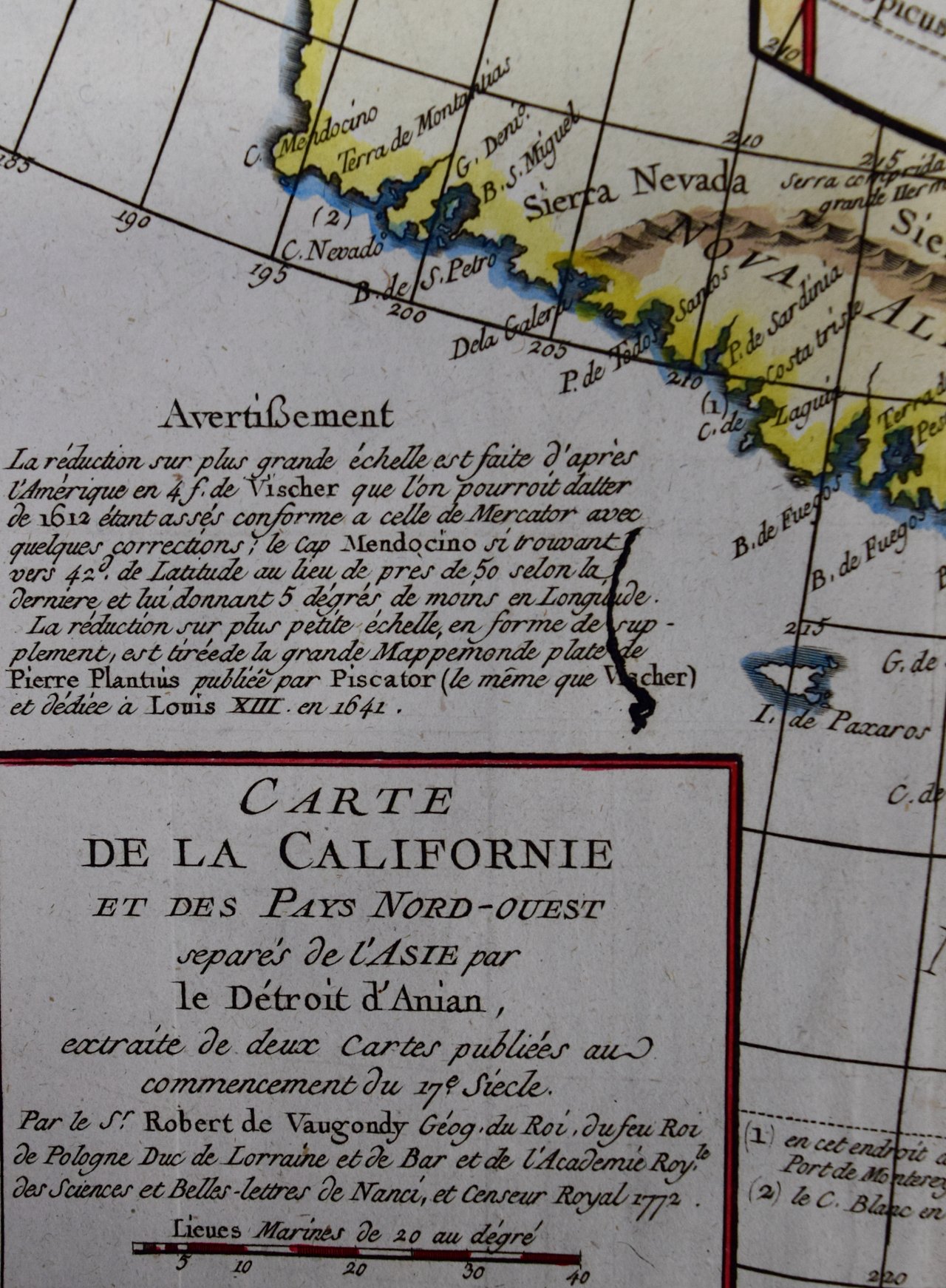 Image 6 of 8
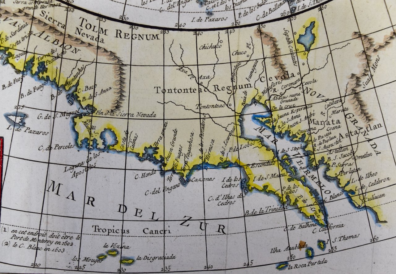 Image 7 of 8
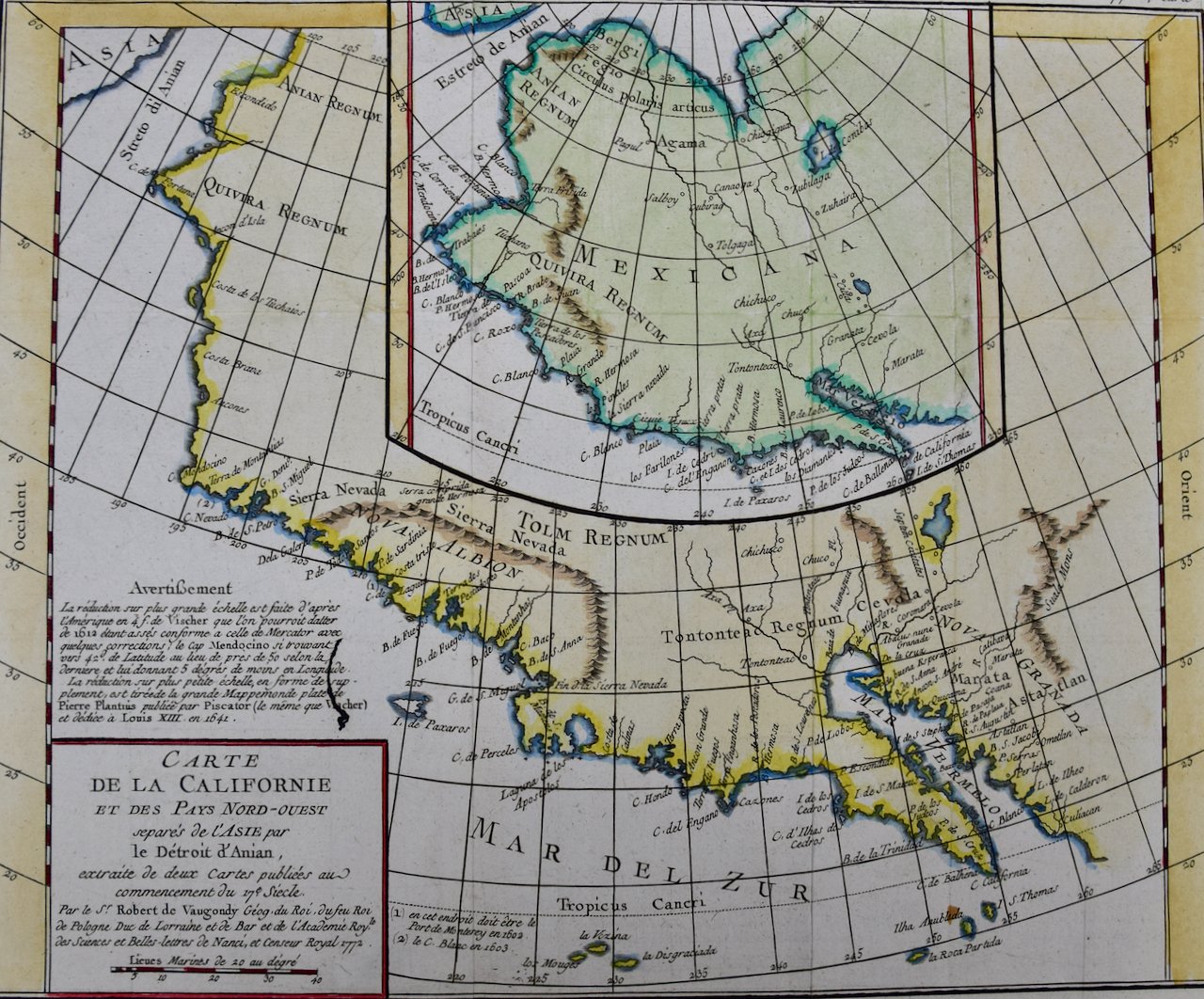 Image 8 of 8
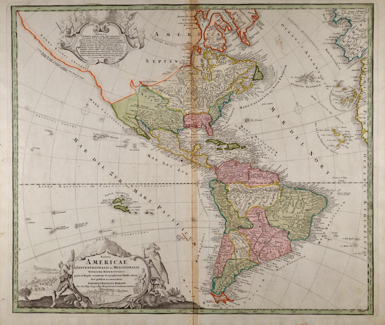
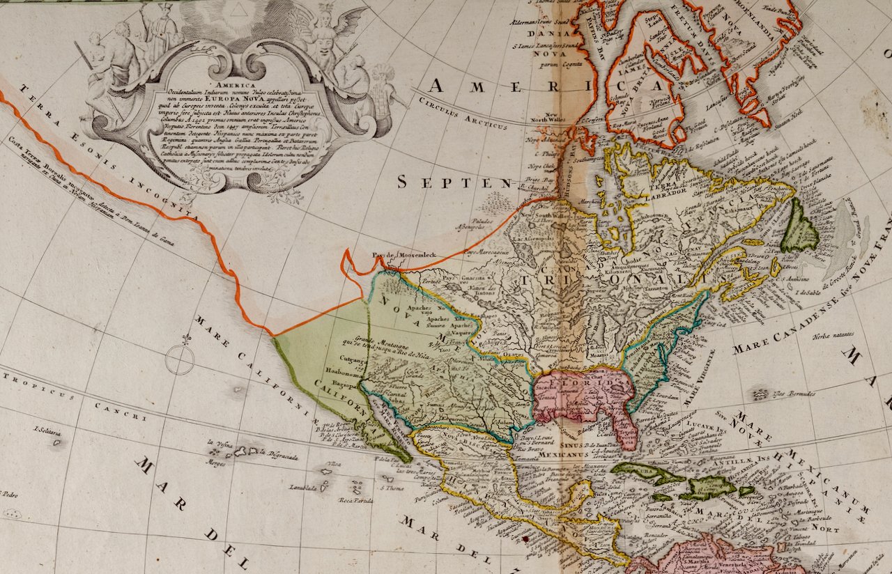
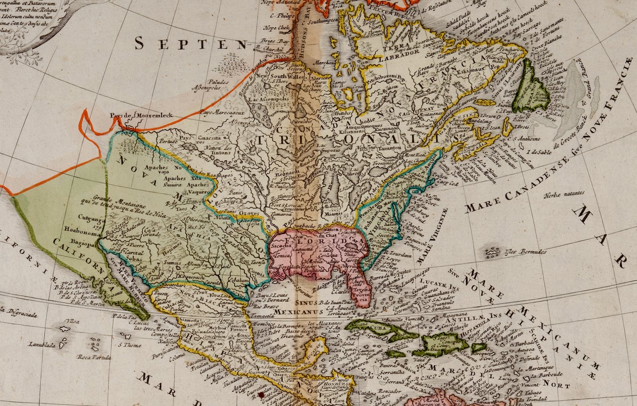
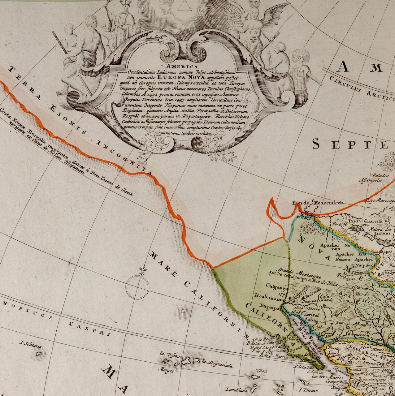
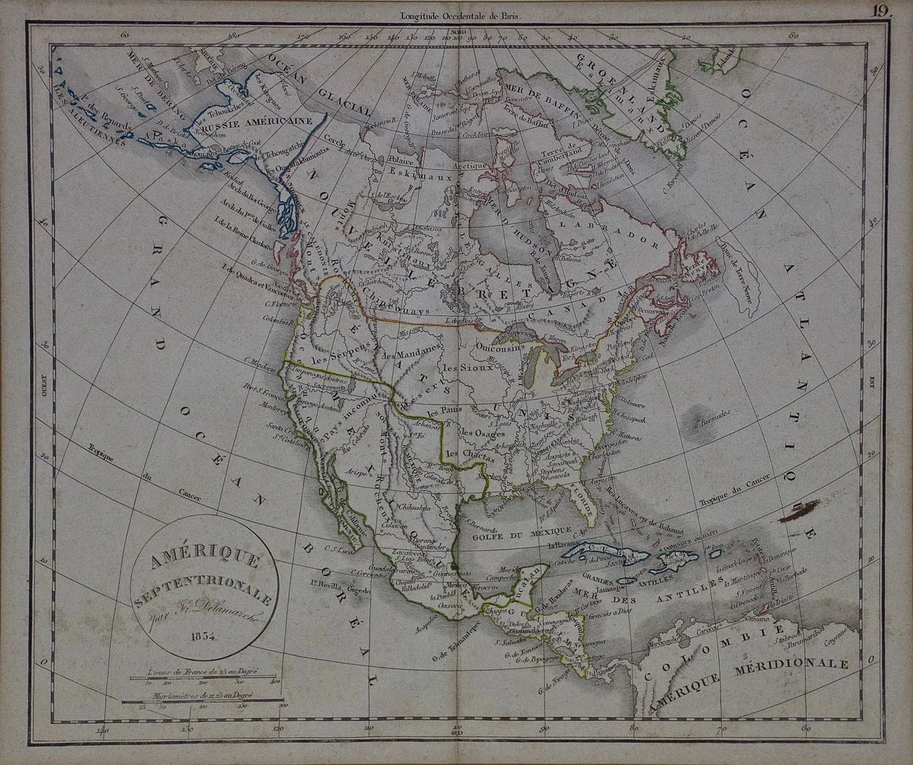
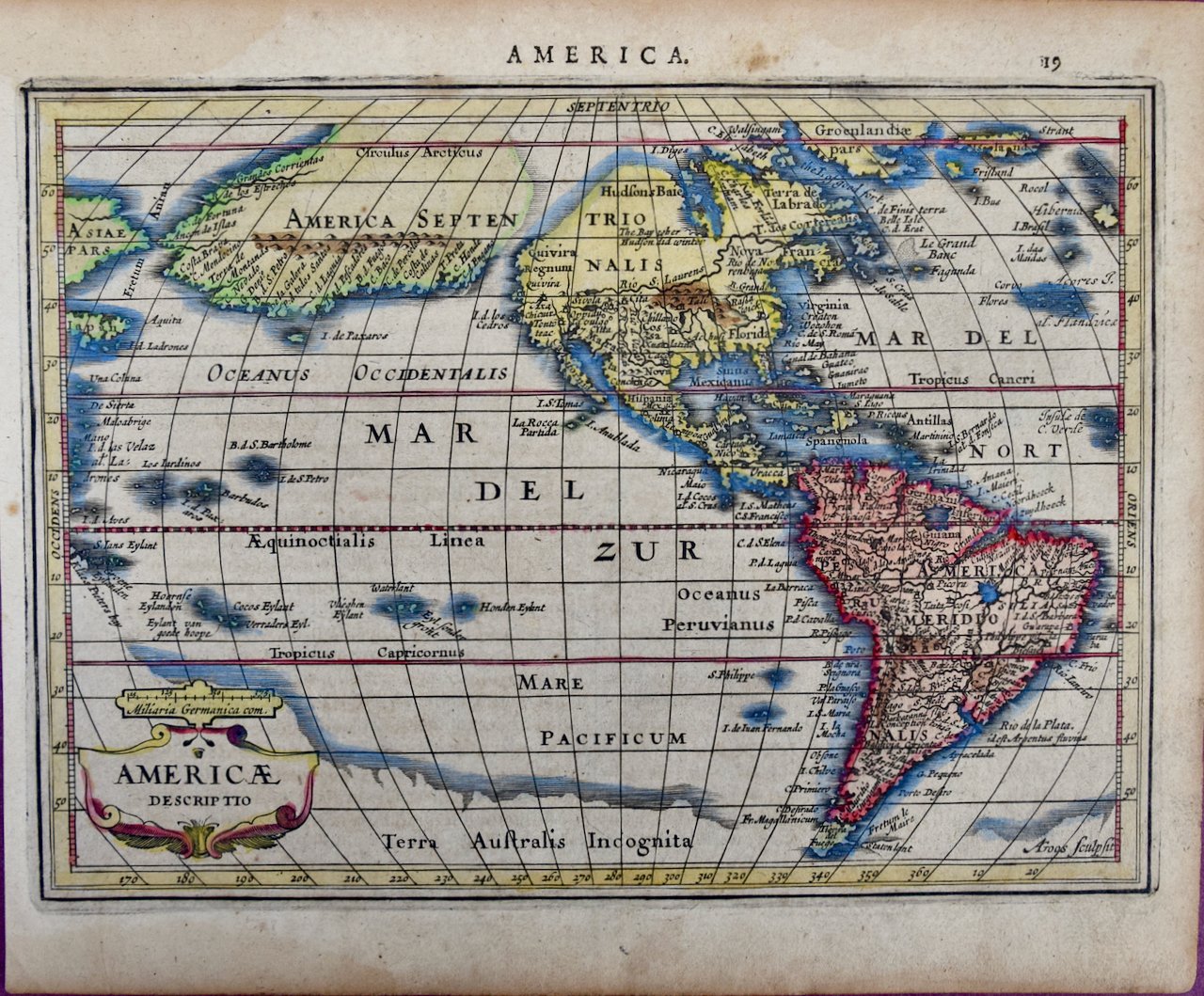
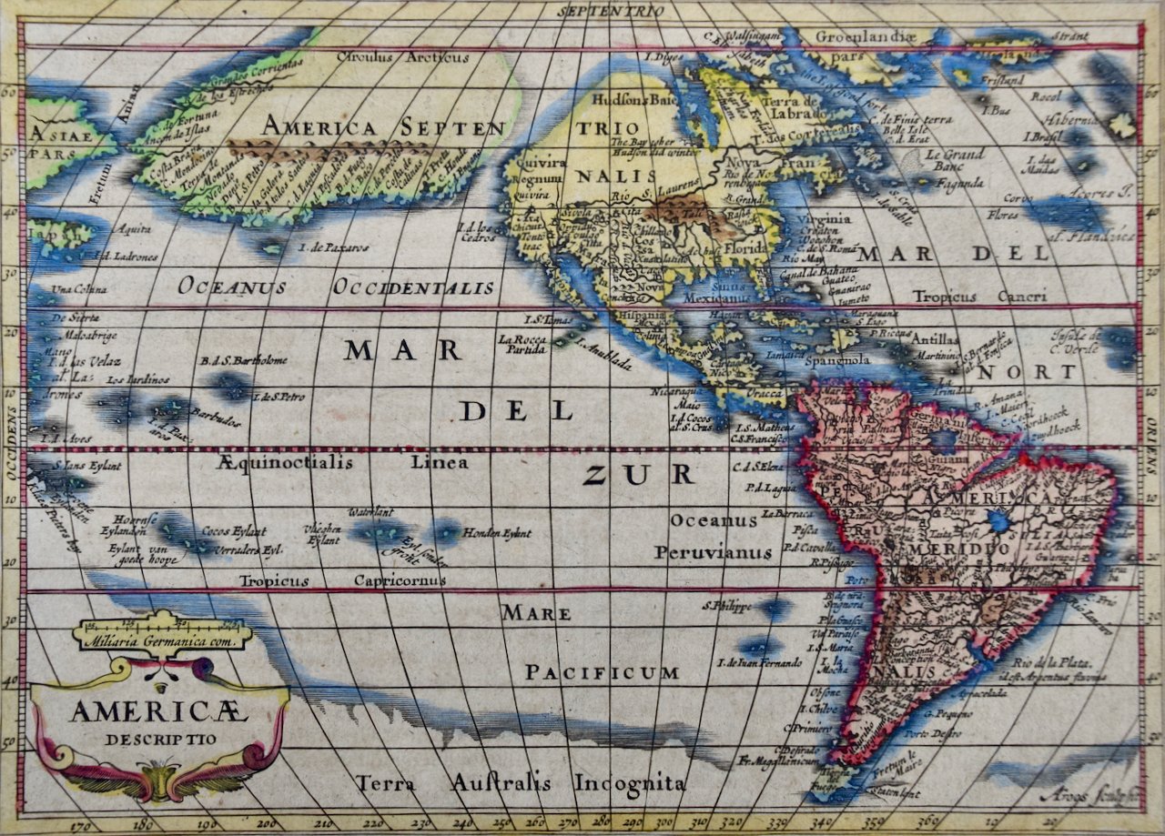
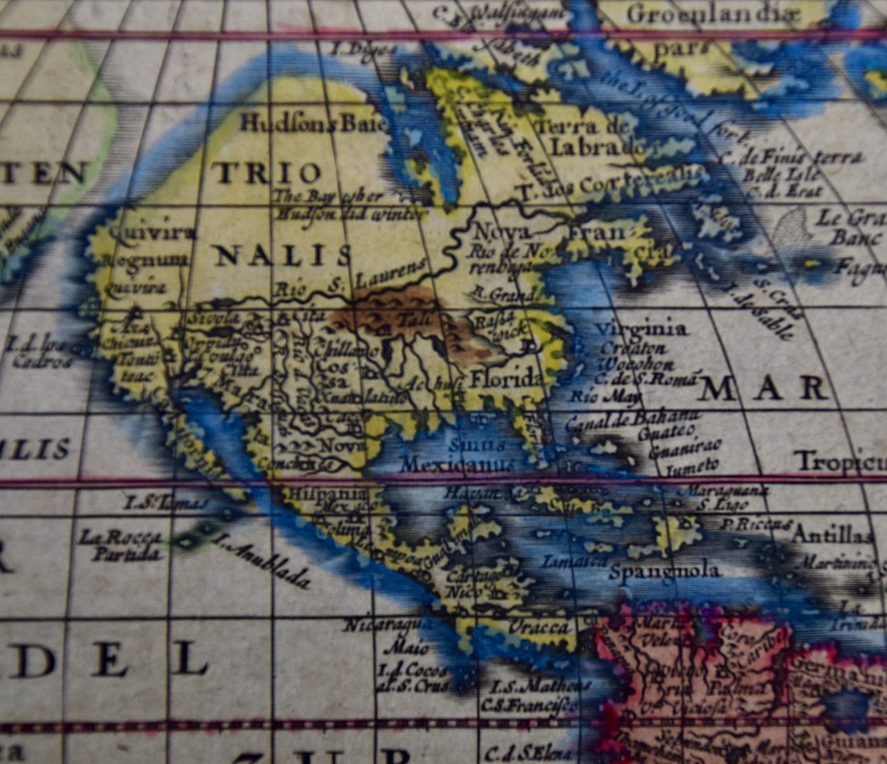
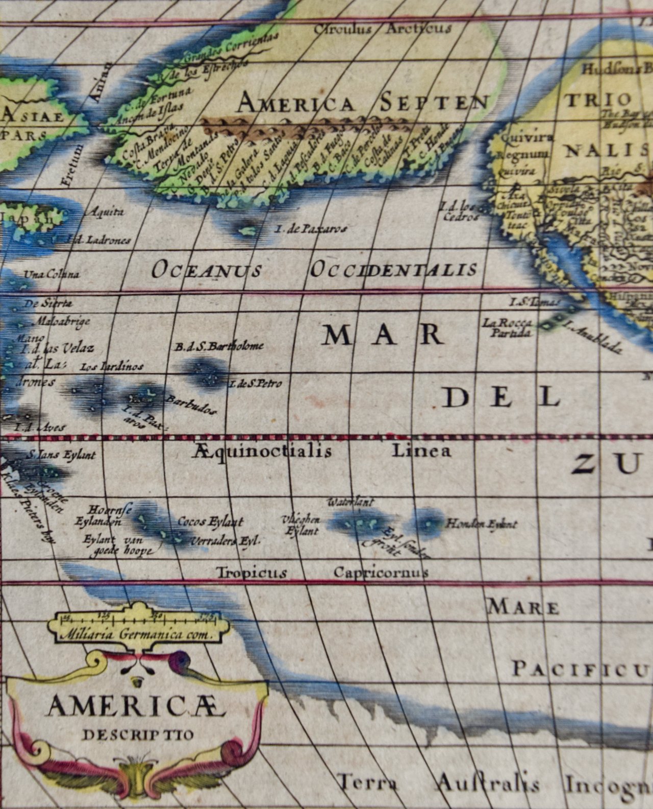
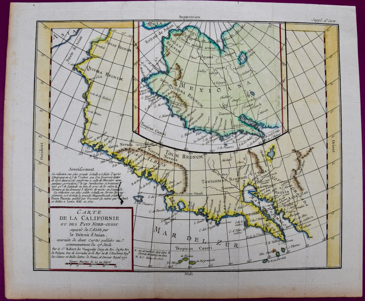
The main portions of the map depicts the west coast of North America from Present day Alaska in the north to Baja California in the south. The map includes the Strait of Anian in the region of Alaska, which refers to the legendary but nonexistent Northwest Passage, hoped to be a link between the Atlantic and Pacific oceans and a desirable trade route from Europe to North America. Captain James Cook eventually disproved its existence during his third and final voyage in 1778.
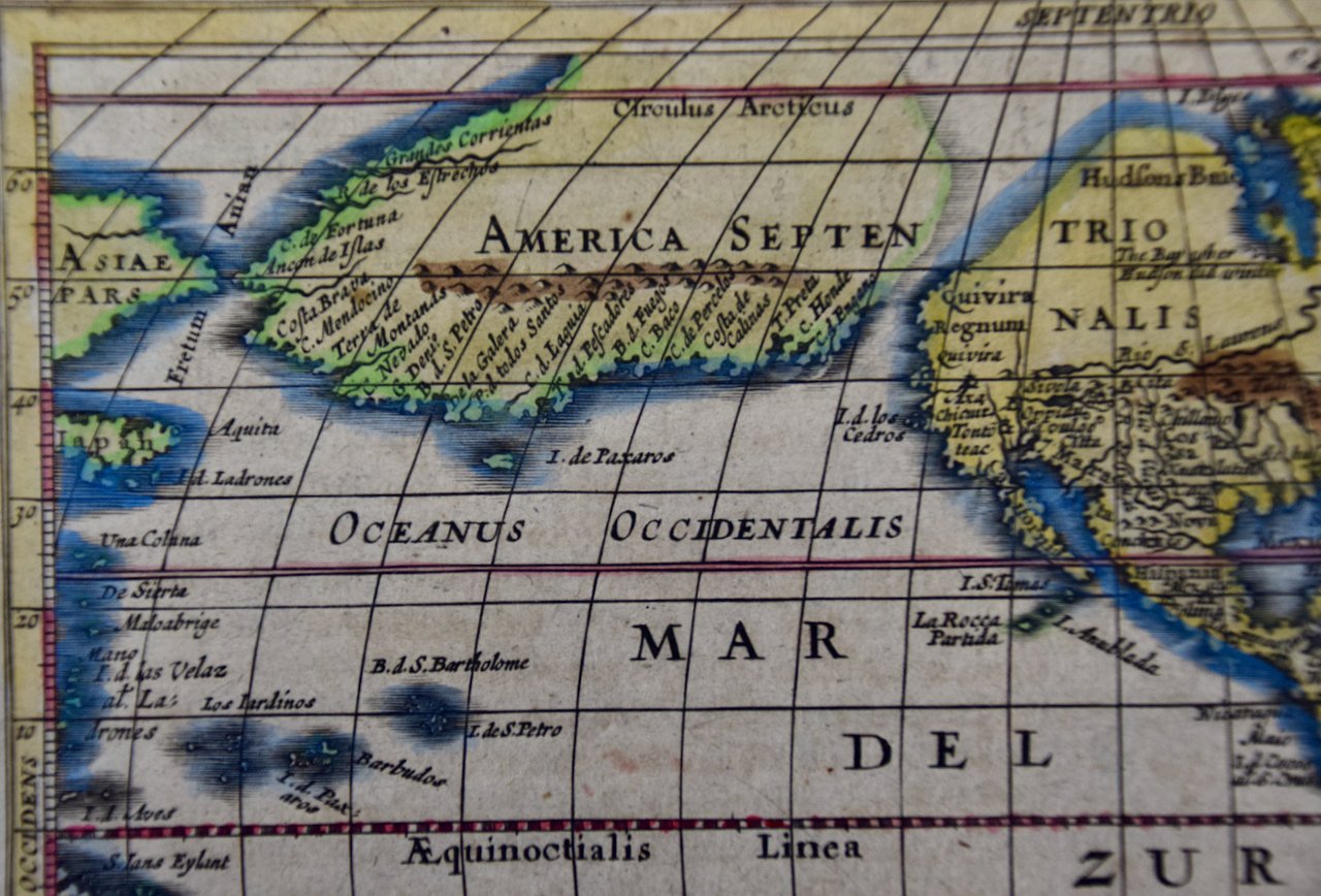
A large inset map of the same region curiously depicts the coastline differently than in the larger portion of the map. The larger map shows Mendocino in Northern California, the Bay of San Miguel (present day San Diego) and Cabo de California (Cabo San Lucas) at the southern tip of Baja California, while the smaller inset map includes C. de San Francisco and los Farilones (the Farallon Islands) and Isle De Paxaros, possibly representing Catalina Island. The larger map shows Nova Albion, the name given to Northern California by Sir Francis Drake when he claimed the area for England in 1579. His point of landfall is now called Drake's Cove, which is part of Point Reyes National Seashore. The smaller inset map identifies the entire region as "Mexicana".
These maps are based on maps by Vischer of 1612 and 1641, and appeared in the Supplement to Denis Diderot's Encyclopedie. Both maps showing the fictitious Strait of Anian at the top; it was part of the legendary Northwest Passage, the long hoped for link of the Pacific and Atlantic Oceans, whose existence many explorers attempted to prove, and which was later definitively disproved by Captain Cook in 1778. The smaller inset map shows much more of the Strait, along with an open sea, making a suggestion of a Northwest Passage.
The map is printed on watermarked laid, chain-linked paper with wide margins. The sheet measures 13.75" high x 16.63" wide. There are vertical and horizontal folds, as issued, with reinforcement of a left vertical fold on the verso. There is minimal discoloration of the edges of the left and lower margins and a few faint spots on the right, but the map is otherwise in excellent condition.
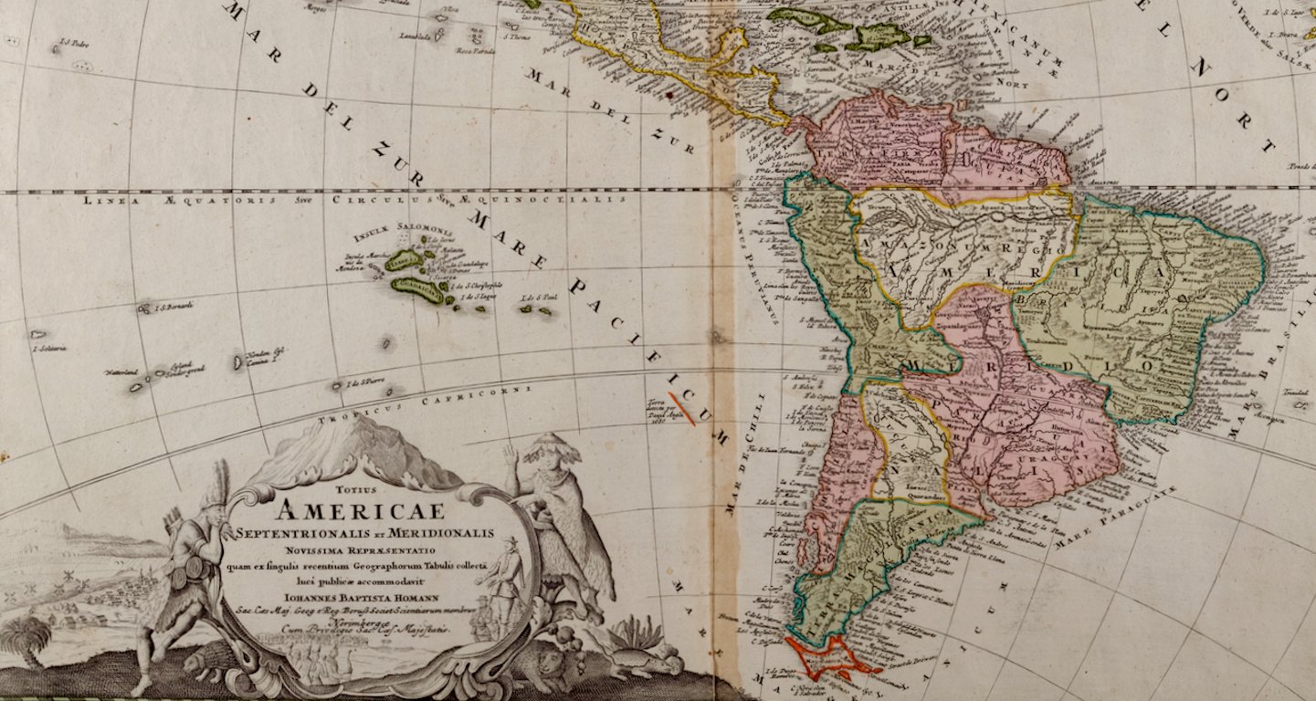
Didier Robert de Vaugondy (1723-1786) was the son of Gilles Robert de Vaugondy, who was a prominent French cartographer, printmaker and publisher. The two worked together in the family business, they publishing atlases. The best know publication was the Atlas Universel (1757). Didier followed his father as the royal cartographer/hydrographer to King Louis XV of France. He held a similar position in the court of the Duke of Lorraine and King of Poland. He later became the royal censor for information published in French geography texts, sea charts and publication describing travel and exploration.