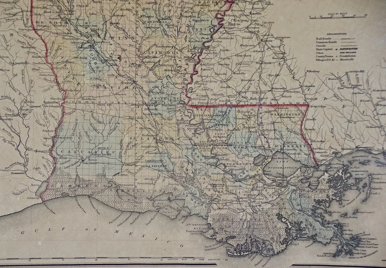
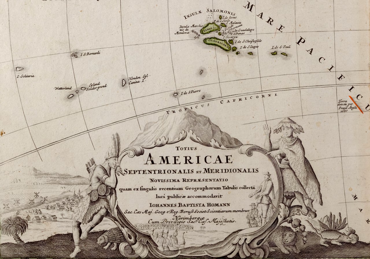
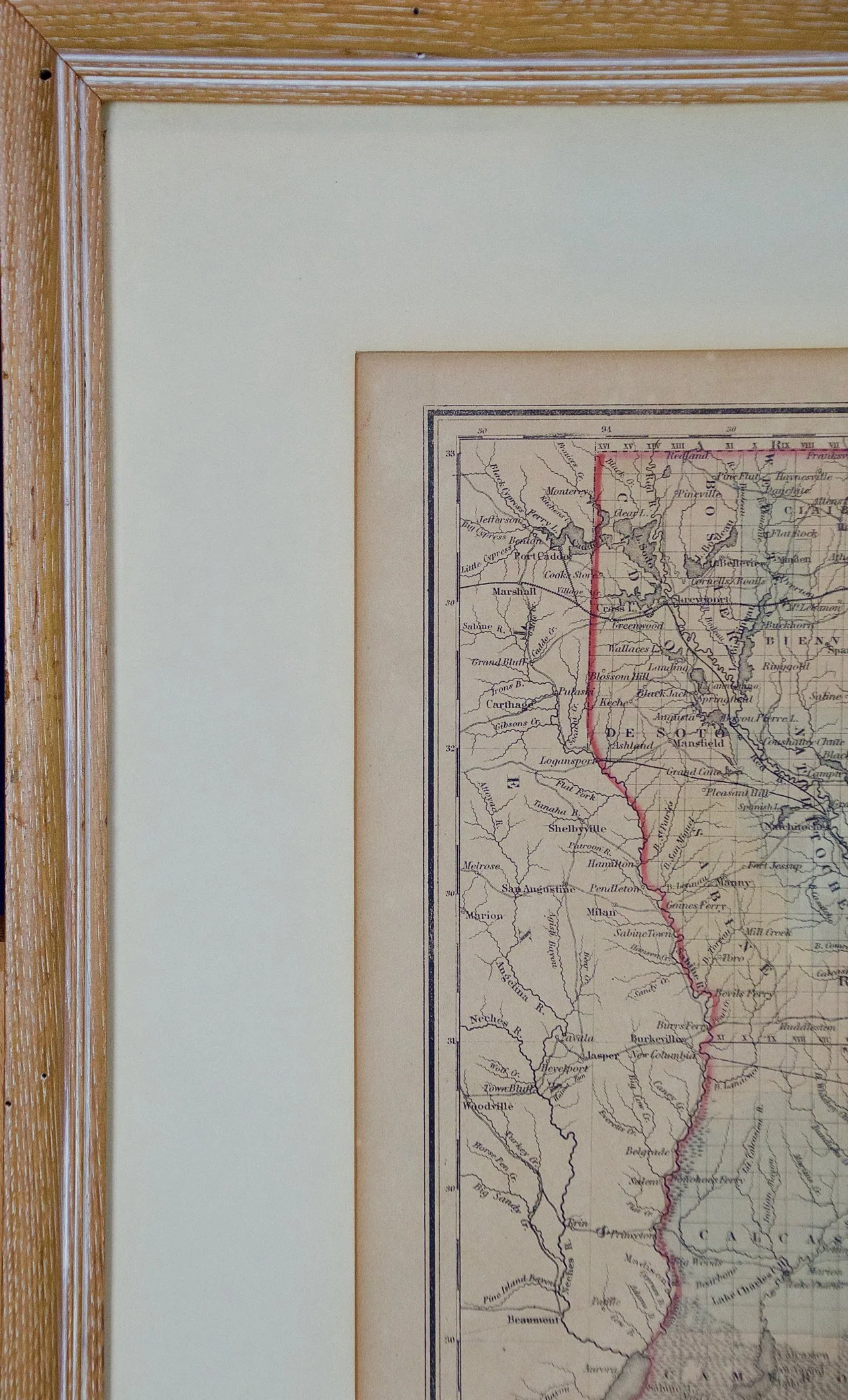
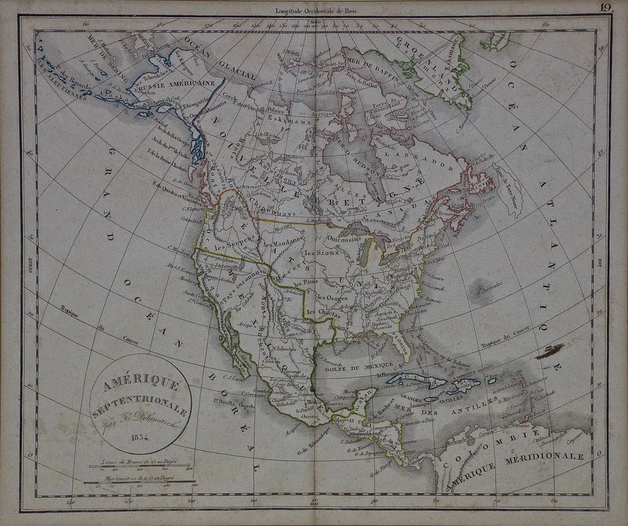
Skip to Content
Timeless Intaglio: Rare Prints, Maps & Books
Shop
All Listings
Antiquarian Prints
Antiquarian Maps
Antiquarian Books
Artists
Our Story
Previews
Contact
Login Account
0
0
Search
Timeless Intaglio: Rare Prints, Maps & Books
Shop
All Listings
Antiquarian Prints
Antiquarian Maps
Antiquarian Books
Artists
Our Story
Previews
Contact
Login Account
0
0
Search
Folder: Shop
Back
All Listings
Antiquarian Prints
Antiquarian Maps
Antiquarian Books
Artists
Our Story
Previews
Contact
Login Account
Search
Shop America "Amérique Septentrionale": A 19th Century French Map by Delamarche
3313 Delamarche, Amérique Septentrionale.jpg Image 1 of 5
3313 Delamarche, Amérique Septentrionale.jpg
3313B Delamarche, Amérique Septentrionale.jpg Image 2 of 5
3313B Delamarche, Amérique Septentrionale.jpg
3313C Delamarche, Amérique Septentrionale.jpg Image 3 of 5
3313C Delamarche, Amérique Septentrionale.jpg
3313D Delamarche, Amérique Septentrionale.jpg Image 4 of 5
3313D Delamarche, Amérique Septentrionale.jpg
3313E Delamarche, Amérique Septentrionale.jpg Image 5 of 5
3313E Delamarche, Amérique Septentrionale.jpg
3313 Delamarche, Amérique Septentrionale.jpg
3313B Delamarche, Amérique Septentrionale.jpg
3313C Delamarche, Amérique Septentrionale.jpg
3313D Delamarche, Amérique Septentrionale.jpg
3313E Delamarche, Amérique Septentrionale.jpg

America "Amérique Septentrionale": A 19th Century French Map by Delamarche

$975.00

This framed mid 19th century map of North America entitled "Amérique Septentrionale" by Felix Delamarche was published in Paris in 1854 by Quay de l'Horloge du Palais, avec les Cartes de Guill. Delisle et de Phil. Buache.

Creator: Maison Delamarche 1 (Artist)

Creation Year: 1855 (manufactured)

Dimensions: Height: 20 in (50.8 cm) Width: 22.63 in (57.49 cm) Depth: 0.88 in (2.24 cm)

Medium: Engraving

Condition: See description below.

Add To Cart

This framed mid 19th century map of North America entitled "Amérique Septentrionale" by Felix Delamarche was published in Paris in 1854 by Quay de l'Horloge du Palais, avec les Cartes de Guill. Delisle et de Phil. Buache.

Creator: Maison Delamarche 1 (Artist)

Creation Year: 1855 (manufactured)

Dimensions: Height: 20 in (50.8 cm) Width: 22.63 in (57.49 cm) Depth: 0.88 in (2.24 cm)

Medium: Engraving

Condition: See description below.

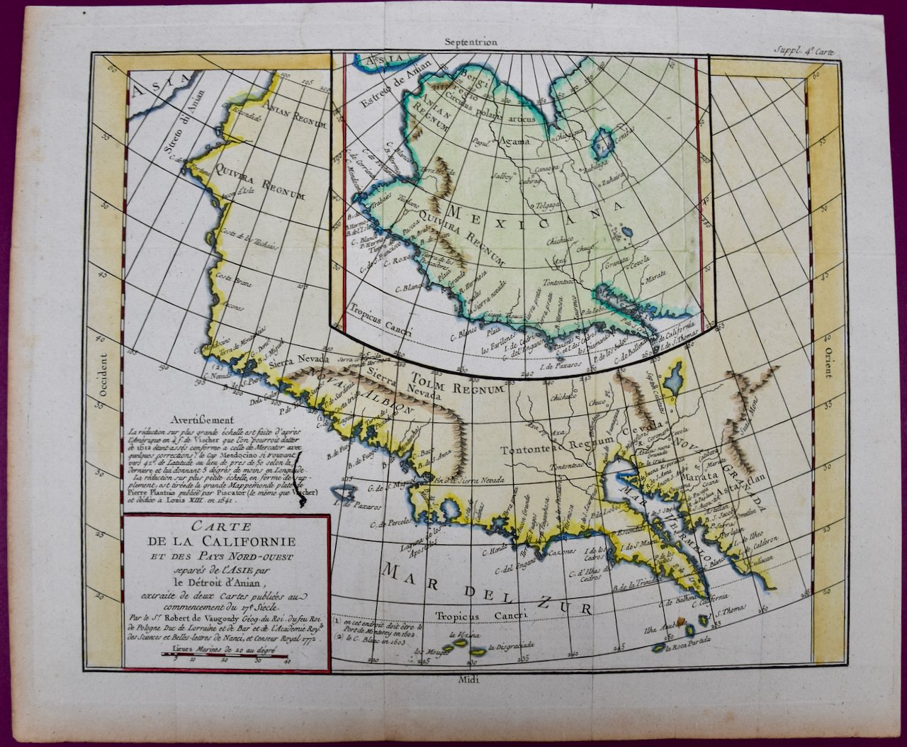
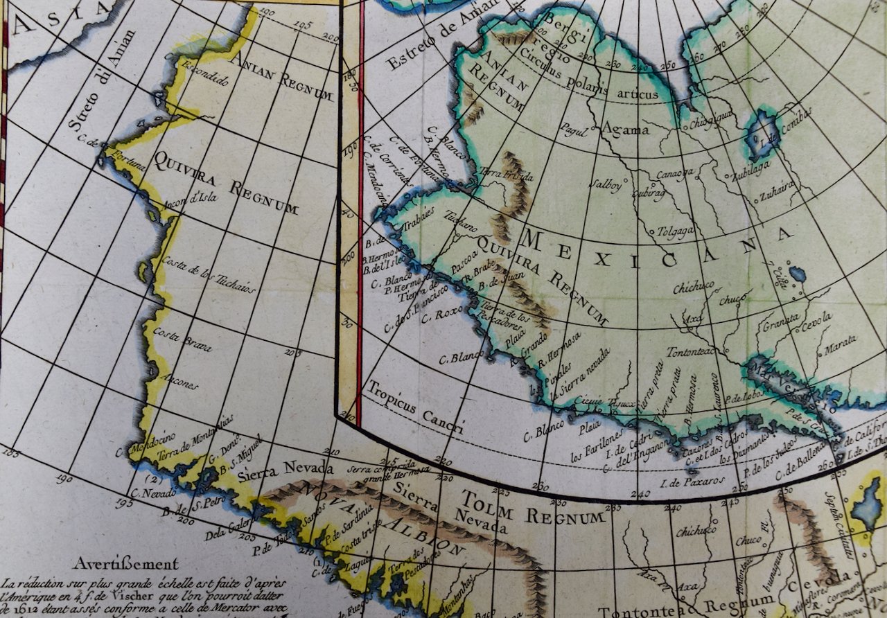
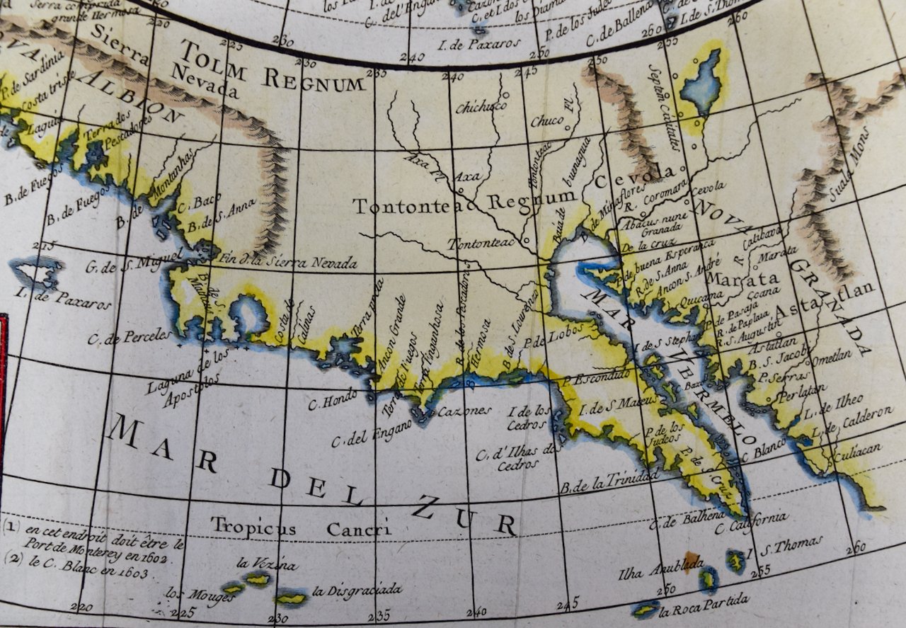
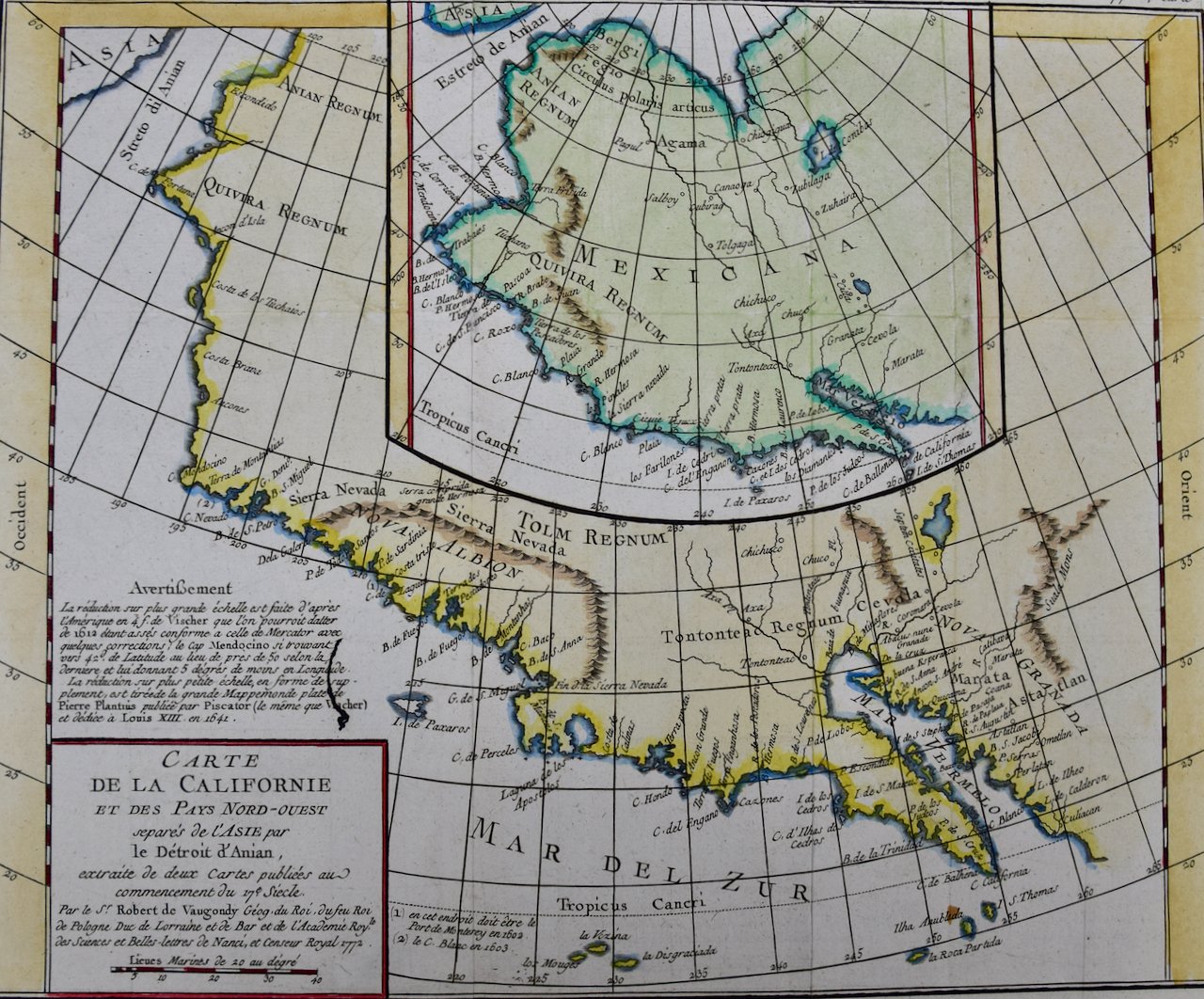
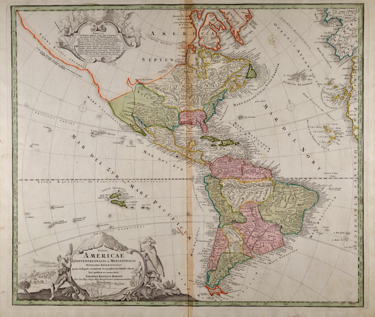
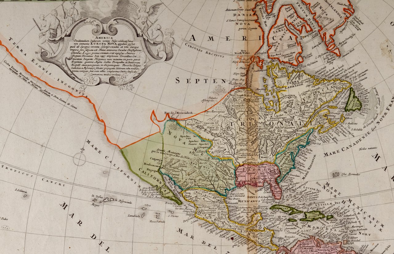
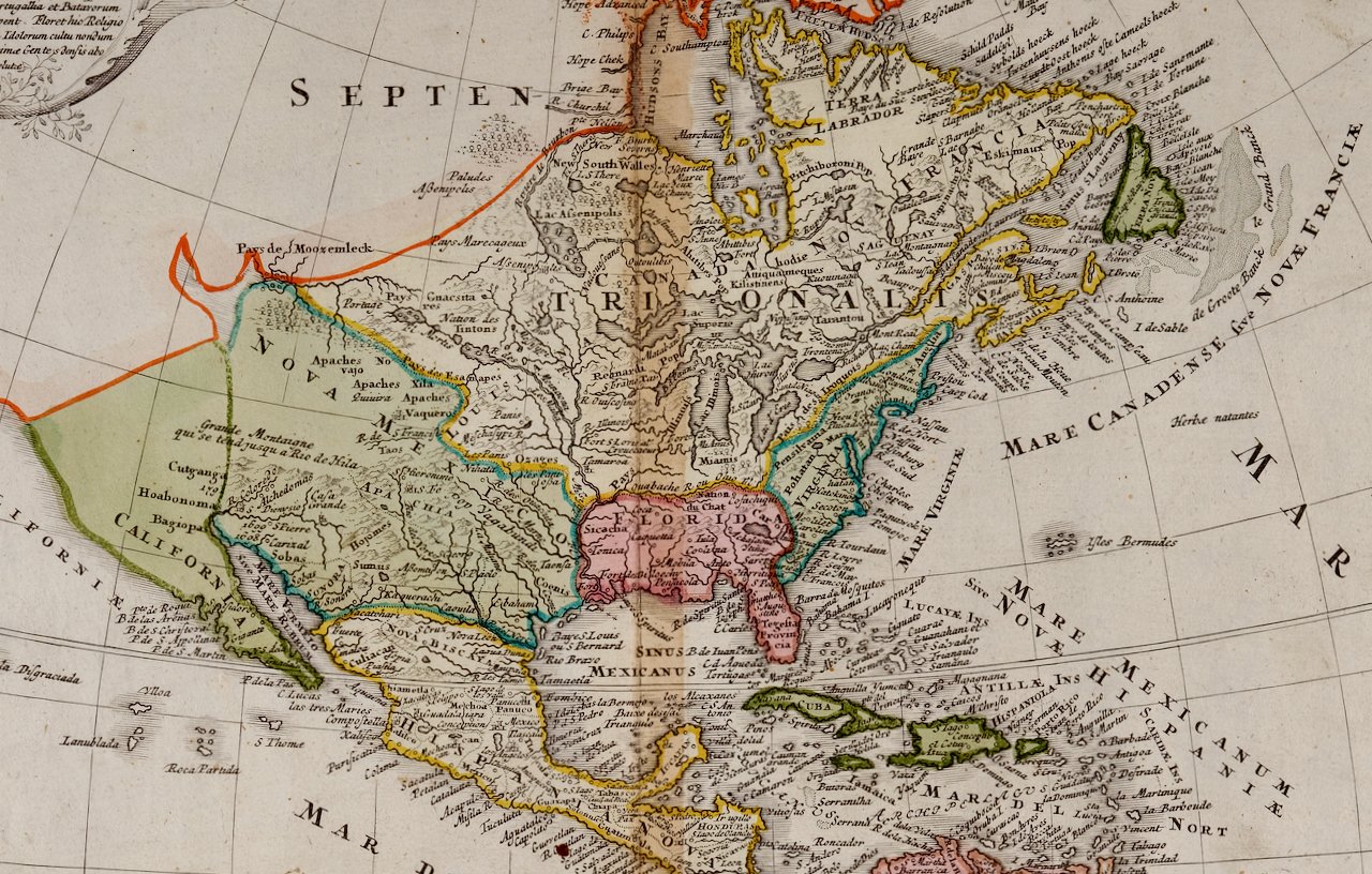
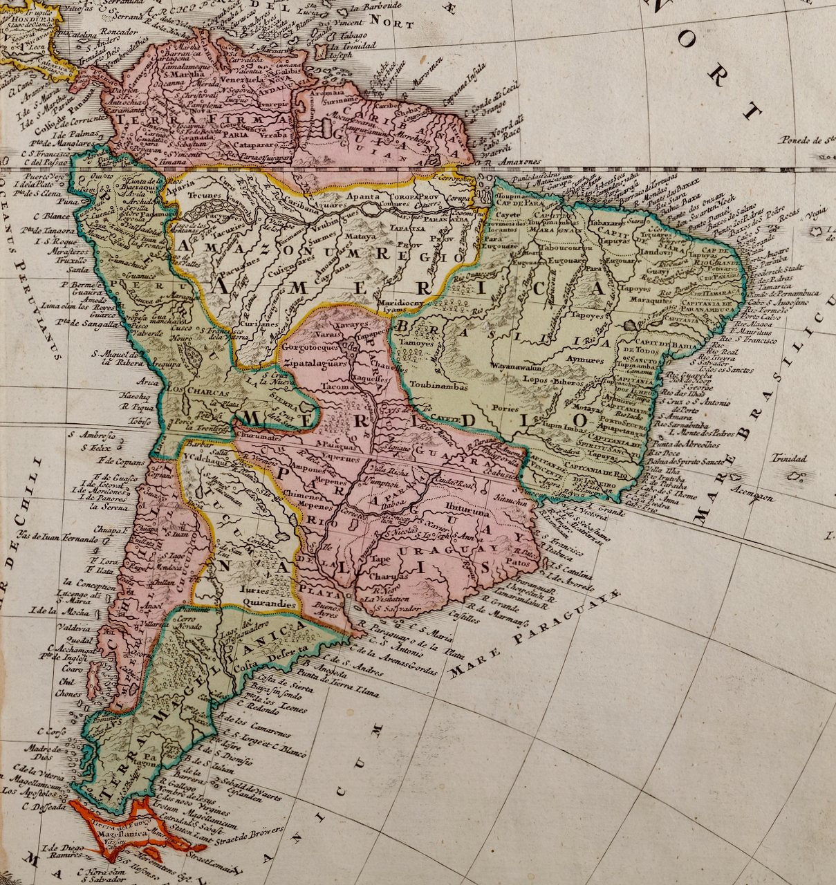
The map includes Central America (labelled Guatimala), portions of Columbia in South America and portions of Greenland, as well as Cuba, Haiti and Santa Dominique (The Dominican Republic). Modern day Alaska is labelled Russie Americaine. Many of the areas in the midwest and west of the United States are named for the Native American tribes that live in the region, rather than their eventual English names. These territories in modern day Colorado, Arizona, New Mexico, Texas, Washington and Oregon include: Les Osage, Les Sioux, Les Mandanes, Les Chactas, Chipeouays, Les Serpens. California and the southwestern states are still part of Mexico at the time this map was published.

The map, which is colored in outline, is presented in a light brown distressed bleached wood frame with a cream-colored mat. The frame measures 22.63" wide x 20" high x 0.88" deep. There are two other 19th century maps of North America (the United States and one including Mexico) listed that are presented in identical style frames and mats. These would make an interesting and attractive grouping. A discount is available for purchase of a grouping of two or three of these maps.

There is a central vertical fold, as issued. The map is somewhat toned, although the appearance appears in part to be related to its tinting. There is some faint spotting, most prominently in the left lower portions of the map. It is otherwise in very good condition.

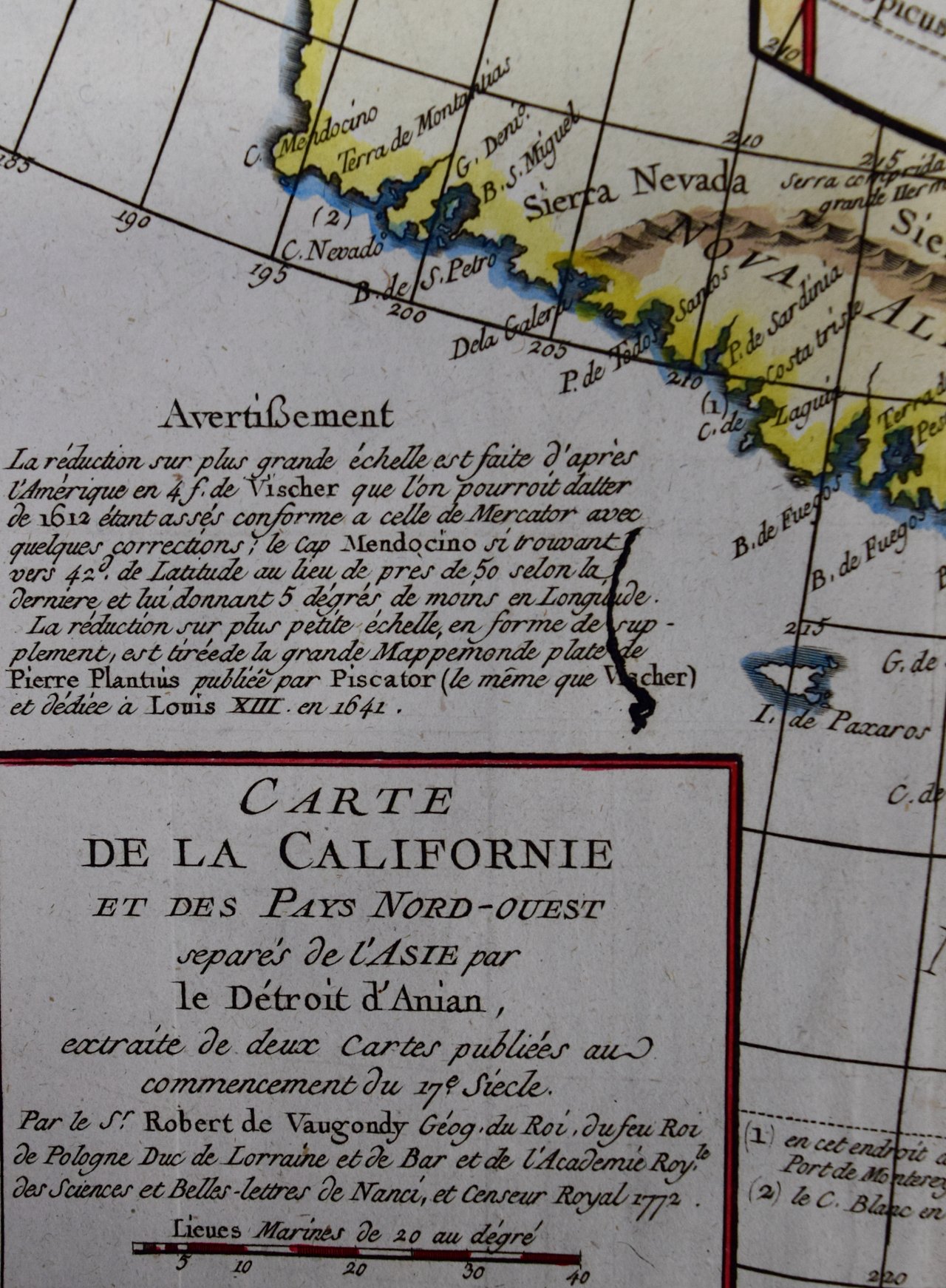
Félix Delamarche was a French geographer and engineer who flourished during the 18th century and early 19th century.[1][2] His father was the map publisher Charles Francois Delamarche. Félix Delamarche became the owner of his father's map publishing company, Maison Delamarche. He ran the company alongside cartographer Charles Dien. The firm would eventually be passed down to Alexandre Delamarche.[1] Delamarche created Atlas de la géographie ancienne et moderne in 1820. The atlas was reprinted during the 19th century. It was utilized by the Ecole Spéciale Militaire de Saint-Cyr. His work is held in the collection of the Library of Congress.[3]

Related Works

North and South America: An 18th Century Hand-colored Map by Johann Homann 1752A Homann, Totius Americae Septentrionalis Et Meridionalis.jpeg 1752B Homann, Totius Americae Septentrionalis Et Meridionalis.jpeg 1752C Homann, Totius Americae Septentrionalis Et Meridionalis.jpeg 1752D Homann, Totius Americae Septentrionalis Et Meridionalis.jpeg 1752E Homann, Totius Americae Septentrionalis Et Meridionalis.jpeg 1752F Homann, Totius Americae Septentrionalis Et Meridionalis.jpeg
North and South America: An 18th Century Hand-colored Map by Johann Homann
$2,375.00
North America: A Framed Hand-colored 19th Century German Map by Adolph Stieler 3312A Stieler, Nord-Amerika. (North America).jpg 3312B Stieler, Nord-Amerika. (North America).jpg 3312C Stieler, Nord-Amerika. (North America).jpg 3312D Stieler, Nord-Amerika. (North America).jpg 3312E Stieler, Nord-Amerika. (North America).jpg 3312F Stieler, Nord-Amerika. (North America).jpg 3312G Stieler, Nord-Amerika. (North America).jpg 3312H Stieler, Nord-Amerika. (North America).jpg
North America: A Framed Hand-colored 19th Century German Map by Adolph Stieler
$975.00
Louisiana: A Framed 19th Century Map by O.W. Gray 3371A Gray, Map of Louisiana.jpg 3371 BGray, Map of Louisiana.jpg 3371C Gray, Map of Louisiana.jpg 3371 DGray, Map of Louisiana.jpg 3371E Gray, Map of Louisiana.jpg
Louisiana: A Framed 19th Century Map by O.W. Gray
$975.00
Sold
California: 18th Century Hand-colored Map by de Vaugondy 339E Vaugondy, Carte de la Californie.jpeg 339D Vaugondy, Carte de la Californie.jpeg 339B Vaugondy, Carte de la Californie.jpeg 339C Vaugondy, Carte de la Californie.jpeg 339F Vaugondy, Carte de la Californie.jpeg 339G Vaugondy, Carte de la Californie.jpeg 339A Vaugondy, Carte de la Californie.jpeg
California: 18th Century Hand-colored Map by de Vaugondy
$875.00

Prints
Maps
Books
Featured Items
Recent Acquisitions

Contact
Our Story
Sell Your Items
Subscribe to our newsletter!

FAQs
Terms and Conditions