Skip to Content
Timeless Intaglio: Rare Prints, Maps & Books
Shop
All Listings
Antiquarian Prints
Antiquarian Maps
Antiquarian Books
Artists
Our Story
Previews
Contact
Login Account
0
0
Search
Timeless Intaglio: Rare Prints, Maps & Books
Shop
All Listings
Antiquarian Prints
Antiquarian Maps
Antiquarian Books
Artists
Our Story
Previews
Contact
Login Account
0
0
Search
Folder: Shop
Back
All Listings
Antiquarian Prints
Antiquarian Maps
Antiquarian Books
Artists
Our Story
Previews
Contact
Login Account
Search
Shop North America: A Framed Hand-colored 19th Century German Map by Adolph Stieler
3312 Stieler, Nord-Amerika. (North America).jpg Image 1 of 9
3312 Stieler, Nord-Amerika. (North America).jpg
3312A Stieler, Nord-Amerika. (North America).jpg Image 2 of 9
3312A Stieler, Nord-Amerika. (North America).jpg
3312B Stieler, Nord-Amerika. (North America).jpg Image 3 of 9
3312B Stieler, Nord-Amerika. (North America).jpg
3312C Stieler, Nord-Amerika. (North America).jpg Image 4 of 9
3312C Stieler, Nord-Amerika. (North America).jpg
3312D Stieler, Nord-Amerika. (North America).jpg Image 5 of 9
3312D Stieler, Nord-Amerika. (North America).jpg
3312E Stieler, Nord-Amerika. (North America).jpg Image 6 of 9
3312E Stieler, Nord-Amerika. (North America).jpg
3312F Stieler, Nord-Amerika. (North America).jpg Image 7 of 9
3312F Stieler, Nord-Amerika. (North America).jpg
3312G Stieler, Nord-Amerika. (North America).jpg Image 8 of 9
3312G Stieler, Nord-Amerika. (North America).jpg
3312H Stieler, Nord-Amerika. (North America).jpg Image 9 of 9
3312H Stieler, Nord-Amerika. (North America).jpg
3312 Stieler, Nord-Amerika. (North America).jpg
3312A Stieler, Nord-Amerika. (North America).jpg
3312B Stieler, Nord-Amerika. (North America).jpg
3312C Stieler, Nord-Amerika. (North America).jpg
3312D Stieler, Nord-Amerika. (North America).jpg
3312E Stieler, Nord-Amerika. (North America).jpg
3312F Stieler, Nord-Amerika. (North America).jpg
3312G Stieler, Nord-Amerika. (North America).jpg
3312H Stieler, Nord-Amerika. (North America).jpg

North America: A Framed Hand-colored 19th Century German Map by Adolph Stieler

$975.00

This framed early 19th century map of North America entitled "Nord-Amerika" is plate No. LIV (No. 46) from Adolph Stieler's Hand-Atlas, published in Gotha, Germany by Justus Perthes in 1832. The original title of the publication was 'Hand-Atlas über alle Theile der Erde und über das Weltgebäude' (Handy Atlas of all Parts of the World and of the Universe).

Creator: Adolf Stieler (1775 - 1836, German)

Creation Year: 1832

Dimensions: Height: 19.5 in (49.53 cm)
Width: 22 in (55.88 cm)
Depth: 0.88 in (2.24 cm)

Medium: Engraving

Condition: See description below.

Add To Cart

This framed early 19th century map of North America entitled "Nord-Amerika" is plate No. LIV (No. 46) from Adolph Stieler's Hand-Atlas, published in Gotha, Germany by Justus Perthes in 1832. The original title of the publication was 'Hand-Atlas über alle Theile der Erde und über das Weltgebäude' (Handy Atlas of all Parts of the World and of the Universe).

Creator: Adolf Stieler (1775 - 1836, German)

Creation Year: 1832

Dimensions: Height: 19.5 in (49.53 cm)
Width: 22 in (55.88 cm)
Depth: 0.88 in (2.24 cm)

Medium: Engraving

Condition: See description below.

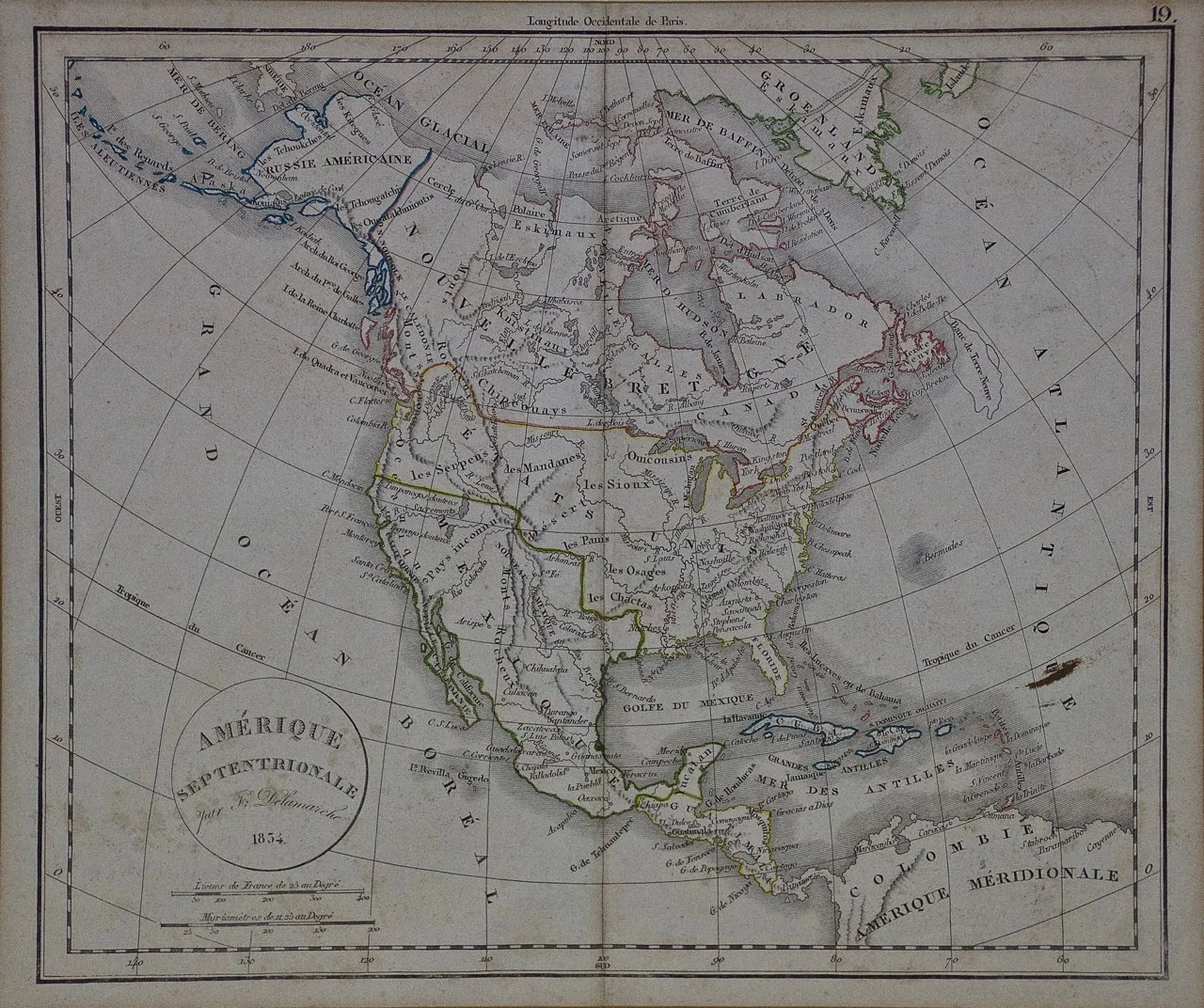
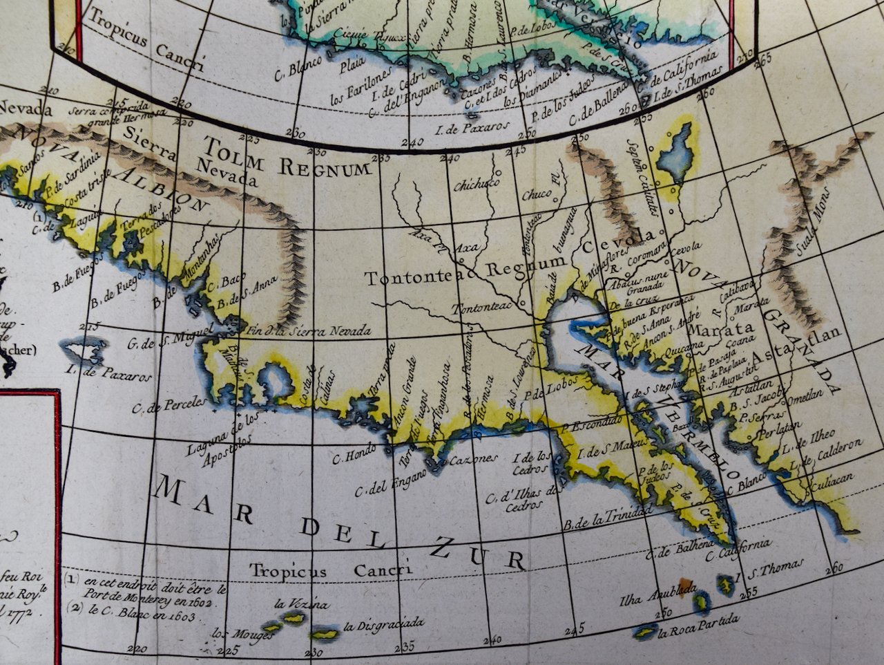
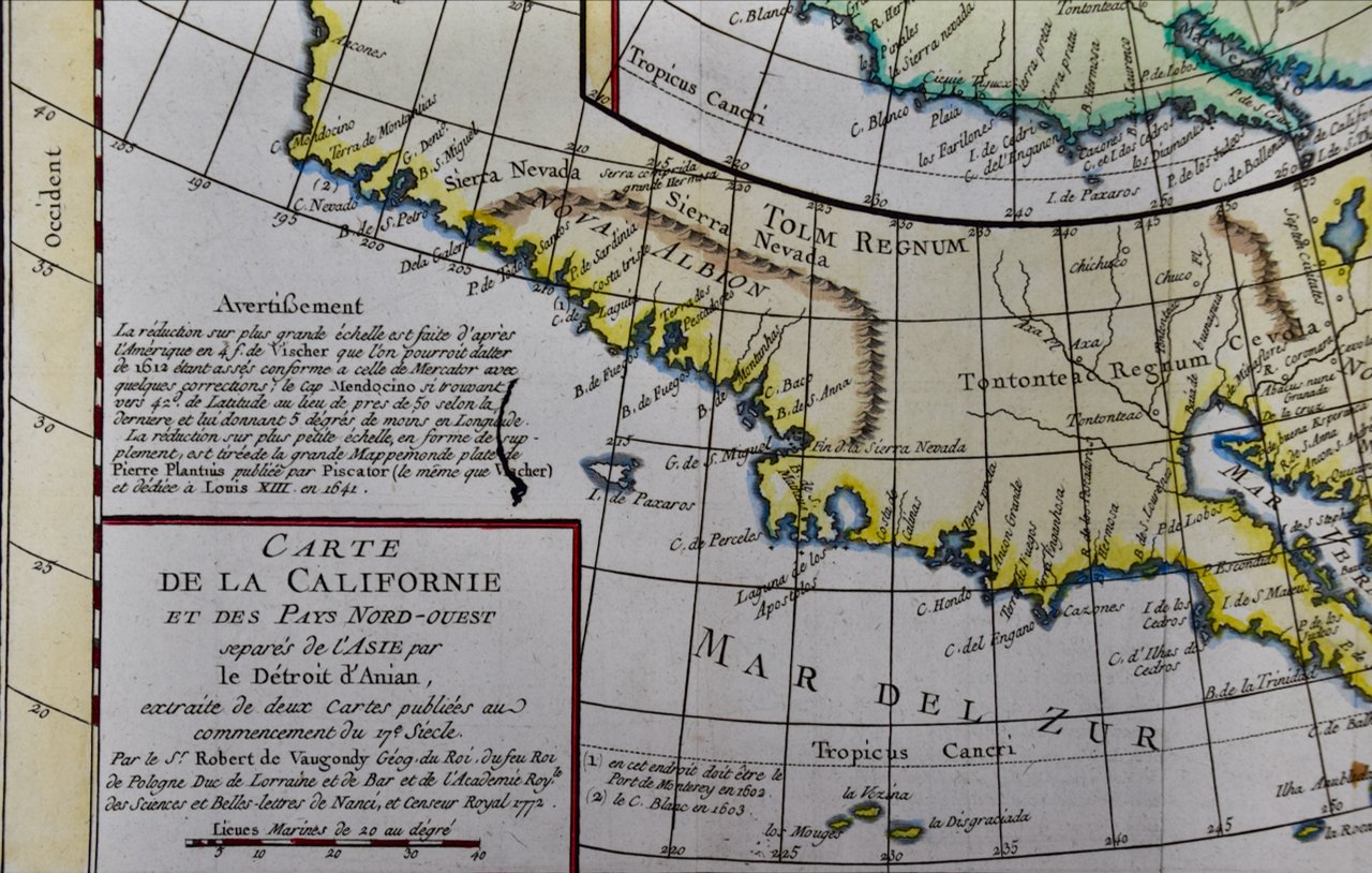
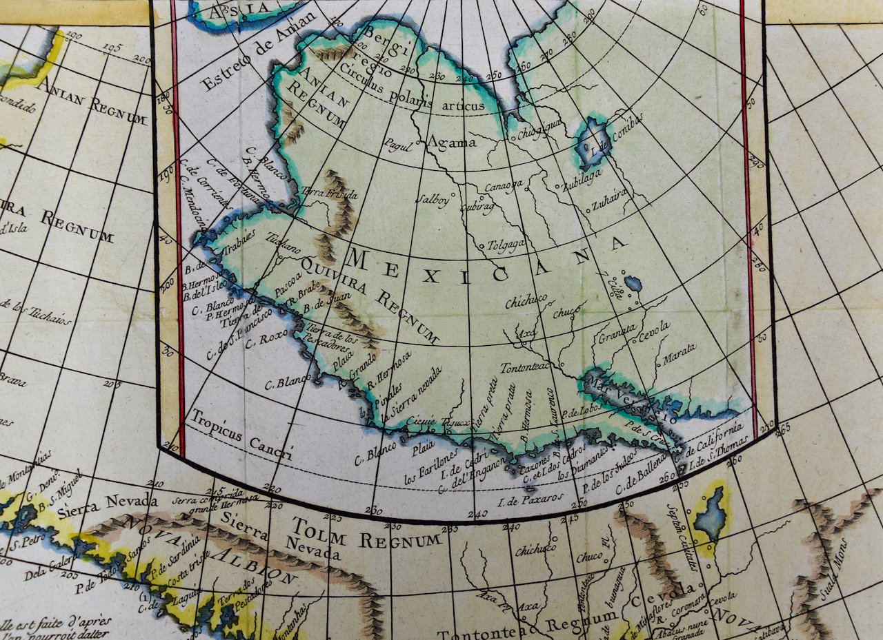
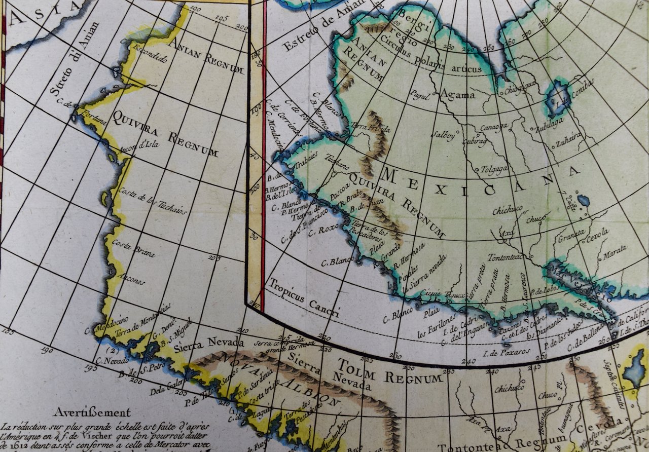
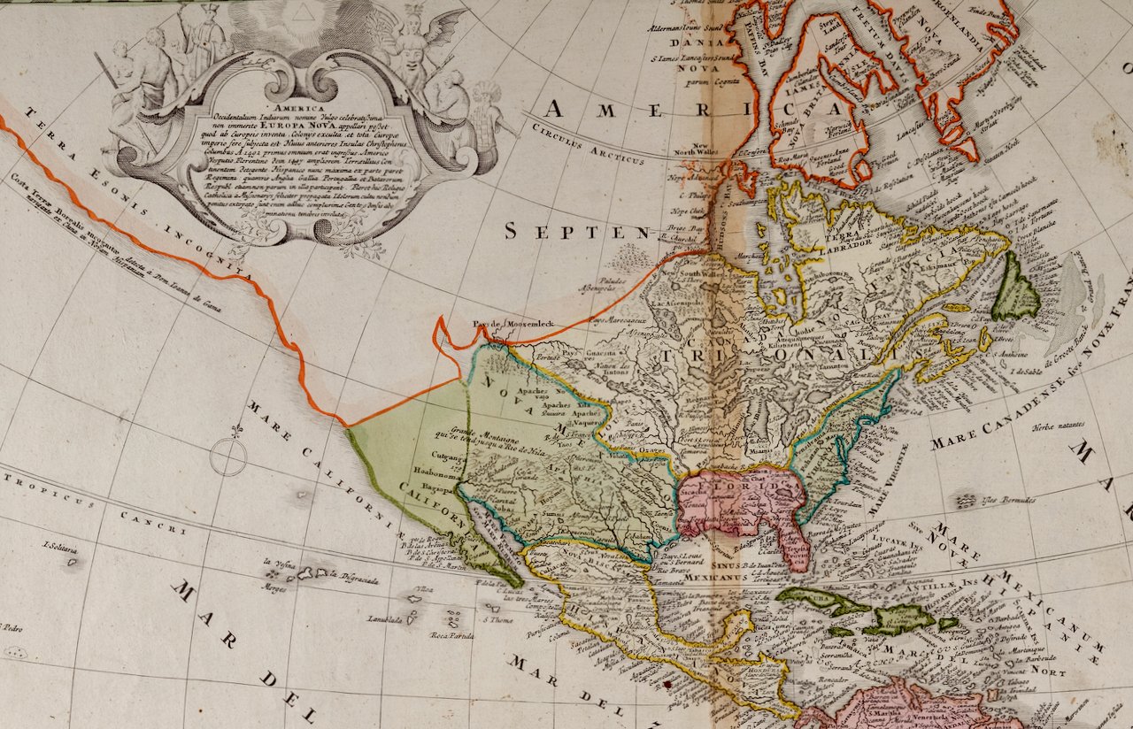
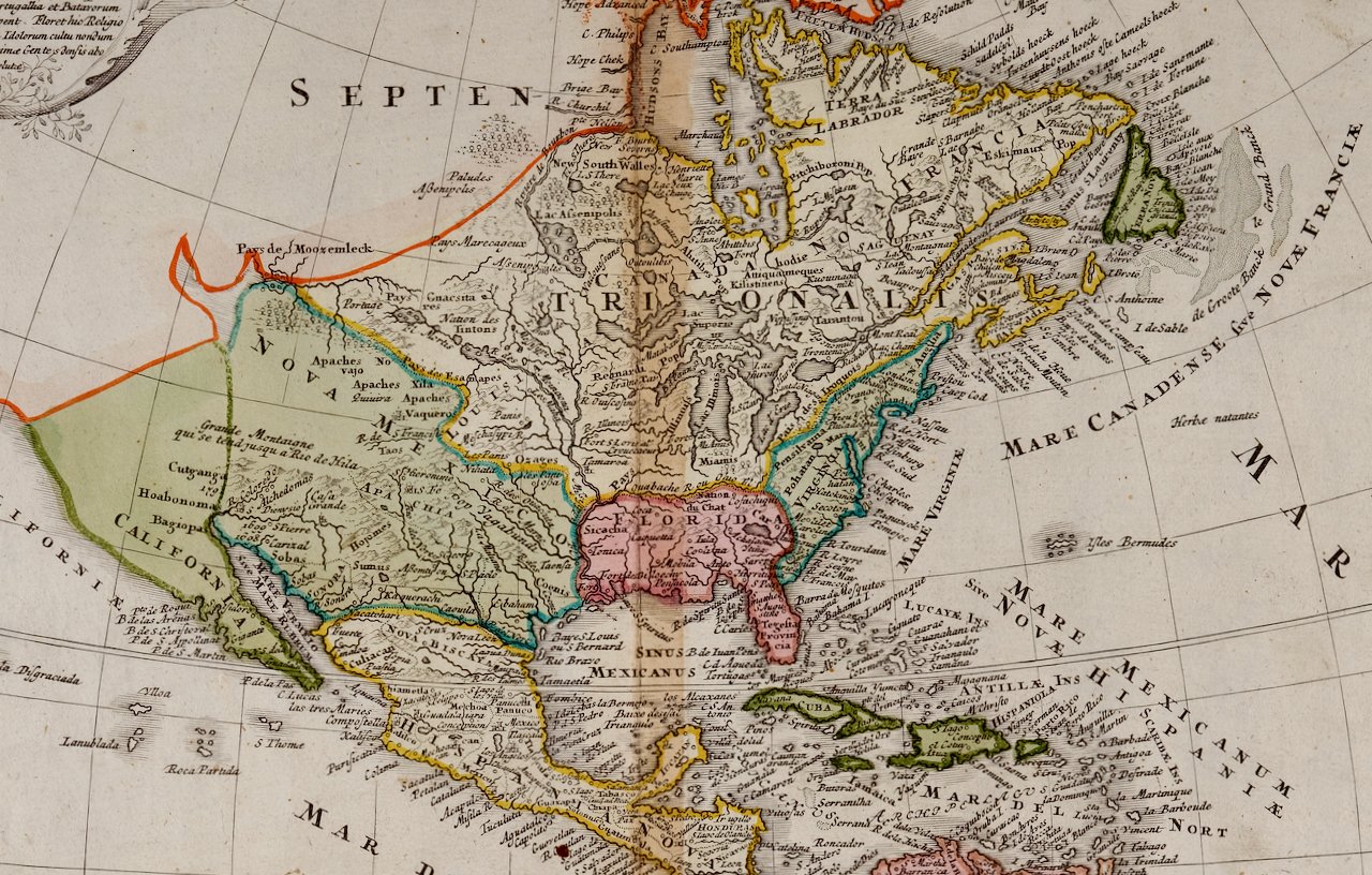
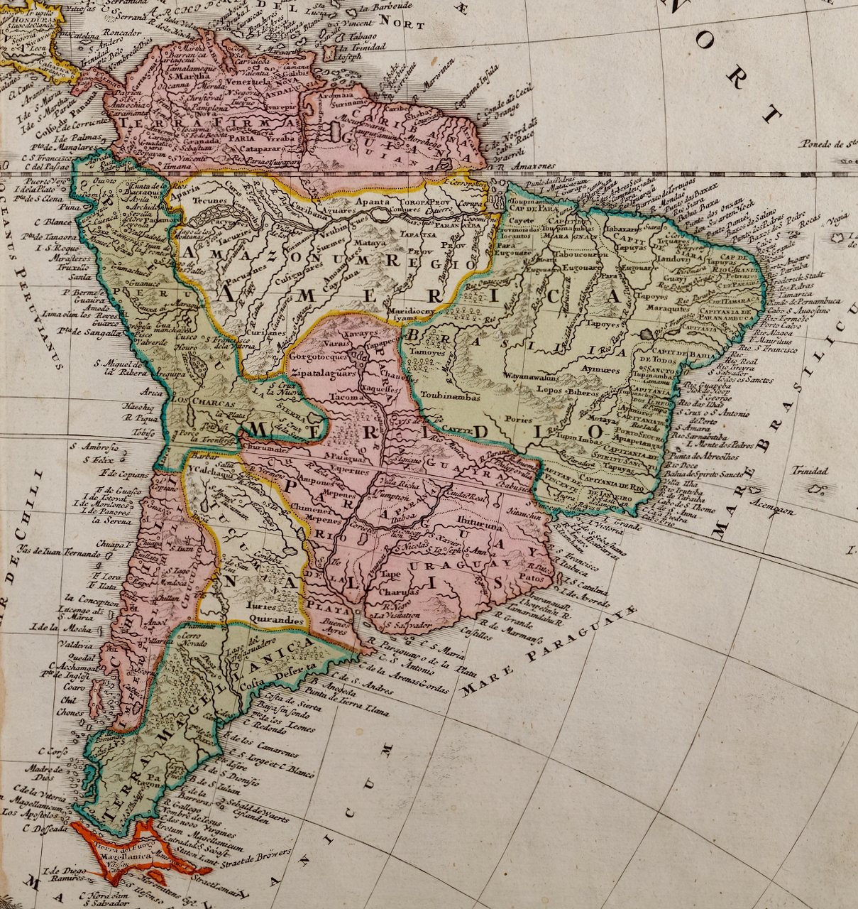
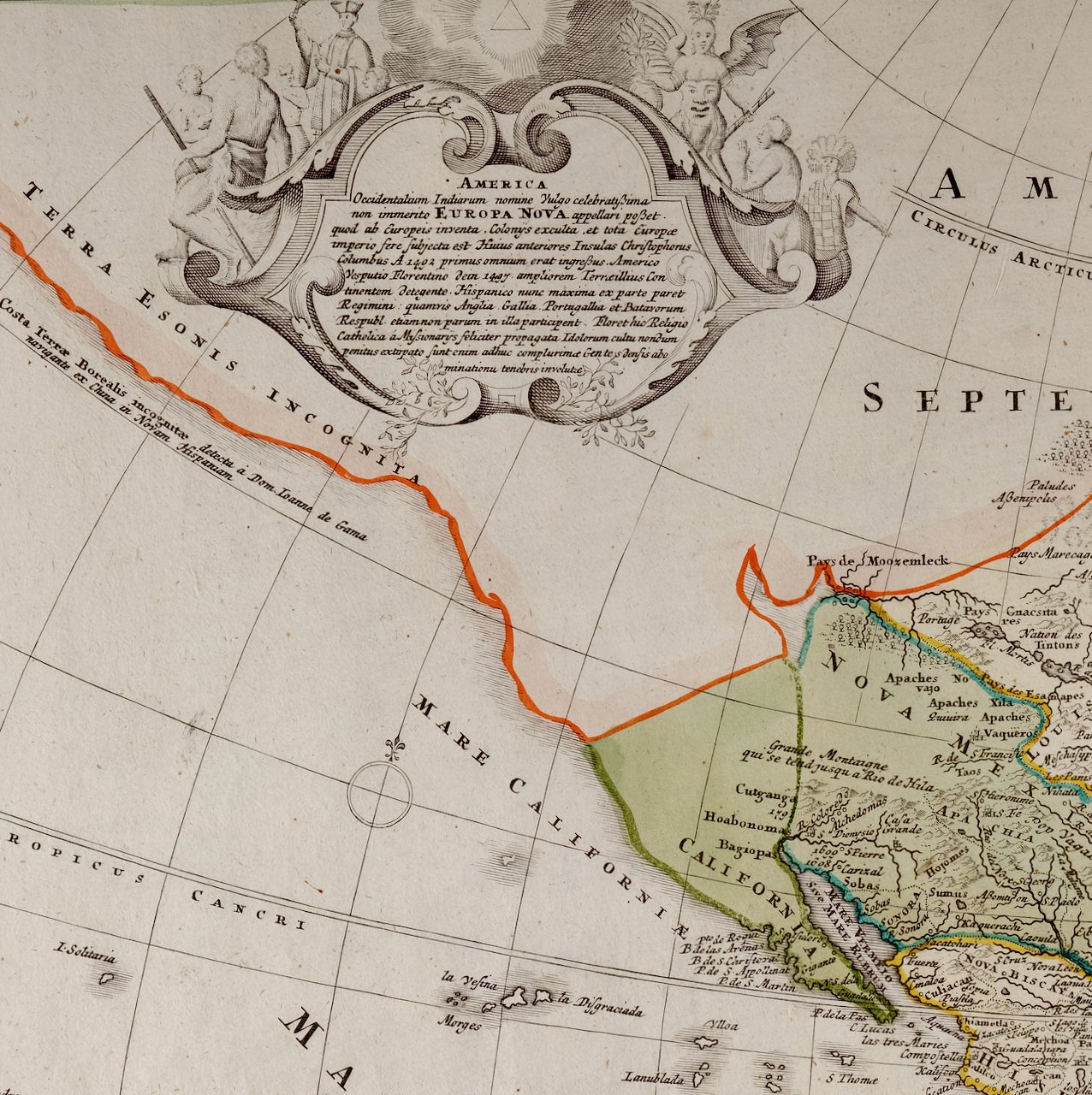
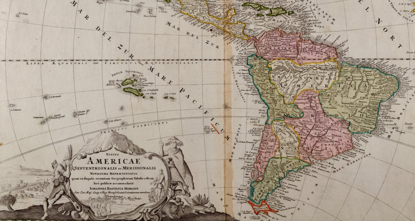
The map depicts eastern portions of Russia and the adjacent Aleutian Islands and Alaska which are identified as Russian territories. California, Arizona, New Mexico and much of Texas are still part of Mexico. The "Oregon District" includes the modern day state of Washington. Much of the central portions of the United States are identified as Native American regions such as The Sioux District, The Mandan District, The Ozark District, The Huron District and The Osage District. The map does include Canada, Mexico, Central America, Cuba, Jamaica, Haiti, Santa Domingo (the Dominican Republic) , the West Indies and portions of Greenland and South America. Along the California coast, Mendocino, Monterrey, Santa Barbara, San Diego, Santa Catalina Island are identified, San Francisco and Los Angeles were not included.

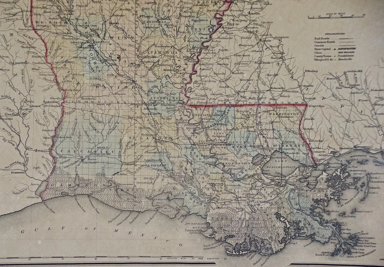
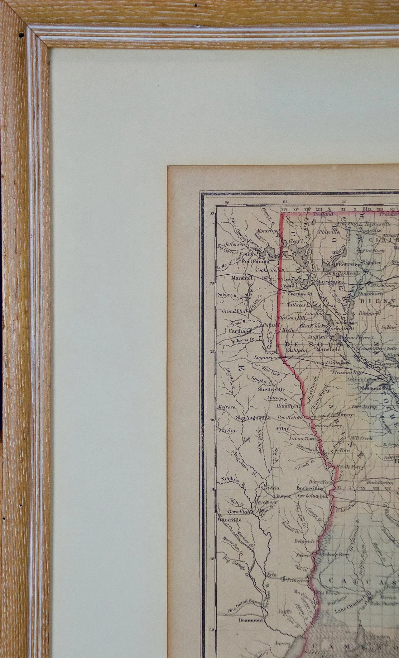
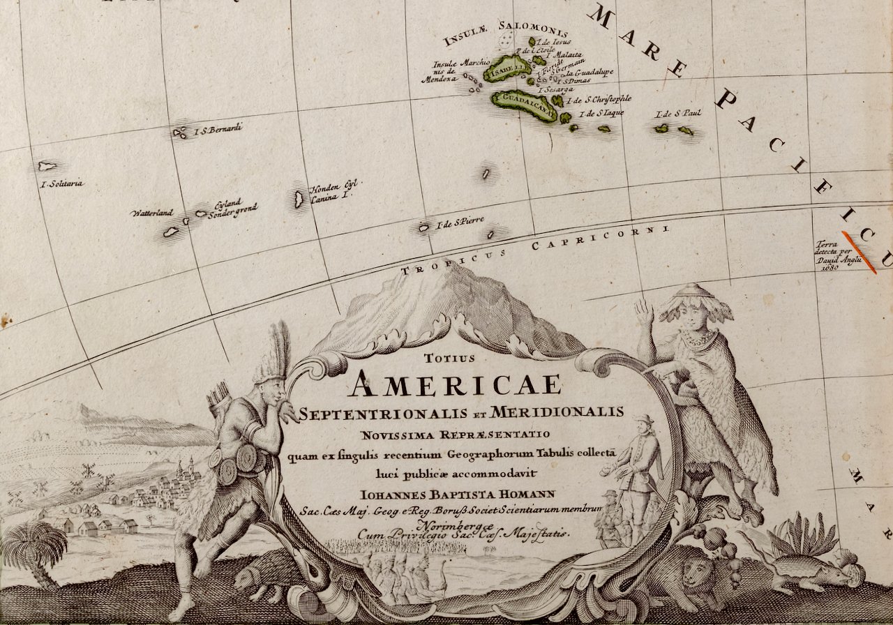
The map is hand-colored in outline. It is presented in a light brown distressed bleached wood frame with a cream-colored mat. The frame measures 19.5" high x 22" wide x 0.88" deep. There is a central vertical fold, as issued. The map is in very good condition. The mat is somewhat toned.

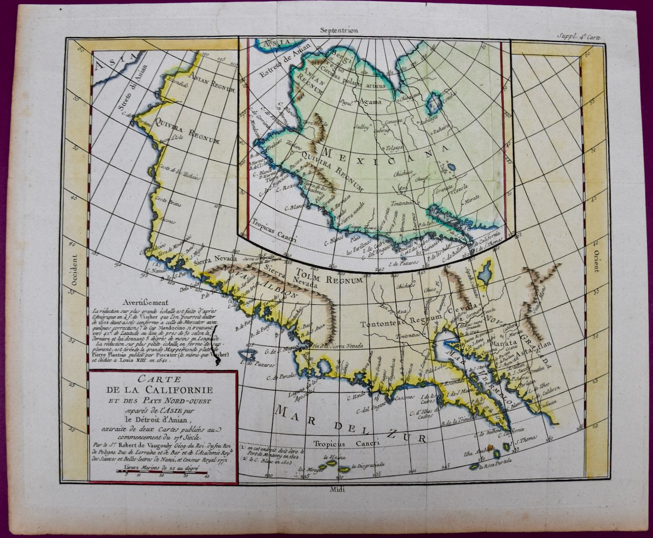
Adolf Stieler (1775-1836) was a German cartographer and lawyer. He was the main cartographer in Justus Perthes' Geographical Institute in Gotha, Germany. He served in the German government for his entire career, but maintained an interest in cartography and published many prominent works, including his Hand-Atlas, which was the leading German world atlas until the middle of the 20th century.

Related Works

3313 Delamarche, Amérique Septentrionale.jpg 3313 Delamarche, Amérique Septentrionale.jpg 3313 Delamarche, Amérique Septentrionale.jpg 3313 Delamarche, Amérique Septentrionale.jpg 3313 Delamarche, Amérique Septentrionale.jpg
America "Amérique Septentrionale": A 19th Century French Map by Delamarche
$975.00
California: 18th Century Hand-colored Map by de Vaugondy 339E Vaugondy, Carte de la Californie.jpeg 339D Vaugondy, Carte de la Californie.jpeg 339B Vaugondy, Carte de la Californie.jpeg 339C Vaugondy, Carte de la Californie.jpeg 339F Vaugondy, Carte de la Californie.jpeg 339G Vaugondy, Carte de la Californie.jpeg 339A Vaugondy, Carte de la Californie.jpeg
California: 18th Century Hand-colored Map by de Vaugondy
$875.00
Louisiana: A Framed 19th Century Map by O.W. Gray 3371A Gray, Map of Louisiana.jpg 3371 BGray, Map of Louisiana.jpg 3371C Gray, Map of Louisiana.jpg 3371 DGray, Map of Louisiana.jpg 3371E Gray, Map of Louisiana.jpg
Louisiana: A Framed 19th Century Map by O.W. Gray
$975.00
Sold
North and South America: An 18th Century Hand-colored Map by Johann Homann 1752A Homann, Totius Americae Septentrionalis Et Meridionalis.jpeg 1752B Homann, Totius Americae Septentrionalis Et Meridionalis.jpeg 1752C Homann, Totius Americae Septentrionalis Et Meridionalis.jpeg 1752D Homann, Totius Americae Septentrionalis Et Meridionalis.jpeg 1752E Homann, Totius Americae Septentrionalis Et Meridionalis.jpeg 1752F Homann, Totius Americae Septentrionalis Et Meridionalis.jpeg
North and South America: An 18th Century Hand-colored Map by Johann Homann
$2,375.00

Prints
Maps
Books
Featured Items
Recent Acquisitions

Contact
Our Story
Sell Your Items
Subscribe to our newsletter!

FAQs
Terms and Conditions