Image 1 of 6
 Image 2 of 6
 Image 3 of 6
 Image 4 of 6
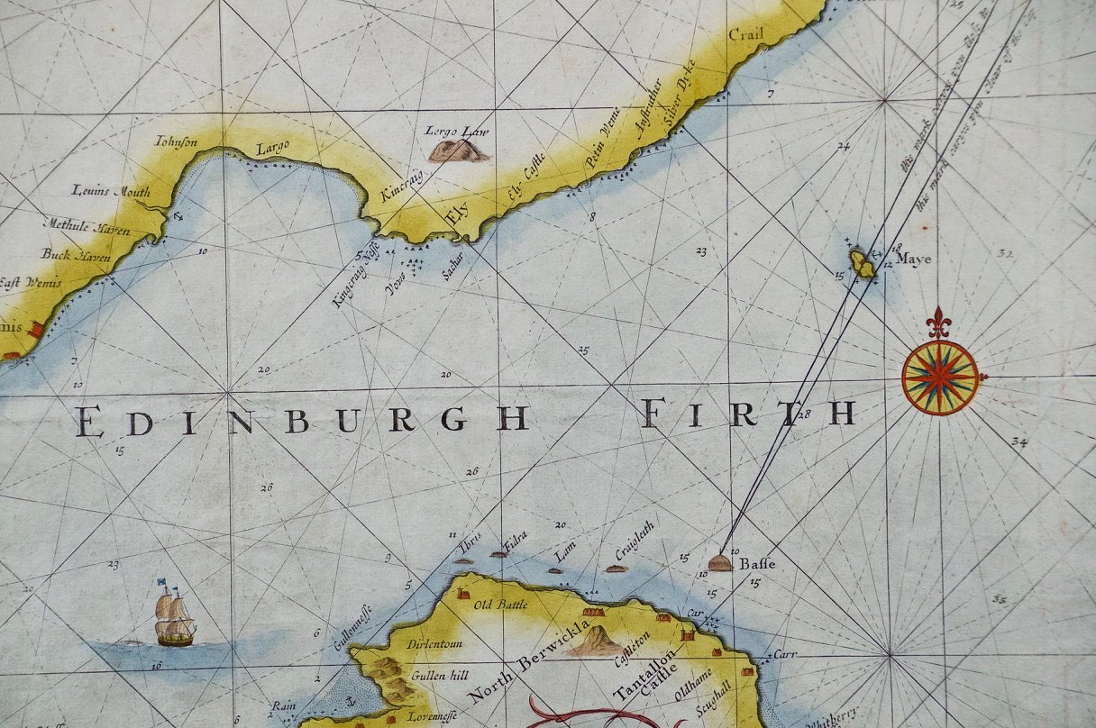 Image 5 of 6
 Image 6 of 6
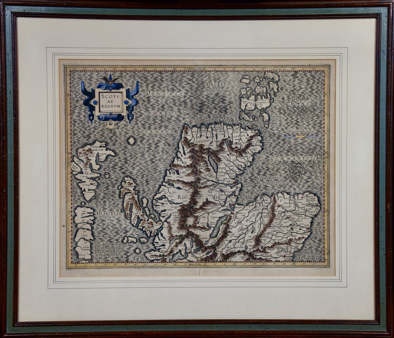
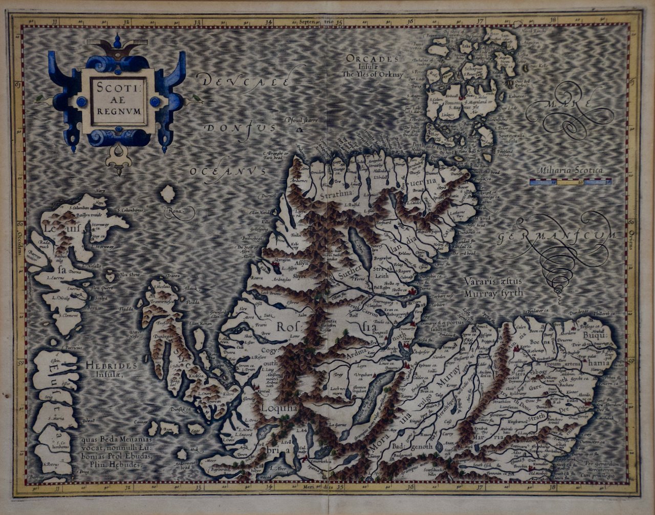
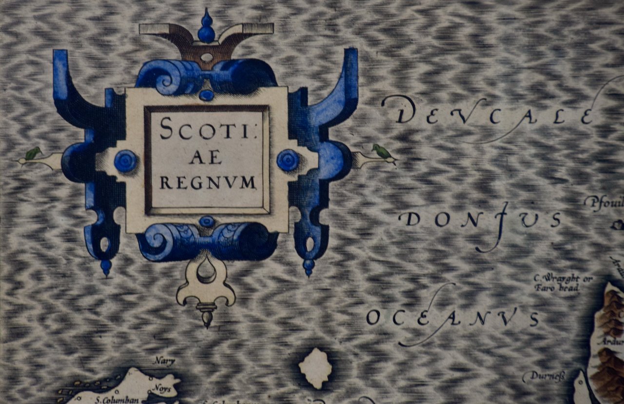
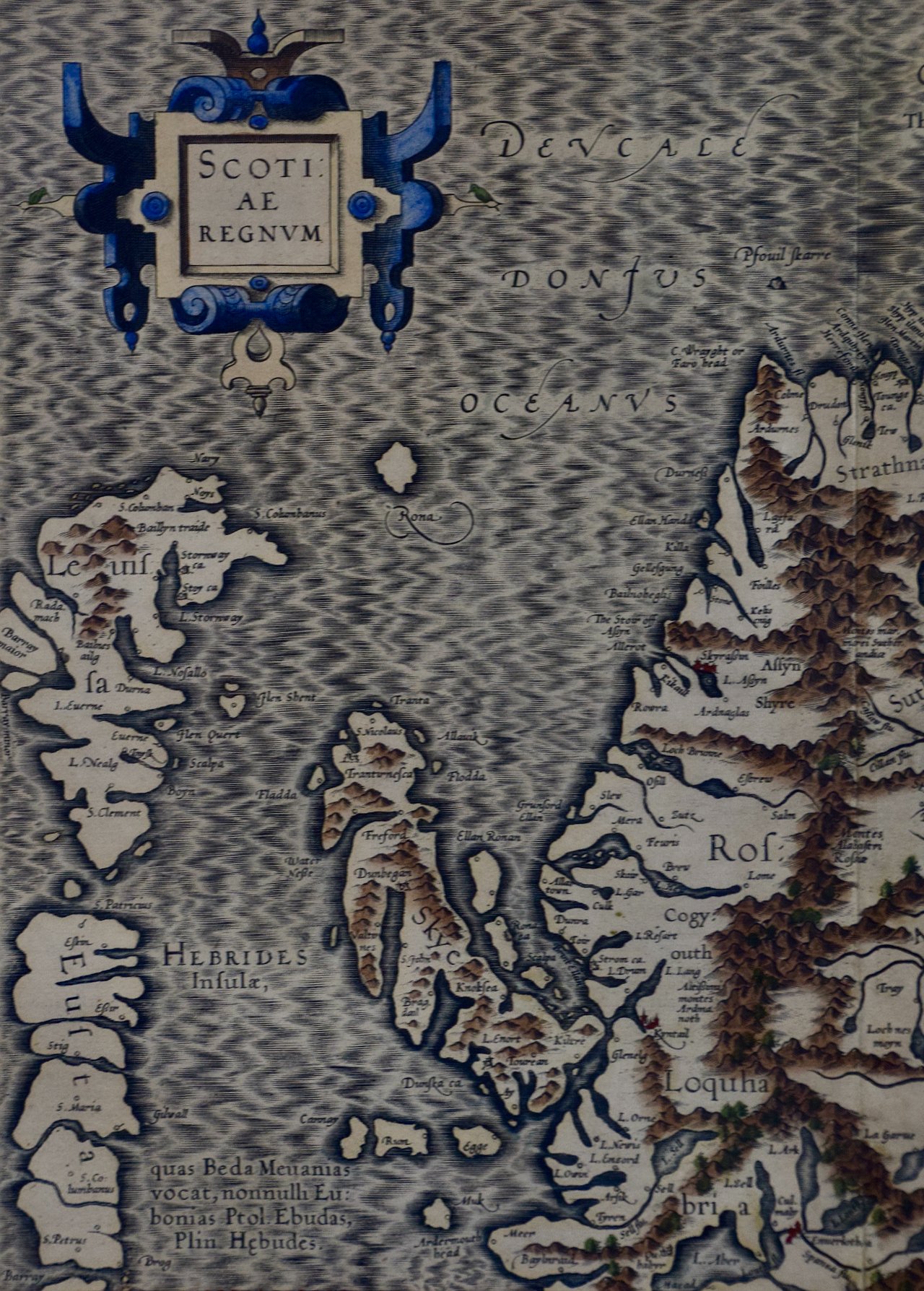
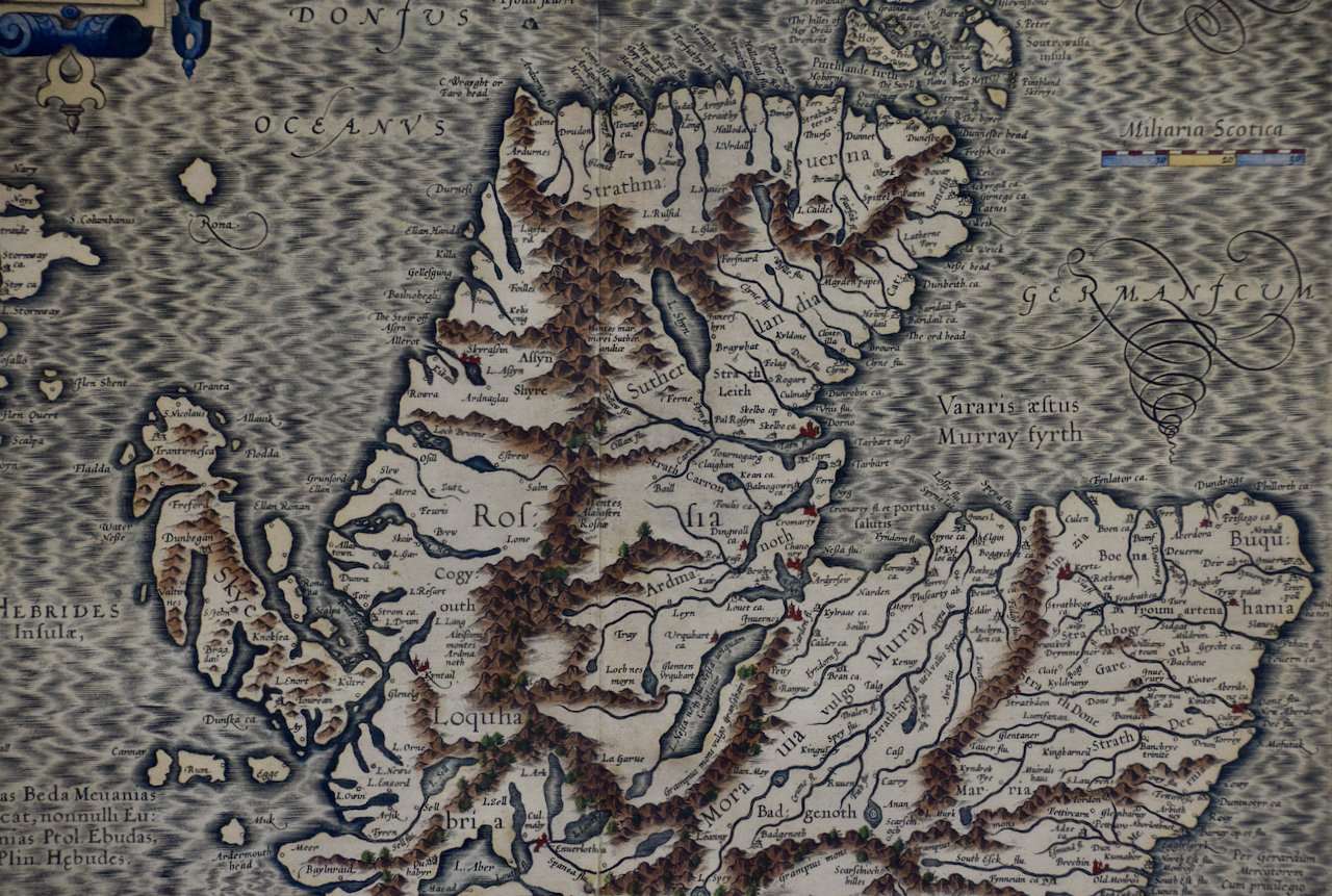
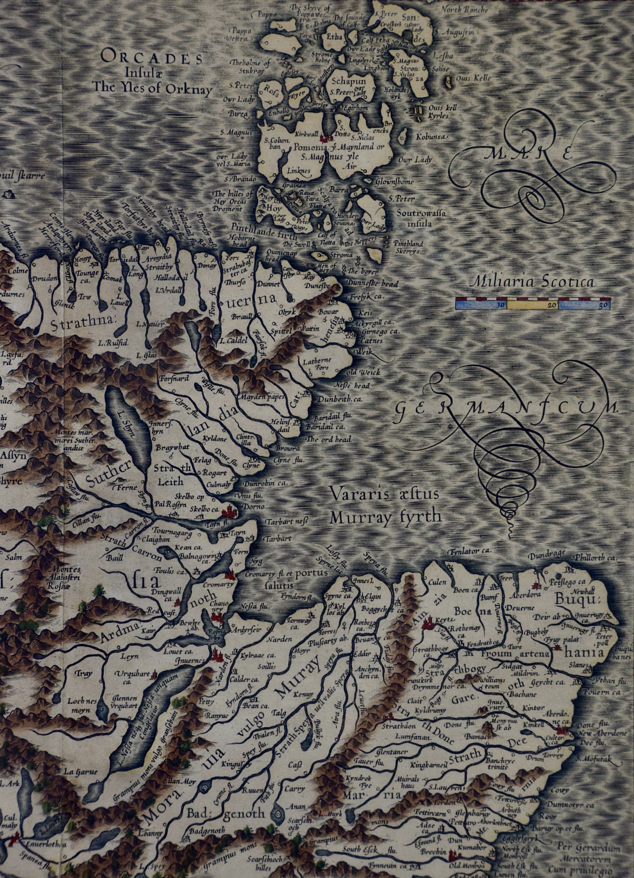
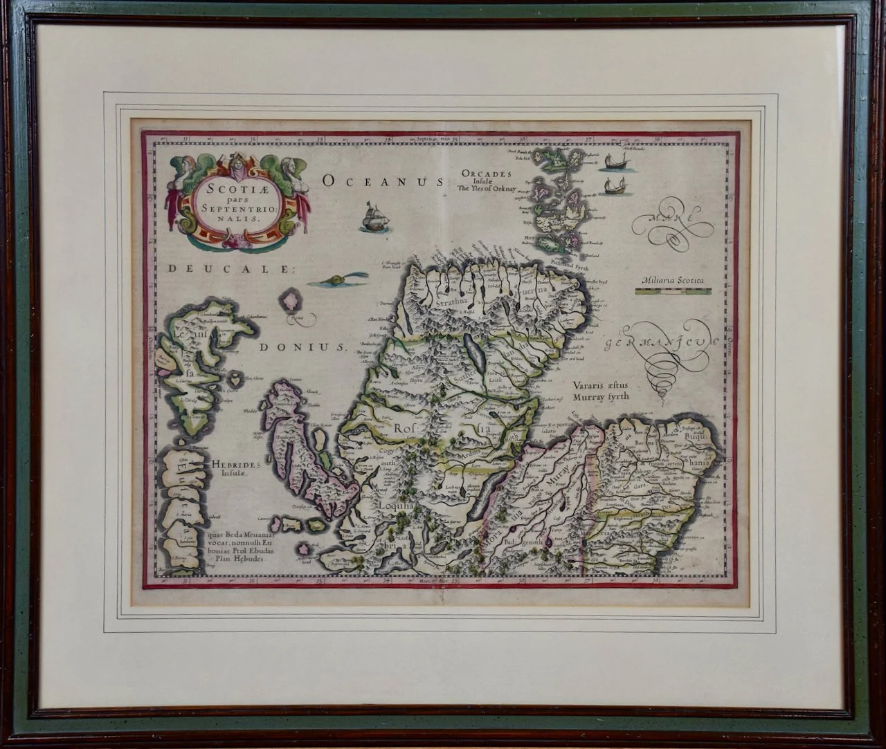
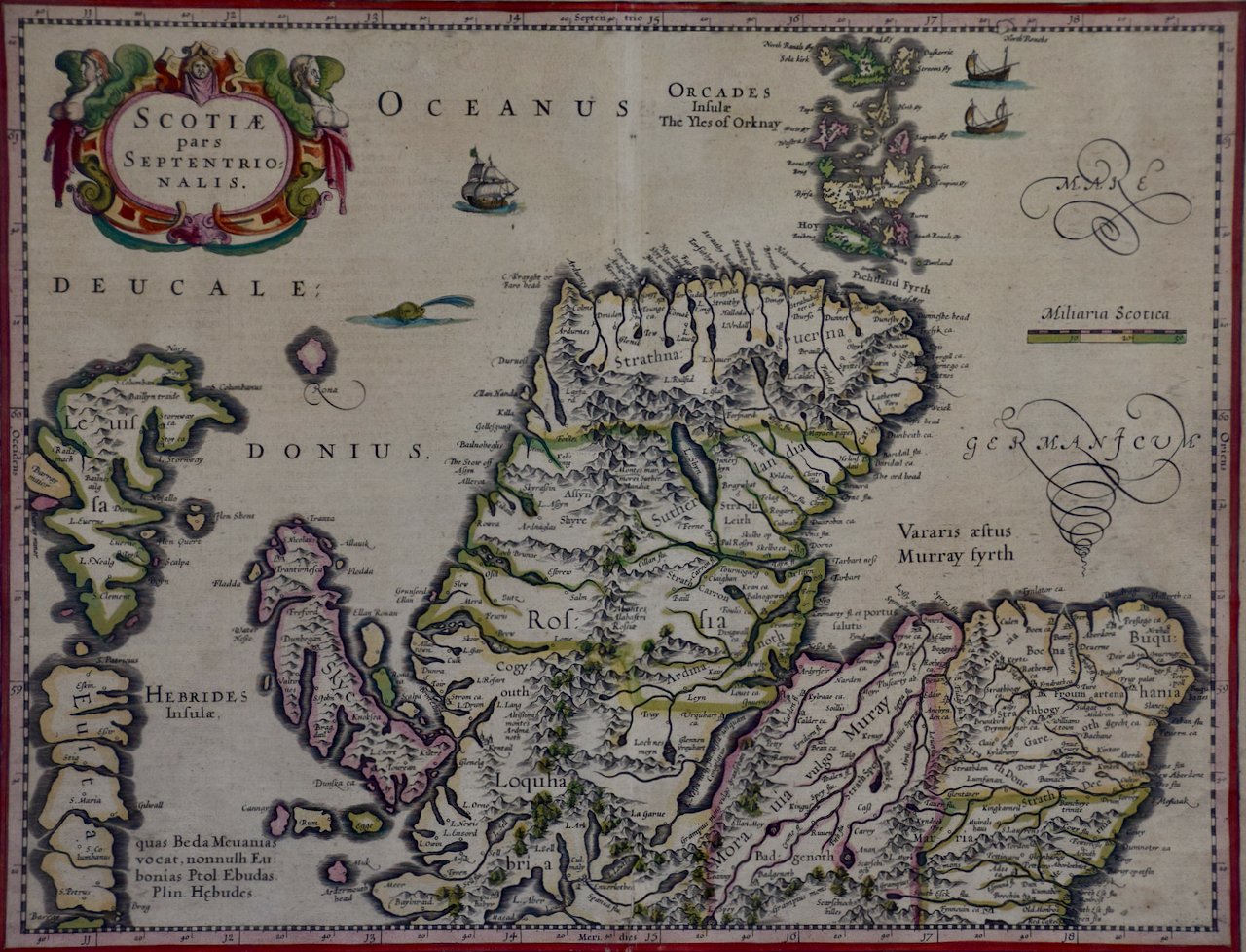
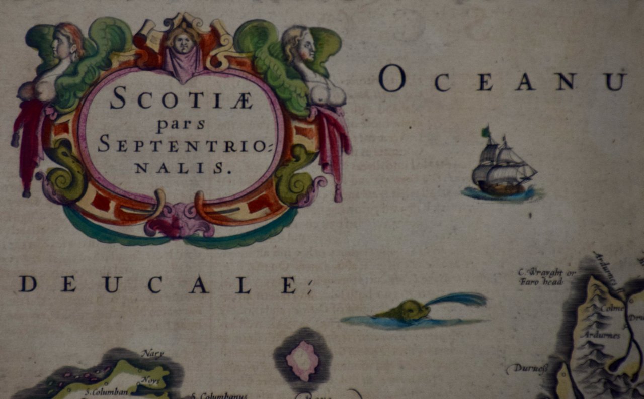
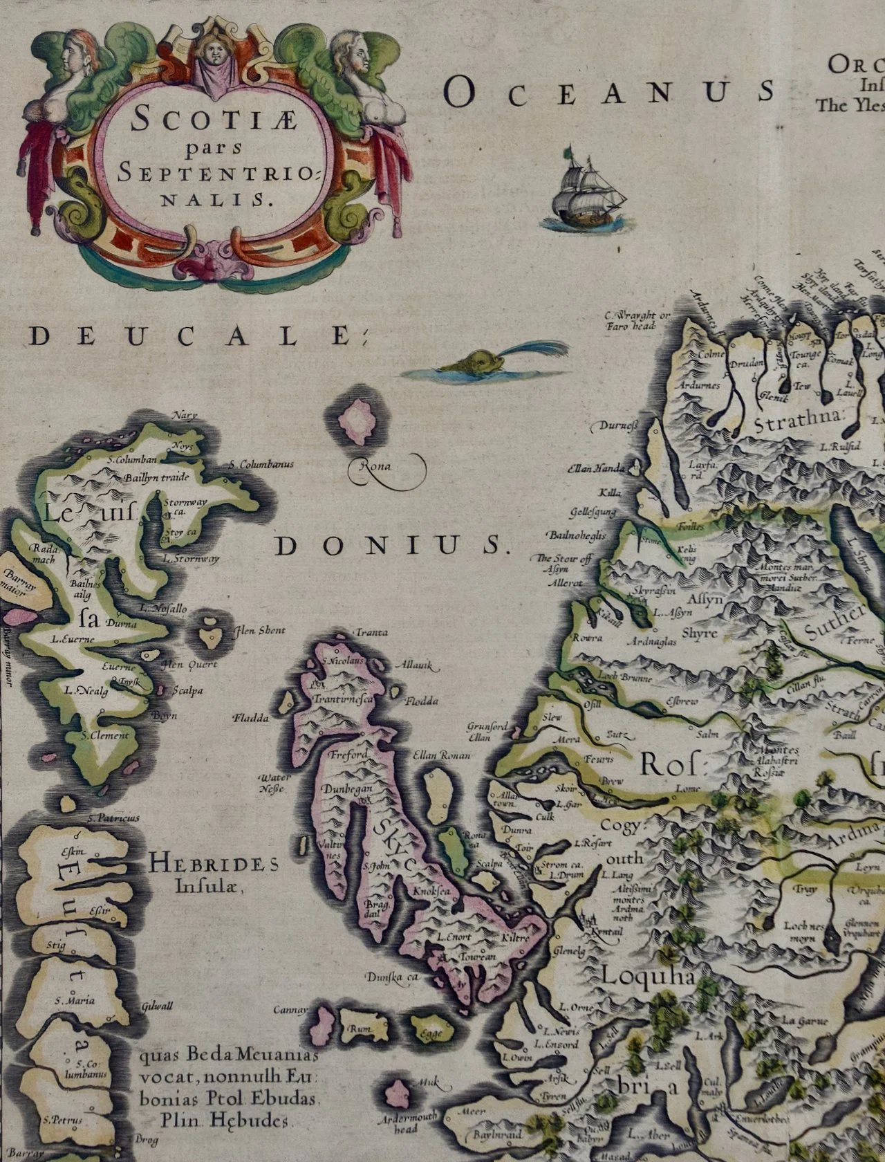
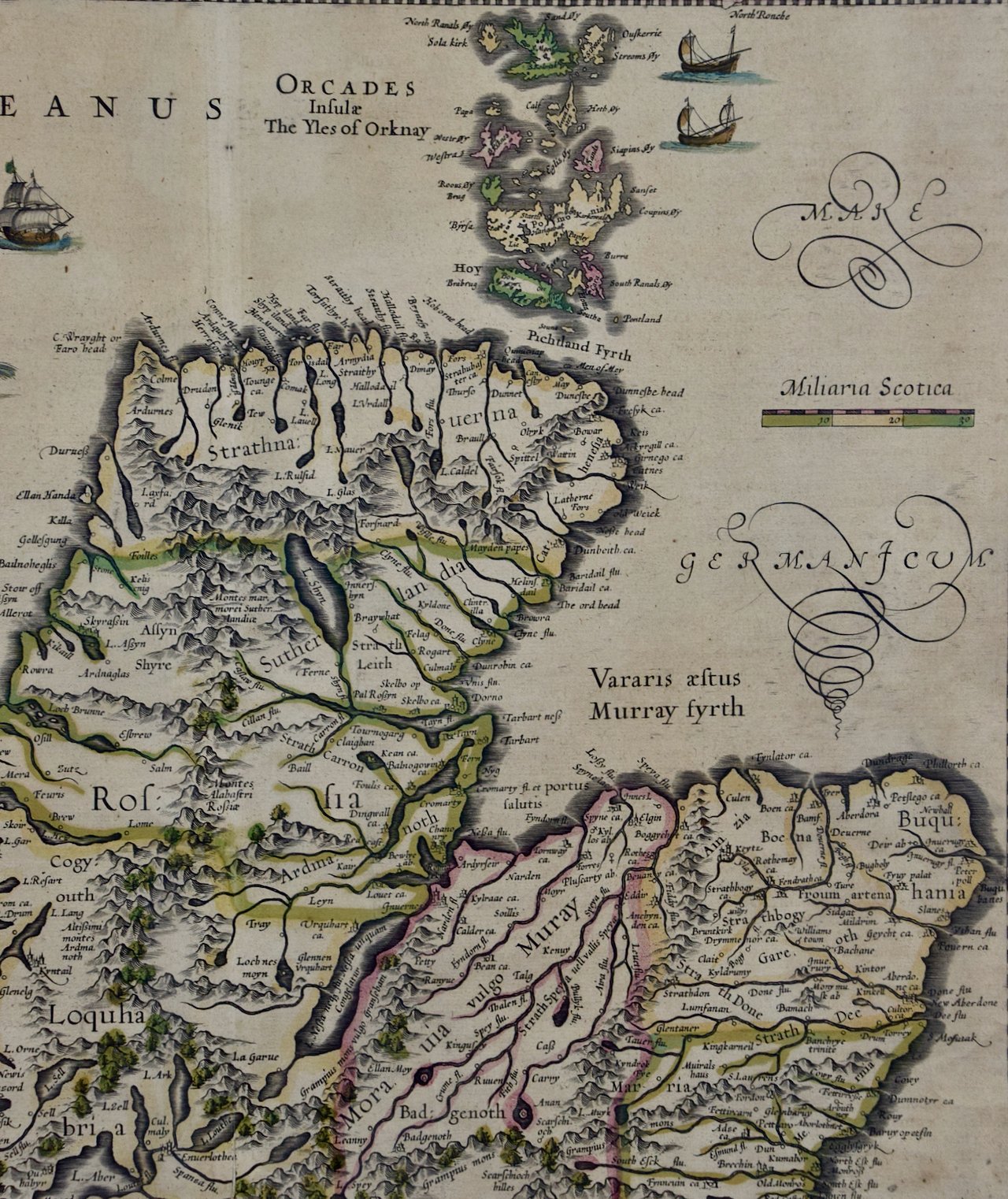
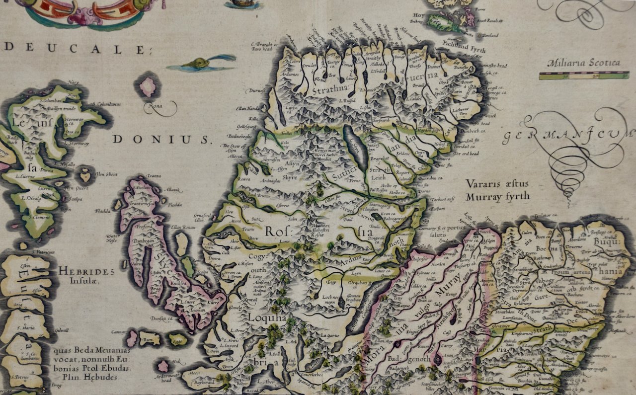
These sea charts by Captain Greenvile Collins (1643-1694) are beautiful, colorful and striking, as well as historically very important to the British navy for approximately 100 years. Captain Collins was appointed “His Majesty’s Hydrographer” by King Charles II and asked to survey the coast of Great Britain and plot all of the harbors, rivers and islands, etc. This took seven years and the resulting charts were first published in 1693. They were published until 1792.
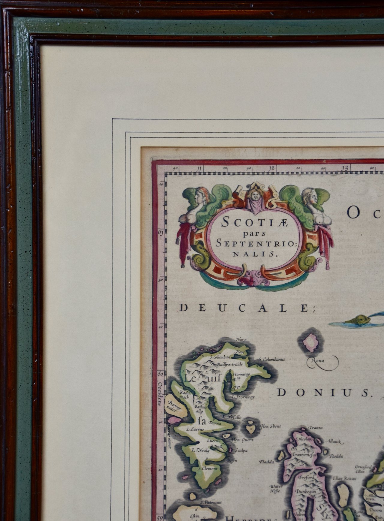
We have 16 sea charts from this series that are all the same size and are framed and matted identically. The frames are a unique plexiglass sleeve design, measuring: 23" x 27.75" x 0.5" and the mats are a cream color. There is a horizontal fold, a vertical crease on the right and tiny spots in the upper chart. It is otherwise in excellent condition.
The provenance for these sea charts is very interesting. They were owned by Tom Perkins, who is considered one of the fathers of Silicon Valley. He was one of the founders of Kleiner Perkins Cauffield and Byers, the first big and most influential Silicon Valley venture capital company. Perkins himself was an avid sailor and had at the time the largest and most technologically advanced sailing yacht in the world, the Maltese Falcon.