Skip to Content
Timeless Intaglio: Rare Prints, Maps & Books
Shop
All Listings
Antiquarian Prints
Antiquarian Maps
Antiquarian Books
Artists
Our Story
Previews
Contact
Login Account
0
0
Search
Timeless Intaglio: Rare Prints, Maps & Books
Shop
All Listings
Antiquarian Prints
Antiquarian Maps
Antiquarian Books
Artists
Our Story
Previews
Contact
Login Account
0
0
Search
Folder: Shop
Back
All Listings
Antiquarian Prints
Antiquarian Maps
Antiquarian Books
Artists
Our Story
Previews
Contact
Login Account
Search
Shop Captain Cook's Exploration of Tahiti: 18th C. Hand-colored Map by Bellin
269 Bellin, Carte de l'isle de Taiti par Lieutenant J. Cook.jpeg Image 1 of
269 Bellin, Carte de l'isle de Taiti par Lieutenant J. Cook.jpeg

Captain Cook's Exploration of Tahiti: 18th C. Hand-colored Map by Bellin

$775.00

This beautiful 18th century hand-colored copper plate engraved map is entitled "Carte de l'Isle de Taiti, par le Lieutenant J. Cook" was created by Jacques Nicolas Bellin and published in 1780 in the French account of Captain James Cook's 1st voyage of exploration. It is the first detailed and accurate chart of Tahiti and it's neighboring island of Eimeo (now known as Moorea), depicting discoveries made by James Cook (still a Lieutenant in the British Royal Navy at the time of this voyage to Tahiti) during his first of three famous voyages of exploration which radically altered the knowledge of the world’s geography. Tahiti, the largest island of French Polynesia, is located in the archipelago of the Society Islands in the southern Pacific Ocean. The island consists of two roughly round portions with a central extinct volcano creating a mountain range and a series of radiating rivers. The map also includes the neighboring island of Eimeo, currently known as Moorea.

Creator: Jacques-Nicolas Bellin (1703 - 1772, French)

Creation Year: 1780

Dimensions: Height: 11.38 in (28.91 cm)
Width: 17.5 in (44.45 cm)

Medium: Engraving

Condition: See description below.

Reference #: 269

Add To Cart

This beautiful 18th century hand-colored copper plate engraved map is entitled "Carte de l'Isle de Taiti, par le Lieutenant J. Cook" was created by Jacques Nicolas Bellin and published in 1780 in the French account of Captain James Cook's 1st voyage of exploration. It is the first detailed and accurate chart of Tahiti and it's neighboring island of Eimeo (now known as Moorea), depicting discoveries made by James Cook (still a Lieutenant in the British Royal Navy at the time of this voyage to Tahiti) during his first of three famous voyages of exploration which radically altered the knowledge of the world’s geography. Tahiti, the largest island of French Polynesia, is located in the archipelago of the Society Islands in the southern Pacific Ocean. The island consists of two roughly round portions with a central extinct volcano creating a mountain range and a series of radiating rivers. The map also includes the neighboring island of Eimeo, currently known as Moorea.

Creator: Jacques-Nicolas Bellin (1703 - 1772, French)

Creation Year: 1780

Dimensions: Height: 11.38 in (28.91 cm)
Width: 17.5 in (44.45 cm)

Medium: Engraving

Condition: See description below.

Reference #: 269

This beautifully hand-colored map is printed on chain-linked, laid paper with wide margins and two watermarks. The sheet measures 11.38" high and 17.5" wide. It has a central vertical fold, as issued. There is faint discoloration in the left upper corner, but it is otherwise in excellent condition.

Captain James Cook (1728 - 1779) was an English explorer, navigator and cartographer. Ultimately rising to the rank of Captain in the Royal Navy, Cook was the first to map Newfoundland prior to making his famous three voyages to the Pacific Ocean. Among his many achievements was the first European contact with the eastern coastline of Australia, the European discovery of the Hawaiian Islands, and the first recorded circumnavigation of New Zealand. Each of Cook’s voyages included scientists, cartographers and an artist to study and document the geography, the fauna and wildlife, as well as the culture of the inhabitants of the lands he visited.

In 1766 the Royal Society engaged Cook to travel to the Pacific Ocean to observe and record the transit of Venus across the sun. Cook, at the age of 39, was promoted to lieutenant and named as commander of the expedition by the British Admiralty. The expedition sailed from England on 26 August 1768, rounded Cape Horn and continued westward across the Pacific Ocean.

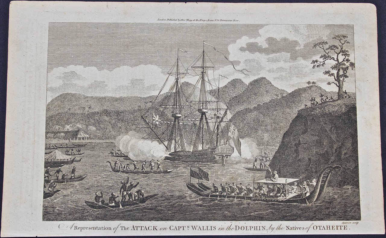
Arriving in Tahiti in April 1769 Cook anchored his ship, the Endeavour, in Matavai Bay on Tahiti's northwest coast, where he named a rocky promontory rising above the shoreline, Point Venus. It is here that he made his observations of the transit of Venus across the sun, fulfilling the initial mission of his voyage. He subsequently continued to explore the southern Pacific Ocean, including Australia, New Zealand, New Guinea and Tasmania, etc., which was the main goal of his voyage.

During his stay on the island, Cook charted Tahiti's coast which took him 5 days in a pinnace (a small boat brought for local exploration), and as this chart taken from his original sketches shows, he saw wooded and fertile regions, hills, and many thickly settled coastal communities as well as coral reefs ringing the islands.

The cartographer was Jacques Nicolas Bellin (1703-1772), a French hydrographer, geographer, and member of the French intellectual group the Philosophes. Bellin was born in Paris. He was hydrographer of France's hydrographic office, member of the Académie de Marine and of the Royal Society of London. Over a 50 year career, he produced a large number of maps of particular interest to the Ministère de la Marine. His maps of Canada and of French territories in North America (New France, Acadia, Louisiana) are particularly valuable. He died at Versailles. The map was engraved by Robert Benard, a well-known French engraver, for inclusion in the official French edition of Cook's Voyages.

Related Works

Theories of Planetary Motion: An 18th C. Framed Celestial Map by Doppelmayr 4099A Doppelmayr Theoria Planetarum Primariarum.jpg 4099B Doppelmayr Theoria Planetarum Primariarum.jpg 4099C Doppelmayr Theoria Planetarum Primariarum.jpg 4099D Doppelmayr Theoria Planetarum Primariarum.jpg 4099E Doppelmayr Theoria Planetarum Primariarum.jpg 4099F+Doppelmayr+Theoria+Planetarum+Primariarum.jpg
Theories of Planetary Motion: An 18th C. Framed Celestial Map by Doppelmayr
$2,175.00
Ruins of the Temple of Kom Ombo, Egypt: A 19th C. Lithograph by David Roberts 5344A Roberts, Ruins of Kom Ombo.jpeg 5344B Roberts, Ruins of Kom Ombo.jpeg 5344C Roberts, Ruins of Kom Ombo.jpeg
Ruins of the Temple of Kom Ombo, Egypt: A 19th C. Lithograph by David Roberts
$2,575.00
4145 Kneller, John Tillotson, Archbishop of Canterbury.jpg 4145 Kneller, John Tillotson, Archbishop of Canterbury.jpg 4145 Kneller, John Tillotson, Archbishop of Canterbury.jpg 4145 Kneller, John Tillotson, Archbishop of Canterbury.jpg
Tillotson, Archbishop of Canterbury: An 18th C. Hand-Colored Portrait by Kneller
$875.00
Hollyhock Plant: An 18th Century Hand-colored Botanical Engraving by J. Weinmann 4502D Weinmann, a. Alcea Folio Lacinato, B. Alcea Vesicaria from Phytanthoza Iconographia, Pl. 36 (1).jpeg 4502A Weinmann, a. Alcea Folio Lacinato, B. Alcea Vesicaria from Phytanthoza Iconographia, Pl. 36 (1).jpeg 4502C Weinmann, a. Alcea Folio Lacinato, B. Alcea Vesicaria from Phytanthoza Iconographia, Pl. 36 (1).jpeg 4502B Weinmann, a. Alcea Folio Lacinato, B. Alcea Vesicaria from Phytanthoza Iconographia, Pl. 36 (1).jpeg 4502E Weinmann, a. Alcea Folio Lacinato, B. Alcea Vesicaria from Phytanthoza Iconographia, Pl. 36 (1).jpeg
Hollyhock Plant: An 18th Century Hand-colored Botanical Engraving by J. Weinmann
$675.00
Dartmouth, England: A Hand-Colored 17th Century Sea Chart by Captain Collins 3247A Collins, Dartmouth Sea Chart.jpg 3247B Collins, Dartmouth Sea Chart.jpg 3247C Collins, Dartmouth Sea Chart.jpg 3247D Collins, Dartmouth Sea Chart.jpg 3247E Collins, Dartmouth Sea Chart.jpg 3247F Collins, Dartmouth Sea Chart.jpg
Dartmouth, England: A Hand-Colored 17th Century Sea Chart by Captain Collins
$2,775.00

Prints
Maps
Books
Featured Items
Recent Acquisitions

Contact
Our Story
Sell Your Items
Subscribe to our newsletter!

FAQs
Terms and Conditions