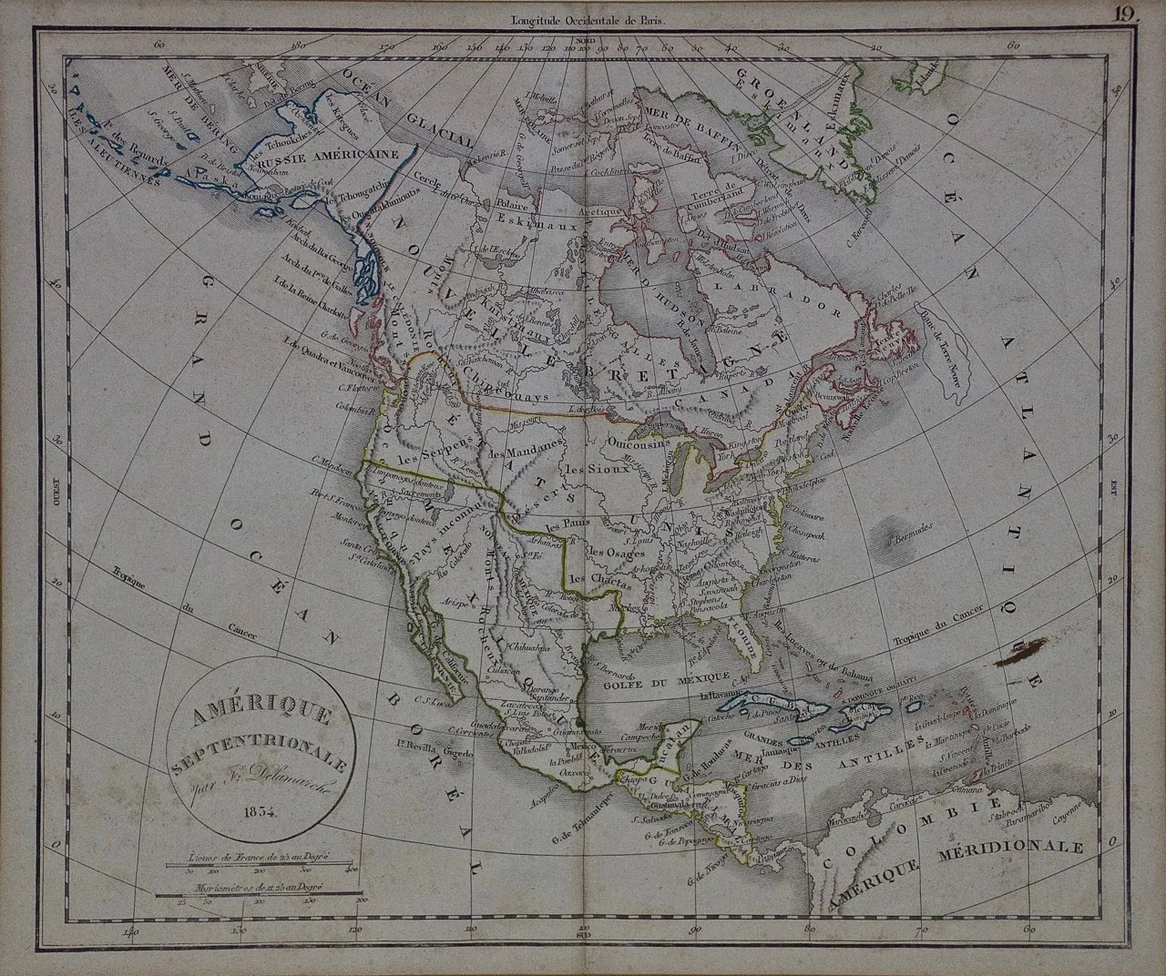
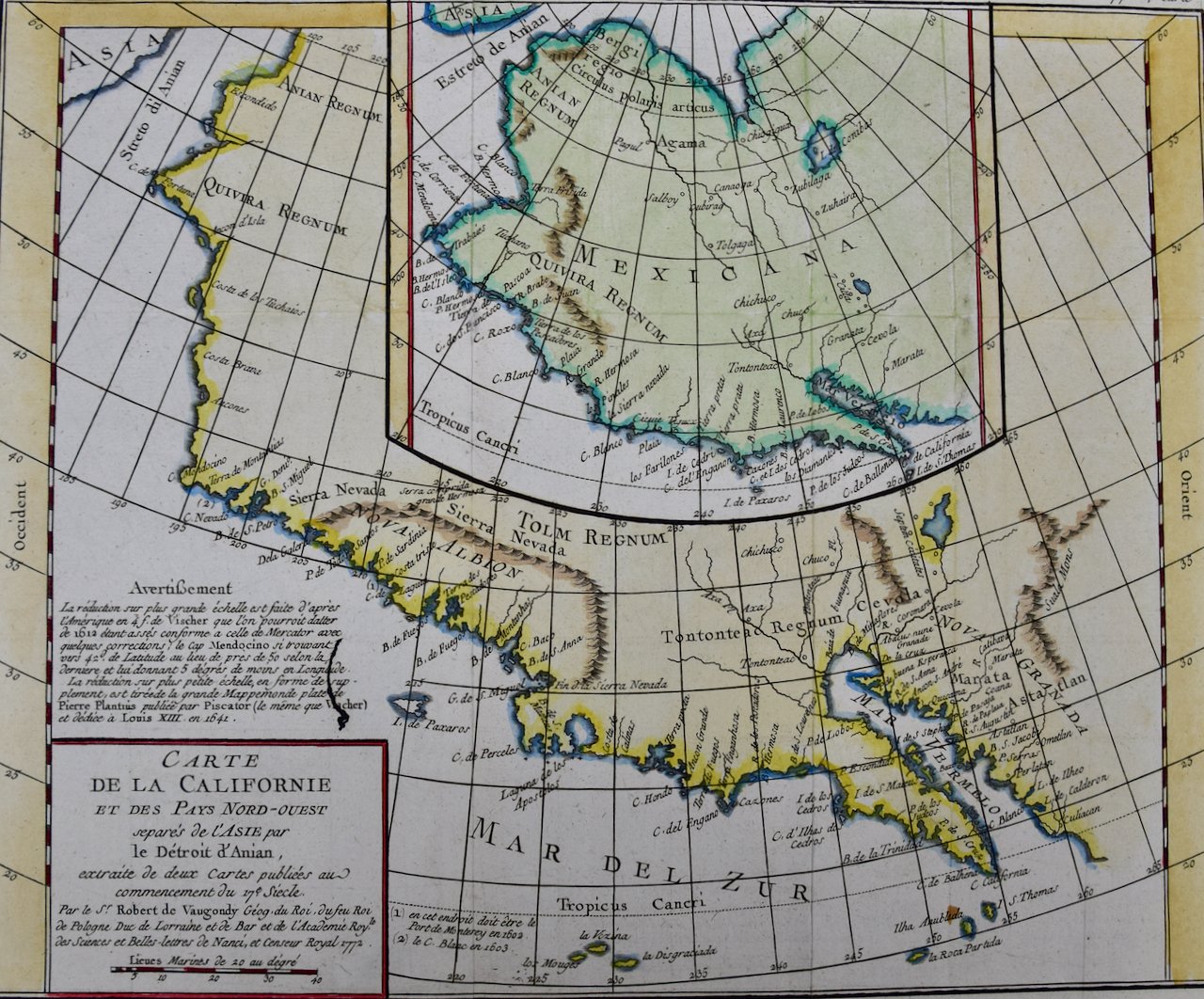
 Image 1 of 7
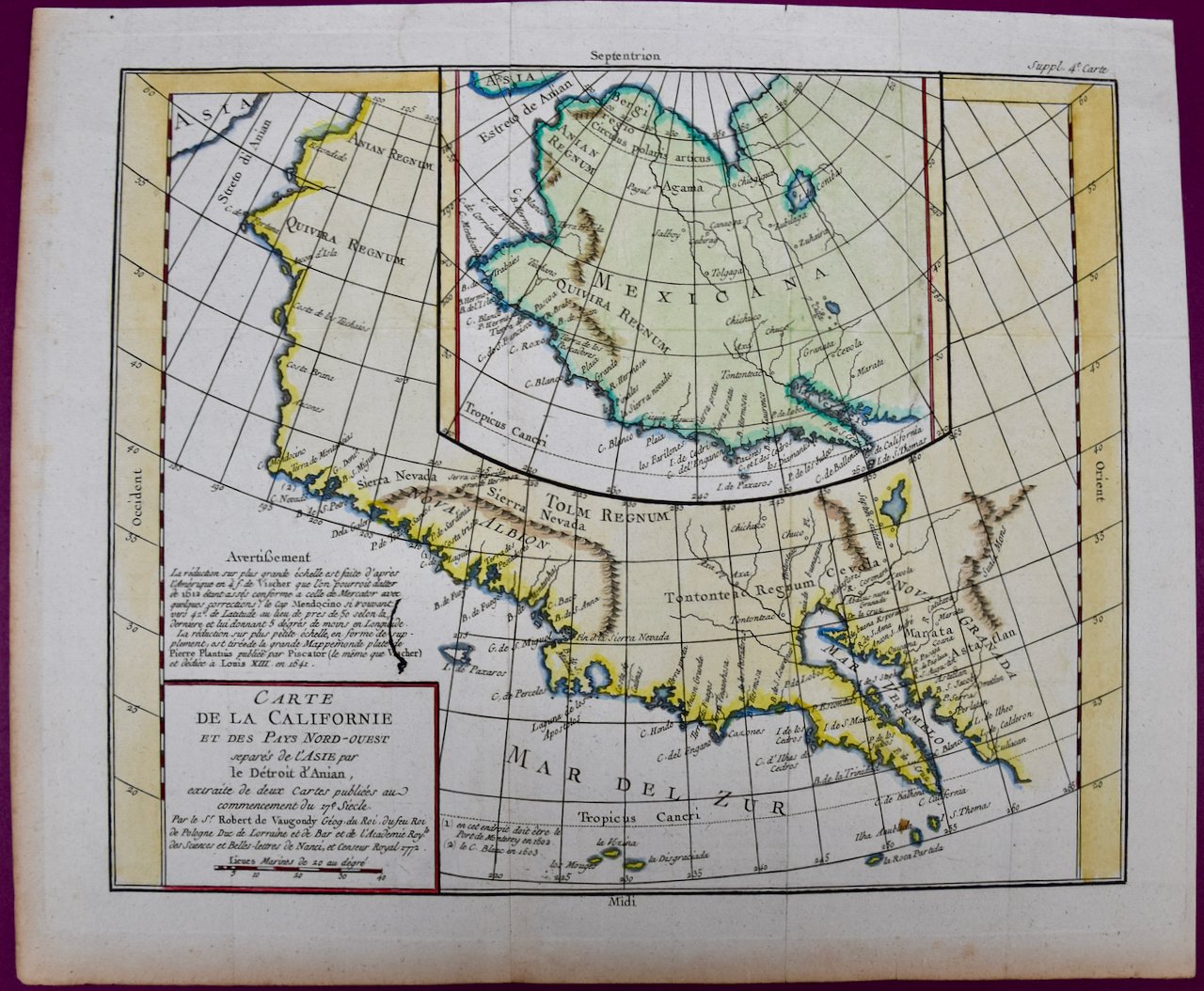
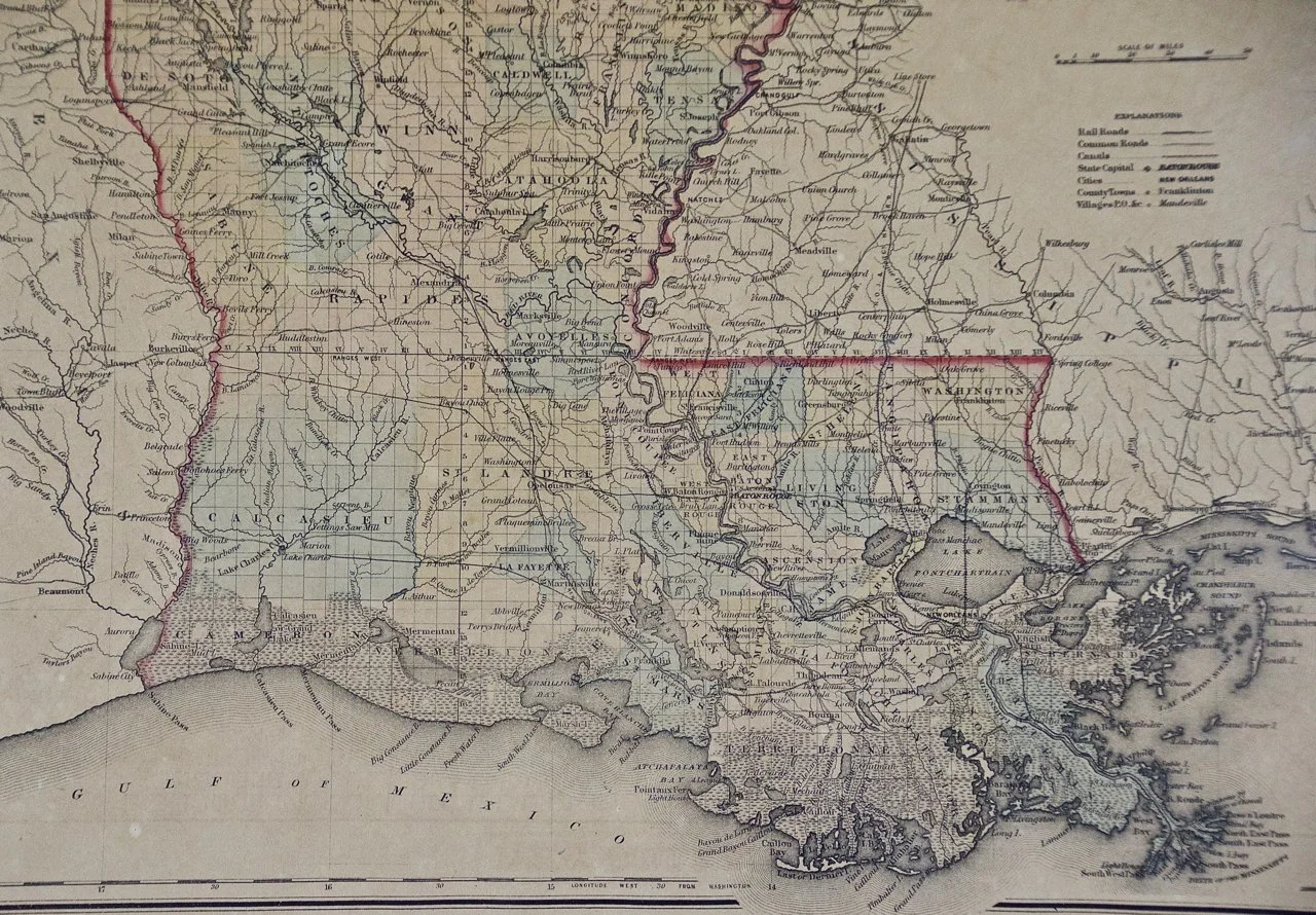
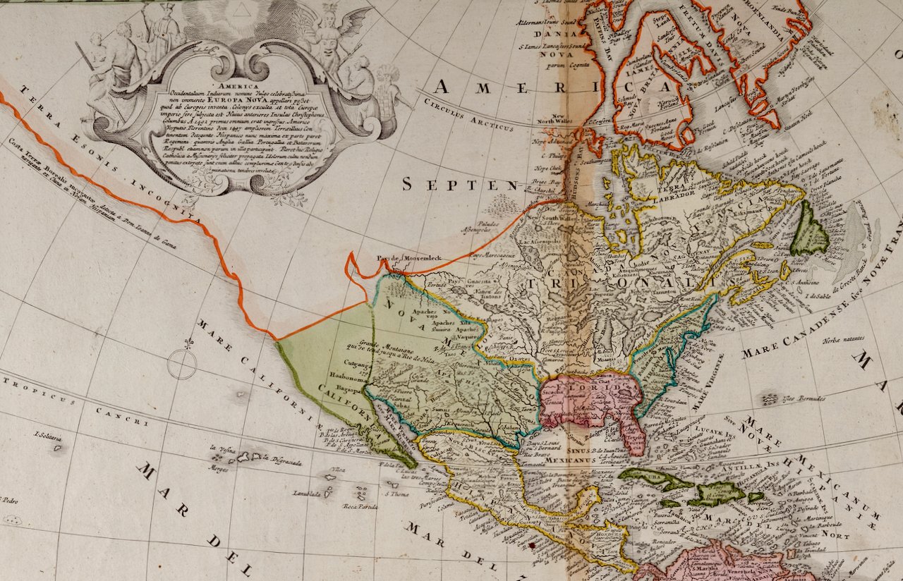 Image 2 of 7
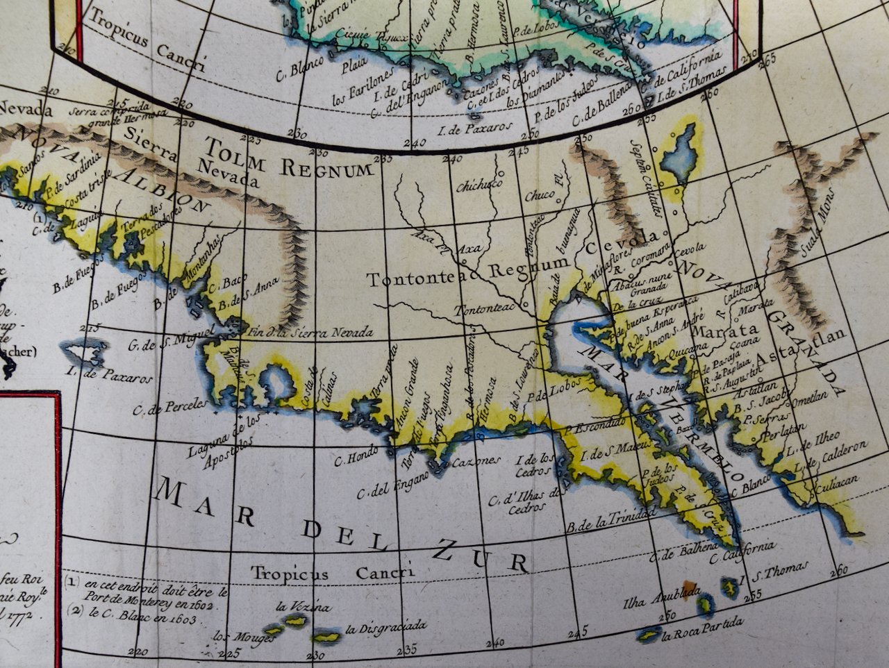
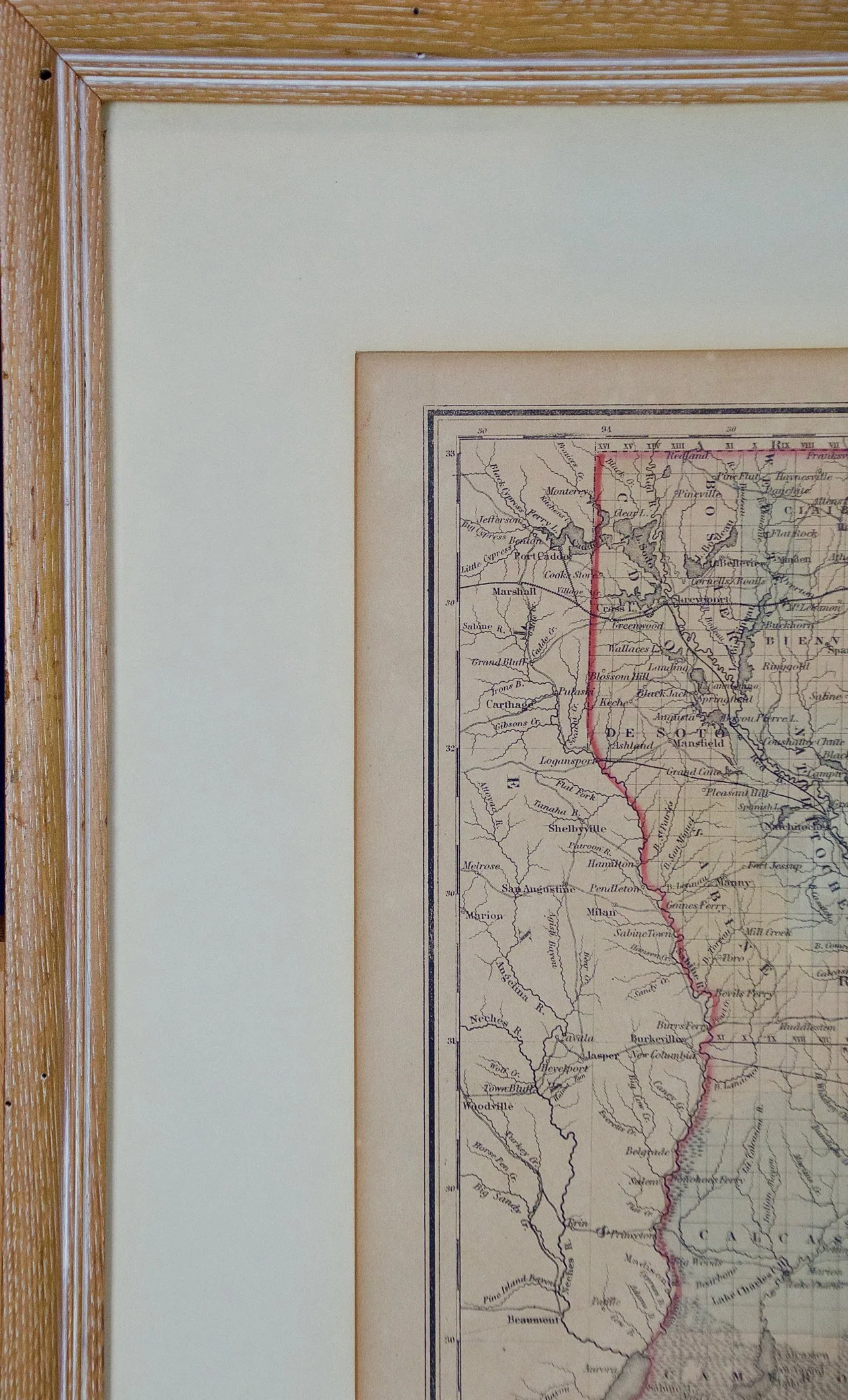
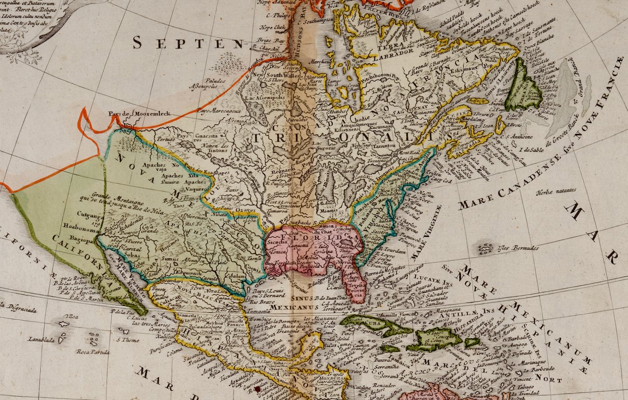 Image 3 of 7
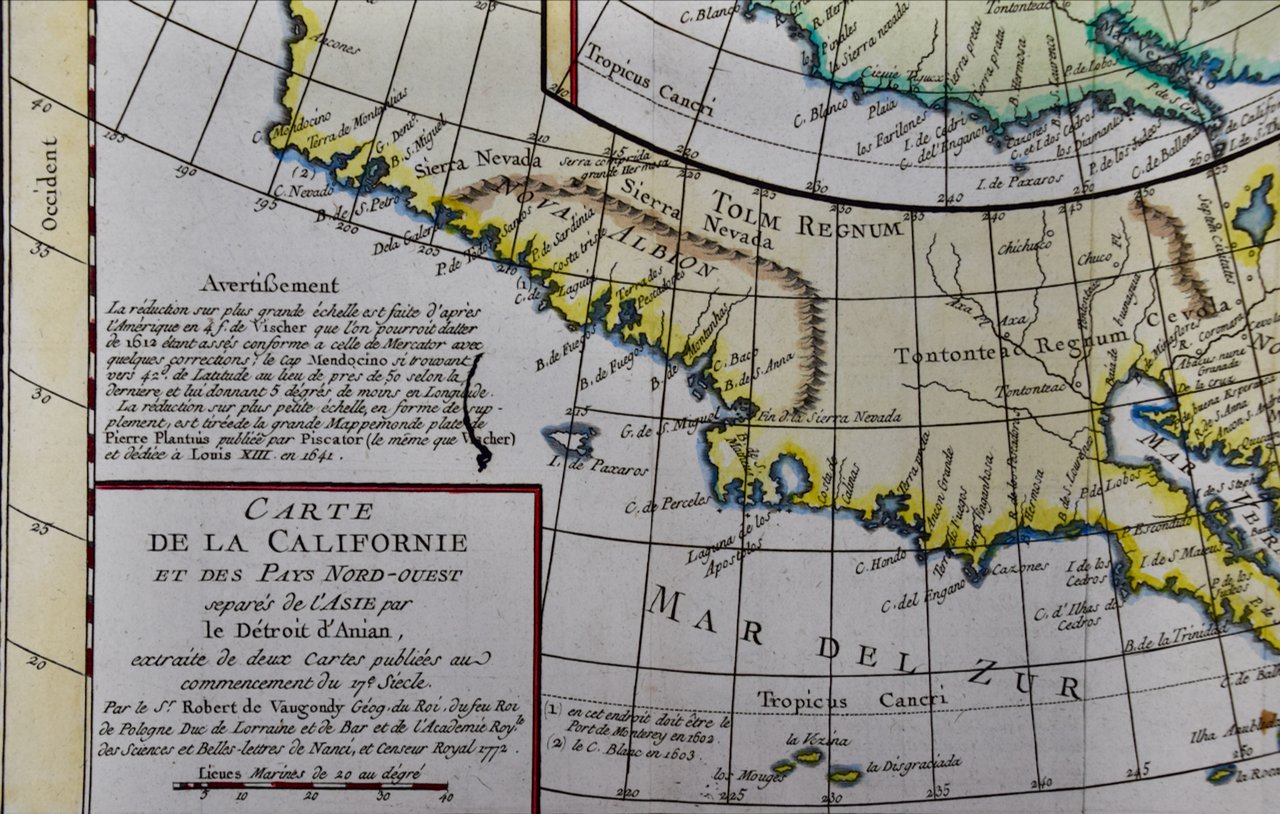
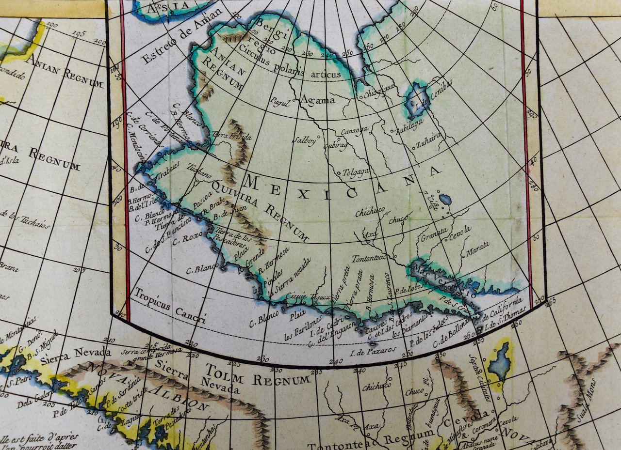
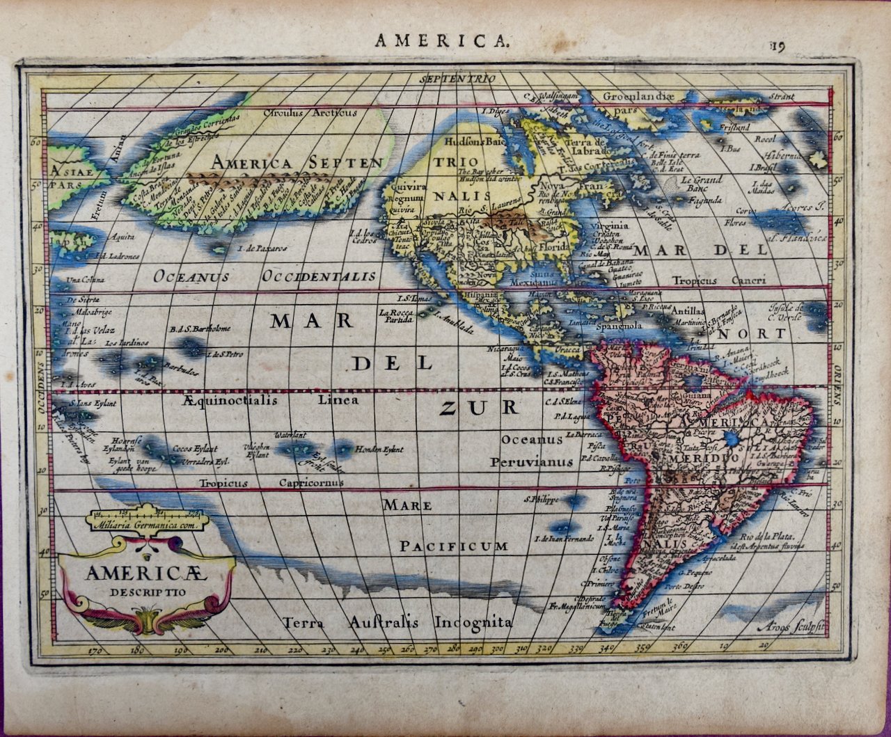
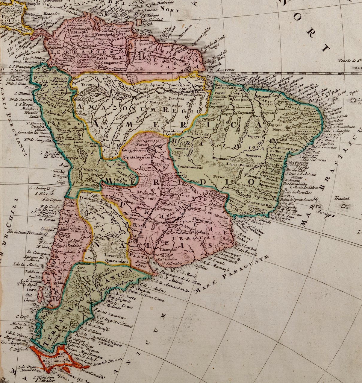 Image 4 of 7
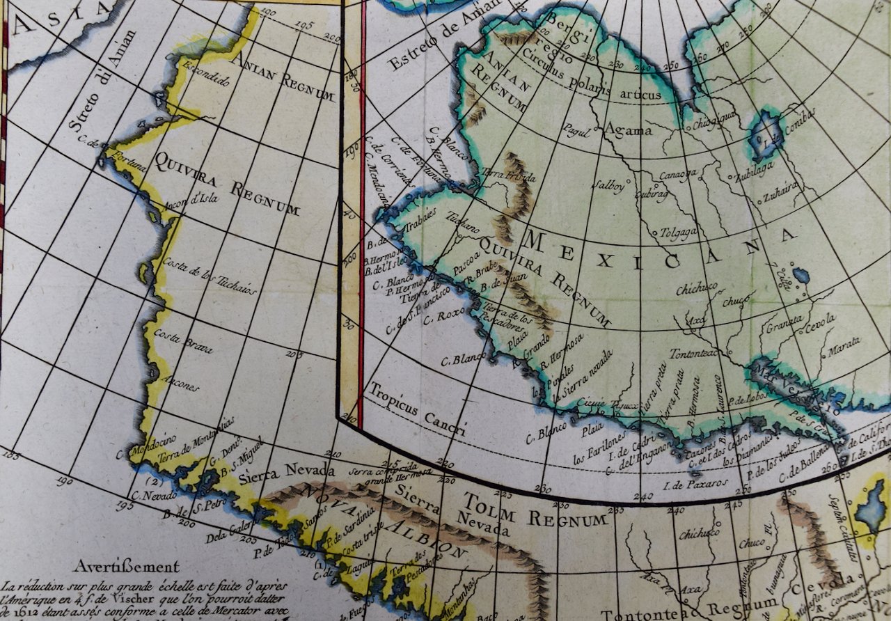
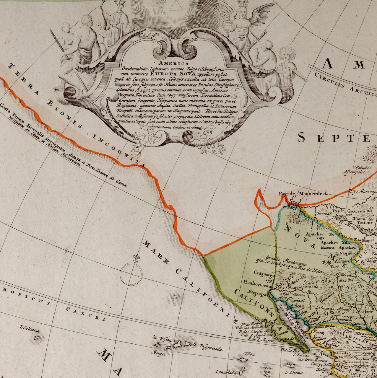 Image 5 of 7
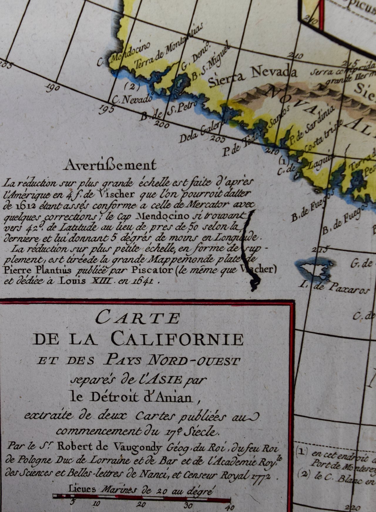
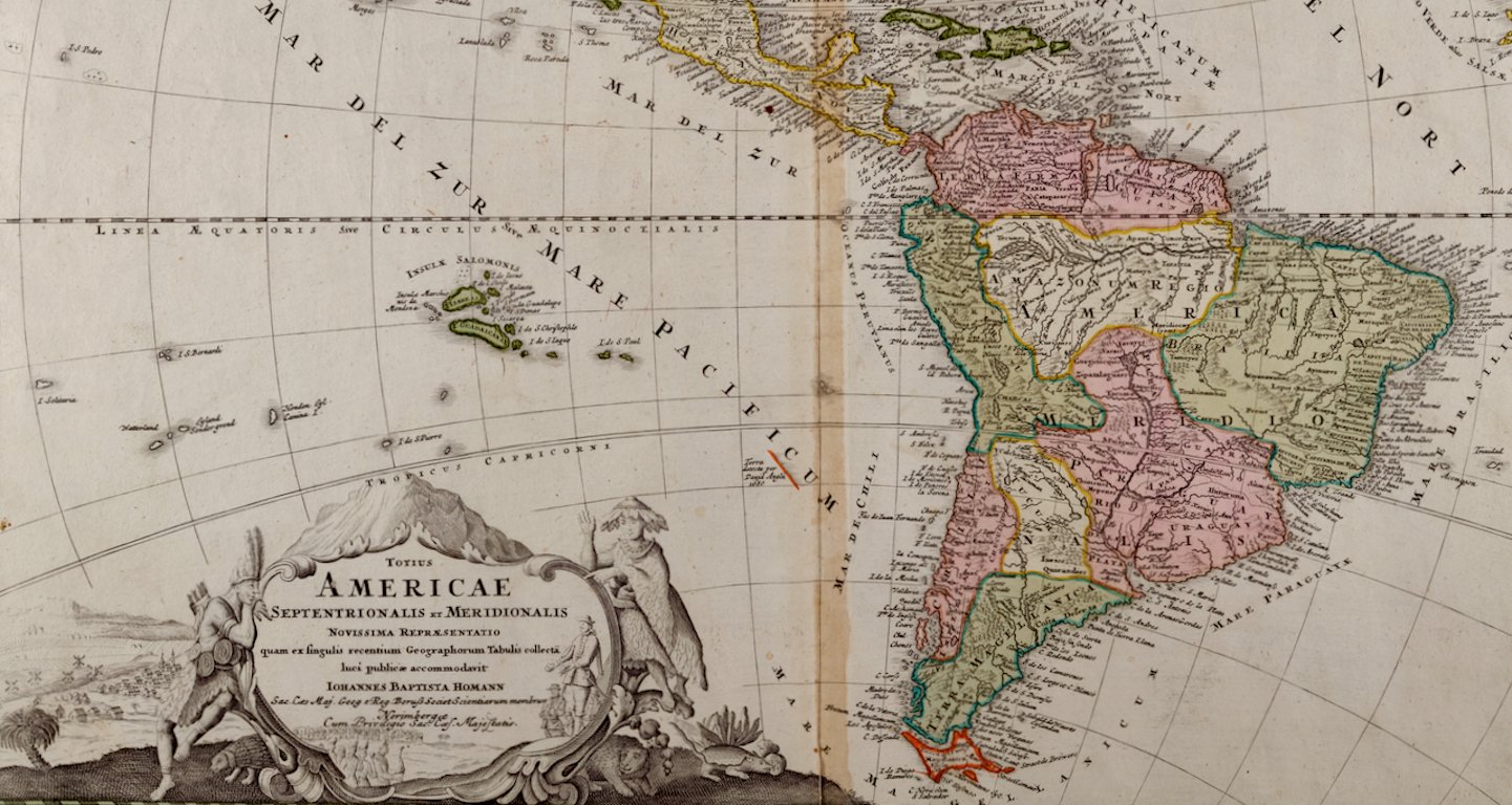 Image 6 of 7
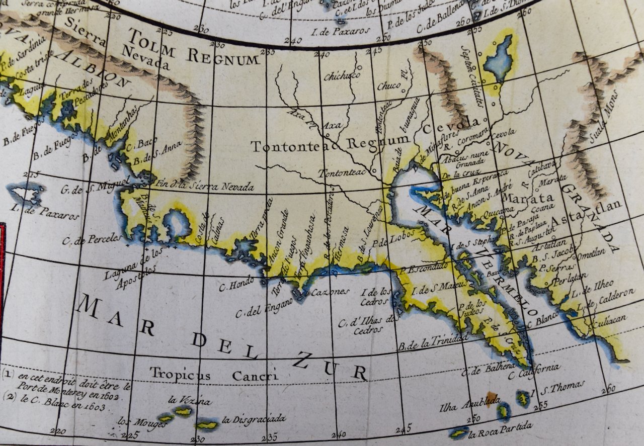
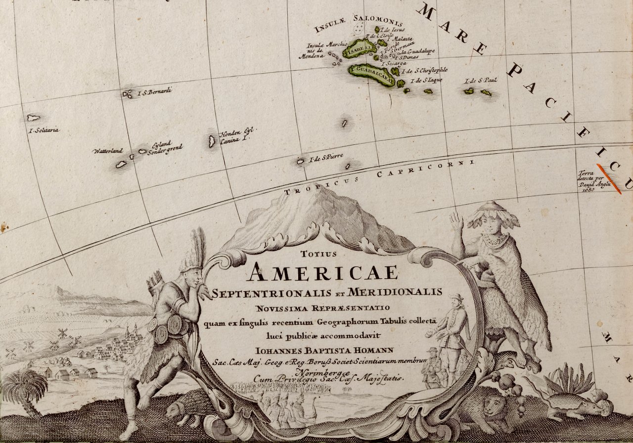 Image 7 of 7
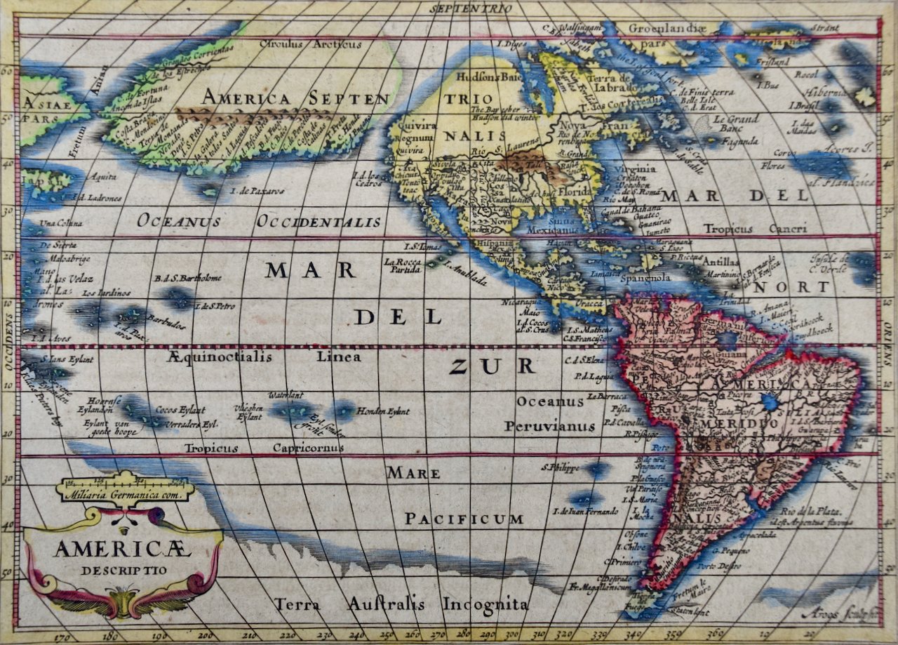
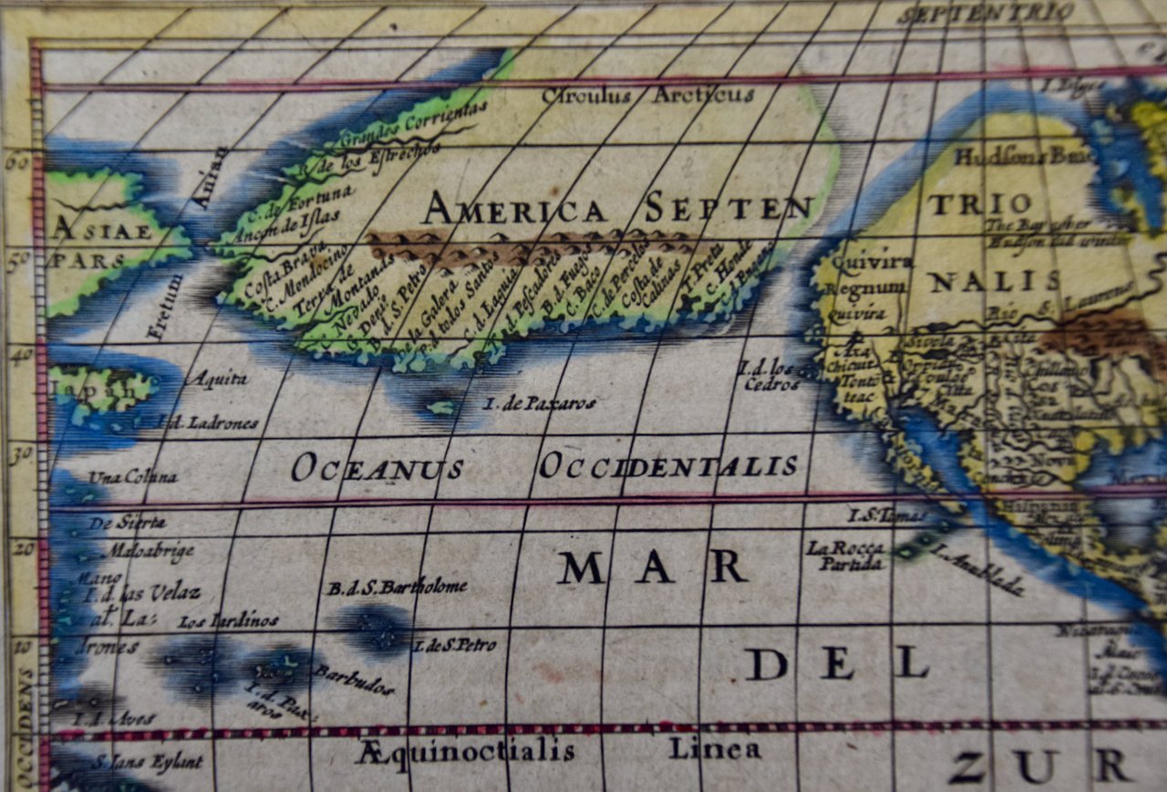
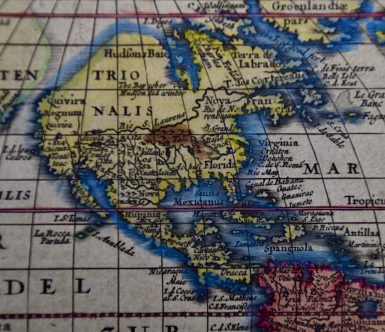
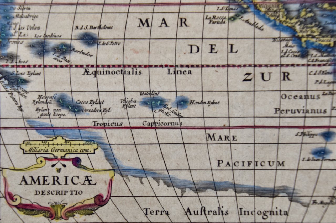
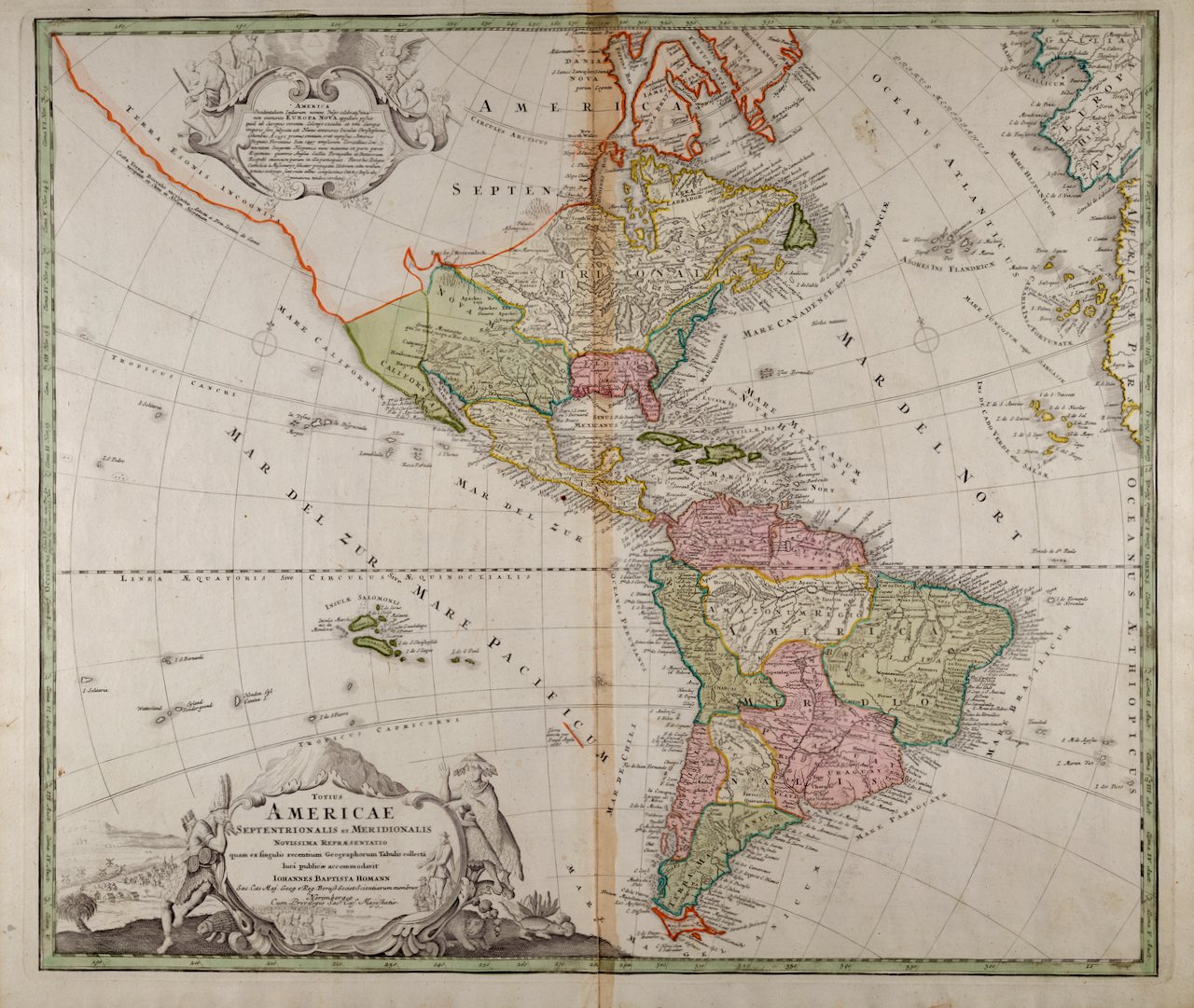
The beautifully hand-colored map is printed on laid chain-linked paper with wide margins. The sheet measures 21" high and 24" wide. There is a vertical center fold, as issued, with mild adjacent discoloration, where the map was bound in the atlas. There is a short area of separation of the lower portion of the center fold, which has been expertly reinforced, as has a small flap at the lower edge of the sheet on the right. There are two small areas of discoloration at the edge of the upper margin, but the map is otherwise in very good condition.
Johann Baptist Homann (1663-1724) was a mapmaker who founded a respected and prolific publishing company, which produced some of the most important maps and atlases of the 18th century. The publishing business continued long after his death as Homann Heirs. Homann lived his entire life in Bavaria, particularly in Nuremberg. Initially, Johann trained to become a priest before converting to Protestantism and working as a notary. In 1702, Johann founded a publishing house that specialized in engravings. The firm flourished, becoming the leading map publisher in Germany and an important entity in the European map market. Homann's maps were prized for their high level of accuracy and detailed information. In 1715, Johann was named Imperial Geographer to the Holy Roman Empire by Charles VI and made a member of the Prussian Academy of Sciences and the Royal Society of London. Most importantly for his business, his reputation and contacts gained him imperial printing privileges which protected his publications and recommended him to customers. Homann died in Nuremberg on July 1, 1724, leaving behind a legacy of influential cartography and geographic scholarship. His publishing house continued under the management of his son, Johann Christoph Homann, and remained one of the most important map publishers of the 18th century.