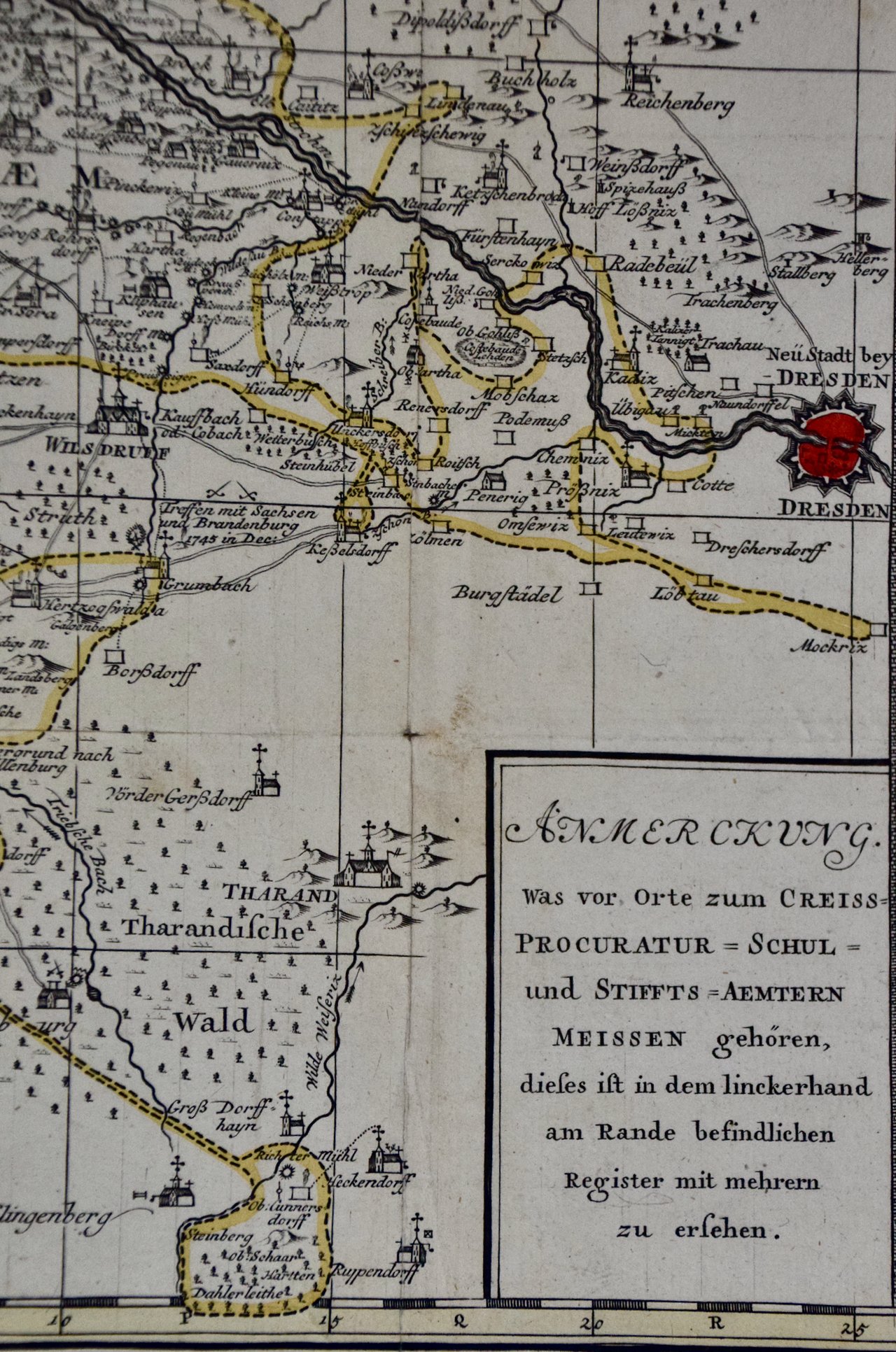
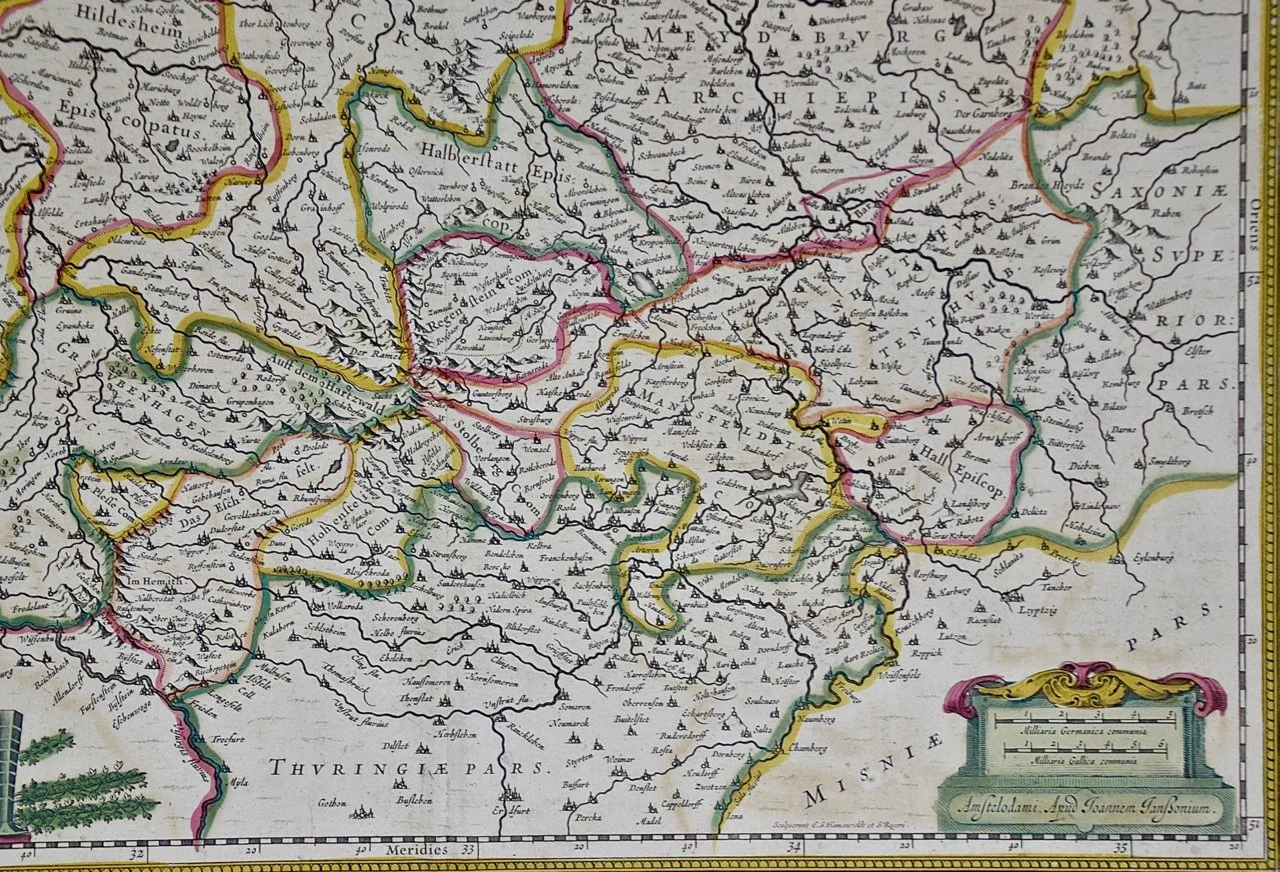
Image 1 of 7
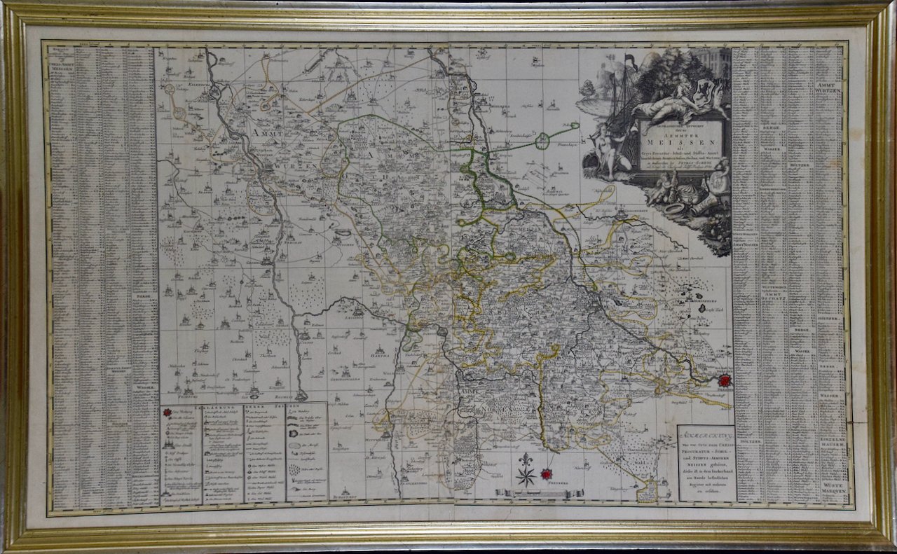
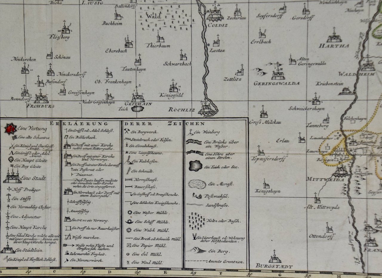
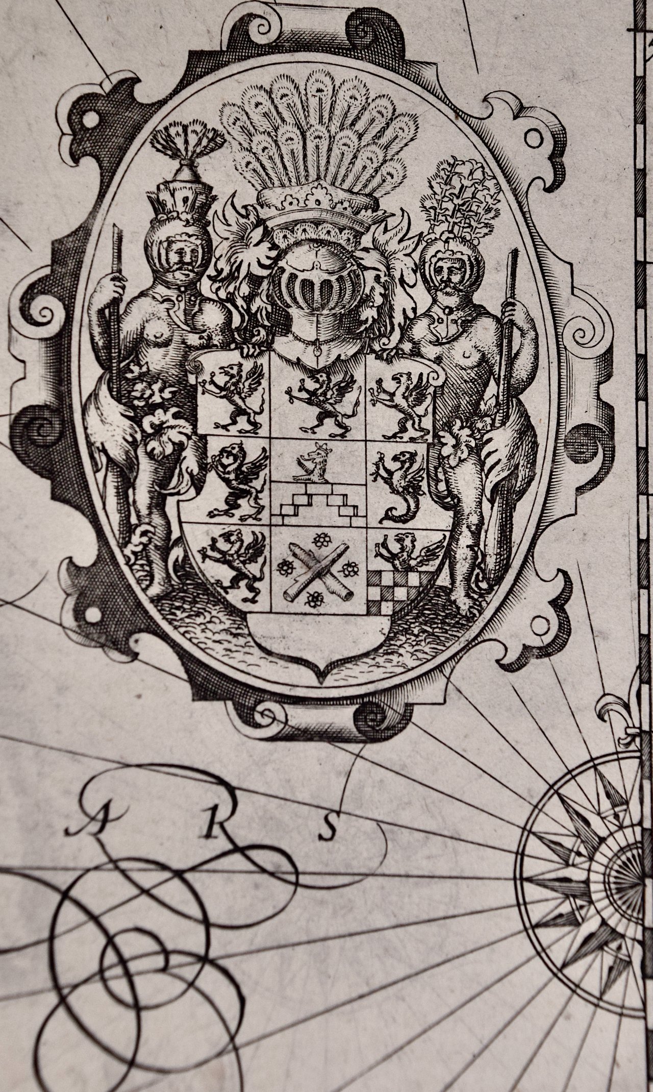
 Image 2 of 7
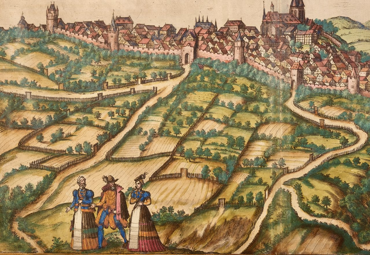
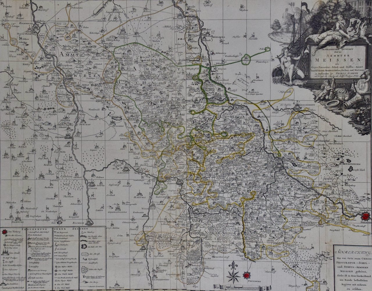
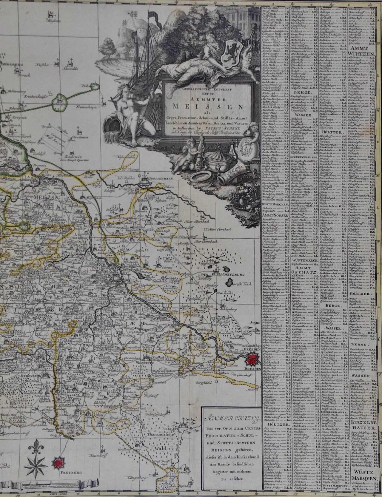
 Image 3 of 7
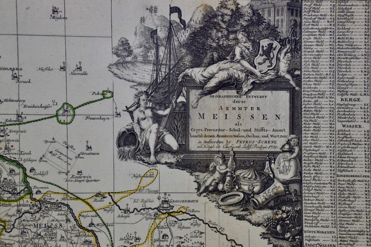
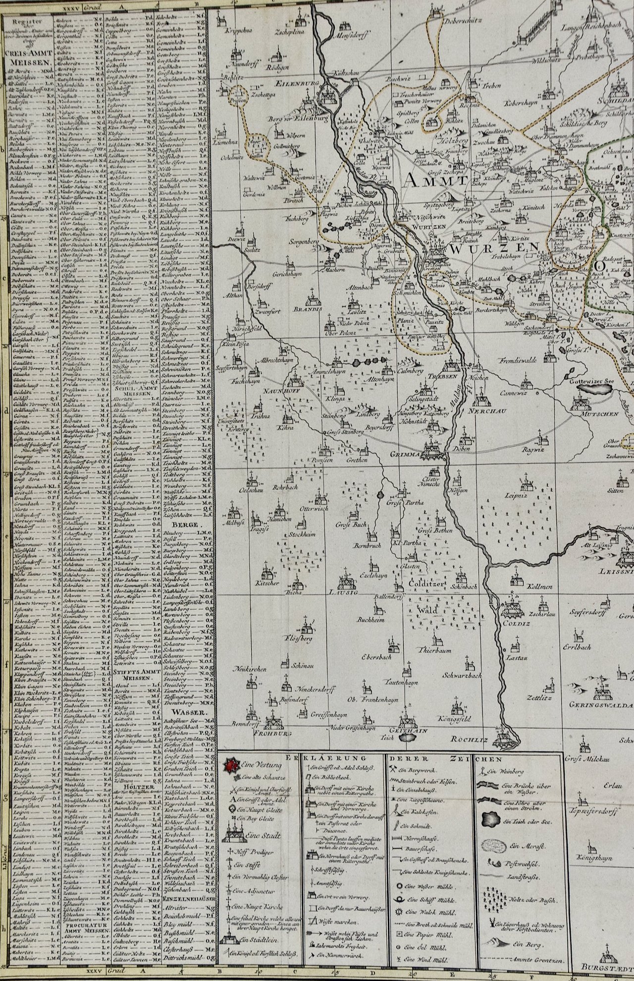
 Image 4 of 7
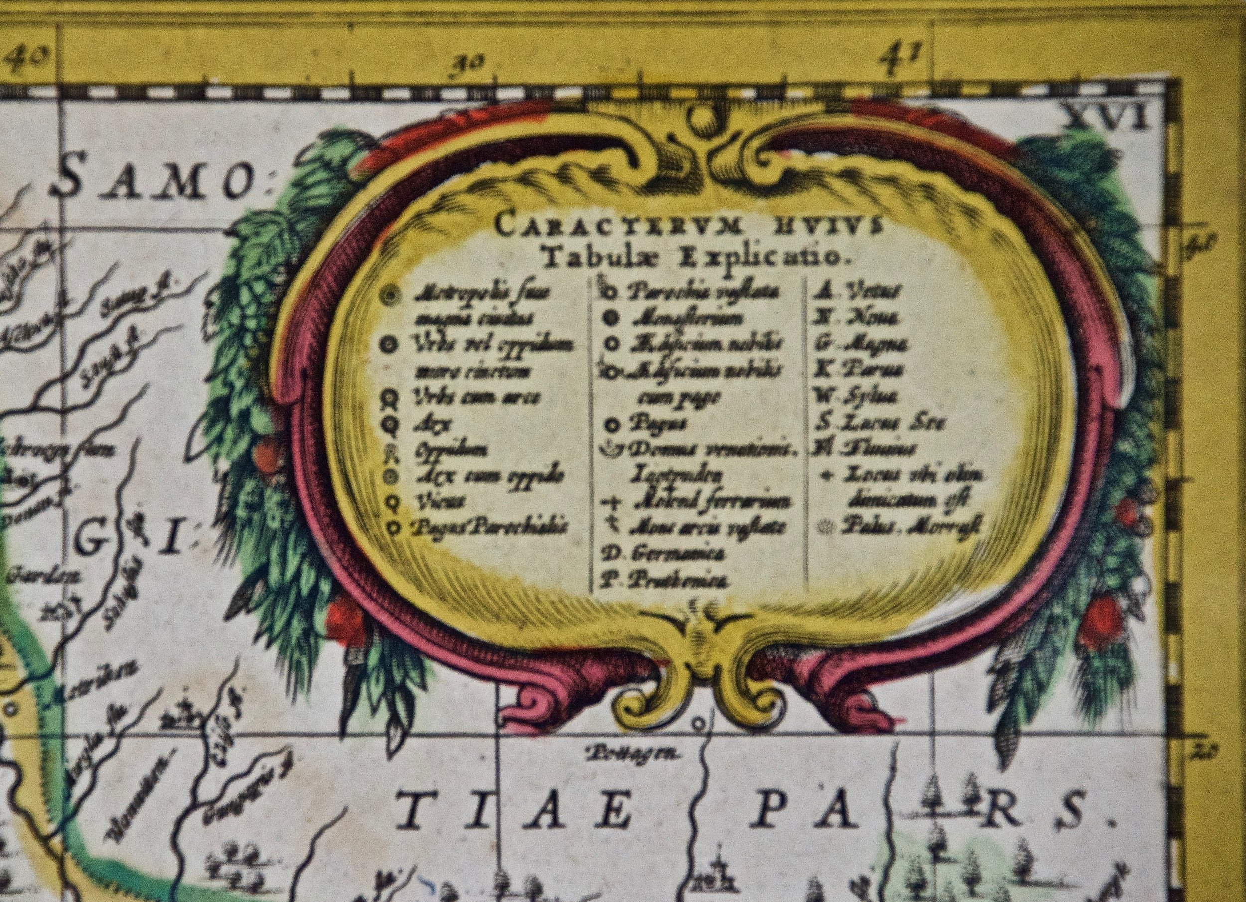 Image 5 of 7
 Image 6 of 7
 Image 7 of 7
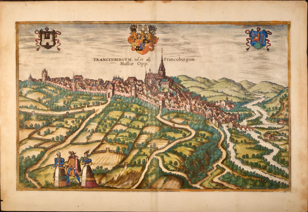
The map, which has large margins, is presented in a cream colored hinged mat with a mylar window and is affixed by mylar corners. The mat measures 21.25" x 24.63" and the sheet measures 21" x 24.25". There is a central vertical fold, as issued and very mild discoloration of the margins, which is not visible behind the mat. Mild color offset in the left upper portion from the right as a result of being folded in the atlas for an extended period of time, possibly centuries.
Johannes Janssonius (1588-1664), also known as Jan Janszoon and Jan Jansson, was a Dutch cartographer and publisher who lived and worked in Amsterdam. He grew up in the book business. He married the daughter of the famous Dutch cartographer Jodocus Hondius and became a book publisher in Amsterdam. He later went into the book and map publishing business with his brother-in-law Henricus Hondius. In addition to their own maps, they published several editions of the famous Mercator/Hondius atlas. Jansson was responsible for expanding their company, publishing several world and city atlases in competition with the Blaeu publishing family, also in Amsterdam. Jansson's most prominent works include the "Atlas Novus" (1638), the "Atlas Majoris Appendix" (1639) and his huge eleven volume "Atlas Major" (1647).