 Image 1 of 9
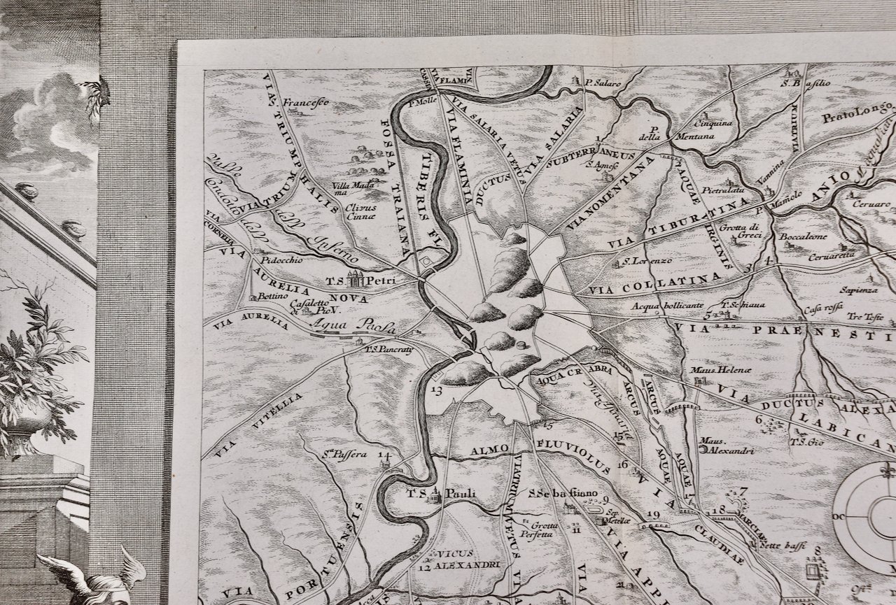
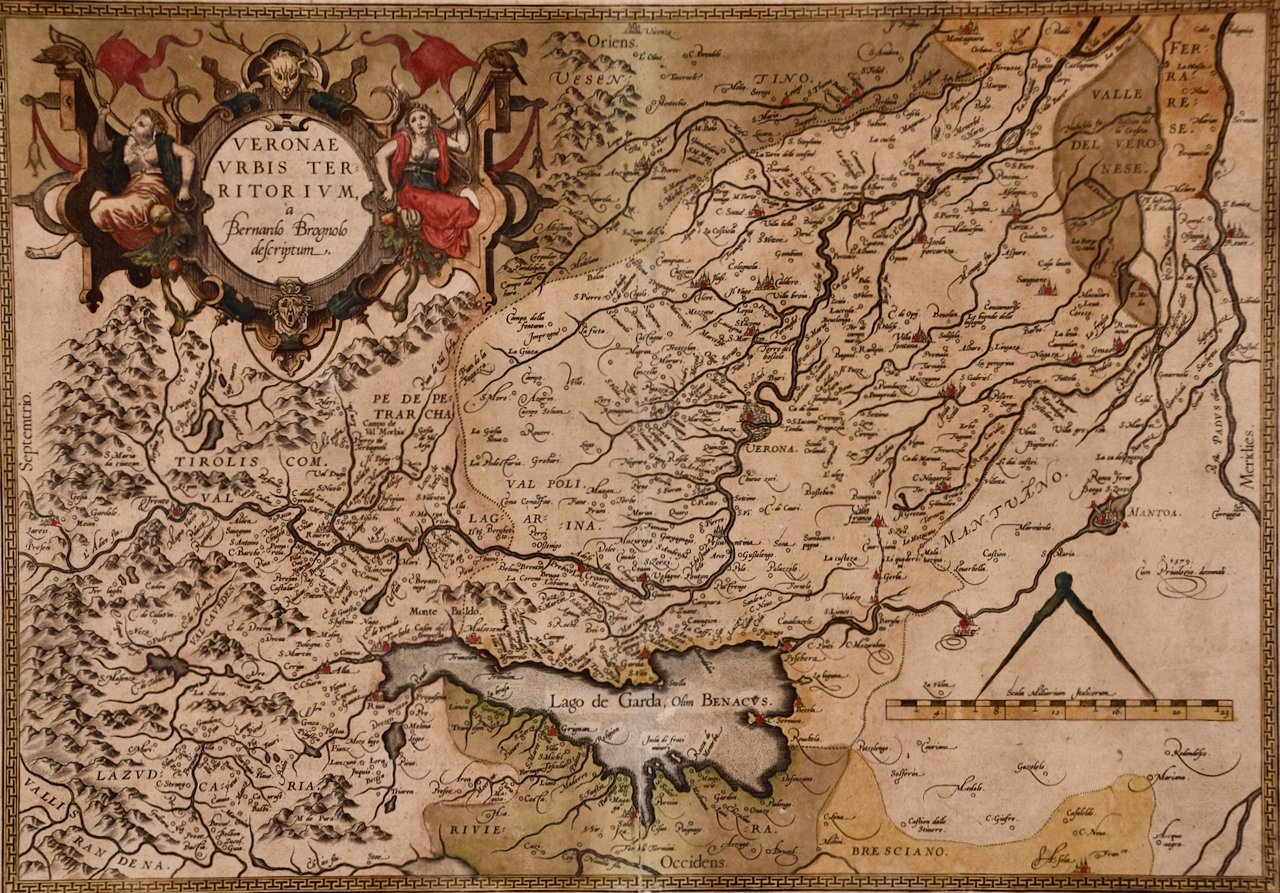 Image 2 of 9
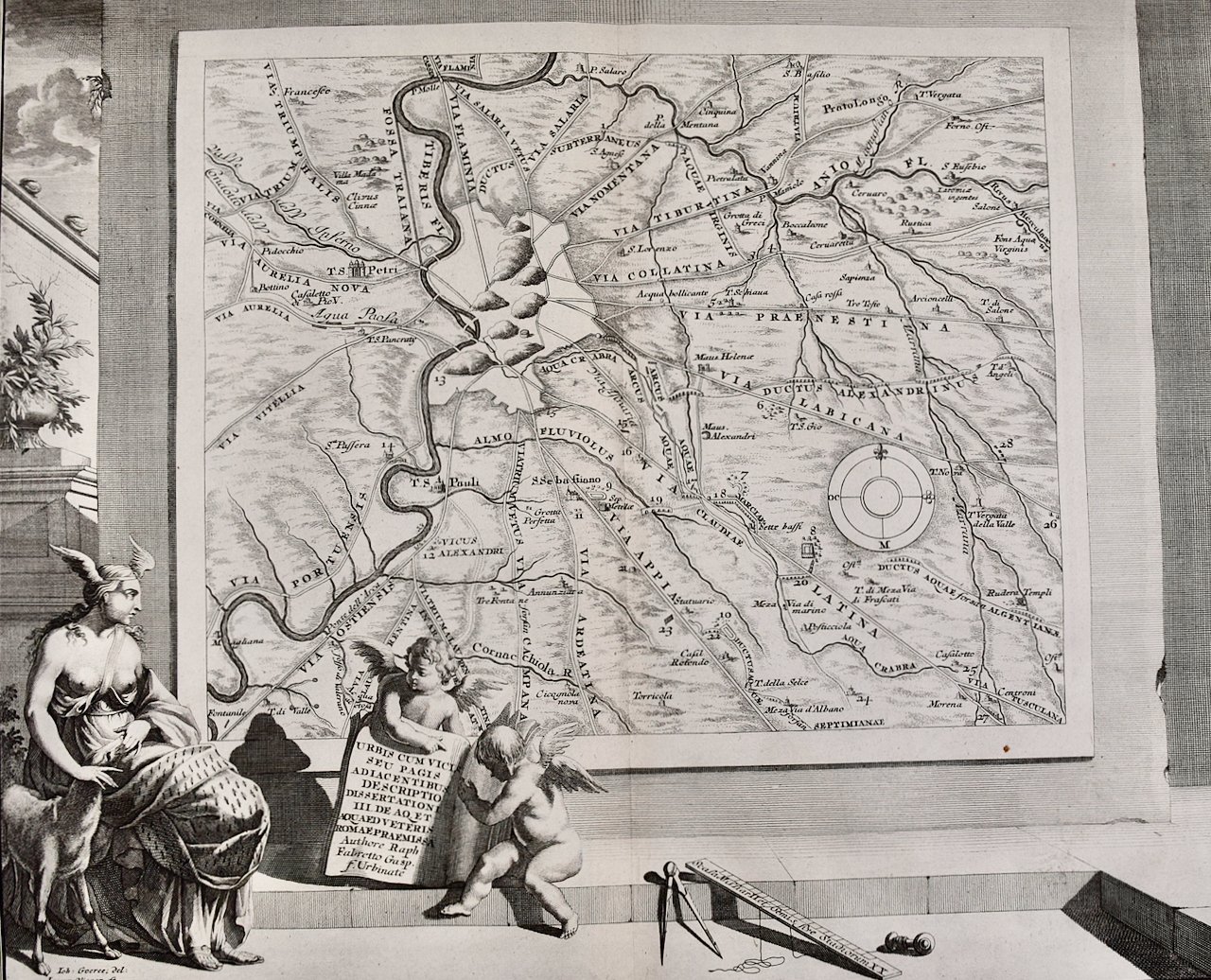
 Image 3 of 9
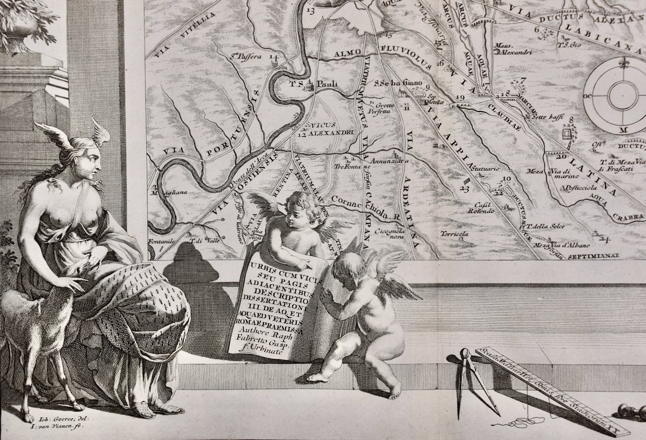
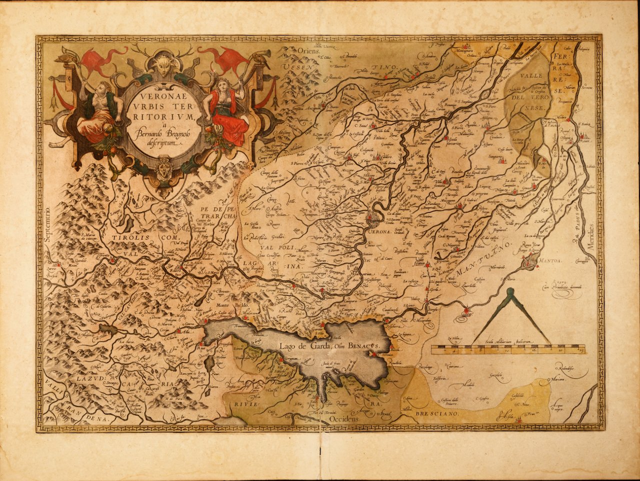 Image 4 of 9
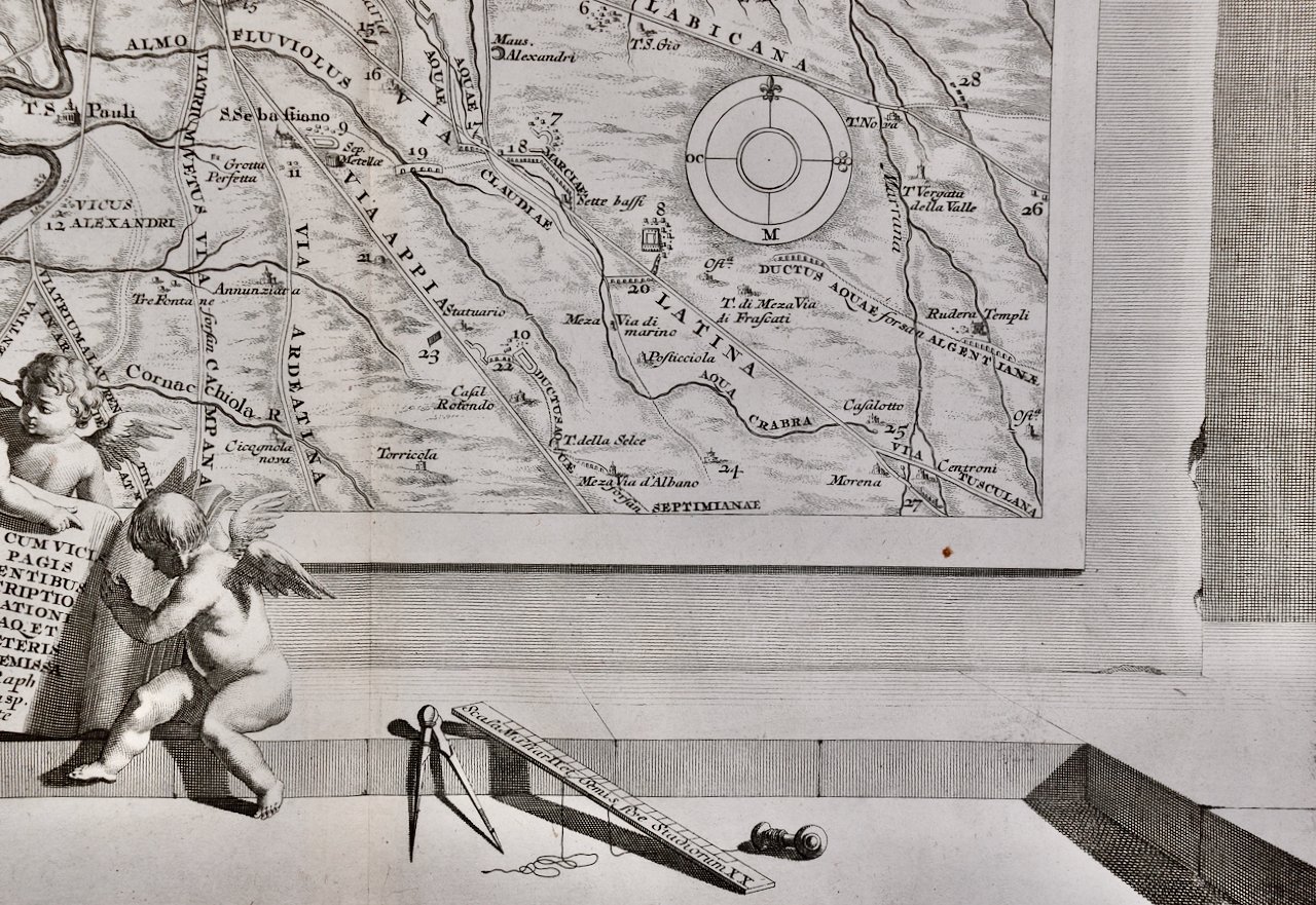
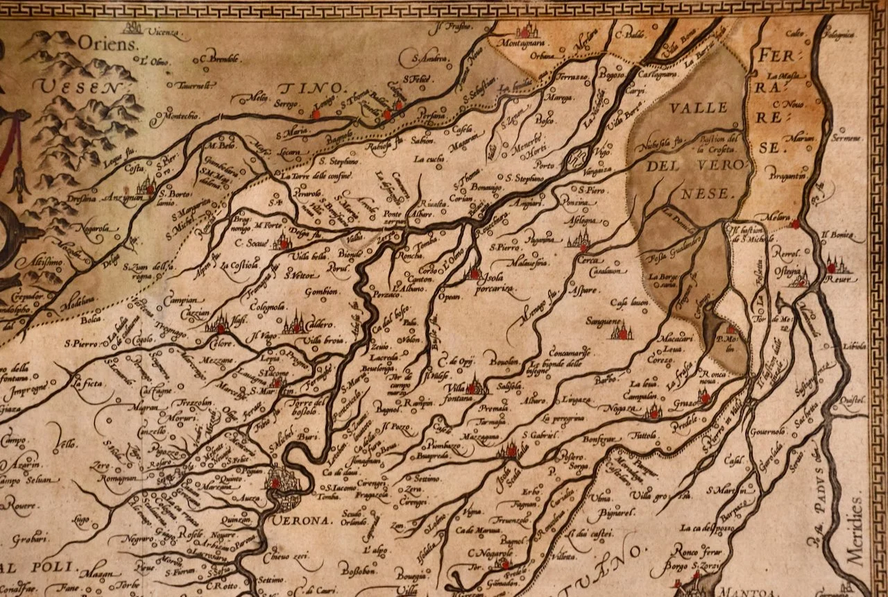 Image 5 of 9
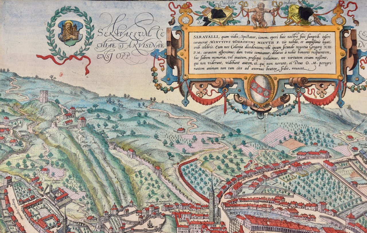
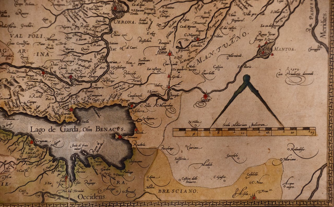 Image 6 of 9
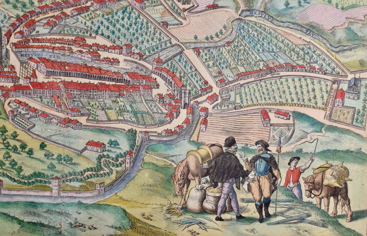
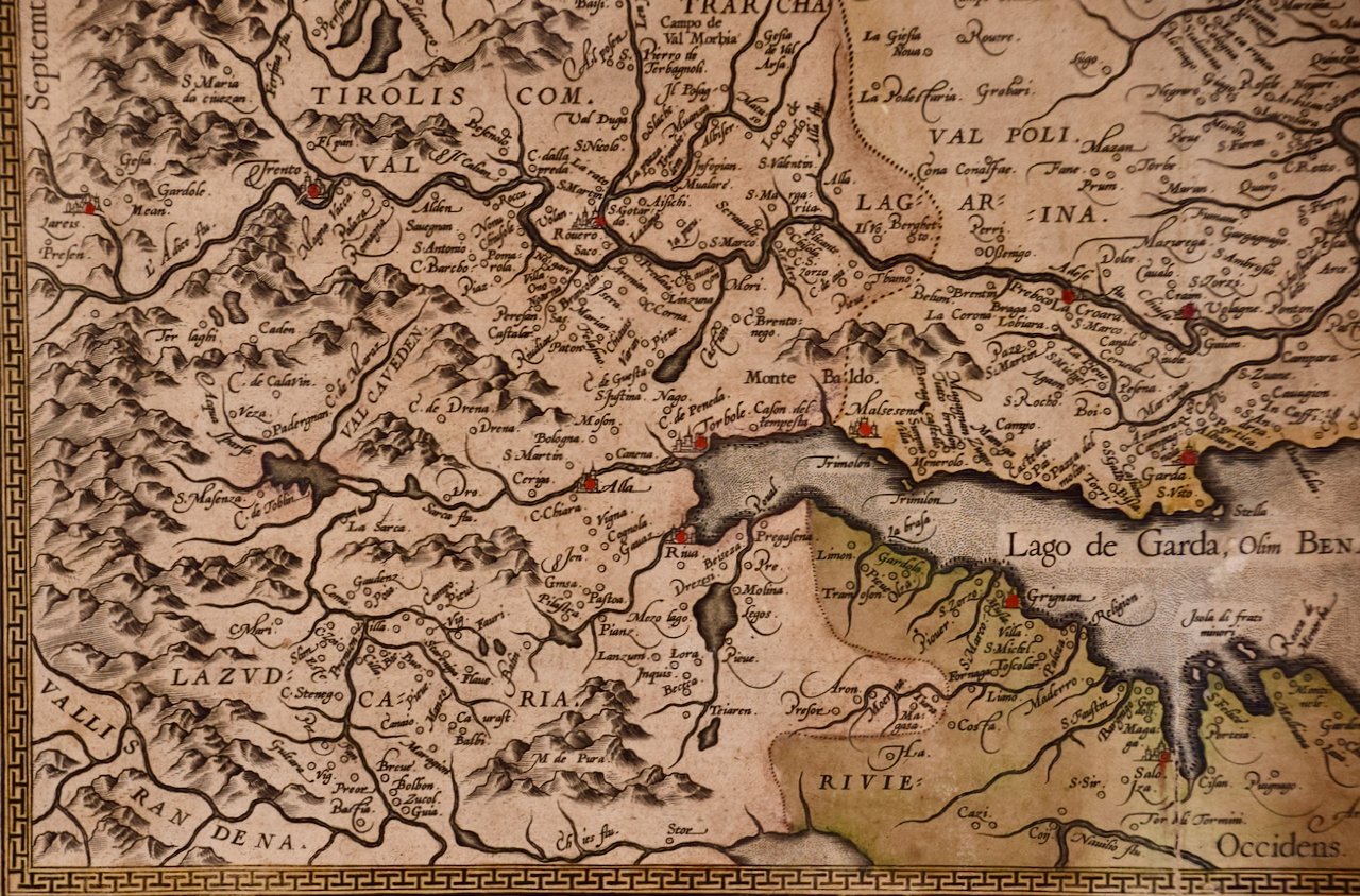 Image 7 of 9
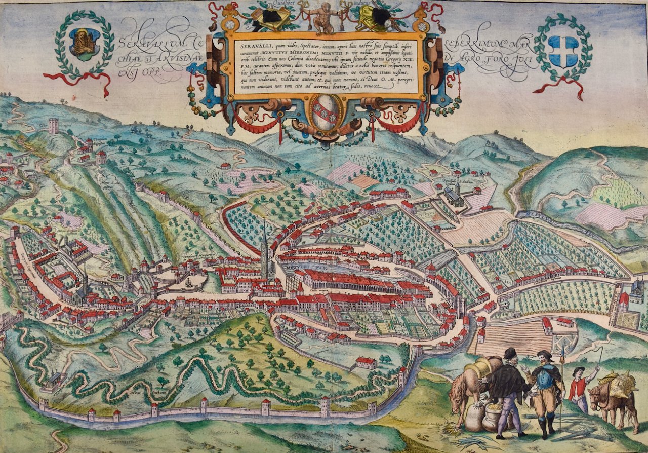
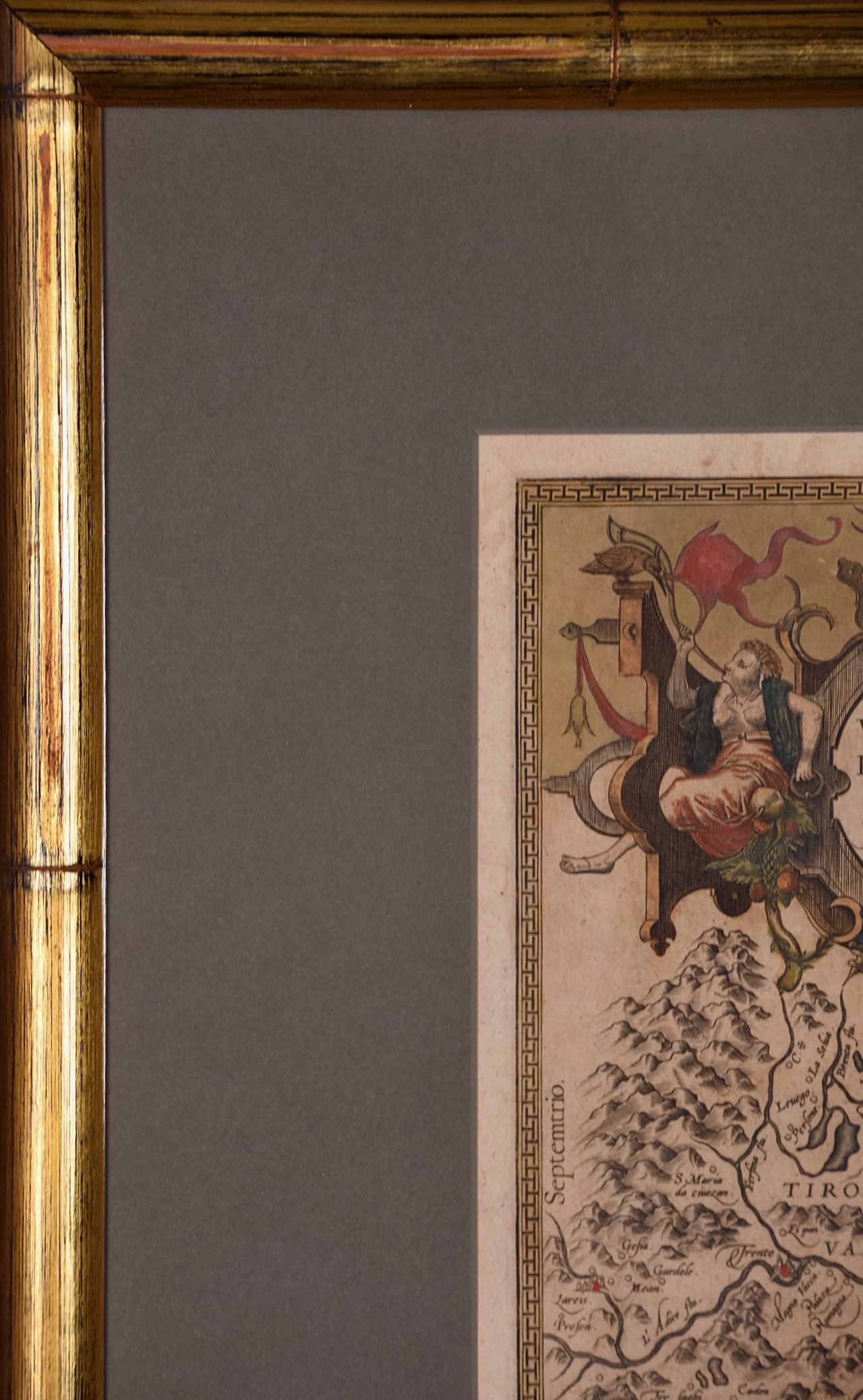 Image 8 of 9
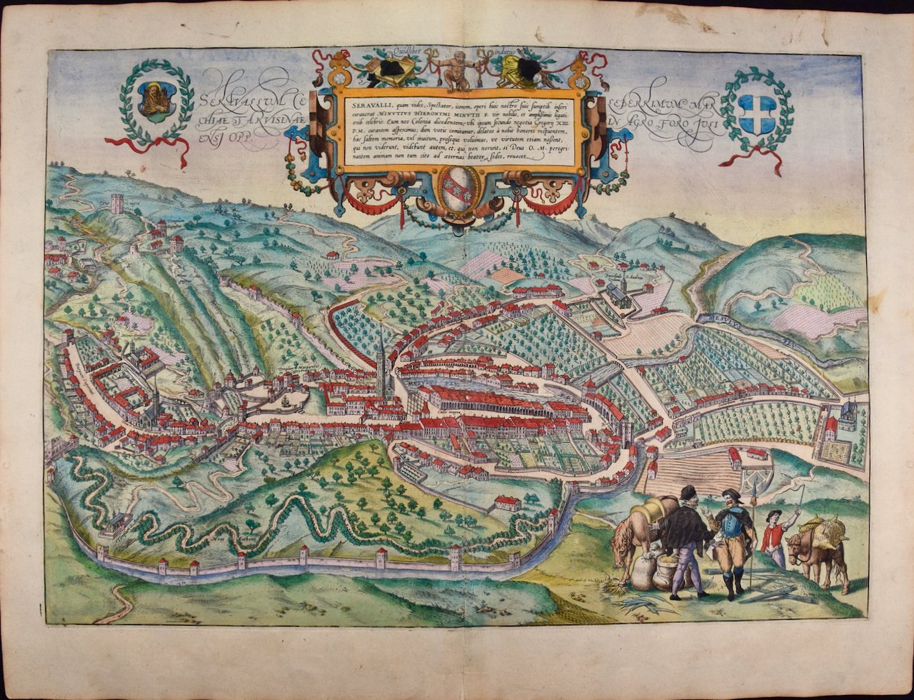
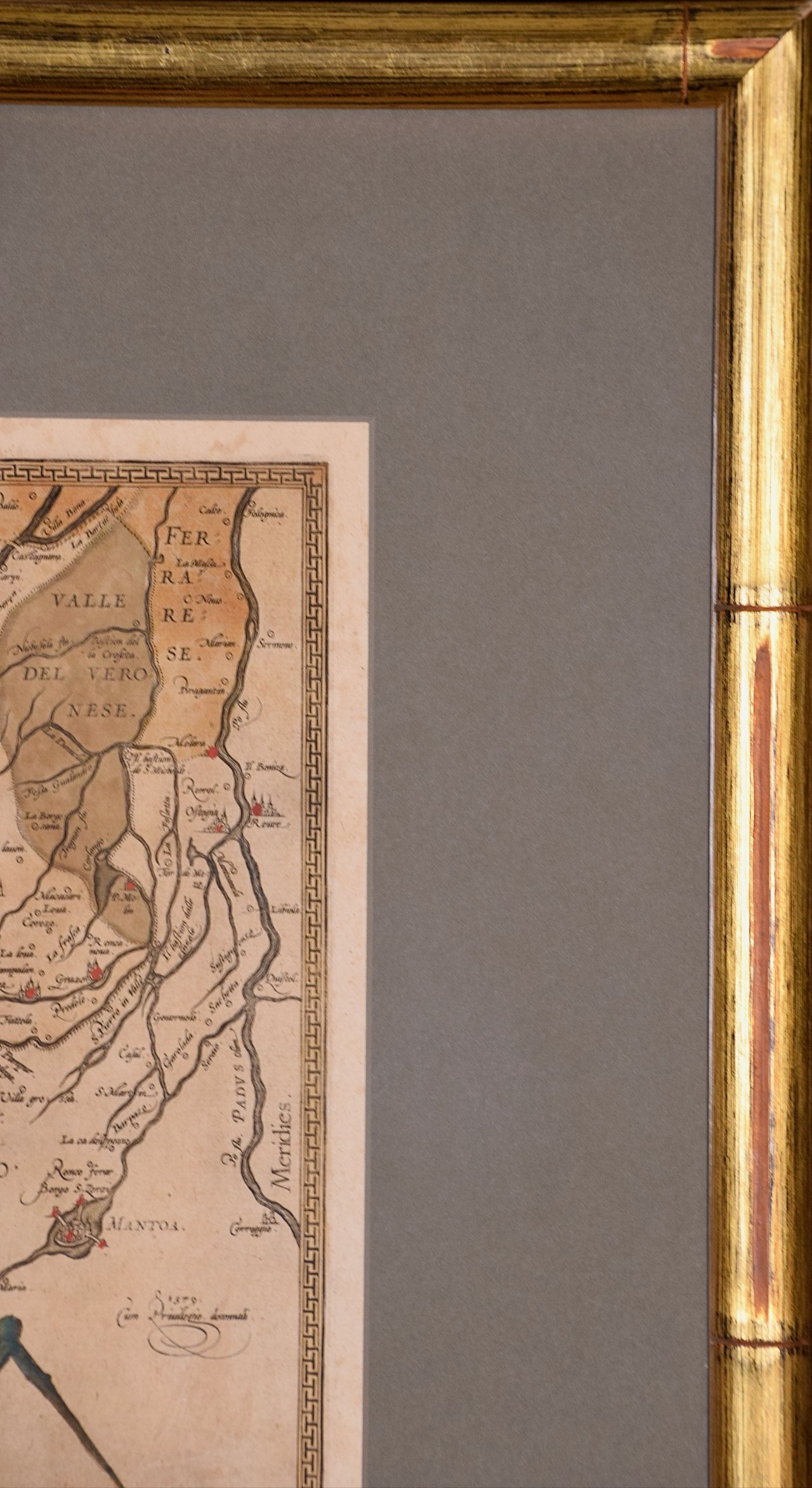 Image 9 of 9
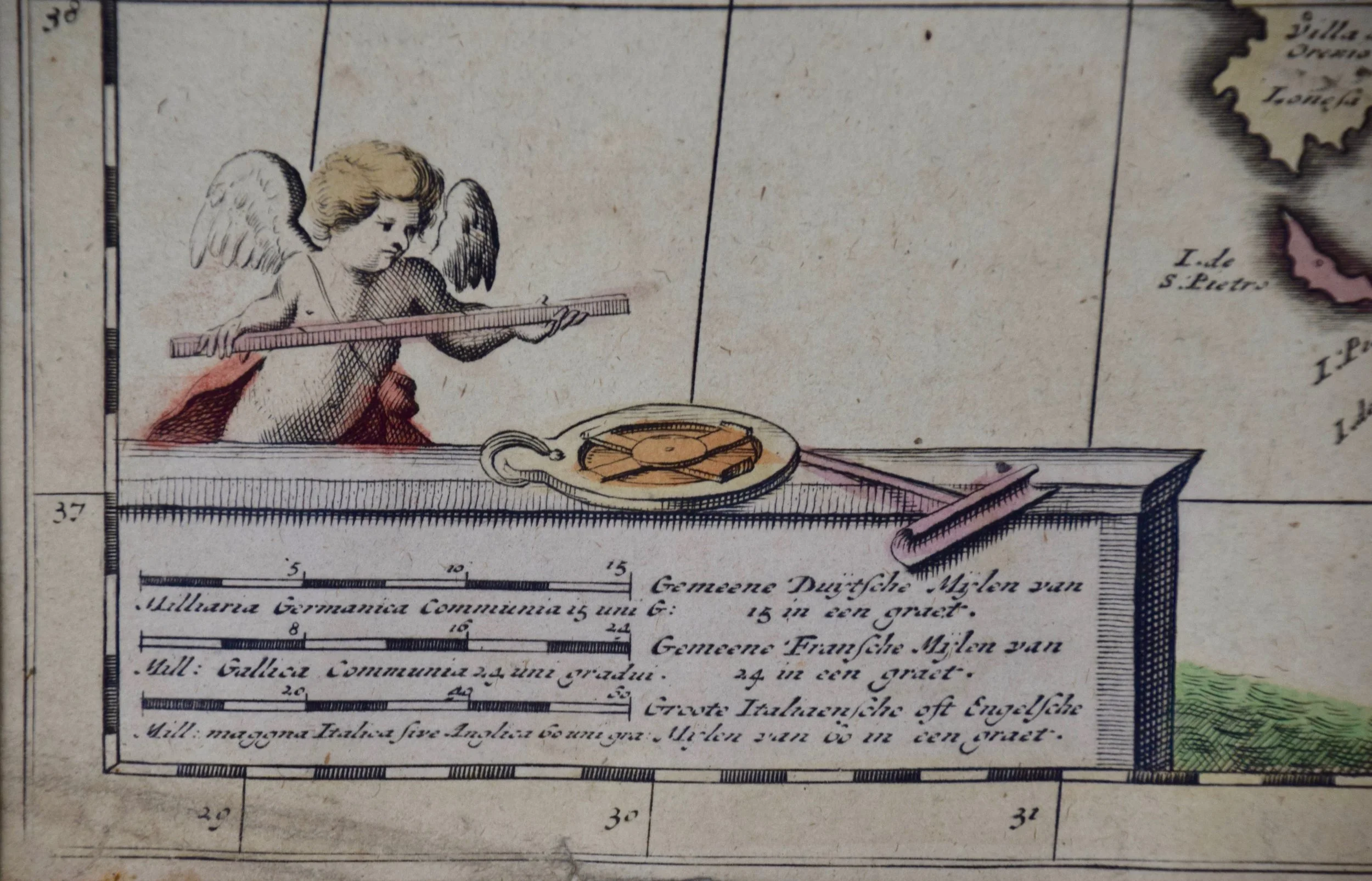
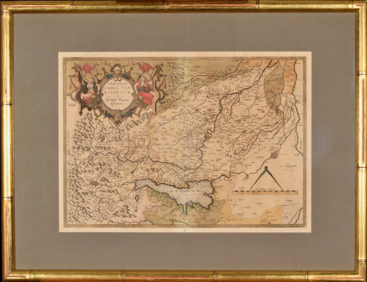
This beautiful map of northern Italy is focussed on Verona and its environs, including Mantua. Lake Garda and the South Tyrol mountains are prominently depicted. There is a very large striking cartouche in the upper left and a decorative distance scale in the lower right.
This striking hand-colored map of northern Italy is presented in a gold-colored wood frame and an olive green-colored mat. It is glazed with UV conservation glass. All mounting materials used are archival. The frame measures 21.5" high by 28" wide by 0.75" deep. There is a central vertical fold, as issued, with slight separation of the lower portion of the fold. There are faint spots in the upper and right margins, but the map is otherwise in very good condition.
Abraham Ortelius (also known as Ortels, Orthellius, and Wortels) (1527-1598) was a Dutch cartographer, geographer, and cosmographer. He began his career as a map colorist. In 1547 he entered the Antwerp guild of St Luke as an "illuminator of maps". He had an affinity for business from an early age and most of his journeys before 1560, were for business. He was a dealer in antiques, coins, maps, and books. His business income allowed him to acquire an extensive collection of medals, coins, and antiques, as well as a large library of books. In 1560, he travelled to Trier, Lorraine, and Poitiers with the great cartographer, Gerard Mercator. During this trip he was impressed by Mercator’s influence which inspired him to pursue a career as a scientific geographer. He rapidly became proficient at mapmaking and printing, completing his “Mappemonde", a large and ambitious eight-sheet wall map of the world in 1564.
Ortelius also published a map of Egypt in 1565, a map of the Holy Land, a plan of Brittenburg Castle on the coast of the Netherlands, and a map of Asia in the late 1560's. Ortelius went on to create the first modern atlas, the 'Theatrum Orbis Terrarum' (Theatre of the World) in 1570, which is often considered as the official beginning of the Golden Age of Netherlandish cartography. The maps were engraved by Franz Hogenberg, who himself achieved fame for his publication with Georg Braun of the 2nd atlas ever created, the 'Civitates Orbis Terrarum', focussed on views of European towns and cities. Ortellius reportedly assisted in the creation of this atlas. In 1573, Ortelius published seventeen supplementary maps under the title of 'Additamentum Theatri Orbis Terrarum'. In 1575 he was appointed geographer to the king of Spain, Philip II. By the time of Ortelius' death in 1598, a total of 25 editions of 'Theatrum Orbis Terrarum' were published, including editions in Latin, Italian, German, French, and Dutch. Ortelius is now considered one of the most famous and respected mapmakers from the golden age of Dutch cartography and printmaking, as well as academic geography. He is believed to be the first person to imagine that the continents were joined before drifting to their present positions.
References: Van der Krogt 3, 7111:31 Van Den Broecke 120