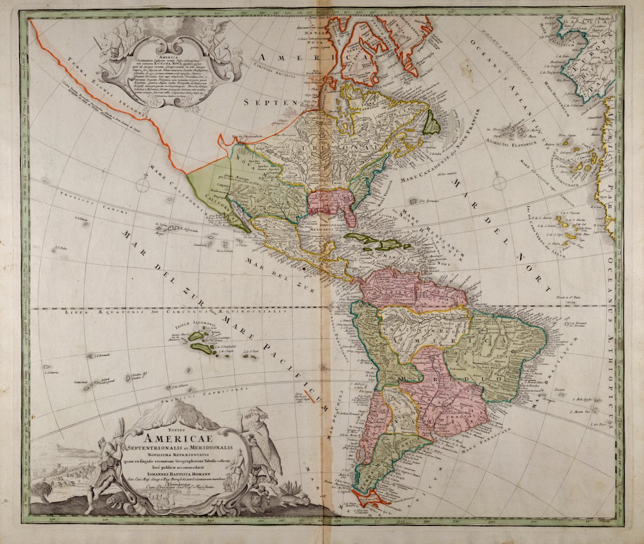
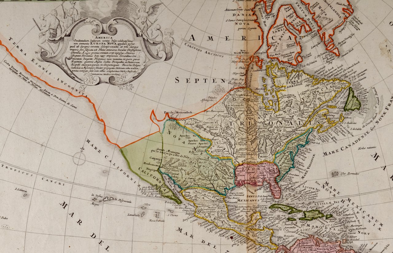
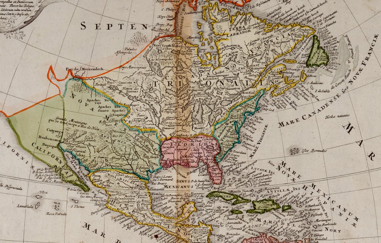
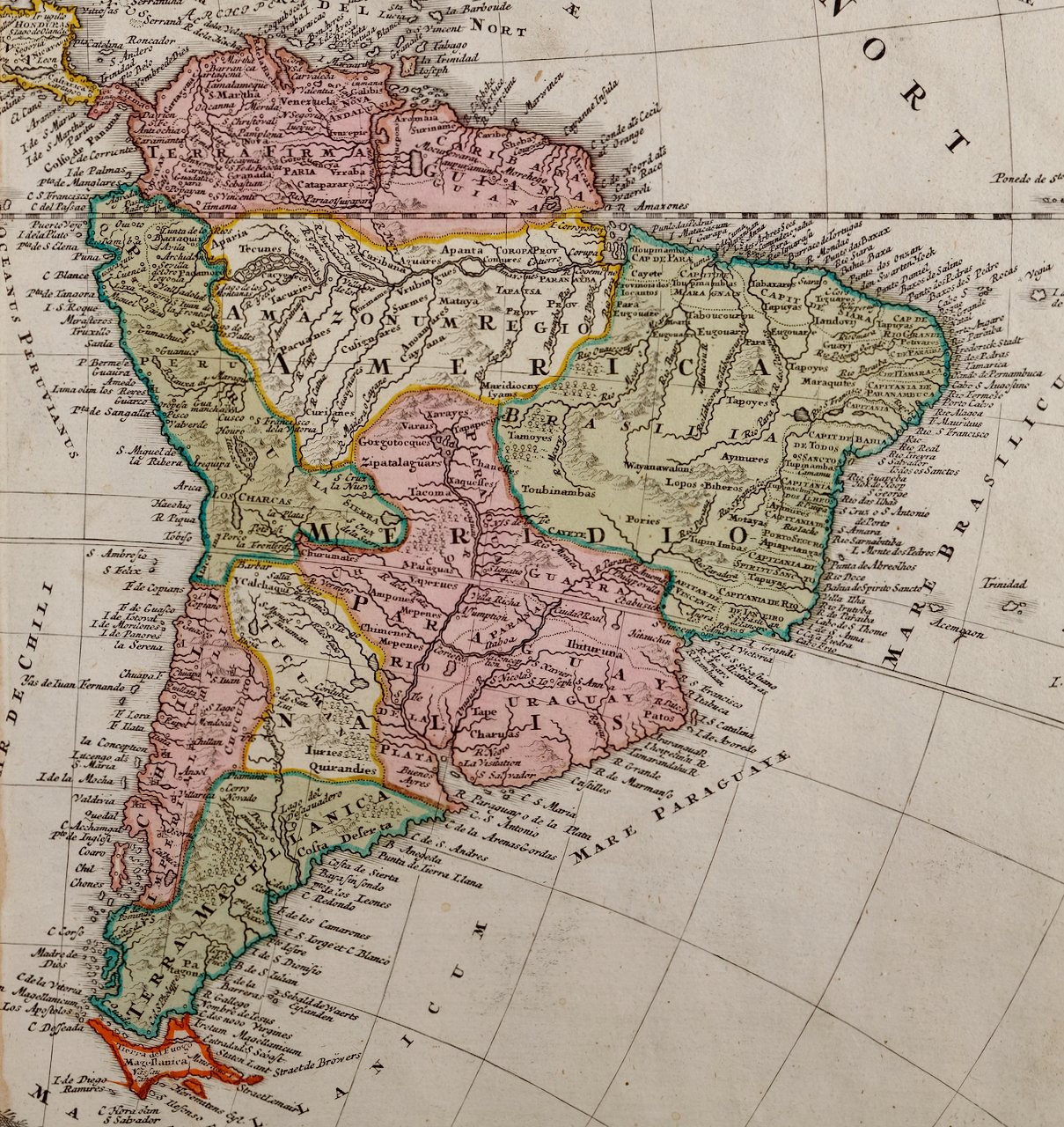
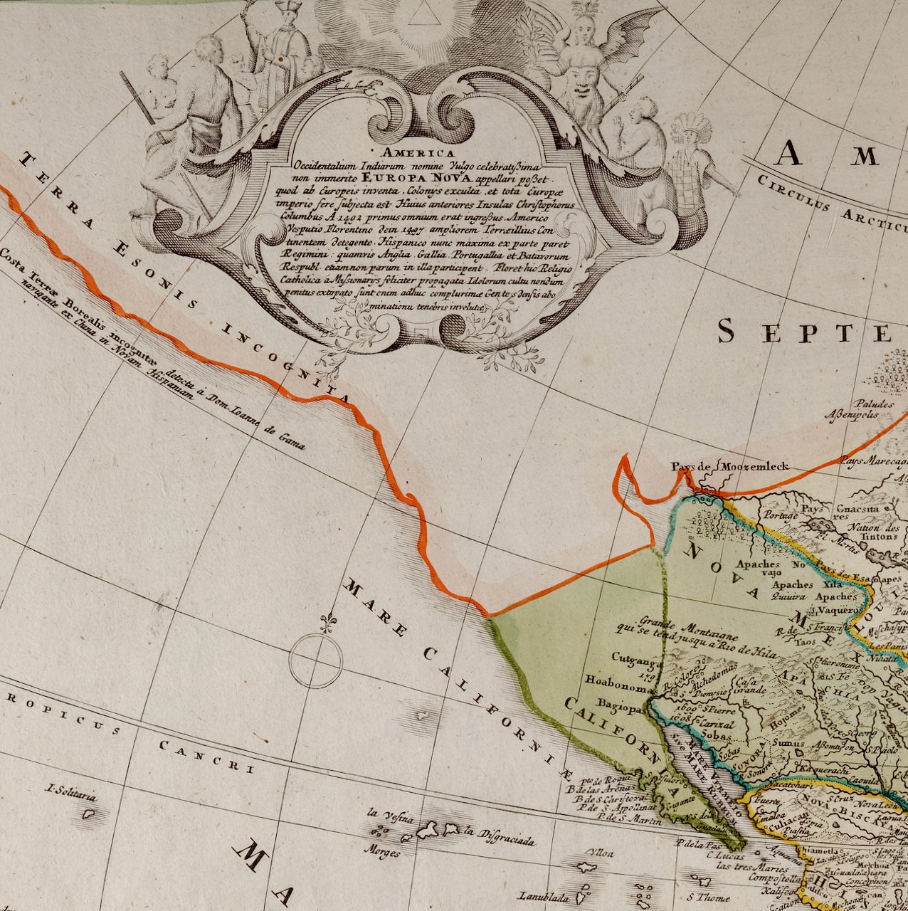
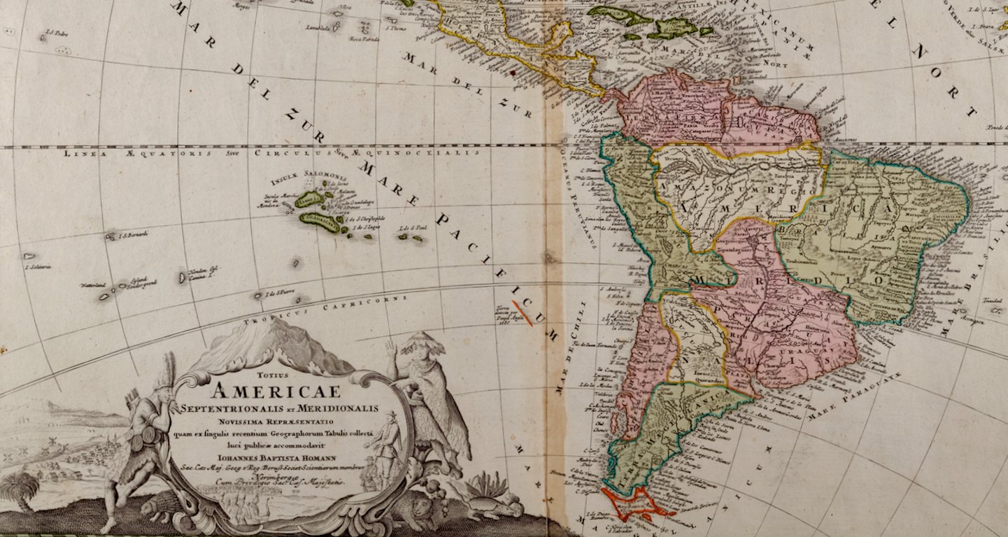
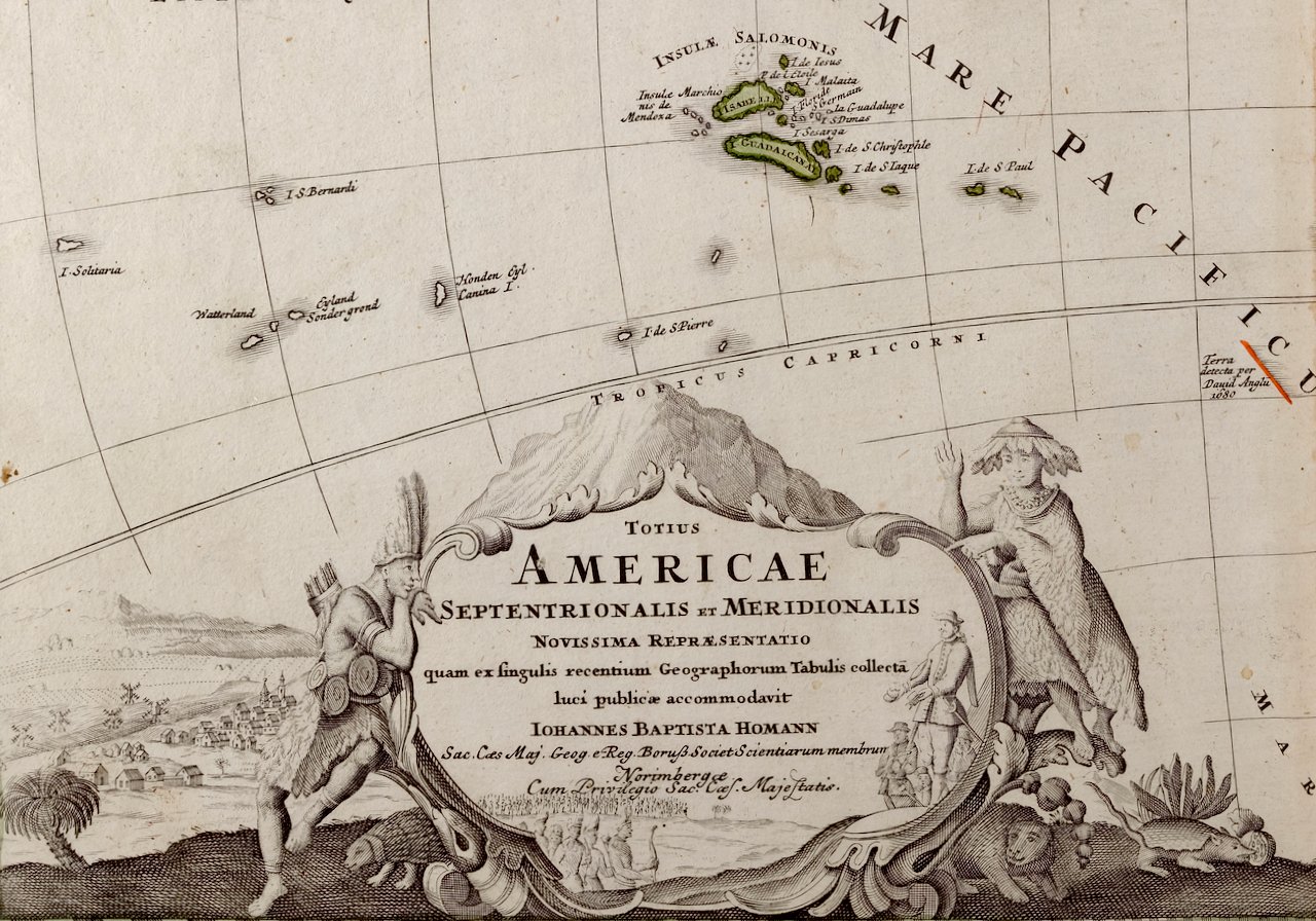
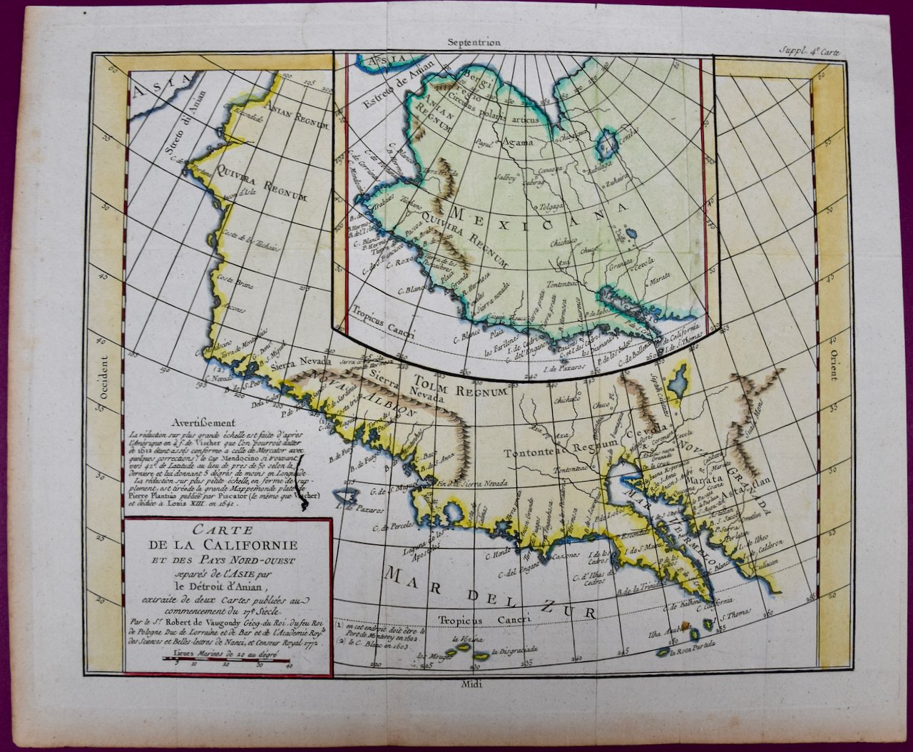
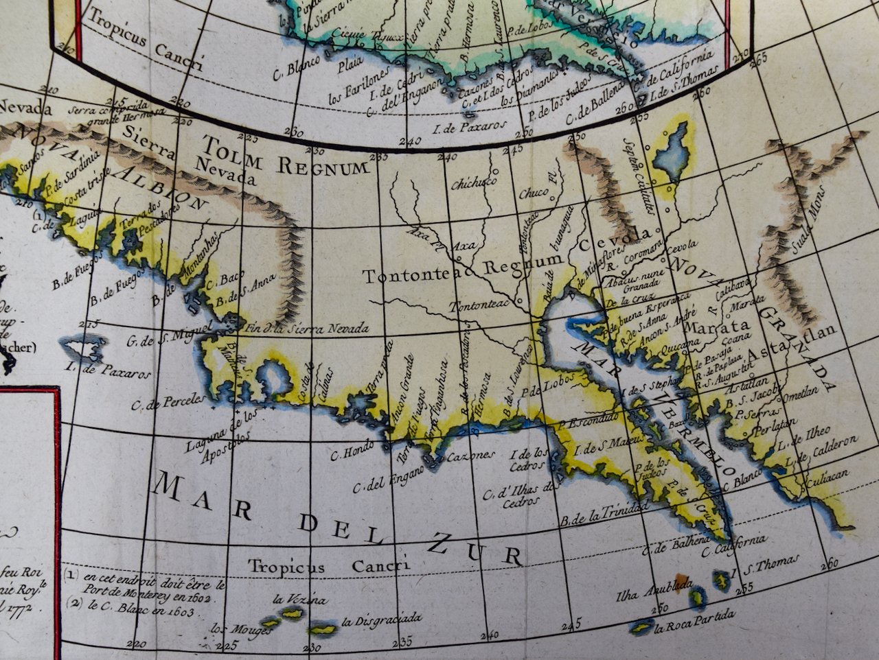
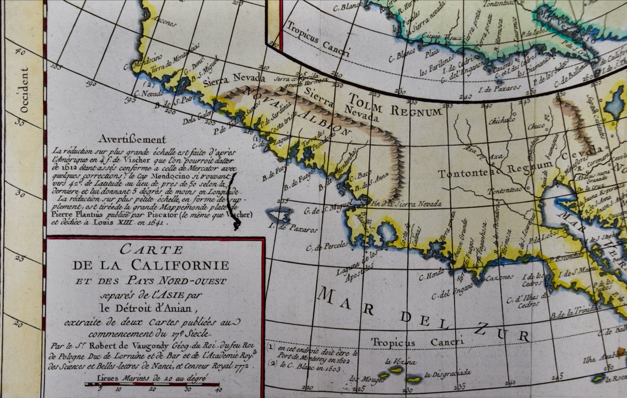
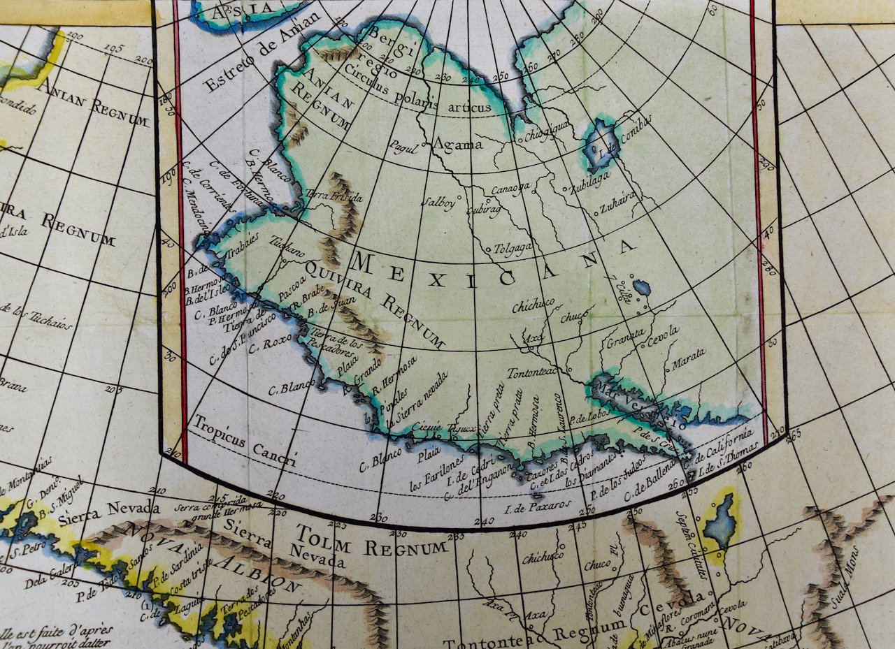
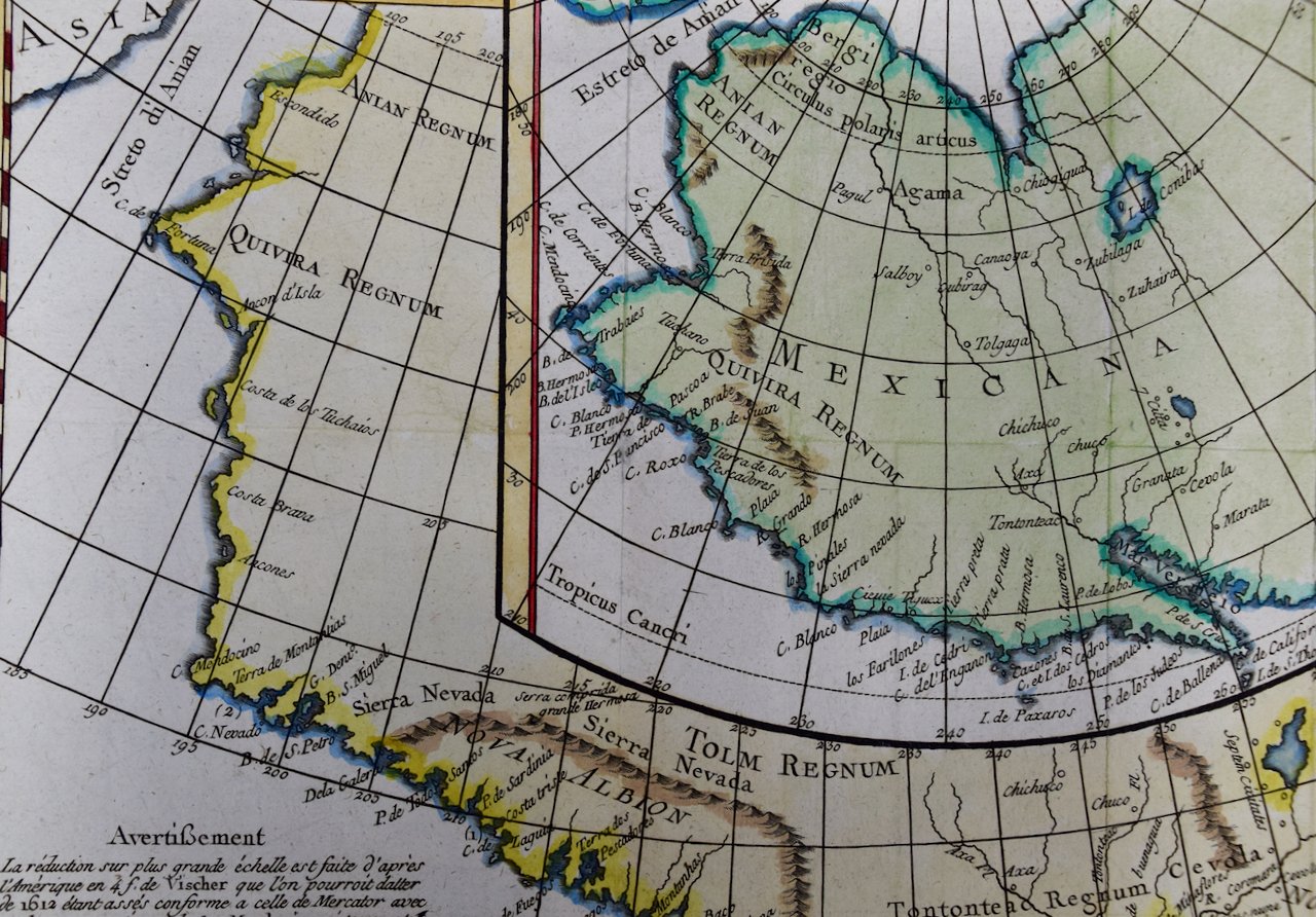
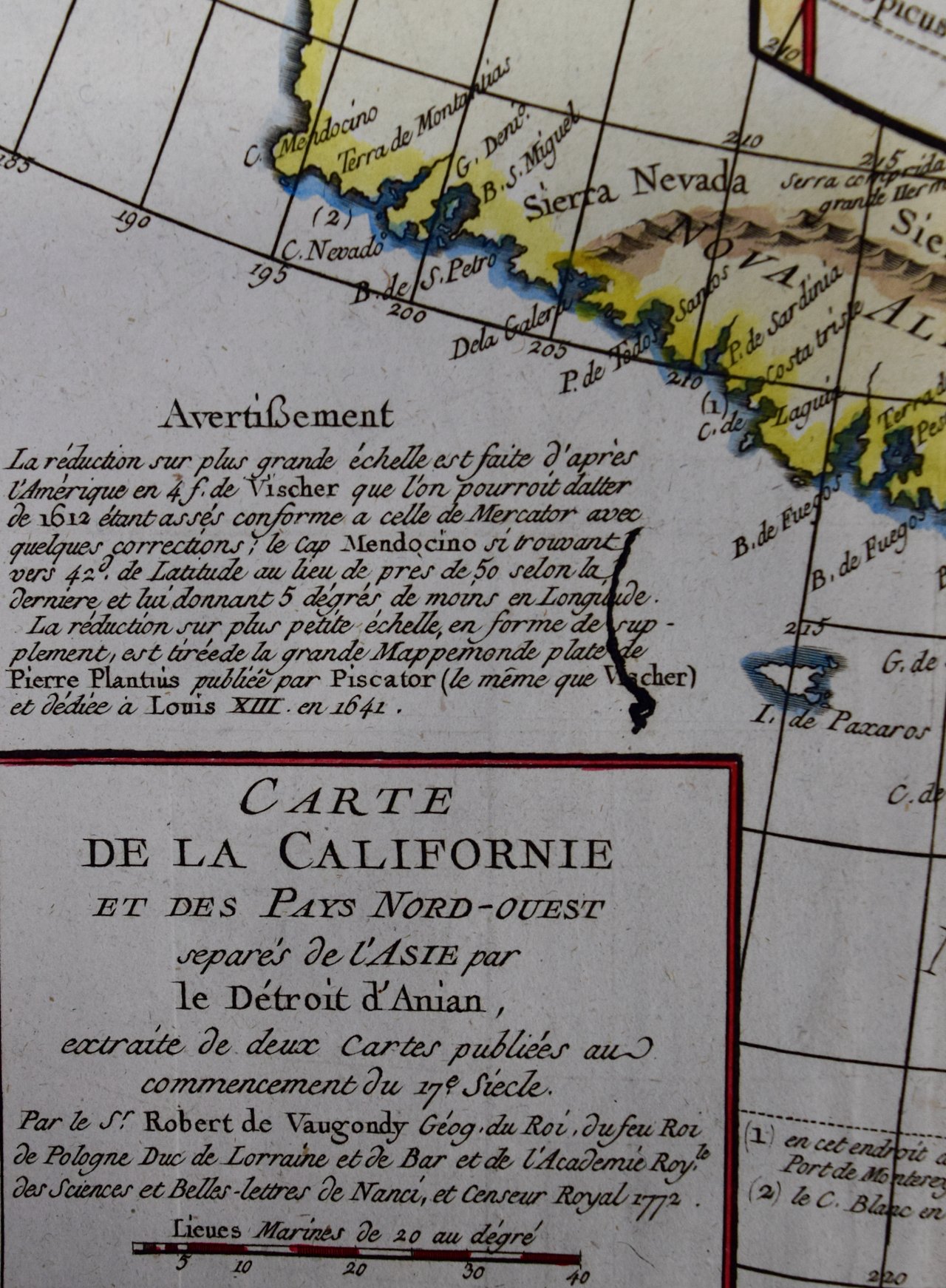
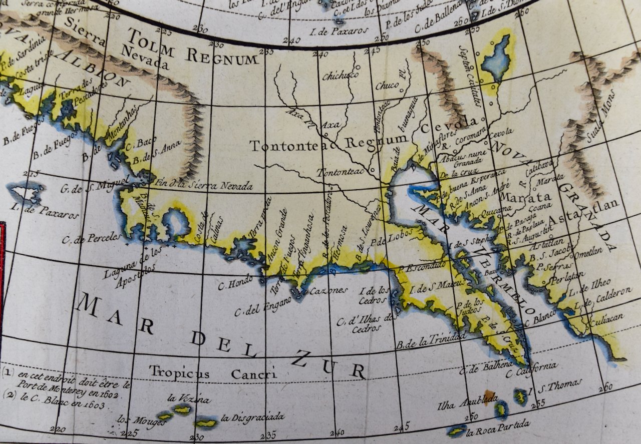
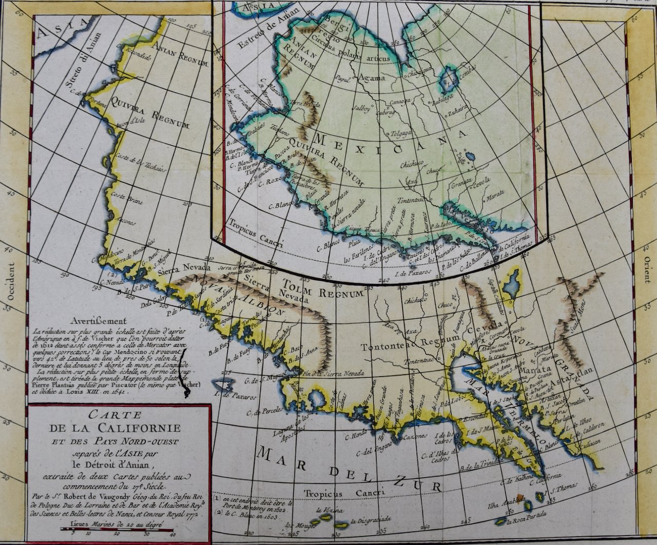
A 17th century hand-colored map of North & South America entitled "Americae Descriptio" by the cartographer Johannes Jansson, published in Jansson's Atlas Minor in Amsterdam in 1628. It was engraved by Abraham Goos. The map is based on an earlier map by Gerardus Mercator. There are many misconceptions about the new world depicted on this fascination map. Among them is the bulging shape of the Northwest coast of North America and the large land mass that extends to Asia, broken only by two small straits. The eastern most strait presumably represents the theorized (and hoped for) Northwest Passage, which was the goal of many explorations maritime for centuries, including the Vikings, Christopher Columbus, Captain James Cook and many more. A navigatable passage through the Americas would facilitate an efficient trade route between Europe and Asia. The map includes portions of Japan, as well as multiple islands in the Atlantic and Pacific Oceans, many of which do not exist. The St. Lawrence River is greatly elongated, extending to the southwest, ending in the region of present-day Colorado. The map also includes the imaginary large land mass in the southern hemisphere, Terra Australis Incognita, the existence of which was not disproved until Captain James Cook's first voyage approximately 150 years later.
Creator: Johannes Jansson (1729 - 1784, Dutch)
Creation Year: 1628
Dimensions: Height: 7 in (17.78 cm) Width: 8.63 in (21.93 cm)
Medium: Engraving
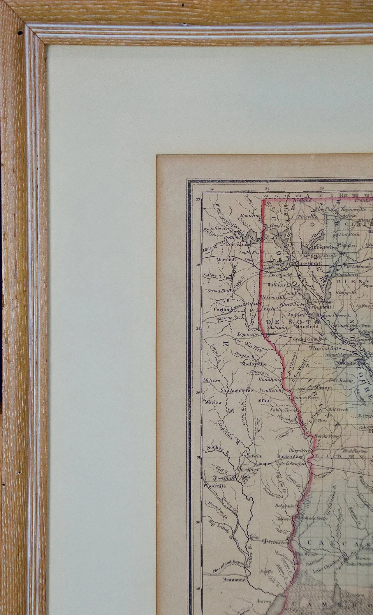
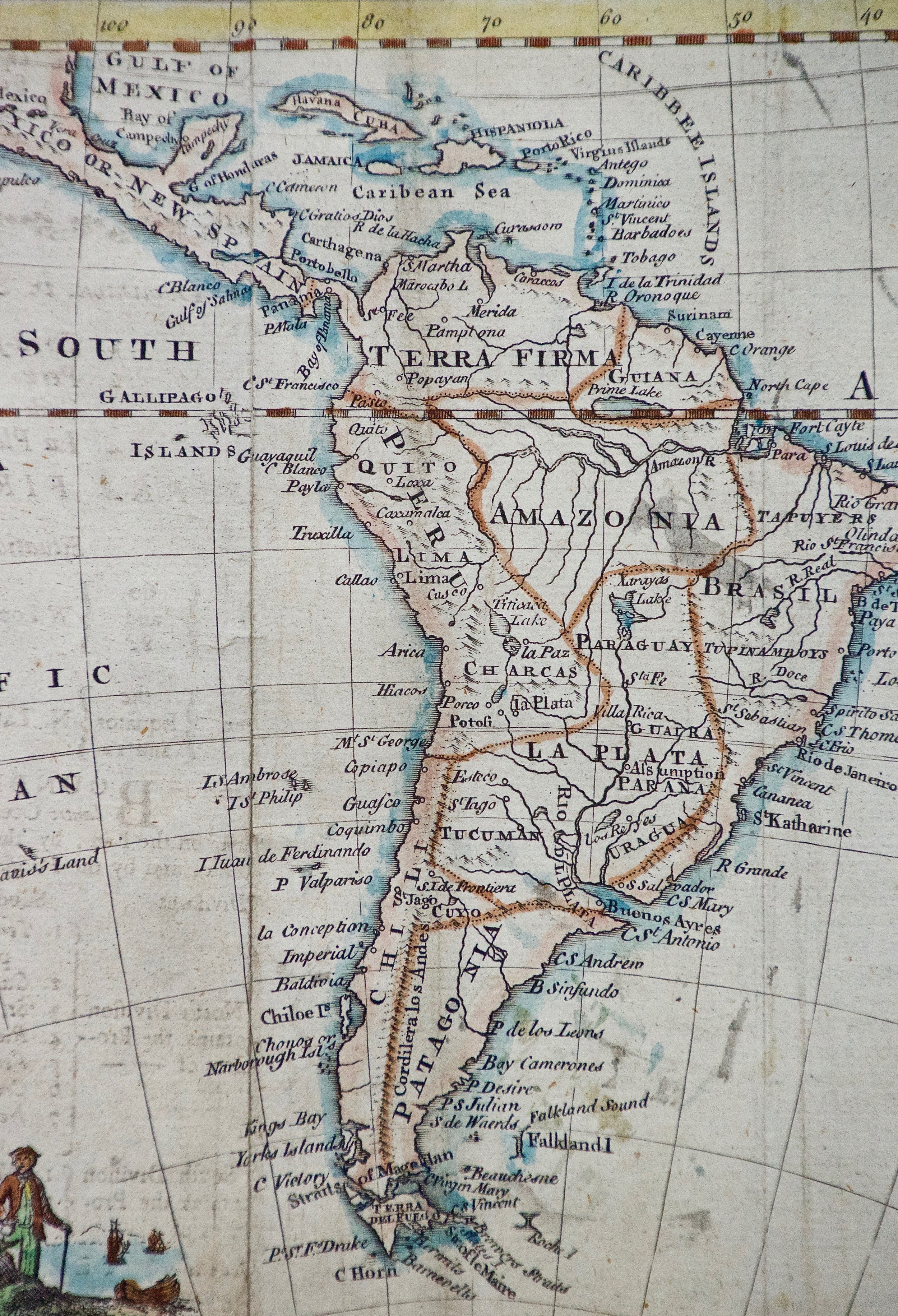
Condition: See description below.
Reference #: 1319
A 17th century hand-colored map of North & South America entitled "Americae Descriptio" by the cartographer Johannes Jansson, published in Jansson's Atlas Minor in Amsterdam in 1628. It was engraved by Abraham Goos. The map is based on an earlier map by Gerardus Mercator. There are many misconceptions about the new world depicted on this fascination map. Among them is the bulging shape of the Northwest coast of North America and the large land mass that extends to Asia, broken only by two small straits. The eastern most strait presumably represents the theorized (and hoped for) Northwest Passage, which was the goal of many explorations maritime for centuries, including the Vikings, Christopher Columbus, Captain James Cook and many more. A navigatable passage through the Americas would facilitate an efficient trade route between Europe and Asia. The map includes portions of Japan, as well as multiple islands in the Atlantic and Pacific Oceans, many of which do not exist. The St. Lawrence River is greatly elongated, extending to the southwest, ending in the region of present-day Colorado. The map also includes the imaginary large land mass in the southern hemisphere, Terra Australis Incognita, the existence of which was not disproved until Captain James Cook's first voyage approximately 150 years later.
Creator: Johannes Jansson (1729 - 1784, Dutch)
Creation Year: 1628
Dimensions: Height: 7 in (17.78 cm) Width: 8.63 in (21.93 cm)
Medium: Engraving
Condition: See description below.
Reference #: 1319

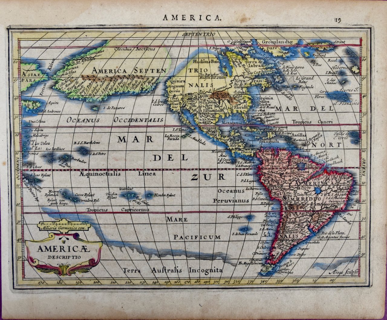 Image 1 of 9
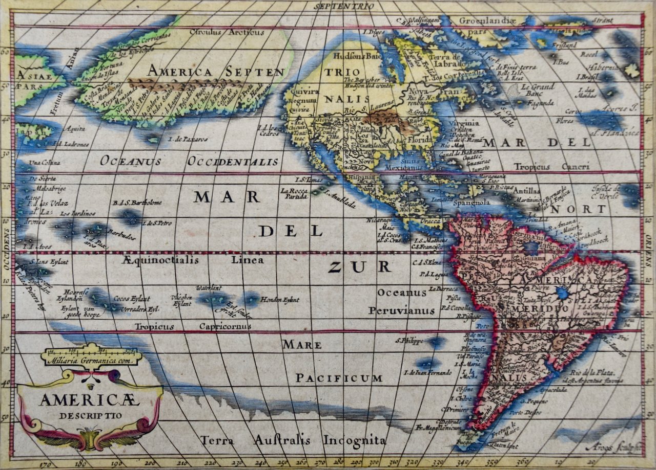 Image 2 of 9
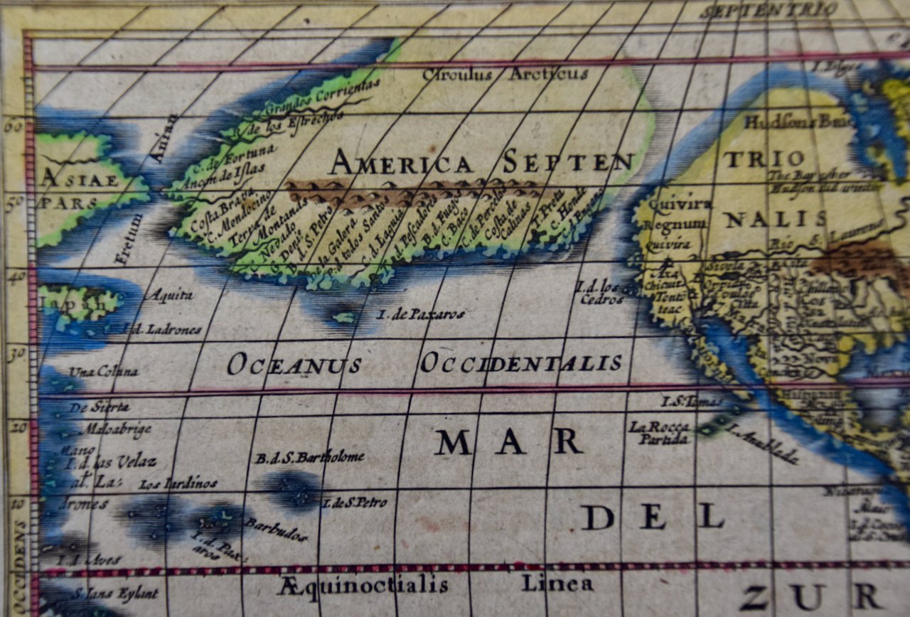 Image 3 of 9
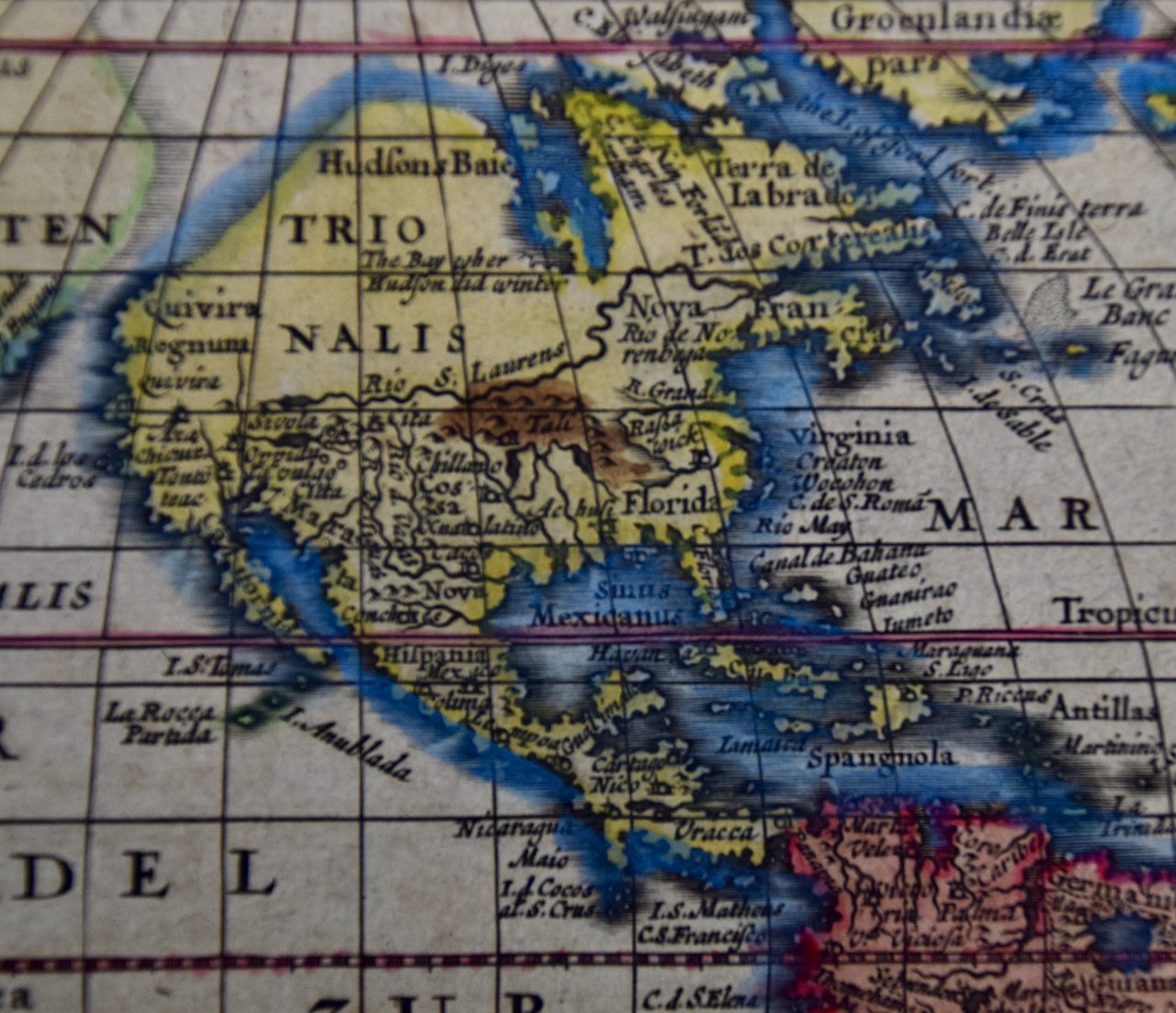 Image 4 of 9
 Image 5 of 9
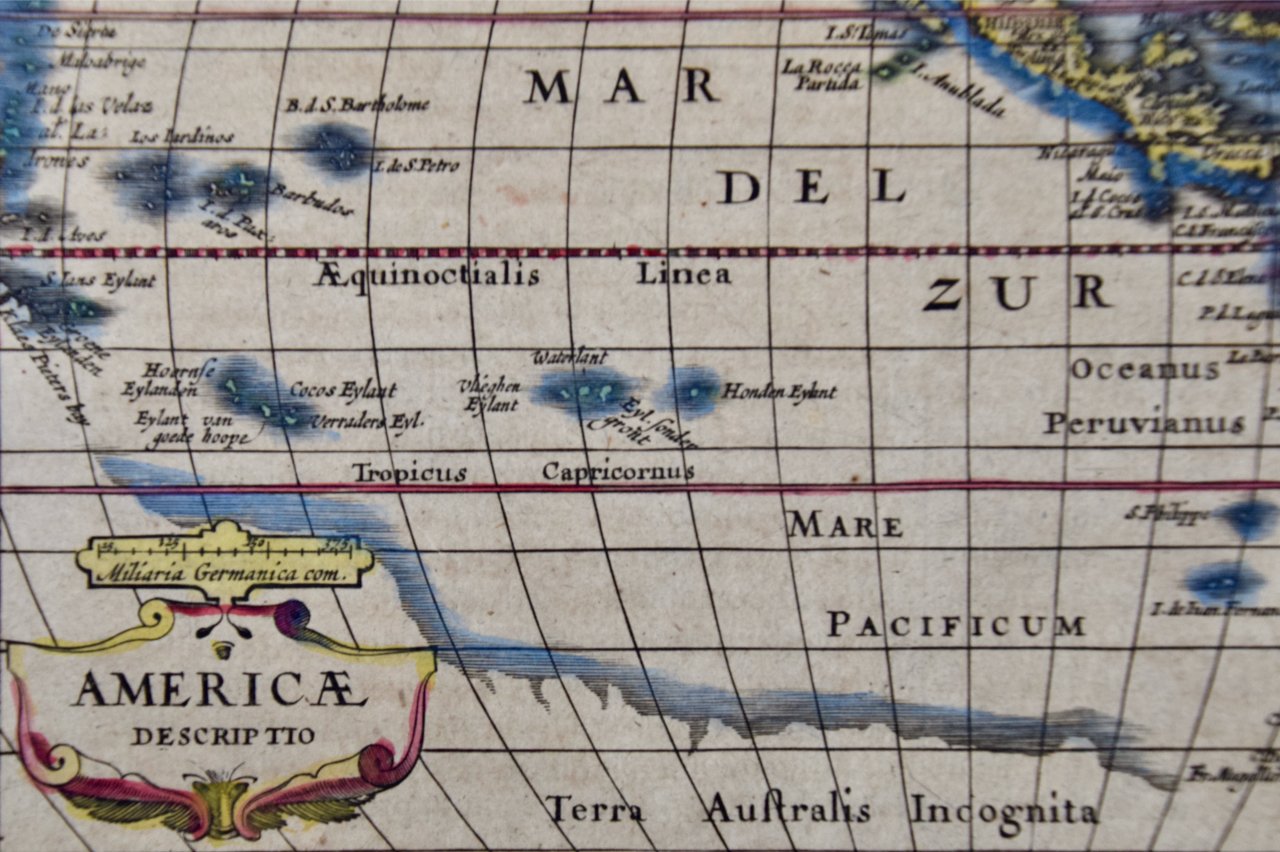 Image 6 of 9
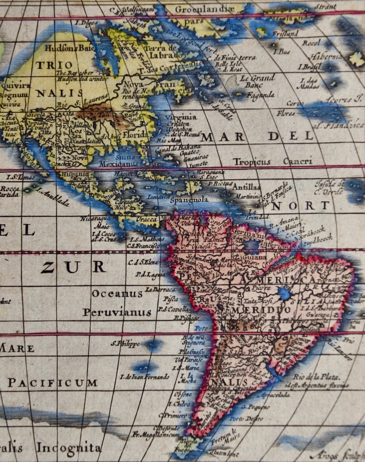 Image 7 of 9
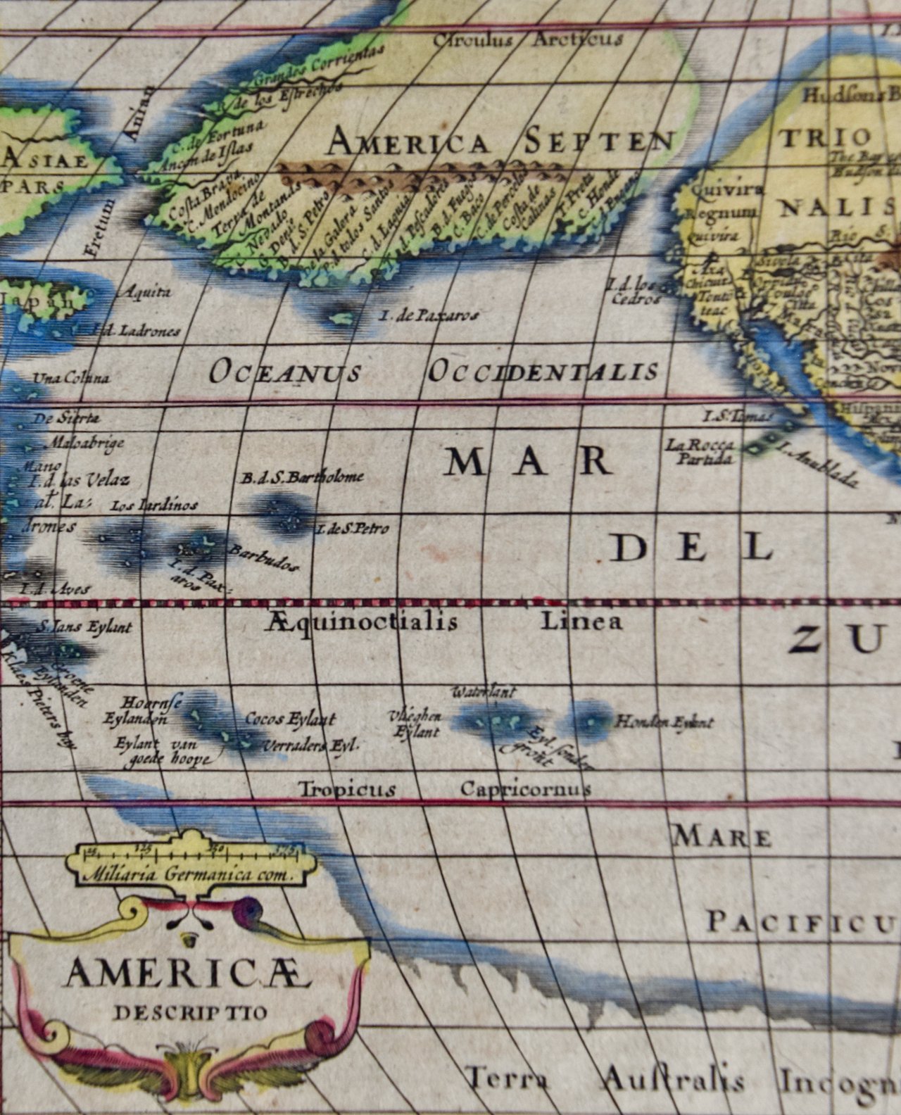 Image 8 of 9
 Image 9 of 9