Image 1 of 9
 Image 2 of 9
 Image 3 of 9
 Image 4 of 9
 Image 5 of 9
 Image 6 of 9
 Image 7 of 9
 Image 8 of 9
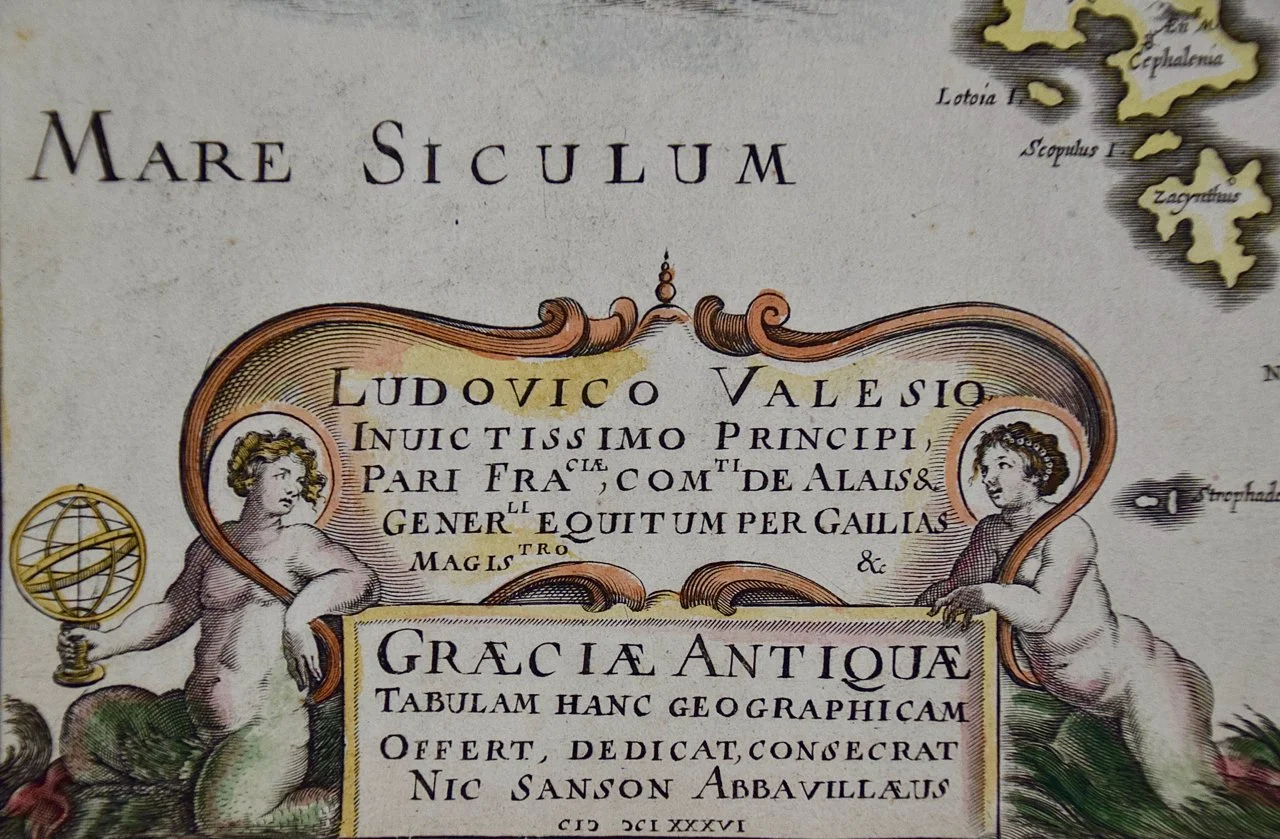 Image 9 of 9
This attractive colorful map is presented in a cream-colored mat, measuring 29.75" wide and 23.75" high. The sheet measures 22.5" wide x 16.875" high. There is a central fold, as issued. There are one and possibly two tiny spots on the left and two very faint spots in the upper right. It is otherwise in excellent condition.
Melchior Tavernier (1594–1665) was a successful engraver and publisher in 17th century Paris. He held the title "Graveur et Imprimeur en Taille-douce du Roi" (Engraver and Intaglio Printer to the King).
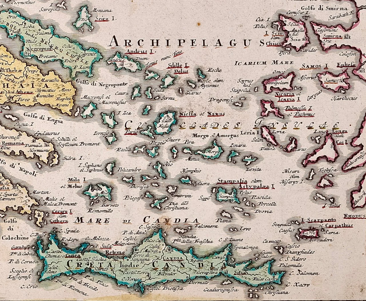
Nicholas Sanson d'Abbeville (1600-1667) was one of the greatest French cartographather of French cartography. Sanson opened his first printing business in Paris in 1638. The king recognized his skill and knowledge and made him the official geographer to the court. He eventually served two kings in this capacity. Sanson was succeeded by his sons, including Guillaume Sanson (1633-1703), and son-in-law in the business and as geographers to the king. Sanson's plates were eventually purchased by the prominent Parisian cartographer Alexis Hubert Jaillot (1632-1712), who continued to publish his maps and atlases with a dual Sanson and Jaillot attribution. Jaillot went on to serve King Louis XIV.