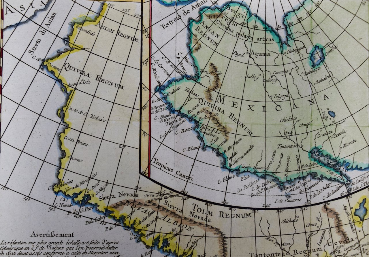
Image 1 of 7
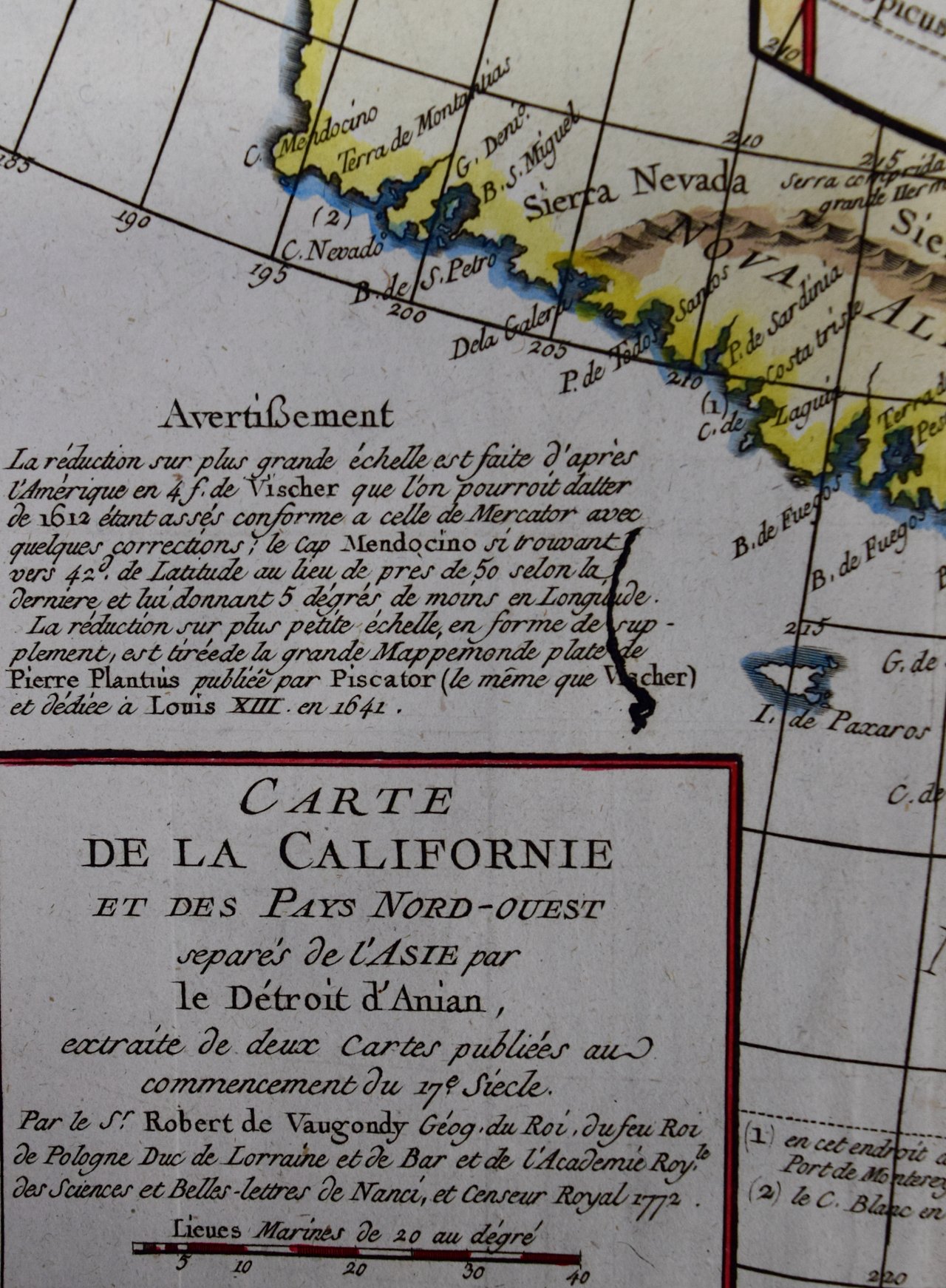
 Image 2 of 7
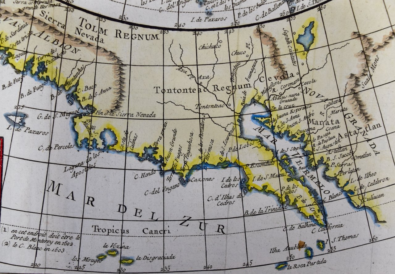
 Image 3 of 7
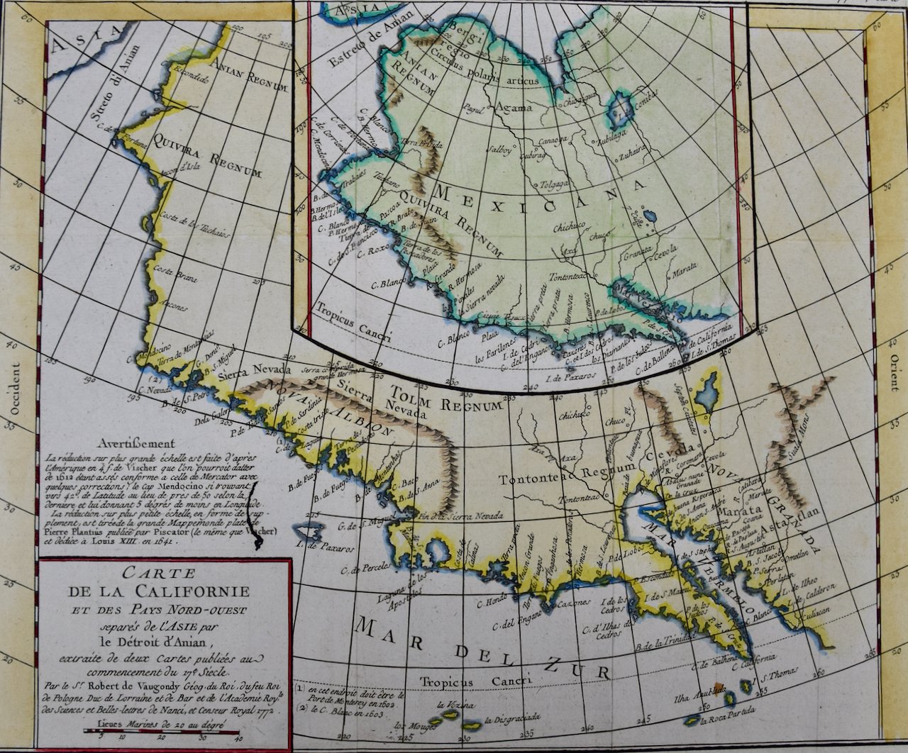
 Image 4 of 7
 Image 5 of 7
 Image 6 of 7
 Image 7 of 7
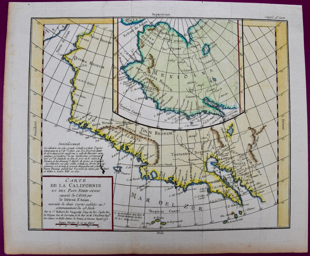
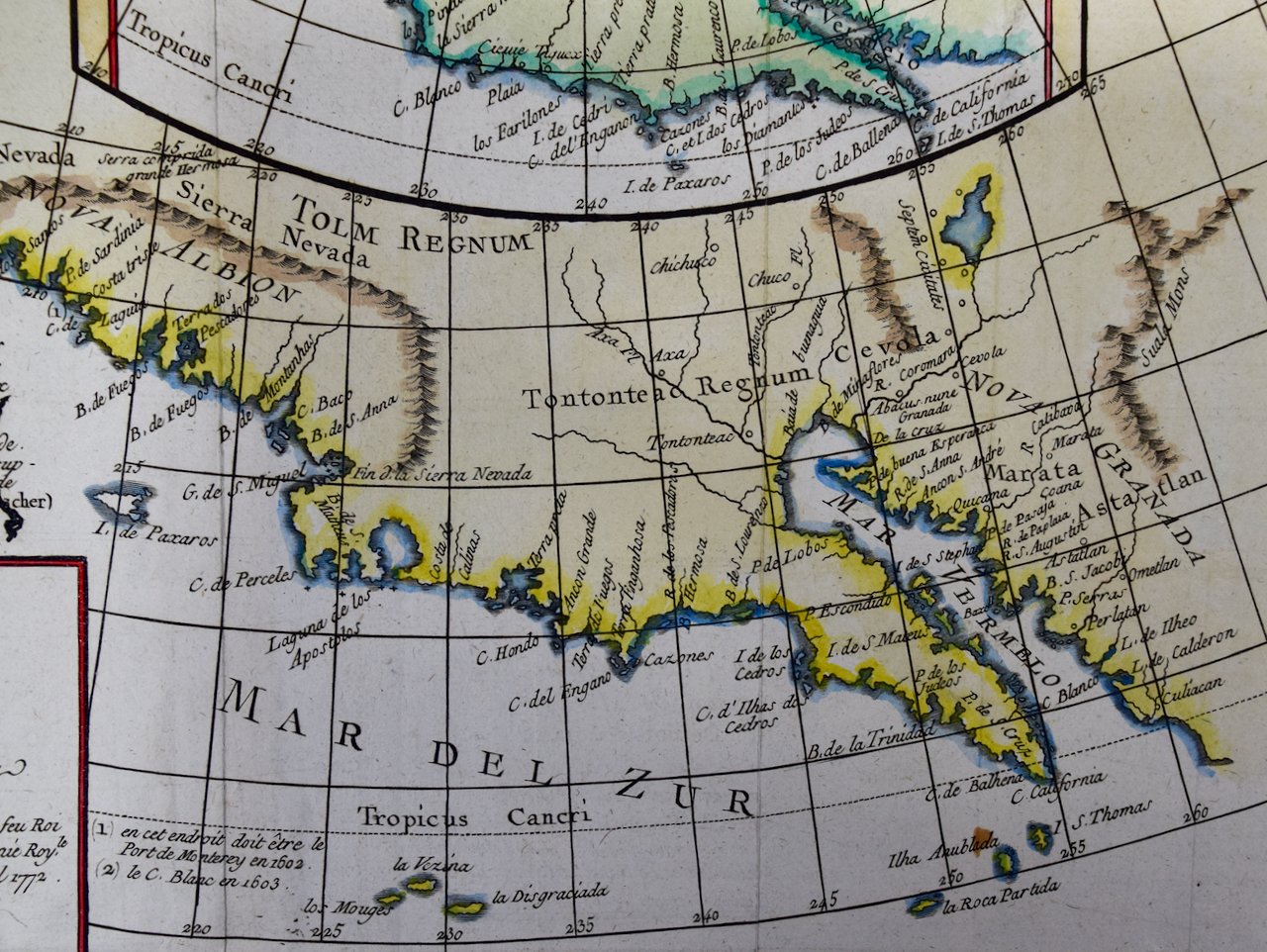
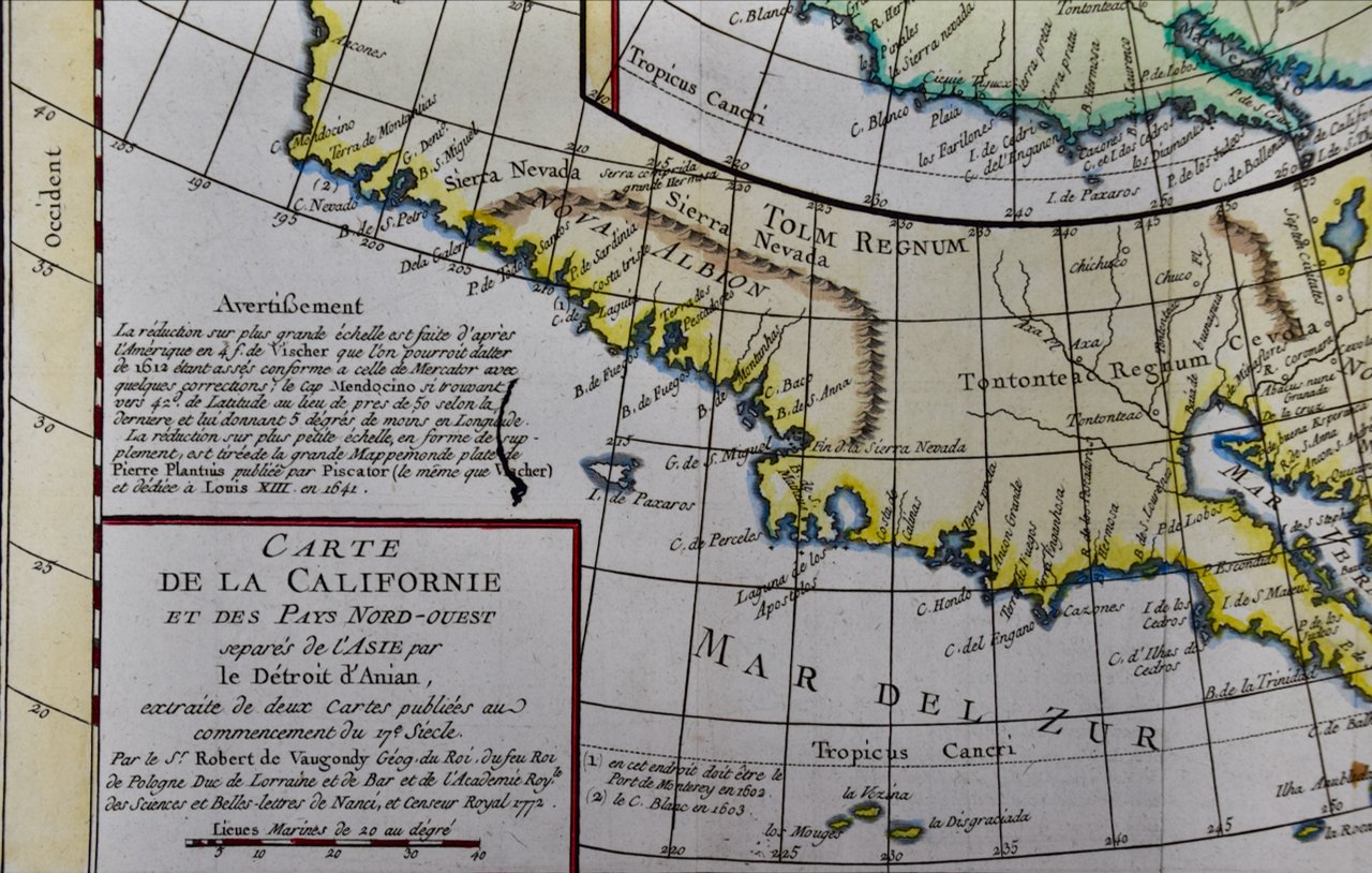
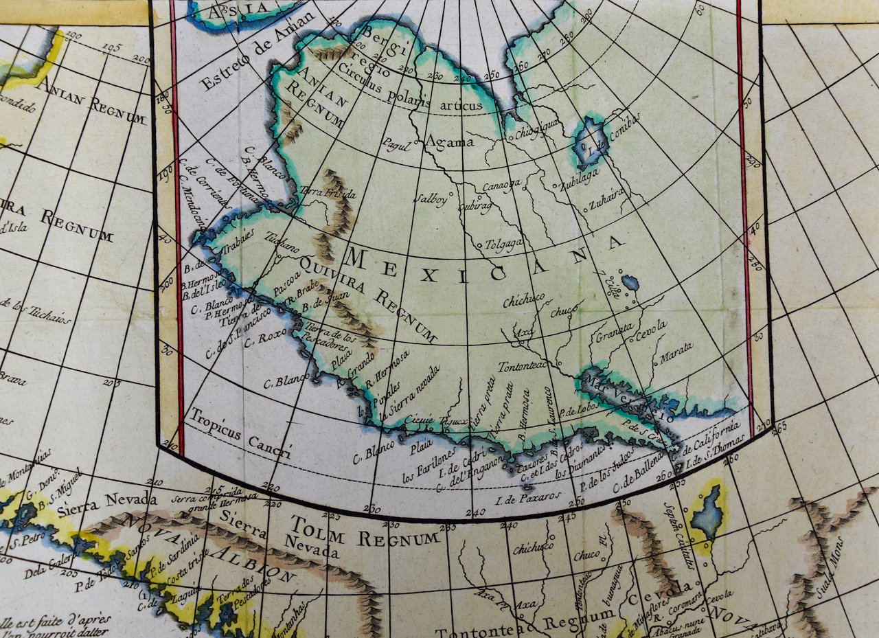
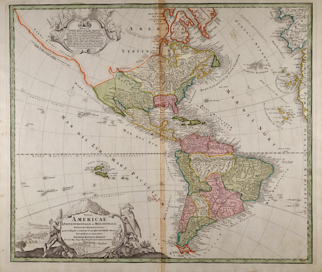
This map is presented in a brown wood frame with a blue mat. The frame measures 12.25" high x 14.325". wide x 1". There is a central vertical fold, as issued. There is some text offset, but the map is otherwise in very good condition.
Thomas Jefferys (1719-1771) was a prolific map publisher based in London. His father was a cutler, but Jefferys was apprenticed to Emanuel Bowen, a prominent mapmaker and engraver. Jefferys was the cartographer to the Prince of Wales and Geographer to King George III beginning in 1760.