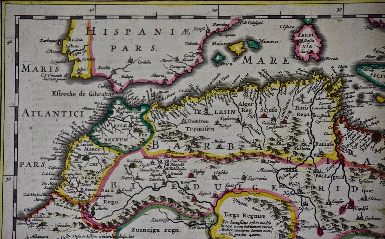
 Image 1 of 5
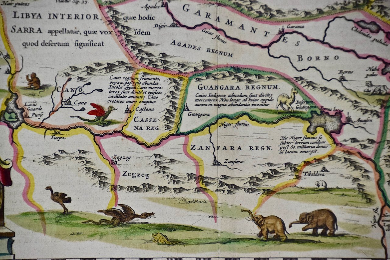
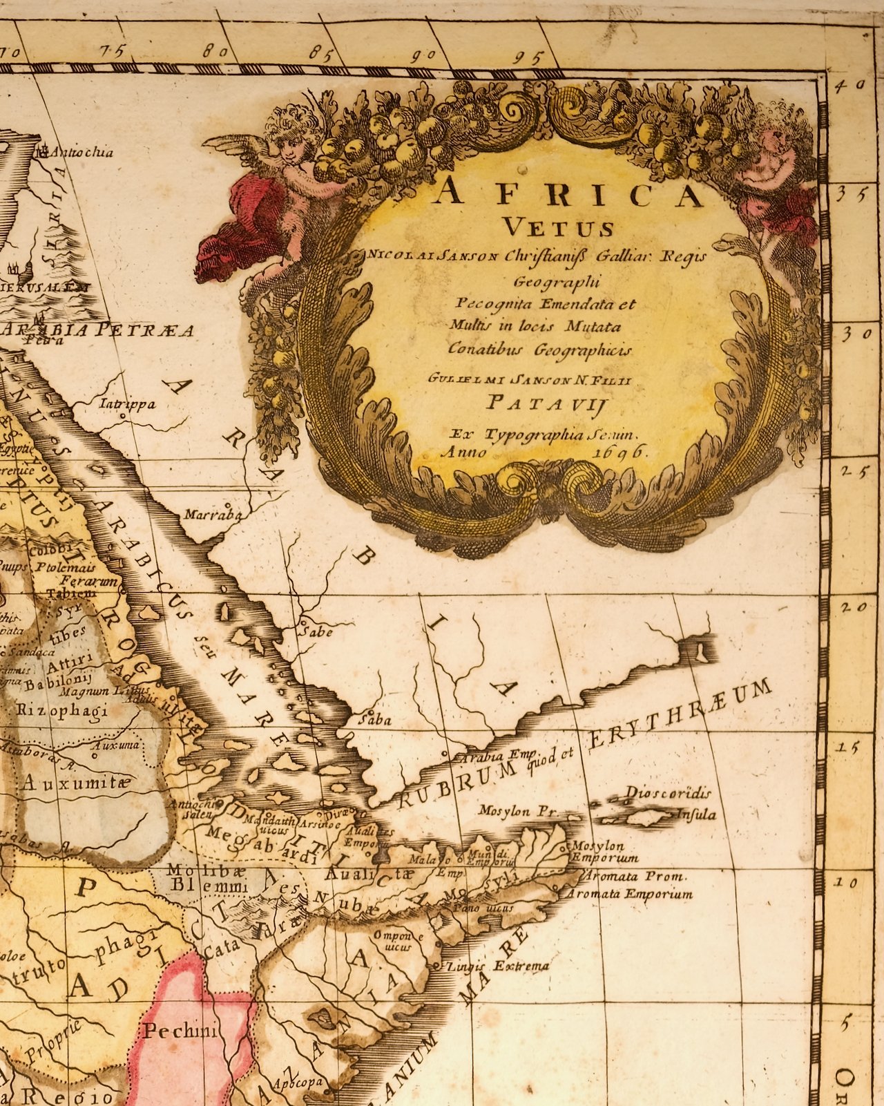 Image 2 of 5
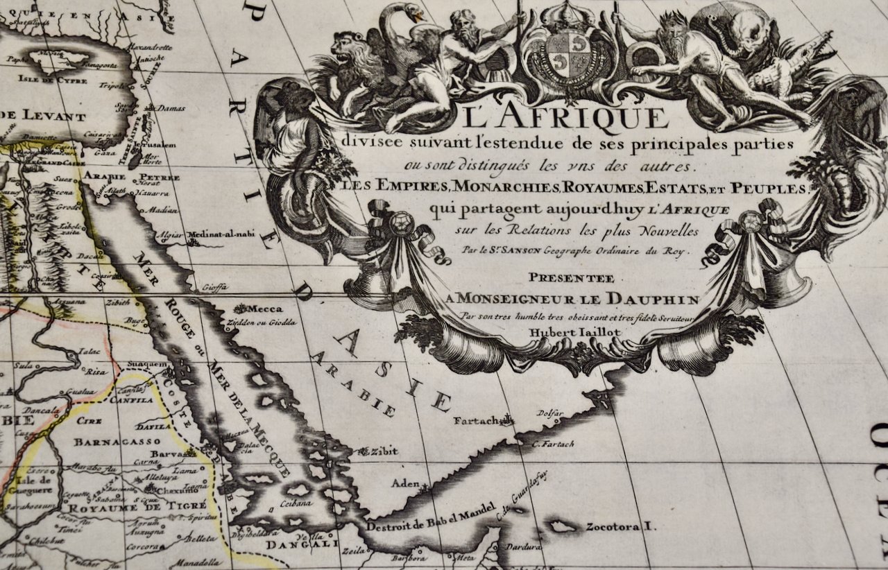
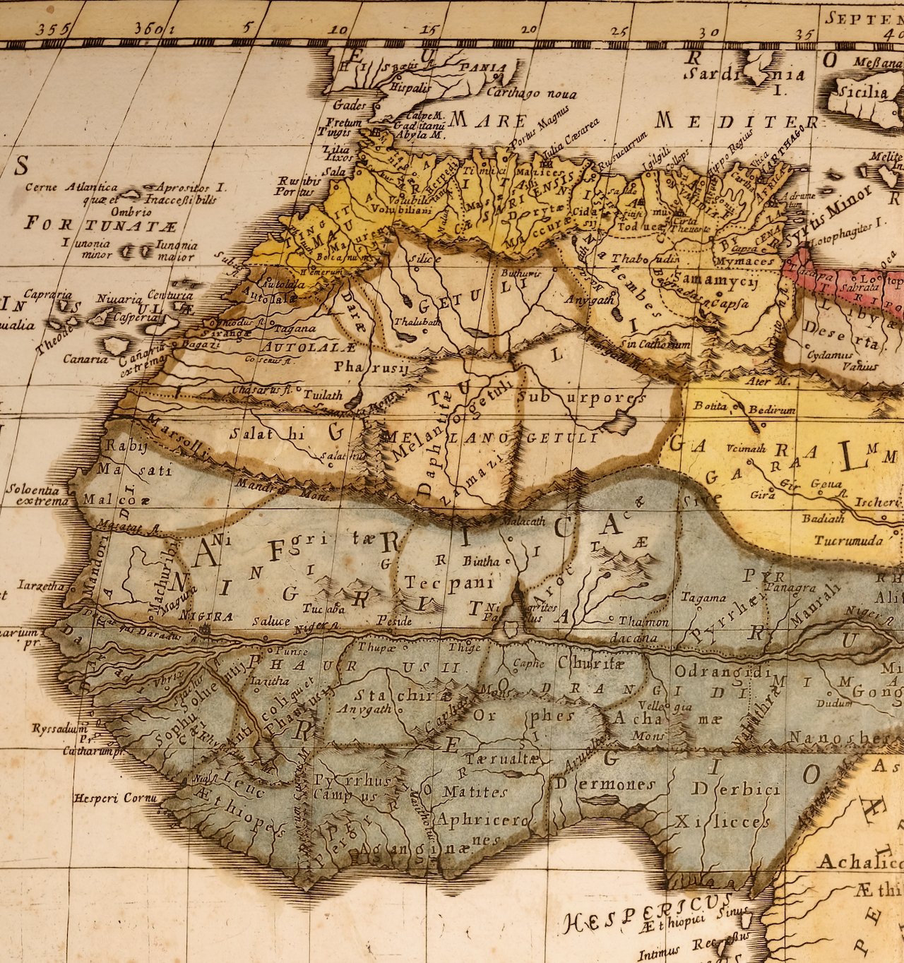 Image 3 of 5
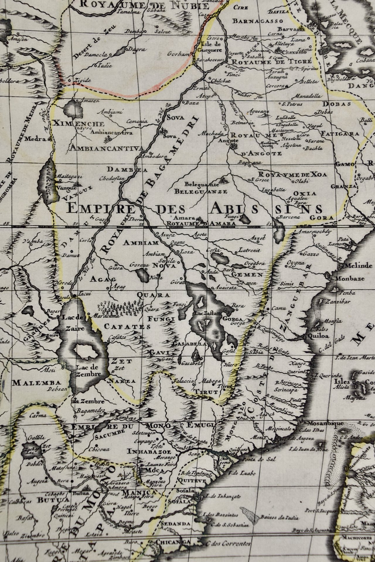
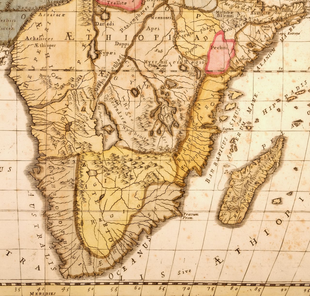 Image 4 of 5
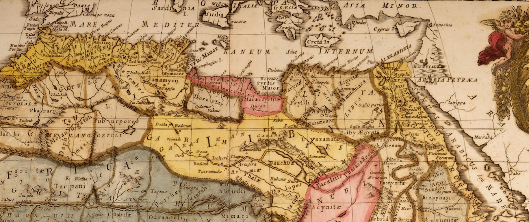 Image 5 of 5
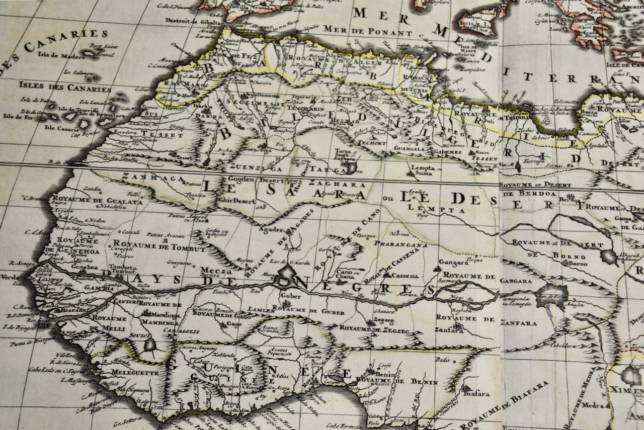
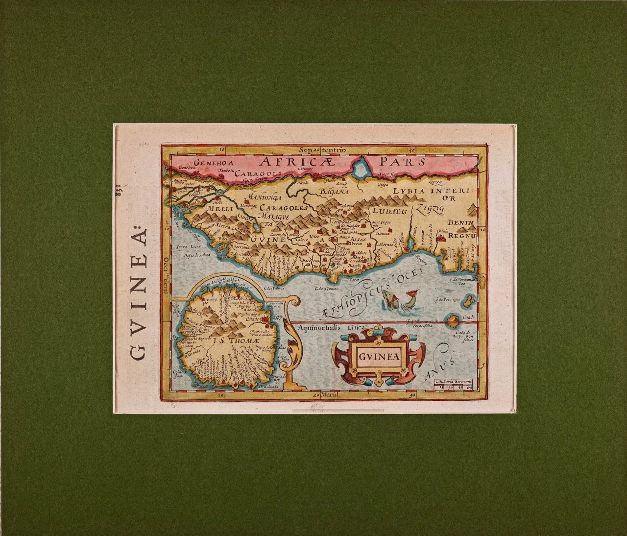
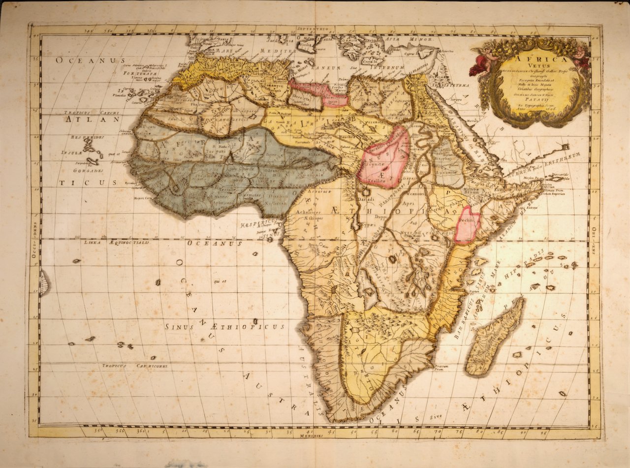
This original hand-colored copperplate engraved map of Africa is printed on antique hand-made watermarked, laid, chain-linked paper with wide margins. The sheet measures 18" high and 24" wide. There is a vertical fold, as issued. There are scattered small faint spots and two small smudges at the edge of the lower margin on the left. The map is otherwise in very good to excellent condition.
Nicholas Sanson d'Abbeville (1600-1667) was one of the greatest French cartographather of French cartography. Sanson opened his first printing business in Paris in 1638. The king recognized his skill and knowledge and made him the official geographer to the court. He eventually served two kings in this capacity. Sanson was succeeded by his sons, including Guillaume Sanson (1633-1703), and son-in-law in the business and as geographers to the king. Sanson's plates were eventually purchased by the prominent Parisian cartographer Alexis Hubert Jaillot (1632-1712), who continued to publish his maps and atlases with a dual Sanson and Jaillot attribution. Jaillot went on to serve King Louis XIV.